Refuge Project
Catacombs of Milos
Milos sights are spread over a volcanic island about 23 km long and 13 km wide. This page sets out the Milos sights as routes: which ones lie together, in what order they appear and how far apart they stand. Background on the island of Milos is on the home page.
The first section groups the Milos sights by area. The second follows the north coast from Pollonia in the north-east to Sarakiniko. Later sections take the hill above the bay, the west and south-west, and the bay with the east. Each section keeps to the main stops and their order.
Where do the Milos sights lie, area by area?
Milos sights fall into four areas: the north coast, the hill above the bay, the bay with the east, and the west with the south-west. Each area holds its own cluster of Milos sights, so the page treats them one area at a time.
Milos is a volcanic island, and a gulf cuts in from the north-west and splits it into two fairly equal parts. For that reason the Milos sights sit around the water and not along one line. Adamantas is the harbour town and main port of the island. Above the harbour stands the plateau of Plaka, the chief town, at a height of 220 metres, with Kastro on a hill above it.
Distances between Milos sights are measured from two bases, the port and the chief town. Pollonia lies almost 10 km from Adamas and 14 km from Plaka. Sarakiniko lies about 5 km from Plaka, and cars and buses reach it. Those figures set the two ends of the north coast at 5 km and 14 km from the chief town, Sarakiniko at the near end and Pollonia at the far end.
The settlements beside the sights differ in size. At the 2021 census Adamas had 1,268 residents, Plaka 902, Trypiti 766, Pollonia 268 and Zefyria 190. Klima had 8 and lies beside the site of ancient Milos, while Phylakopi, beside the Bronze Age site, had 4. The whole municipality, with the uninhabited islands of Antimilos and Akradies, counted 5,193 inhabitants, so the Milos sights stand in or beside small places.
- North coast: Pollonia, Phylakopi, Papafragas and Sarakiniko lie along one shore, from the north-eastern tip westward.
- Hill above the bay: Plaka, Kastro, Trypiti and Klima stand above the gulf, near ancient Milos.
- Bay and east: Adamantas lies on the north-eastern shore of the gulf, and hot sulphurous springs rise by the harbour.
- Old chief town: Zefyria lies in the inner part of the island and was the chief town before Plaka.
- West and south-west: Kleftiko has white cliffs and islets around three coves, reached by boat or path.
Seen together, the Milos sights form clear, separate groups: the north coast along one shore, the hill and the bay around the gulf, and the west and south-west around Kleftiko. Distances between the groups are measured from Plaka and Adamas. The next section starts at the north-eastern tip of the island, in Pollonia, the second port.


Which Milos sights lie on the north-coast route from Pollonia to Sarakiniko?
Milos sights on the north coast run west from Pollonia, past Pelekouda, Phylakopi, Papafragas and five beaches, to Sarakiniko. The route follows one shore and meets a fishing village, a Bronze Age site, a sea cave and a white rock coast in that order.
The route starts at Pollonia, a fishing village at the north-eastern tip of the island. It is the second port of Milos after Adamas, and its name comes from a temple of Apollo that stood east of the settlement. On the pier in front of the church of Agia Paraskevi, local boats unload fish, octopus and lobster each morning. A regular small-boat link joins Pollonia to Kimolos, the neighbouring island.
West of Pollonia, the shore passes Pelekouda and Kalogeros before Phylakopi and Papafragas, which lie side by side. Phylakopi was a Bronze Age settlement whose life ran through the whole age, and the sea has washed away part of it. The remains include a wall of large volcanic blocks, a sanctuary and a megaron. Papafragas, with three caves, lies next to the ruins, and its sea cave opens inside the archaeological site.
Five beaches lie between Papafragas and Sarakiniko: Kapros, Pachaina, Agios Konstantinos, Alogomandra and Mytakas. Pachaina is a sandy beach with tamarisk trees and a view of the Glaronissia. Agios Konstantinos comes between Pachaina and Alogomandra. Alogomandra is a strip of sand closed in by high cliffs, with shallow green-blue water, and it stays out of sight of the road. Mytakas is a sandy beach with clear water beside the houses of fishermen.
Sarakiniko ends the route on the north shore. The beach is not organised, and the sand covers only a small part of the site. The white volcanic rock around it holds caves cut by waves. Mandrakia follows to the west, and then Firopotamos further on, so the north coast continues beyond the end of this route. Among the Milos sights, Sarakiniko is the stop where rock, not sand, forms the shore.
- Pollonia: The main beach is sandy, and taverns and restaurants extend to the end of the settlement.
- Pelekouda: The peninsula and the church of Agios Nikolaos lie on the left side of the village.
- Local lore: A couple who sit on the small chair-shaped rock there are said to stay together forever.
- Phylakopi: The site has information material and plans laid out for visitors.
- Kapros: The first beach after Papafragas is easy to reach by car and visible from the main road to Pollonia.
The north-coast route holds a fishing village, a Bronze Age site, a sea cave, five beaches and a white rock shore in one order from east to west. These Milos sights share one coastline, so the stops follow one fixed order from Pollonia to Sarakiniko. The page on the beaches of Milos describes each shore of the island in detail.
Which Milos sights lie on a walking route from Plaka to Klima?
Milos sights on the hill above the gulf follow one downhill line: the Kastro and churches of Plaka, the village of Tripiti, the ancient walls, the Venus find spot, the Roman theatre, the Catacombs and the seaside village of Klima.
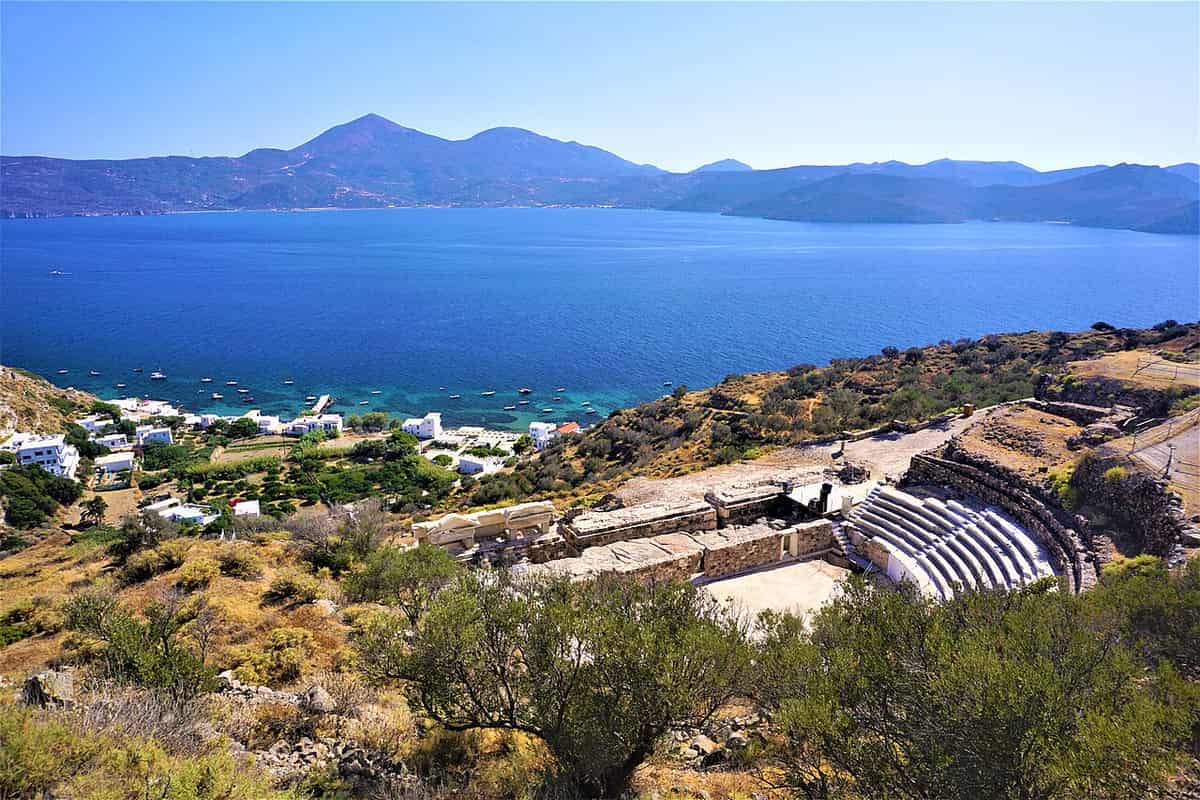
The route starts in Plaka, a town built 220 metres above the sea with a view over the gulf. The Venetians built the Kastro at its highest point in the 13th century, on a hill of volcanic origin. Among the Milos sights of this first stretch, the church of Panagia Thalassitra is met on the climb to the fortress, and the small vaulted church of Mesa Panagia crowns the summit. A single climb therefore joins the town, the fortress and both churches.
Tripiti follows, and it is almost united with Plaka, so the walk from the Kastro leads straight into the village. It stands 150 metres above the sea and 5 kilometres north-west of the port of Adamantas, with views over the bay of Adamas. The church of Agios Nikolaos dominates its centre. Of the Milos sights in the village, the chapel of Panagia Faneromeni lies on the road to the catacombs, and it holds two arched tombs and traces of wall paintings.
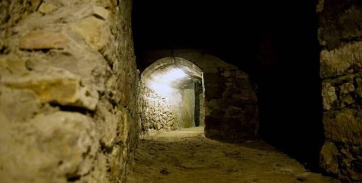
The road from Tripiti ends near the ancient city, and a lane continues on foot. The city walls come first. A short step further lies the spot where a farmer found the Venus de Milo in 1820, where the gymnasium is supposed to have stood. The Roman theatre lies south of the agora plateau, west of the stadium and against part of the eastern wall. The Catacombs lie outside that wall, 200 metres east of the theatre. Four Milos sights share this ground.
Klima, the last of the Milos sights on the route, lies below Tripiti at the entrance of the gulf, 6 kilometres from Adamantas. The ruins around it belong to the old Klima, the first port of the island, and its two citadels are the hill of Profitis Ilias and Pyrgaki. In the fishing village of Klima, the sirmata are two-storey houses, and the ground floor kept the boat during winter. The church of Agia Paraskevi stands inside a cave.
- Altitude: Plaka stands at 220 metres, while Tripiti and the catacombs stand at 150 metres.
- On foot: No cars can enter Plaka, because the spaces between walls and buildings are narrow.
- Footpath: A hiking route links Tripiti with Plaka.
- Theatre: The theatre is still used for theatrical performances and musical events.
- Residents: Plaka had 902 residents in 2021, Tripiti 766 and Klima 8.
The route covers the Milos sights of one slope in a fixed order. Plaka and Tripiti are almost joined, the road from Tripiti reaches the ancient city and the Catacombs, and Klima lies directly below the village. Each stop leads to the next, and the descent from 220 metres to the sea gives the walk its direction. The next route leaves the hill for the south-west and west.
How do visitors reach the Milos sights of the west and south-west?
Milos sights in the south-west and west are reached by sea or by dirt road. Excursion boats call at Kleftiko and Sykia, while the monastery of Agios Ioannis Siderianos and the highest summit, Profitis Elias at 748 metres, lie beyond the gulf in the uninhabited west.
The sea route comes first. Kleftiko lies in the south-west, where white cliffs and rock islets spread over three connected coves. It can be reached by excursion boat or by a footpath. The same boats also stop at Sykia, a cave on the west coast whose roof has collapsed. The two Milos sights therefore form one line along the coast, from the south-west corner of the island to its west side.
The gulf strikes in from the north-west and splits the island into two fairly equal portions, with an isthmus no more than 2.2 kilometres broad. The western region beyond it is uninhabited. Among the Milos sights of this region, the beach of Agios Ioannis lies at the end of a dirt road of about 12 kilometres. The beach has three parts joined by paths. The first can be reached by car, while the other two need a long walk and a descent over rocks.
The monastery of Agios Ioannis Siderianos stands on the south-west side of the island, at Halakas, and documents mention it from 1582. The church is a spacious domed basilica, surrounded by cells of different sizes. Its very old icon of Saint John is thought to be the work of the Evangelist Luke. Among the Milos sights of the west, the highest point, Profitis Elias, rises to 748 metres in the same part of the island.
- Status: Kleftiko is a designated landscape of particular natural beauty inside a Natura 2000 area.
- Triades: Three sandy beaches lie one after the other, enclosed between rocks.
- Kalogries: Among the Milos sights of the north-west, this secluded beach has a bay that forms a natural pool.
- Beach name: The beach of Agios Ioannis takes its name from the monastery.
- Natura: Almost all of the uninhabited western region is a Natura 2000 site.
The Milos sights of the south-west and west call for two kinds of travel. Kleftiko and Sykia belong to one sea line along the coast, while Agios Ioannis, the monastery and Profitis Elias belong to the dirt roads of the uninhabited west. The gulf and its narrow isthmus set this side of the island apart from the plateau villages around Plaka, so the two halves make two separate routes.


Which Milos sights lie around the bay and in the east of the island?
The Milos sights of the bay and the east make one route from the harbour town of Adamantas to Zefyria, where it forks towards Paleochori and the old sulphur mines. Museums and a war shelter come first, then a former capital, then volcanic shores and mine ruins.
Adamantas stands on the north-east shore of the bay, one of the largest and safest natural bays in the Mediterranean, and it is the first view of the island from the sea. Cretan refugees from Sfakia built the town. The Milos sights here include the Maritime, Ecclesiastical and Mining museums, the church of the Holy Trinity and the French cemetery of the Crimean war. The museums of Milos have their own page, so this route treats them as opening stops.
The war shelter lies below the town and belongs to the Milos sights of the Second World War. German occupation forces ordered it built, and it consists of twelve large chambers that branch off both sides of a central passage. For years it served as a water-supply works, and it is now restored and open. The War Museum stands on the site of an older shelter. A later art project invited 17 more artists to make works inside the refuge.
In the east, the Milos sights start at the Mining Museum, and the coastal road runs 2.3 km to a central crossroads, where a left turn leads to Zefyria. The village lies 5 km from Adamantas and 9 km from Plaka, beside a large plain. A former capital, it has the church of Panagia Portiani at its centre. Zefyria is the junction of the east: the road to Agia Kyriaki and Paleochori passes through, and the dirt road to the mines starts there.
- Agia Kyriaki: The beach lies 10 km south-east of Adamantas and keeps an ancient harbour where storage rooms still stand.
- Paleochori: The shore lies 14 km south-east of Adamantas, and warm water gushes among rock in red, pink, yellow and white-grey.
- Fumaroles: Active vents at Adamantas, Agia Kyriaki, Paleochori and Pyromenes release gas at temperatures up to 100 degrees Celsius.
- Marble slab: A small monument beside the dirt road marks a resistance operation against German troops on 23 December 1944.
- Sulphur mines: Thiorichia in the cove of Paliorema ends the marked Route 3 and is the only protected industrial complex of Milos.
Read in order, the Milos sights of the bay and the east give a clear choice at Zefyria. The south road reaches warm shores, and the dirt road reaches the mines, where wagons still stand on their rails. Route 3 covers 13 km and runs by car, by bike or on foot. More activities on the island, such as the other geological walks, have their own page.
What do visitors ask about the Milos sights of the bay and the east?
The Milos sights of the bay and the east raise the same questions about distance, roads, volcanic ground and wartime history. The answers below give the distances from Adamantas, the road to each stop and the facts behind the shelter, the mines and the warm shores.
How far from Adamantas are the Milos sights of the east?
Zefyria lies 5 km south-east of Adamantas and 9 km from Plaka. Agia Kyriaki is 10 km south-east of Adamantas, and Paleochori is 14 km south-east. Both shores lie on the south coast. The sulphur mines at Thiorichia are the end of Route 3, which starts at the Mining Museum in Adamantas.
Which Milos sights in the east need a dirt road?
The sulphur mines at Thiorichia need one. The dirt road leaves Zefyria, follows the Lagada ravine beside the torrent bed, passes the marble slab and descends the Palioremata ravine to the old mines. The vegetation along the passable track is very degraded, and no residents live at the cove at its end.
Which Milos sights show the volcanic ground of the island?
Active fumaroles at Adamantas, Agia Kyriaki, Paleochori and Pyromenes release gas at up to 100 degrees Celsius. Warm water gushes at Paleochori, and hot springs on the island reach 55 degrees. Steam has been found 1,100 metres underground. Pliny the Elder named Milos the richest supplier of sulphur in the ancient world.
Which Milos sights recall the Second World War?
The shelter below Adamantas, with its twelve chambers off a central passage, was built on German orders, and the War Museum stands on the site of an older shelter. The marble slab on the dirt road to the mines marks a resistance operation of 23 December 1944. German works also stood at Trachilas, Kastro, Areti and Provatas.
Which Milos sights belong to the mining history of the east?
The Mining Museum in Adamantas tells the story first, and its upper floor shows the minerals mined on the island since the Neolithic era. The sulphur works at Thiorichia come next. Exports ran until 1956, and wagons on rails, rusty tools and spare parts still stand in the warehouse. The Ministry of Culture designated the complex a historic site.
What do the Milos sights of Zefyria show about the old capital?
Venetians founded Zefyria in the 13th century, and earthquakes and epidemics from gas in the fault lines emptied it in 1767. The old metropolis church of the island, Panagia Portiani, survives there beside the walled church of Agios Nikolaos. Every 15 August one of the main festivals of the island honours the Virgin Mary in the village.