- Welcome to Milos Advisor
- Municipality of Milos
- Weather in Milos
- Contact
Milos Travelling Advisor
- Car Rental – Learn more
- Ferry Tickets – Learn more
- Hotel Booking – Learn more
- Packages – Learn more
- Activities – Learn more
- 24h Services – Learn more
OUR RENTAL AGENCIES
Rent A Car & moto Piraeus and Athens
Rent a car in Piraeus and Athens from the experts
Rent A Car & moto Milos
Rent a car in Milos from the experts
Rent A Car & moto Folegandros
Rent a car in Folegandros from the experts
Rent A Car & moto Salamina
Rent a car in Salamina from the experts
Rent A Car & moto Kimolos
Rent a car in Kimolos from the experts
POPULAR POSTS
- Miloterranean Geo Walks
- History
- The Folklore Museum of Milos
- Mineral Museum of Milos
- Naval Museum of Milos
- Feel the magic of excellentyachting
- Tripiti
- Plaka
- Pollonia
About Us
RAC SA is a car and motorcycle rental company operating in the western Cyclades and Attica.
- Thesmoforiou Street, 2-4
- +30 210 40 80 300
- [email protected]
Useful Links
- Aegean Speed Lines
- Bus Schedules Milos
- Car Rental
- Municipality of Milos
- News of Milos
- Olympic Air
- Seajets
- Weather in Milos
Milos is a volcanic Greek island in the Aegean Sea, at the south-western end of the Cyclades. It lies between mainland Greece and Crete. A large natural bay cuts into the island and divides it into two fairly equal parts. Villages, beaches, museums and old mine sites are spread across the island and along its coast. This page explains where Milos lies and how to travel there.
The municipality of Milos had 5,193 residents at the 2021 census. Its harbour town is Adamantas, and its capital is Plaka. Obsidian from Milos was a commodity as early as 15,000 years ago, and the Venus de Milo sculpture comes from the island. Today Milos is a popular summer destination. The sections below cover its position and the routes that lead there.
Where is Milos and what kind of island is it?
Milos is a volcanic island in the Aegean Sea, at the south-western end of the Cyclades. Its area is estimated at 151 square kilometres. The harbour town Adamantas lies on its large bay, and the capital Plaka stands on the plateau above it.
Milos belongs to the Cyclades, an archipelago in the Aegean Sea southeast of the Greek mainland. The group holds about 220 islands, and its name refers to the circle they form around Delos, which was sacred to ancient Greek religion. Naxos is the largest island of the group, and Syros has the largest population. Milos sits at the south-western corner of the archipelago, 120 kilometres due east of the coast of Laconia, with the Sea of Crete to the south.
The size of the island can be stated in simple numbers. From east to west it measures about 23 kilometres, and from north to south about 13 kilometres. Its area is estimated at 151 square kilometres. The municipality also includes the uninhabited offshore islands of Antimilos and Akradies, which brings the combined land area to 160.147 square kilometres. The 2021 census counted 5,193 inhabitants. The land is rugged and hilly, and Mount Profitis Elias reaches 748 metres in the west.
Milos is one of only two volcanic islands in the Cyclades, and the other is Santorini. The rest of the group consists of the peaks of a submerged mountainous terrain. On Milos, a large natural harbour cuts in from the north-west and divides the island into two fairly equal portions, joined by an isthmus no more than 2.2 kilometres broad. Adamantas sits in the north of the gulf, and Plaka overlooks it from an altitude of 220 metres above sea level.
Adamantas is the harbour town of Milos and its cultural and commercial centre, with 1,268 residents at the 2021 census. From the harbour there is an ascent to the plateau above, where the chief town Plaka stands, perched on top of a large rock and overlooking the gulf. Plaka had 902 residents at the 2021 census. Cars cannot enter the village because the spaces between the walls and buildings are narrow, and Kastro rises on a hill above it.
- Archipelago: Milos is the south-western island of the Cyclades, which are bounded to the south by the Sea of Crete.
- Size: The island measures 23 kilometres from east to west and 13 kilometres from north to south.
- Highest point: Mount Profitis Elias in the west reaches 748 metres above sea level.
- Neighbours: Kimolos lies 1.6 kilometres to the north-east, and Polyaigos lies 2 kilometres south-east of Kimolos.
- Offshore island: The uninhabited Antimilos lies 21 kilometres north-west of Milos.
Milos has become an increasingly popular destination in recent decades. Visitors are drawn by its traditional Greek architecture, its varied coastline and beaches, and a less crowded setting than Santorini and Mykonos. Knowing where Milos lies and how the bay divides the island makes the rest of the page easier to follow. The next section explains how to reach the island from Athens by sea and by air.


How can travellers reach Milos from Piraeus and Athens?
Milos is reached by ferry from the port of Piraeus or by air from Athens to Milos Island National Airport. Ferries dock at Adamantas, the main port of the island. The municipal tourist portal lists two or three daily flights from Eleftherios Venizelos Airport.
Piraeus is a port city within the Athens urban area, eight kilometres southwest of Athens city centre on the east coast of the Saronic Gulf. Its central port serves ferry routes to almost every island in the eastern part of Greece, including Crete, the Cyclades and the Dodecanese. By 2015 Piraeus handled 8.1 million passengers a year, which made it the sixth-largest port in the European Union for passenger transport. The municipal tourist portal of Milos names Piraeus as the departure port.
Two kinds of crossing run from Piraeus to Milos. A conventional boat with a direct connection to the port of Milos takes five hours. Other boats call first at Kythnos, Serifos and Sifnos, and sometimes at Kimolos, so the journey lasts seven or eight hours. These times come from the municipal tourist portal. In the summer months the port has frequent connections with Cycladic islands such as Syros, Paros, Naxos, Tinos, Ios, Sikinos, Folegandros and Santorini, and also with Crete and Rhodes.
Adamantas is the main port of Milos and the first image of the island on arrival by boat. The town stands in the north of the gulf, which the municipal portal calls one of the largest and safest natural bays in the Mediterranean. The marina of Adamantas receives private boats and offers fuel, water and electricity. Pollonia is a second mooring point, and coves such as Provatas, Kleftiko and Paliochori also suit mooring, depending on the wind direction.
Milos Island National Airport opened on 17 January 1973, and a new terminal building came into use in October 1995. It lies five kilometres southeast of the harbour of the island. The airport handles both regular scheduled flights and charter flights. The municipal tourist portal lists two or three daily flights from Eleftherios Venizelos Airport in Athens and gives a flight time of 30 minutes and refers to a 50-seater plane. Taxis link the airport with the rest of the island.
- Airport codes: The airport uses the code MLO from IATA and the code LGML from ICAO.
- Aircraft: Only Dash 8, ATR 42 or smaller aircraft can use the airport.
- Apron: The apron covers 7,800 square metres and holds one Dash 8-sized aircraft or two light aircraft at one time.
- Runway plans: A runway of 2,000 by 45 metres at a new location was planned, and economic difficulties suspended the plan.
- Ground link: Other than by car, the airport is linked to the rest of the island by taxi.
Two main routes lead to the island from the mainland. The ferry from Piraeus ends in the harbour of Adamantas, and the flight from Athens lands at an airport five kilometres southeast of that harbour. Travellers who plan the crossing can read the full route details on the page about how to go to Milos. Both routes end close to Adamantas, the main port and commercial centre of Milos.
What is the history of Milos, from Phylakopi to the Venus de Milo?
Milos has a long recorded past. Obsidian traders reached the island thousands of years ago, Bronze Age settlers built Phylakopi, Athens besieged the city in 416 BC, Rome later gained influence, and a farmer found the Venus de Milo in 1820.
Obsidian gave Milos its first importance. The volcanic glass from the island was a commodity as early as 15,000 years ago. People fashioned it into extremely sharp stone tools, and it travelled long distances well before farming began. The quarrying did not lead to permanent homes or workshops. Instead, people in search of obsidian came by boat, beached it in a suitable cove, and cut pieces of glass from the quarries. The position between mainland Greece and Crete made the island an important centre of early Aegean civilisation.
Phylakopi lies on the northern coast of Milos and ranks among the major Bronze Age settlements of the Cyclades. The first settlers were tuna fishermen, and people lived there from the mid-3rd millennium BC until the 12th century BC. Excavations by the British School at Athens began in 1896. They revealed a town wall, a Pillar room with a fresco of a flying fish, and a Mycenaean-style megaron. The sea has washed away part of the site, which was abandoned and never reoccupied.
Dorian settlers founded a city on the eastern shore of the bay, south-west of present-day Tripiti. In 480 BC the Melians refused to submit to Persia and sent two warships to the battle at Salamis. In the Peloponnesian War they stayed largely neutral, and Milos was the only significant Aegean island that Athens did not control. In the summer of 416 BC, Athens landed at least 3,400 men and demanded surrender and tribute. The Melians refused to give in.
Thucydides recorded his version of the talks before the siege as the Melian Dialogue. The Athenians offered no moral argument and said that the strong do what they can and the weak suffer what they must. The Melians trusted in the gods and in their Spartan kin, but the Athenians said that no help was coming. The city surrendered in the winter. The Athenians executed the men of fighting age, sold the women and children into slavery, and settled 500 colonists on Milos.
- Roman period: In 197 BC Rome forced Philip V out of Greece, and Milos came under Roman influence.
- Byzantine period: A Byzantine chrysobull of 1198 mentions the island as still important.
- Venetian rule: Marco Sanudo took control of Milos and other Cycladic islands after the Fourth Crusade.
- Ottoman rule: The Ottomans annexed the Duchy of Naxos in 1579, after duke Joseph Nasi died.
- Independence: Milos joined the Greek War of Independence in 1821, and Cretan refugees founded Adamantas in 1841.
On 8 April 1820, a Greek farmer discovered the Venus de Milo on the island. Olivier Voutier, a French sailor interested in archaeology, witnessed the find and urged the farmer to keep digging. The Parian marble statue stands over 2 metres tall and has been displayed at the Louvre in Paris since 1821. The Archaeological Museum of Milos in Plaka shows finds from Phylakopi and a plaster cast of the statue.
Why is Milos a volcanic island, and what shaped its bay and rocks?
Milos is a volcanic island on the South Aegean Volcanic Arc. Eruptions began two to three million years ago, and the last came 90,000 years ago. The natural harbour is the hollow of the principal crater, and tuff, trachyte and obsidian are ordinary island rocks.
The South Aegean Volcanic Arc formed through plate tectonics. The African plate sank beneath the Eurasian plate, and later the crust behind the arc thinned, so magma broke through and built a chain of volcanoes. The arc is about 450 km long and 20 km to 40 km wide, and it runs from the Isthmus of Corinth to the Bodrum peninsula. Sousaki, Aegina, Methana, Santorini, Kolumbo, Kos, Nisyros and Yali belong to it. Only Santorini, Kolumbo and Nisyros have erupted or shown unrest in the past 100 years.
Milos is considered a dormant volcano that can erupt again. Its activity began in the Pliocene, and the last eruption came in the Pleistocene. Heat remains in the ground. In one cave on the south coast the heat from the volcano is still great, and hot sulfurous springs rise on the eastern shore of the harbour. The Bronze Age eruption of Santorini left a mark on the island, because tephra from it turned up in the Mansion levels at Phylakopi.
The bay of Milos fills the hollow of the principal crater. Its depth diminishes from 130 m to 55 m. The bay strikes in from the north-west and separates the island into two fairly equal portions, joined by an isthmus not more than 2.2 km broad. The harbour town of Adamantas stands on its shore, and Plaka, the chief town, sits on the plateau above. The ancient town of Milos stood nearer the entrance, on the slope between Tripiti and the landing place at Klima.
Tuff, trachyte and obsidian are ordinary rocks on the island. Obsidian is a natural volcanic glass that forms when lava cools quickly with minimal crystal growth. Iron and other transition elements can give it a dark brown to black colour, and black obsidian carries nanoinclusions of magnetite, an iron oxide. Antimilos, an uninhabited island 21 km to the north-west, is a mass of trachyte. The greater part of Milos is rugged and hilly, and Mount Profitis Elias rises to 748 metres in the west.
- Obsidian: This hard, brittle glass is amorphous, so it fractures with very sharp edges.
- Perlite: Obsidian becomes perlite as it slowly takes up groundwater.
- Bentonite and kaolin: Bentonite, pozzolana and small quantities of kaolin are collected from the volcanic ground.
- Sulfur: Pliny the Elder described Milos as the ancient world’s top source of sulfur.
- Melian earth: Ancient artists used this earth as a pigment.
Every landmark of the island’s geology traces back to one volcanic system. The crater bay, the hot springs on its eastern shore, the warm cave on the south coast and the obsidian that drew early traders all belong to it. Milos stands in the same arc as Santorini, yet Santorini, Kolumbo and Nisyros are the only volcanoes of that arc to show unrest in the past 100 years. The island itself is considered dormant.
What are the main villages of Milos?
Milos has six main villages: Plaka, the capital, on its hill; Adamantas, the harbour town; Tripiti, beside the ancient city; Triovasalos, between port and capital; Pollonia, on the north-east coast; and Zefyria, in the inner part of the island.
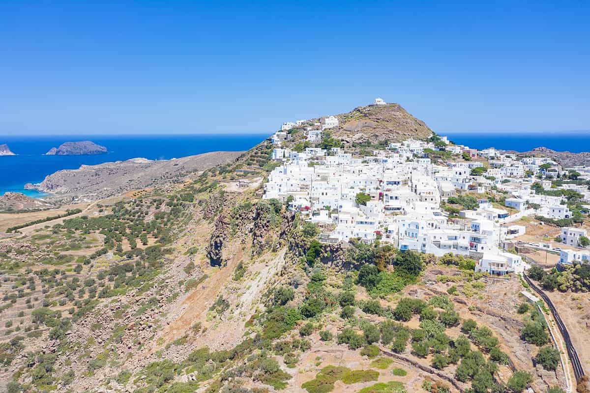
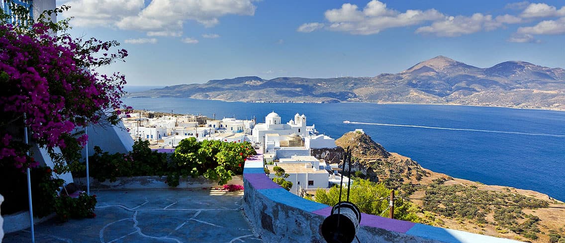
Plaka is the capital of Milos, and its official name is simply Milos. The houses stand 220 meters above sea level, on top of a large rock that overlooks the gulf. A Venetian castle of the 13th century crowns the hill above the bay. Cars cannot enter, because the lanes between the walls are narrow, so motorbikes and mopeds are the only vehicles. The village took its name from the flat ground where the first inhabitants built, once the castle no longer had room for the whole population.
Adamantas is the harbour town of Milos. It stands in the north of the gulf, on one of the largest and safest natural bays in the Mediterranean. Cretan refugees from Sfakia settled it in 1824, after their failed revolution against the Turks. The name comes from the Greek word adamas, which means diamond. The town is the commercial and cultural centre of the island and the largest tourist centre of Milos. A French cemetery from the Crimean war and the church of the Holy Trinity stand in the town.
Tripiti lies almost joined to Plaka. It is built in the shape of an amphitheatre over the ruins of the classical city of Klima, on soft volcanic rock full of holes, which gave the village its name. The church of Agios Nikolaos stands in the centre, and old windmills survive. The Milos Catacombs and the Roman theatre lie next to the village. Triovasalos comes earlier on the road from the port to Plaka. It is a dense village that forms a pair with Pera Triovasalos on two neighbouring cliffs.
Pollonia is a seaside village in the north-east of Milos and the second harbour of the island after Adamantas. It took its name from a temple of Apollo that stood east of the settlement. Fishing boats land fish, octopus and lobster at the pier by the church of Agia Paraskevi. Zefyria lies in the inner part of Milos. The Venetians founded it in the 13th century, and it served as the capital before Plaka, until earthquakes and epidemics emptied it in 1767. Today it is a rural settlement.
- Census: Triovasalos counted 1,379 residents in 2021, Adamantas 1,268, Plaka 902, Tripiti 766, Pollonia 268 and Zefyria 190.
- Pollonia: The village lies almost 10 kilometers from Adamantas and 14 from Plaka.
- Zefyria: The village lies 5.5 kilometers from Adamantas and 9 from Plaka.
- Triovasalos: Saint Spyridon dates to the start of the 19th century and Saint George to 1849.
- Zefyria heritage: The old diocese church Panagia Portiani stands beside the walled church of Agios Nikolaos.
From Adamantas, the road climbs to the plateau above the harbour, where Plaka and the castle hill stand. Triovasalos lies on the way up, Tripiti beside Plaka, and Pollonia and Zefyria further out, one on the coast and one inland. Each village of Milos has its own role: port, capital, ancient site, trading village, fishing harbour and farming settlement. A longer description of every place, with position and landmarks, is on the page about the villages of Milos.
Where are the sirmata fishing villages of Milos?
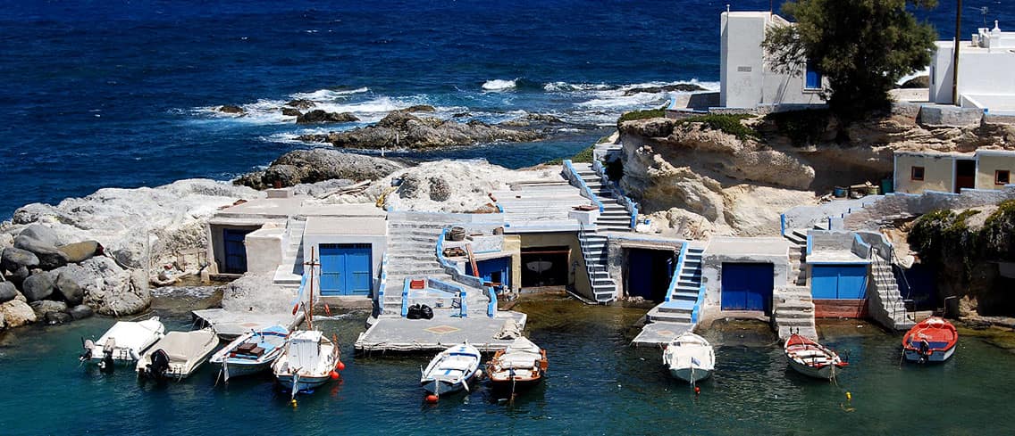
Milos keeps its sirmata fishing villages at Klima inside the gulf and at Firopotamos and Mandrakia on the north coast. Sirmata means wires, the local name for two-storey boathouses set into the rock, with the boat below and the family above.
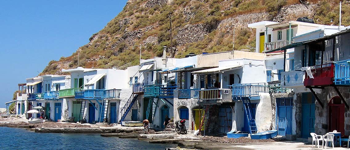
Klima is a traditional fishing village on the shore of the gulf, and the 2021 census counted only 8 residents. The word sirmata, which means wires, names the fishermen’s houses that stand in natural cavities of the rock. The playful colours of the doors and windows draw photographers to the rows of boathouses. Klima lies near the site of the ancient city of Milos and its theatre, and a road from Tripiti leads down to the Catacombs close by.
The wider area of Klima holds the ruins of the old town and of the first port of the island. After Phylakopi declined, the Dorians built the second-largest city of Milos here, from the southern part of Tripiti down to the shore. The remains include the two citadels of Profitis Ilias hill and Pyrgaki, parts of a market wall, parts of a temple from the Hellenistic and Roman period, parts of the ancient theatre, and the spot where the statue known as the Venus de Milo was found.
Firopotamos is a seaside settlement on the north coast of Milos, built around a creek that the sirmata ring. The beach is small, sandy and organised, and it suits both swimming and fishing. Tamarisk trees grow along the shore, and a beach bar stands on the sand. At the far edge, beyond the last of the fishing houses, stand an abandoned loading ladder and the church of Agios Nikolaos. The municipal tourism site lists Firopotamos with Klima and Mandrakia as settlements, apart from the villages.
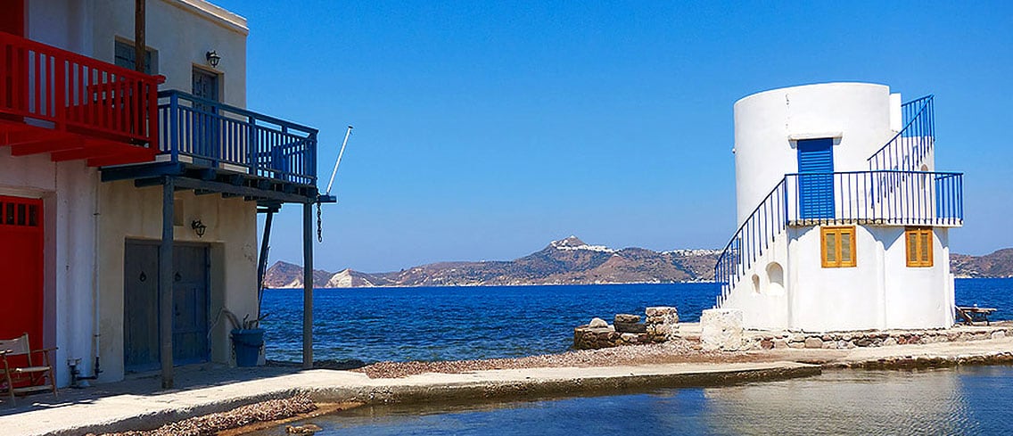
Mandrakia is a traditional fishing village on the north coast of Milos, surrounded by sirmata in bright colours. The village has rooms for rent and a restaurant for visitors. Its small, quiet beach is almost 150 meters long, with fine dark grey pebbles and tamarisk trees. Fourkovouni, inside the gulf of Milos, is a further tiny fishing village with a small beach and colourful sirmata, so the same building type appears on more than one shore of the island.
- Ground floor: The rock cavity under each house stored the fishing boat during winter.
- Upper floor: The fisherman’s family lived in the rooms above the boat.
- Doors: Owners paint doors and windows in bright colours.
- Modern use: A number of the Klima houses now serve as tourist accommodation.
- Beaches: Firopotamos and Mandrakia both keep a small beach with tamarisk trees beside the boathouses.
The sirmata show how fishing families on Milos used the rock of the shore for shelter and storage. Klima, Firopotamos and Mandrakia differ in size and setting, but each pairs a small harbour with a row of sirmata and a strip of beach. A closer account of the settlements, with their position and surroundings, appears on the page about the fishing village of Milos, which treats the boathouses one by one.
What are the main beaches on the north coast of Milos?
Milos has four beach areas on its north coast: Sarakiniko with its white volcanic rock, Papafragas with a sea cave, Firopotamos beside fishing houses, and the cove at Pollonia. Each one has a different shore, from bare rock to sand and tamarisk trees.
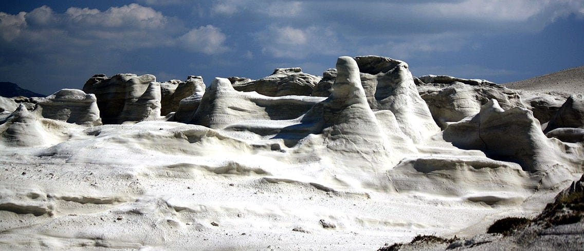
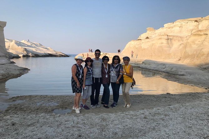
Sarakiniko is a beach on the north shore of Milos, on the Aegean Sea. Waves driven by north winds shape the greyish-white volcanic rock, and the area is compared to a moonscape. Local people call the landscape Lunar. The official tourism portal of Milos names it the best-known beach of the island and notes constant alternations of volcanic material and abundant fossils in the rock. Erosion by wind and waves gives the bone-white rock its shape, and the lack of vegetation sharpens the scene.
The sand at Sarakiniko covers only a small part of the Milos site. The beach lies niched between white rock formations and is made of thin white sand, and a couple of trees give small patches of shade at the back. A small natural harbour closed in by rock holds green-blue water. The name comes from pirates, who used the place as a shelter, and ship bollards carved into the rock are still preserved. Scenes of the film Bugonia by Yorgos Lanthimos were shot here.
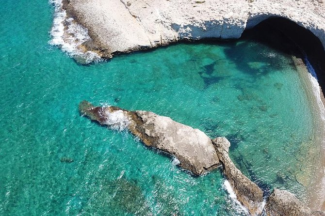
Papafragas lies next to the ruins of Fylakopi, a Bronze Age settlement on the north coast of Milos. Three caves are found here. Papafragas Cave is a deep sea cave where swimmers move through turquoise water between grey and white rock leading to the open sea. The beach is small and surrounded by bright rock, and a steep carving in the rock leads down to it. Byzantine pirates used it as a base. The last Frank Pope, who used the beach to protect his boat, gave it the name.
Firopotamos is a seaside settlement on Milos with a small but organised beach, suited to swimming and fishing. The beach is sandy, and a beach bar serves the shore. The settlement has tamarisk trees and a small creek surrounded by fishing houses. At the far edge, past the fishing houses, stand an abandoned loading ladder and the church of Agios Nikolaos. The municipal tourism portal lists Firopotamos among the north beaches of Milos, next to Sarakiniko, Papafragas and Pollonia.
- Sarakiniko east side: The dry east side holds the wreck of the ship Africa, which crashed there in 2003.
- Pollonia: The fishing village around a cove has a sandy beach and tamarisk trees.
- Harbour: Pollonia is the second harbour of Milos after Adamantas.
- Kapros: This small cove has fine sand and blue water beside white rocks.
- Nearby coves: Polychroni’s beach and Piso Thalassa lie close to the village.
The north coast of Milos shows how far one shore can change. Sarakiniko is bare white rock, Papafragas is a rock-walled cove beside a Bronze Age site, Firopotamos is a fishing settlement with sand and a beach bar, and Pollonia is a village around a cove. Pollonia and Kapros are easy to reach by car and by public transport, according to the island’s tourism portal. A stop at Papafragas joins swimming on Milos with Bronze Age history.
Which beaches lie on the south coast of Milos?
Milos has Tsigrado, Firiplaka, Paleochori, Provatas and Agia Kyriaki along its south coast. The shore is made of volcanic cliffs, coloured pebbles, fine sand and warm water, and the beaches range from an unorganised cove to large beaches with sunbeds and beach bars.
Firiplaka lies on the southern side of Milos, between Provatas to the west and Tsigrado to the east. The beach is extensive, with towering volcanic cliffs, fine grey-white sand, white pebbles and shallow turquoise water. Sunbeds, umbrellas and a beach bar serve it. The tourism portal spells the name Fyriplaka. Access is by car, taxi, bus or a boat that goes around the island from the port of Adamas. The largest part of the road is asphalt, and the last part is a gravel drive.
Tsigrado is a beach on the south coast of Milos, embraced by rocks, with white sand and emerald water. The municipal tourism portal spells the name Tsigkrado and lists it among the south beaches of Milos, with Paleochori, Firiplaka and Agia Kyriaki. A relatively easy dirt road leads to it, and reaching the sand means going down the hill on a steep path covered with sand. The beach is not organised, so visitors get the essentials from the nearby beach of Firiplaka.
Paleochori is almost 2 km long and very popular. The tourism portal writes the name Palaiochori. It has coloured pebbles, coarse sand and cool, clear, deep water. The rocks show red, pink, yellow and white-grey colours, a result of volcanic energy and the geological vitality of the area, and warm water gushes at the beach. In one cave on the south coast of Milos the heat from the volcano is still great, and the hot springs of the island have been noted since antiquity and are referenced by Hippocrates.
Provatas, on the south coast of Milos, has golden red sand coloured by iron oxides and very shallow water, suitable for children to play. It is organised with sunbeds and umbrellas, and it has a hotel, rooms to let and taverns. The road is paved and runs 7 km from Adamas, with good signage, and a frequent bus service reaches the beach. The official tourism portal describes it as a beach for families, and it lies west of Firiplaka, with easy access.
- Agia Kyriaki: This large organised beach has sunbeds, umbrellas, beach bars and a volleyball court.
- Water and sand: Cool water, colourful pebbles and thick sand mark Agia Kyriaki.
- Setting: Rooms to rent and a restaurant stand within walking distance of Agia Kyriaki.
- Firiplaka: A large rock with a cave under it stands in the water near the shore.
- Quiet stretches: Two lonelier beaches lie beyond the organised part of Firiplaka.
The south coast of Milos holds beaches of very different kinds. Volcanic cliffs at Firiplaka, iron-red sand at Provatas and warm water at Paleochori give it its character. Tsigrado stays unorganised, while Agia Kyriaki and Provatas have sunbeds and umbrellas. The tourism portal also lists east, west and inside-the-gulf shores, and the page on the beaches of Milos places every shore side by side, from organised sand to coves reached only on foot.
Which boat trips around Milos reach Kleftiko, Sykia and the west coast?
Milos boat trips visit Kleftiko, the Sykia sea cave and beaches that cannot be reached from land. Excursion boats and sailboats depart from the ports of Adamantas and Pollonia. Kleftiko lies in the south-west of the island, and Sykia lies on the western coast.
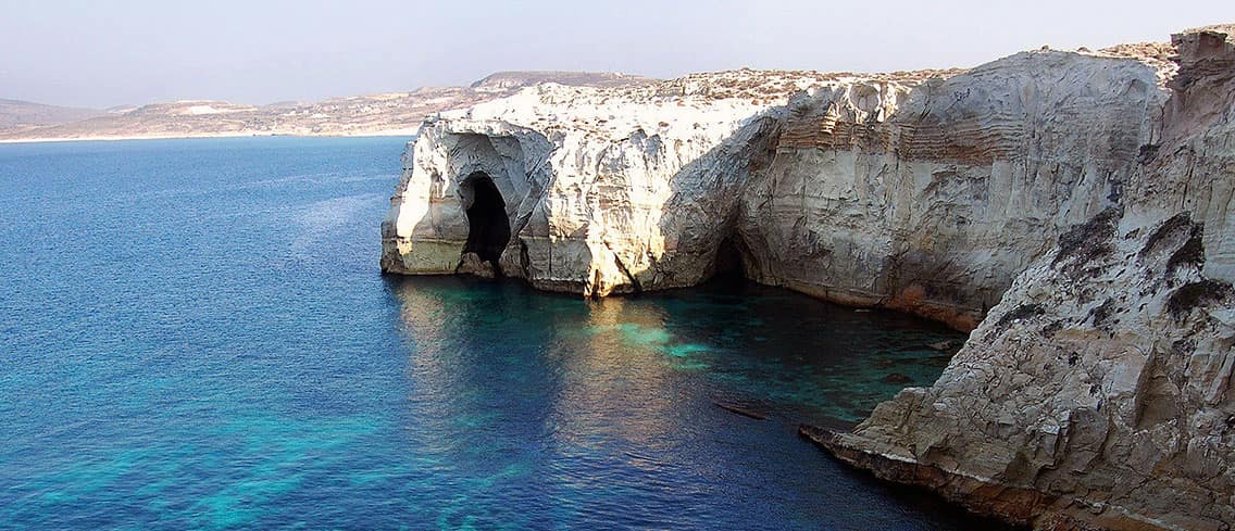
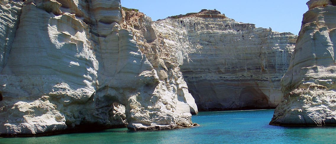
Kleftiko is a group of white cliffs and rock islets spread over three connected coves in the south-west of Milos. The municipal tourist portal describes gray and white rocks with strange shapes, caves and pits that wind and sea cut over the centuries. Tuffs of pumice breccia, formed about 3.1 million years ago, make up the cliffs, and basalt appears around them. The place is part of a Natura 2000 area. Its water is crystal clear, and the place also carries the name Thalassina Meteora.
The name Kleftiko goes back to piracy. The municipal portal states that the place served as a shelter and a base for pirates, and that the name comes from this use. The coves worked as a base from which pirates moved against ships, and the caves gave shelter in bad weather. Piracy stayed part of the story of Milos, and in the 19th century the island was a major rendezvous point for American and British ships that fought pirates in the Mediterranean.
Sykia is a sea cave on the west coast of Milos, and the municipal portal calls it a cave accessible only from the sea. The roof of the cave has collapsed. Sunlight enters from above and lights the emerald water inside. Excursion boats that call at Kleftiko stop at Sykia as well, so the cliffs and the cave form one route around Milos. On the south coast, the heat of the volcano is still great inside one of the caves.
The west of Milos is uninhabited and rugged. Almost all of this western region is a Natura 2000 site with over 800 different taxa, 35 of them endemic to Greece, and Mount Profitis Elias rises there to 748 metres, the high point of the island. The municipal portal lists the west-coast beaches as Sykia, Agios Ioannis, Ammoudaraki, Triades, Agkathia and Kalogries. Sea excursions let swimmers reach beaches that are not accessible from land and admire the mineral wealth of the island.
- Departure ports: Adamantas is the main port, and Pollonia is the second harbour.
- Kleftiko: The municipal portal advises a boat or sailboat for the white cliffs and caves.
- Sykia: The cave has no roof, so sunlight reaches its emerald water directly.
- Moorings: Private boats moor at Adamantas, Pollonia or coves such as Provatas, depending on wind direction.
- Monk seals: Fishermen report that Mediterranean monk seals used the Kleftiko caves as breeding sites.
Boat trips join the separate coasts of Milos into one route: the pirate coves of the south-west, the open cave of Sykia and the uninhabited shore between them. The one-day cruises from Adamantas start in the main port, which stands in the north of a bay that ranks among the largest and safest natural bays in the Mediterranean. The harbour of Pollonia serves the north-east. Both ports share the departures that circle the island.


How do day trips from Milos reach Kimolos and Polyaigos?
Milos day trips to Kimolos cross a channel 1 km wide, and a regular small boat links Pollonia with the neighbouring island. Polyaigos, an uninhabited island, lies 2 km from Kimolos and 6.2 km from Milos, and its only residents are goats.
Kimolos lies to the north-east of Milos and is separated from it by a channel 1 km wide. The island is round, with a land area of 36 square kilometres, and the 2021 census counted 810 inhabitants. Kimolos belongs to the Milos regional unit, and the port authority of Kimolos is a department of the Milos coast guard. The highest point is Mount Paleokastro at 364 metres. The island lies in the south-west of the Cyclades and shares the volcanic arc of Milos.
Pollonia is the second harbour of Milos after Adamantas and sits at the north-eastern tip of the island, almost 10 km from Adamantas and 14 km from Plaka. The village took its name from a temple of Apollo and had 268 inhabitants at the 2021 census. A regular connection runs from Pollonia to Kimolos with a small boat. The local ferry between Milos and Kimolos offers another way across. The one-day cruises from Pollonia set out from the same village.
Chorio is the main settlement of Kimolos and stands on a hill in the south-east of the island. The national tourism portal calls it the capital and divides it into two parts, Mesa Kastro and Exo Kastro. Mesa Kastro grew around the core of the medieval castle and has domes and arches, while Exo Kastro has square, austere buildings. The harbour, Psathi, has whitewashed houses, narrow cobbled streets and small boat houses. The portal calls the island a miniature version of the Cyclades, the group that includes Milos.
Polyaigos is an uninhabited island of the Cyclades and is part of the community of Kimolos. It measures 6 km along its longest axis and 4.3 km across its shortest, with an area of about 18 square kilometres. Two summits rise on it, Stroggylo at 330 metres and Psilo Vouno at 370 metres. Its name refers to goats, and their grazing keeps the island barren. The Greek Orthodox church owns a great part of the land and sublets parts of it to herdsmen from Milos and Kimolos.
- Chalk: The island is named after kimolia chalk, and Kimolian Earth became a valuable trade good.
- Skiadi: This huge mushroom-shaped stone in a small valley was shaped by wind-blown dust.
- Local transport: Vehicles are permitted on Kimolos, and bus and taxi routes serve popular beaches.
- Polyaigos: Beaches lie mainly in the south, and its sea caves shelter a dwindling monk seal population.
- Ancient records: Ptolemy, Pliny the Elder and Pomponius Mela mentioned Polyaigos.
Day trips from Milos link three islands of one volcanic arc. Kimolos adds a hill-top Chorio and a working harbour, and Polyaigos adds an empty landscape of goats and sea caves. In the Hellenistic period, the Melians and the Kimolians took their dispute over Polyaigos to Argos, and the Argives decided that the island belonged to Kimolos. Today Polyaigos is part of the community of Kimolos, and the Kimolos article calls it the largest uninhabited island of the Aegean.


What does sea kayaking in Milos offer along the coast?
Milos offers sea kayaking along a volcanic coast of sea caves, tunnels and white rock, with deserted beaches and uninhabited islands close by. The official tourist site lists canoe-kayak among its sea sports, and the summer north wind shapes each day on the water.
The official tourist site of the Municipality of Milos ties the coast to the volcano. Because of the volcanic make-up of the island, the shore has sea caves and tunnels that suit exploration by water. The same page lists clear water, deserted beaches and neighbouring uninhabited islands as places to paddle. A sea kayak is built for open water, with a covered deck and room for a spray deck. A paddler can rest on the deserted beaches of Milos and wander out to the neighbouring islands.
The north shore of Milos shows what wind and water do to soft volcanic rock. At Sarakiniko, waves driven by north winds shape the grey-white rock, and the area is compared to a moonscape. A route description adds that the white rock forms caves in the sea. On the south-west coast, Kleftiko is a set of grey and white rocks with strange shapes, caves and pits cut by air and sea, and the official site names a boat or sailboat as the way to reach it.
The island has a sheltered side too. The natural harbour is the hollow of the main crater, which cuts in from the north-west and divides Milos into two fairly equal portions. The official site says the natural bay offers maximum safety for windsurfing and kitesurfing, and it names Achivadolimni and Papikinos as beaches there. The gulf holds a long run of beaches, among them Empourios, Fatourena, Rivari and Areti. Short recreational kayaks with wide beams and large cockpits are the type made for sheltered water.
The meltemi sets the limits. These strong, dry north winds blow across the Aegean from late spring to mid-September, and they are strongest in the afternoon. A spell can last for days without a break. The winds rise in clear weather without warning and can reach force 7 to 8 on the Beaufort scale, which makes them dangerous to sailors. North-facing shores such as Sarakiniko take the waves that north winds drive, while the gulf of Milos cuts in from the north-west.
- Size: Milos measures about 23 km east to west and 13 km north to south.
- Warm cave: One south-coast cave still holds great heat from the volcano.
- Neighbours: Kimolos lies 1.6 km north-east, and uninhabited Antimilos lies 21 km north-west.
- Season: The official site lists escorted day trips by canoe-kayak from April to October.
- Sykia: This roofless cave on the west coast is reached only from the sea.
A plan for sea kayaking in Milos starts with the wind and then picks the coast. The official site gives April to October as the season for escorted day trips, a period that contains the meltemi months. The caves, the white rock and the neighbouring islands belong to the open coast, while the official site places maximum safety in the natural bay. The activity page for kayaking in Milos goes further into the options for paddlers.

Which hiking and walking paths in Milos lead past mines, coves and craters?
Milos and neighbouring Kimolos share seven marked geo-routes that cross volcanic landscape and reach coves, craters, old mines and villages. The shortest, the Sarakiniko route, is 4.5 km long, and the longest, Route 1, is listed at 24 km, with driving and walking combined.
The official tourist site presents the seven routes as a way to read the geological time, nature and history of the island. Each route is marked on the ground and comes with a text and a detailed map. The land is rugged and hilly, and Mount Profitis Elias in the west reaches 748 metres. Milos has a Mediterranean climate with warm to hot dry summers. Almost all of the uninhabited west is a Natura 2000 site with over 800 different taxa.
Route 6 is the coastal walk. It runs 4.5 km from the settlement of Agios Konstantinos to Sarakiniko, and the path is not visible along its whole length. A walker stays parallel to the coast on flat rock. On the way, an islet called Kofto, cut off from the shore by faults, holds a small colony of silver gulls. At Sarakiniko the white volcanic rock forms caves in the sea and gives the impression of a lunar landscape.
Route 2, called Volcano, covers 13 km and starts at the old salt pans of Alykes. It climbs through a cedar forest to Kedrolivado, a large meadow with centuries-old cedars. The main stop is the crater of Fyriplaka, 1,700 metres across and 200 metres deep, a pyroclastic cone with layers of ash, sand and perlite fragments. Farther south, at Kalamos, old kaolin galleries and yellow crystals of native sulfur mark the vapour points, and the beach of Agia Kyriaki comes into view.
Two routes lead into the mining landscape of the island. Route 3, Sulfur Mines, covers 13 km from the village of Zefyria along the Lagada ravine, past galleries where kaolin was mined and past rocks that sea air has worn into shapes like open-mouthed animal heads. It ends at the old sulfur mines, the only industrial complex of Milos designated as protected. Route 4, Aggeria, covers 12 km and reaches an observation point above the large Aggeria mine, where the geological layers show colour.
- Adamas to Plaka: From Adamantas an ascent leads to Plaka and Kastro.
- Route 7: It leads from Adamas to Tripiti, where walkers continue among age-old olive trees.
- Viewpoint: The chapel of Panagia Tourliani looks west across Milos and the bay of Adamas.
- Pollonia: Route 4 begins at Pollonia, at the north-east end of Milos.
- Kimolos: Route 5 covers 17 km, with a 1.5 km side path to Skiadi.
Planning a walk in Milos starts with the route list, because lengths run from 4.5 km to 24 km and the surface changes from flat rock to dirt road. Walkers match the route to the season, since summers are hot and dry and the meltemi blows from late spring to mid-September. The official routes start from villages such as Adamas, Zefyria and Pollonia. The activity page on hiking in Milos lays out the walks in more detail.
Which museums in Milos tell the story of the island?
Milos has four main museums: the Archaeological Museum and the Folklore Museum in Plaka, the Mining Museum in Adamantas, and the Ecclesiastical Museum close to the port of Adamantas. Together they cover the prehistory, village life, mineral extraction and church art of the island.
The museums of Milos start with the Archaeological Museum on the main square of Plaka. It fills a neoclassical building from 1870. The permanent display has three rooms, a porch and an open courtyard, and it presents finds in chronological order. The prehistoric room holds objects from the Neolithic settlement at Pounta Agali, from Early Cycladic cemeteries and from Phylakopi, a Bronze Age town inhabited from 3300 to 1100 BC. Obsidian tools from the Neolithic to the early Bronze Age complete the display.
The two rooms of the historical period show reliefs, grave stelae, statues and pottery. A copy of the Venus de Milo stands among the sculptures, while the original is in the Louvre in Paris. Inscriptions on stelae and statue bases record facts about the government of Milos, its citizens, its temples and cults, and its sculptors. The exhibits come mainly from the ancient town and its cemeteries and outline life from the 8th century BC to the 5th or 6th century AD.
The Folklore Museum of Milos lies in Plaka behind the church of Panagia Korfiatissa. Founded in 1967, it shows island life mainly between 1850 and 1930, a time of prosperity for local society. The two-storey building presents what a town household was like in the 19th century. Its living room, work area with a loom, kitchen, bedroom and cellar show daily routine. The cellar also served as a warehouse for farm produce, and a gallery works as a historical archive.
The Mining Museum of Milos is in Adamantas. A non-profit company created it in 1998 to honour the mining history and the geological and natural heritage of the island. The ground-floor room presents the social, economic and technological side of mining on Milos. The first-floor exhibition covers the minerals mined on the island from the Neolithic era to today, stressing everyday uses. Films show how minerals are extracted and produced, and a screening room carries stories from old miners.
- Collections: Finds from Milos run from the late Neolithic to the Byzantine period.
- Phylakopi: The best pieces are in the Ashmolean Museum, the British Museum and the National Museum of Athens.
- Folklore exhibits: Furniture, textiles, embroidery, clothes and old photographs fill the rooms.
- Adamantas: The Milos Mining Museum belongs to the cultural and commercial centre of the island.
- Courtyard: Two 1937 mosaics show a dragon shaped like Milos and the battle of good and evil.
The Ecclesiastical Museum of Milos sits close to the port of Adamantas, inside the church of the Holy Trinity. The building began as a monastery named Panagia Theofani, and Cretan refugees bought it in 1839 to serve as their village church. Its three-aisled basilica with a dome is rare, since only one other church of the type exists, in Levidi in Arcadia. The museum shows icons of the 14th century, works of the Cretan school and carved wood.
What do the Catacombs of Milos and the ancient theatre of Milos show?
Milos keeps an ancient Christian cemetery and a Roman theatre close together near Trypiti and Klima, on the slope of the ancient city. The catacombs are rock-cut burial galleries, and the theatre has marble seats above an arena. The Venus de Milo was found nearby.
The ancient town of Milos spread over the slope between the village of Trypiti and the landing place at Klima. Dorian settlers founded the city on the eastern shore of the bay, south-west of present-day Trypiti. Klima lies near the site of ancient Milos and its theatre, and near the place where the Venus de Milo was found. A Greek farmer dug up the statue on 8 April 1820, and a French naval officer wrote that it lay in a quadrangular niche.
The Catacombs of Milos form an ancient underground Christian cemetery, in use from the 1st century AD. They lie near Trypiti, next to the site of the agora of the ancient city and 200 metres east of the ancient theatre. Trypiti takes its name from the holes in the soft volcanic rock, where caves still serve as storerooms and stables. The galleries are 1 to 5 metres wide and 1.6 to 2.5 metres high, with tombs cut into the walls and the floor.
The present entrance opens into the hall of Catacomb B. That hall keeps the only intact two-storey arched tomb and fragments of an inscription of the Presbyters in red capital letters. In the middle stands a freestanding tomb shaped like a sarcophagus, known as the tomb of the martyr. Researchers think it served as an altar table, because a canopy once rose above it. Catacomb A, to the west, is the second hall open to visitors, and its north side holds paired arched tombs.
The Roman theatre of Milos stands south of the flat area identified as the agora and next to part of the eastern city wall. A cemetery of the Hellenistic period seems to have occupied the spot. The horseshoe-shaped seating area is cut mainly into the natural slope of volcanic tuff. The excavated lower part has eight marble stairways that divide the marble seats into seven sections and holds about 800 spectators. The orchestra lies 1.6 metres below the first row, so it worked as an arena.
- Local name: Milos residents called the catacombs the Greek Cave.
- Digs: Work in 2007 to 2009 found nine arched tombs, four horizontal tombs and 33 pit graves.
- Grave goods: Amulet cases, a metal ring, glass perfume jars and glass beads were rare finds.
- First record: A Jesuit monk found three rows of marble seats in 1735.
- Theatre digs: Work in 1990 to 1995 and 2010 to 2015 uncovered the arena and stage building.
The theatre stopped working in the 4th century AD, yet its spaces served as homes or workshops until the end of the 6th or early 7th century. Graves were opened in the arena walls, and lime kilns were built in the orchestra and the stage area. Even after final abandonment, the ruin supplied building material to islanders. A restoration project from 2010 to 2015 stabilised the visible part and added new marble pieces to the seating area.
What is the mining heritage of Milos?
Milos has been a mining island since prehistory. Obsidian was already a commodity 15,000 years ago, and sulphur, kaolin, baryte, bentonite and perlite followed. Abandoned galleries, rails and warehouses still mark the coast, while bentonite and perlite are still extracted today.
Obsidian is a glass-like volcanic rock, and Milos was the source of it for Greece and the lands around it. Obsidian from Milos was a commodity as early as 15,000 years ago and was shaped into extremely sharp tools well before farming began. Pieces reached Knossos in Crete and Nea Nikomedeia in Macedonia. Collectors arrived by boat, beached in a cove and cut the glass from the quarries. The work created no permanent settlement, and the trade faded when bronze replaced stone for weapons.
Sulphur made Milos known in the ancient world. Pliny the Elder named the island as the best-known source of sulphur and listed four kinds, used for medicine, by fullers, to bleach wool and for lamp wicks. Milos alum ranked next to alum from Egypt, and Melian earth, a white pigment made mainly from kaolin, served ancient painters. Sulphur mining continued into the twentieth century. The old workings at the cove of Paliorema operated until 1956, and they are the only industrial complex on Milos protected as a historic site.
Kaolin and baryte left galleries across the island. Old kaolin tunnels cut the slopes of the Lagada ravine and the hills at Kalamos, where yellow crystals of native sulphur still form at the vapour points. Near Mersinia, old galleries held kaolin and baryte. The kaolin of Milos carries iron oxides, so it is not very white, yet the whiter outcrops were once worked through galleries for small-scale ceramic use. Baryte was mined until 2000, and a restored kaolin processing plant now serves as a conference centre.
Bentonite and perlite define mining on Milos today. Bentonite is a swelling clay that forms when volcanic ash alters, and Milos holds a known deposit of it. Perlite is volcanic glass formed by the hydration of obsidian, and it serves as a soil conditioner. Both are taken from open pits, together with pozzolana, and sold all over the world. Industrial installations at Voudia beach block access to that part of the east coast, a reminder that mining remains part of the local economy.
- Obsidian quarries: Nychia and Demenegaki were the main prehistoric obsidian quarries on Milos.
- Sulphur ruins: Paliorema keeps wagons on their rails, rusty tools and spare parts in a warehouse.
- Kaolin tunnels: Galleries survive in the Lagada ravine, at Mersinia and at Kalamos.
- Salt works: The old saltworks at Alykes, abandoned since 1981, now form a wetland.
- Perlite road: A dirt road on the Volcano walk crosses soft perlite that looks like sand.
Mining gave Milos a long working history that the landscape still records. Prehistoric boat crews, ancient sulphur makers and modern open-pit operators all worked the same volcanic ground, taking obsidian first, then sulphur, then clays and perlite. Rusted rails, tunnels and processing buildings show how the island earned its living, and the marked geological walks of Milos lead to them. The minerals still leave the island for buyers around the world.
What is the local food of Milos?
Milos cooks with sheep and goat cheeses, capers, tomatoes, fresh fish and honey. The best-known dish is the pitaraki, a small pie filled with cheese or herbs. Tavernas serve octopus, lobster pasta and local meat, and weddings bring koufeta, a sweet of pumpkin, honey and almonds.
The food of Milos grows from the land and the sea and from the self-sufficiency of its people. In yards, traditional cafes and gardens, capers dry in the sun, pitarakia bake and tomatoes are picked. Capers grow in abundance on the rocky soil, are collected by hand, dried in the sun and then kept in vinegar or salt. Olive trees and orange trees grow on the island, which is too dry for profuse vegetation, and the plains hold olive groves, vineyards and fields of cereals.
Cheese forms the base of the local table. Across Greece, climate and terrain favour goats and sheep over cattle, and the cheeses of Milos follow that pattern. Arseniko comes from sheep or goat milk and matures in stone storerooms, which gives it a spicy flavour. Xino tyri is a fresh cheese with a mild acidity. Manoura is made with goat milk, touloumotyri ages in an animal skin, and xinomyzithra is creamy and tangy. The pitarakia fill with myzithra and mint or with a peppery dry cheese.
Pies carry a large part of the island cooking. The pitaraki is a small half-moon pie of myzithra, fried and served hot with honey. Ladenia is a pie with oil, tomato and onion. Tomatoes also go into domatokeftedia and courgettes into kolokythokeftedia, both fried lightly in olive oil. Fouskoma is a sourdough bread baked in a wood-fired oven. Local tomatoes make beltes, a tomato paste served as an appetizer with olive oil. Everything is cooked simply, with knowledge passed down through generations.
The sea supplies the taverna menus. Fish dishes are common on Greek islands, and ancient Greek cuisine already treated fish as more common than meat. Fresh fish, grilled octopus, octopus cooked in wine and lobster pasta all appear on Milos. Meat dishes are local as well, such as braised or wine-roasted rooster and lemonato, goat cooked with lemon. In tavernas and at panigyria, the traditional festivals, skoufomakarono, a pasta with myzithra cheese and browned butter, joins the table. Local menus run from fresh fish to international cuisine.
- Koufeto: A sweet of pumpkin crumbs, honey and almonds, served at weddings and engagements.
- Karpouzopita: A sweet watermelon pie from the island.
- Pasteli: Bars of sesame and honey.
- Kourtalides: Local name for loukoumades, fried dough balls served with honey.
- Wine and honey: Winemakers work with the volcanic soil, and small units produce thyme honey and herbs.
Food on Milos follows the same rule as its mining past: it uses what the volcanic island offers. Volcanic soil shapes the wines, rocky ground feeds the capers, and the surrounding sea fills the taverna kitchens with fish. Cheese matured in stone storerooms and pies baked in the oven add the local flavour. At weddings, the honey of koufeto stands for a sweet married life. The page on food in Milos covers the island table in more detail.

When is the best time of year to visit Milos?
Milos has a Mediterranean climate, with mild, rainy winters and warm to hot, dry summers. Late spring, early summer and early autumn bring daytime highs of about 23 to 27 °C with very little rain, while July and August add the strongest heat and the meltemi wind.
Summer on Milos is hot and almost rainless. Mean daily highs reach 27.1 °C in June, 28.1 °C in July and 27.6 °C in August, while July nights average 21.8 °C. July receives 0.3 mm of rain and August 1.4 mm, with only 0.1 rainy days in each month. The record high for June is 44.0 °C, so extremes occur. The dry months run from late spring to early autumn, and none averages more than 13.1 mm of rain.
The meltemi, also called the etesian wind, is a strong, dry north wind of the Aegean Sea. It blows from late spring to mid-September and peaks in July and August. Its direction ranges from north-east to north-west, depending on local topography. Gusts can reach force 7 or 8 on the Beaufort scale, and the wind rises in clear weather without warning. It is strongest in the afternoon and frequently eases at night, but spells lasting for days occur. Under such conditions, certain yachts and inter-island ferries cannot sail.
Sea temperature around Milos changes with the seasons. The Mediterranean Sea is mild in winter and warm in summer, and the relatively cooler sea and the sea breeze moderate heat along the coast. The Aegean meltemi also keeps air temperatures lower than on the Ionian Sea coast or the mainland. Winter is the wet season: December averages 90.3 mm of rain over 9.0 rainy days, January 74.7 mm and November 60.7 mm, with a yearly total of 410.8 mm.
The shoulder seasons sit on either side of the summer peak. In April the mean daily high is 18.4 °C and rainfall is 20.5 mm. In late spring the high rises to 22.8 °C with 13.1 mm of rain, and the meltemi is less frequent than in July and August. September brings 25.2 °C with 5.8 mm of rain. By October the high is 21.3 °C, but rainfall climbs to 42.9 mm, so the wet season is already returning.
- April: the nights average 12.4 °C and the month has 2.9 rainy days.
- June: the month has 0.3 rainy days and humidity averages 58.8%.
- August: the daily mean is 24.6 °C and nights average 21.6 °C.
- October: the daily mean is 18.5 °C and the month has 3.9 rainy days.
- January: the daily mean is 10.5 °C and the month has 8.8 rainy days.
For a trip to Milos, the climate figures favour late spring, early summer and early autumn: days are warm, rain is rare and the meltemi is less frequent than at the July and August peak. July and August suit visitors who want the highest air temperatures and accept the wind. Winter on Milos is mild but wet, and the cooler months bring more rain and lower daytime highs.
Which areas of Milos work best as a base for staying?
Milos has five main bases for staying: Adamantas, the port and commercial centre; Plaka, the chief town on its rock; Pollonia, the second harbour in the north-east; Tripiti, beside the ancient theatre; and Klima, a seaside village of traditional sirmata fishermen’s houses.
Adamantas is the harbour town of Milos and the cultural and commercial centre of the island. Cretan refugees from the Cretan Revolt founded the port in 1841. The town holds the Milos Mining Museum and the Maritime Museum, together with the French cemetery used during the Crimean war and a church of the Holy Trinity that is 600 years old. The harbour fills the hollow of the principal crater, which opens from the north-west and divides the island into two nearly equal parts.
Plaka is the chief town of Milos. It stands on the top of a large rock and overlooks the gulf of Milos, on the plateau above the harbour of Adamantas. The village of Kastro rises on a hill above it. No cars can enter Plaka, because the spaces between walls and buildings are narrow. Motorbikes and mopeds are the only usable vehicles, so cars cannot reach the lanes inside. The 2007 film To Fili Tis Zois was shot in Milos, in Plaka and the port of Adamas.
Pollonia, also written Apollonia, is a seaside village in the north-eastern part of Milos and the second harbour of the island after Adamantas. It takes its name from a temple of Apollo that once stood east of the settlement. A small boat connects the village with neighbouring Kimolos. The main beach is sandy and popular with tourists, and two more beaches, Polychroni’s beach and Piso thalassa, lie near the village. It belongs to the community of Triovasalos in the municipality of Milos.
Tripiti is a small town next to the Milos catacombs and the Roman theatre. Klima is a seaside village near the site of ancient Milos and the spot where the Venus de Milo was found. The ancient town occupied the slope between Tripiti and the landing place at Klima, and the Dorian city stood on the eastern shore of the bay. The sirmata of Klima are fishermen’s houses of two floors: the family lives upstairs, and the boat is stored on the ground floor during winter.
- Adamantas: the harbour town counted 1,268 residents, the largest of the five.
- Plaka: the chief town counted 902 residents and has no car access.
- Pollonia: the harbour village counted 268 residents and has a sandy main beach.
- Tripiti: the small town counted 766 residents and lies beside the catacombs.
- Klima: the seaside village counted 8 residents, the smallest of the five.
The choice of base on Milos comes down to access and setting: the port for transport links and services, the hill town for a car-free village, the north-east for a sandy beach and boat links to Kimolos, and the bay shore for ancient sites and sirmata. Today a portion of the sirmata serve as tourist accommodation, and the stay options are listed on the page about accommodation in Milos.
How do travellers get around Milos?
Milos has roads that climb from the harbour to the plateau villages, local buses on certain routes, taxis at the port and the airport, and the largest dirt-road network in the Cyclades, while boats serve beaches that no road reaches.
Adamantas is the harbour town of Milos and the cultural and commercial centre of the island. It had 1,268 residents at the 2021 census. The natural harbour fills a crater that cuts in from the north-west and divides the island into two fairly equal parts, with an isthmus no more than 2.2 kilometres broad. A road climbs from the harbour to the plateau above it, where Plaka, the chief town, stands below Kastro. Triovasalos, Peran Triovasalos, Pollonia and Zefyria, also called Kampos, are other villages.
Local buses serve certain areas of Milos, and the summer timetable is frequent. Passengers buy the ticket on board, and the fare depends on the destination. Coaches are available for hire as well. The visitor site lists a phone line and a website for bus timetables. Fifteen taxis work on the island, and they wait at the port and at the airport. The airport lies 5 kilometres south-east of the harbour, and taxis link it with the rest of the island.
The official visitor site lists motorcycling as an off-road activity and describes three routes. One runs from Empourio past Agios Stylianos to a main dirt road, turns at the junction towards Vani and ends at a swimming spot. Another leaves Plaka towards Firopotamos and turns onto a passable dirt road that ends at the lonely beach of Trachilas. The third follows the road to the top of Profitis Elias in the west, with a view of the sea and of Kleftiko.
The same site states that the network of dirt roads of Milos is the largest in the Cyclades. These roads lead to coastal sites, chapels and mines, and in places the routes are very difficult. The western region of the island has no residents. Almost all of it is a Natura 2000 area, which is home to over 800 taxa, including 35 that are endemic to Greece. The official visitor site also sorts the beaches into north, south, east and west groups.
- Agios Ioannis: a west beach at the end of a dirt road of about 12 kilometres, where only the first of three parts is accessible by car.
- Agkathia: this west beach is quite inaccessible because of the dirt road that leads there.
- Sea excursions: boats and sailboats reach beaches that are not accessible from the land.
- Departure ports: daily boat departures include the ports of Adamas and Pollonia.
- Kimolos: frequent local ferry boats connect the neighbouring island with Milos.
A map of Milos shows how the harbour road, the plateau villages and the dirt roads of the west relate to the coast. The official visitor site describes sea excursions as the way to reach beaches that no land route serves, including caves and the mineral wealth of the island. Roads, buses, taxis and boats cover different parts of the island, and the terrain decides which one fits a given beach.


What do travellers ask about Milos?
Milos is a volcanic Greek island in the Aegean Sea at the south-western end of the Cyclades. The questions below give the practical facts that travellers ask about the island, from size and population to the chief town, neighbouring islands, the mainland and the Venus de Milo.
How large is Milos?
From east to west the island measures about 23 kilometres, and from north to south it measures 13 kilometres. The area of the island is estimated at 151 square kilometres. The municipality also includes the uninhabited offshore islands of Antimilos and Akradies, and the combined land area of the municipality is 160.147 square kilometres.
What is the population of Milos?
The 2021 census counted 5,193 inhabitants in the municipality, which includes the uninhabited offshore islands. The population peaked at 6,562 people in 1928 and stood at 4,977 in 2011. Adamantas, the harbour town, had 1,268 residents in 2021. The Ottoman Empire never performed a census before 1881, so earlier figures are hard to find.
What is the capital of Milos?
Plaka is the chief town of Milos. It stands on the plateau above the harbour, and Kastro rises on a hill above it. The harbour town of Adamantas is the cultural and commercial centre of the island, so the chief town and the main commercial centre are two different places.
What is the highest point of Milos?
The greater part of the island is rugged and hilly, and it culminates in Mount Profitis Elias, which stands 748 metres high in the west. One of the three off-road routes on the official visitor site follows the road to its top. The highest point of neighbouring Kimolos is Mount Paleokastro, at 364 metres.
Where is the Venus de Milo, the statue found on Milos, kept today?
The Venus de Milo stands in the Louvre in Paris, where it has been displayed since 1821. A Greek farmer found the statue on Milos on 8 April 1820, when the island was still part of the Ottoman Empire. The Louvre sits on the Right Bank of the Seine, in the 1st arrondissement of the city.
How far is Kimolos from Milos?
Kimolos lies to the north-east of Milos, separated from it by a channel 1 kilometre wide. The island has a land area of 36 square kilometres and reported 810 inhabitants in the 2021 census. Local ferry boats connect the two islands frequently, and bus and taxi routes on Kimolos run to popular beaches.
Which uninhabited islands lie near Milos?
Antimilos lies 21 kilometres north-west of the main island and is an uninhabited mass of trachyte. Akradies belongs to the municipality and has no residents either. Polyaigos lies 2 kilometres south-east of Kimolos, and it is the largest uninhabited island of the Aegean. It belongs to the municipality of Kimolos, together with Agios Efstathios and Agios Georgios.
How far is Milos from the Greek mainland?
Milos lies 120 kilometres due east of the coast of Laconia. The island sits between mainland Greece and Crete, just north of the Sea of Crete, at the south-western end of the Cyclades. That position made it an important centre of early Aegean civilisation, because obsidian from the island reached buyers over long distances.