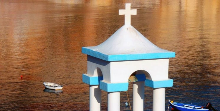
Once you rent a car, an ATV or a buggy from Rac SA, take the road to Klima.
In Klima you will admire the “sirmata”, small houses with large, colourful wooden doors.
They were first built to shelter the fishing boats in winter, but over time many of them have been turned into small holiday homes.
The statue of the Venus de Milo was found by chance in a field near Klima in 1820.
Klima is a shore settlement on the island of Milos, at the entrance of the gulf below the village of Tripiti. Two layers of history share one cove. A row of boathouses cut into rock stands at the water, and the slope above holds the ruins of the ancient city of Melos. The sections below take the settlement first and the ancient city second.
The ruins of the ancient city, its harbour town and its cemeteries spread over a large area around the cove. Klima is a village of sirmata, the landing place of a Dorian city and the ground near the Venus de Milo find. The shore carries the fishermen’s boathouses, and the slope above carries the walls, the theatre and the burial ground. Klima is a living cove and an archaeological one.
Where does Klima lie, and how do its boathouses follow the shore?
Klima lies at the entrance of the gulf of Milos, below Tripiti, in the cove that once served as the ancient harbour. Its boathouses are cut into volcanic rock beside the sea, and they mark the line of that old shore.
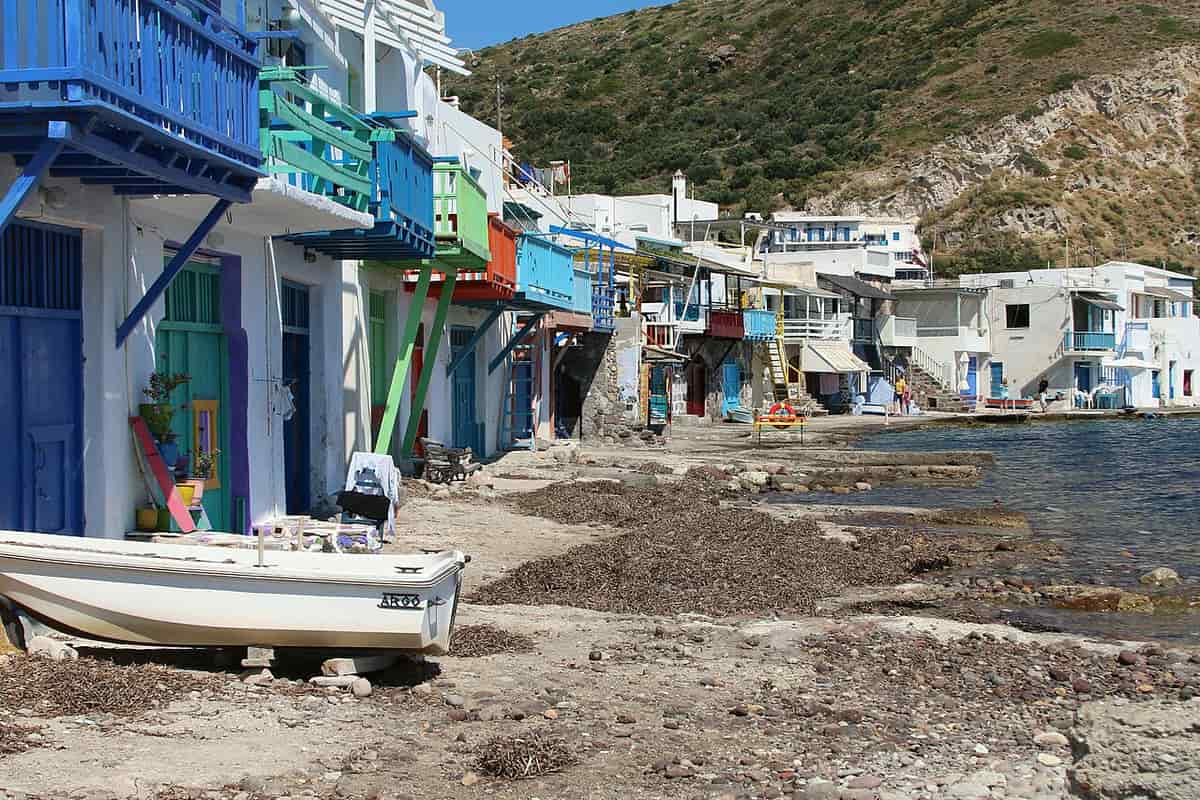
Klima stands at the entrance of the bay of Milos, under the village of Tripiti. Dorians from Laconia founded the city of Melos in a strategic position, on the eastern side of the narrow entrance to the great gulf. The ancient town stood nearer to the entrance of the harbour than Adamantas does, on the slope between Tripiti and the landing place at Klima. Klima has been a designated traditional settlement since 1978.
The ground under the boathouses is young in geological terms. Volcanic activity on Milos began 2 to 3 million years ago, in the Pliocene, and the last eruption came 90,000 years ago. The volcano is still considered dormant. The boat spaces are dug into volcanic tuff beside the sea, and the houses stand in soft rock or in the natural cavities of the rocks.
The settlement is known for the sirmata, the houses of the fishermen who live there. A sirma is known as a two-storey house, with the fisherman and his family living on the upper floor. The row of boathouses has a clear link to the old port. The characteristic sirmata of the fishermen at seaside Klima defined the shoreline in the cove that once was the harbour of the ancient city. Silt from the valley now covers much of that old harbour, and part of it lies under the sea. The line of doors at the water therefore follows the edge of a port that has partly filled in with silt and partly sunk.
The villages above the cove arrived much later than the harbour did. The ancient city and its harbour were not lived in again after they were abandoned. Plaka and Tripiti were founded in the second half of the 18th century, more than a thousand years after the city was abandoned, and both kept outside the ancient walls, as Kastro had earlier. The old city and its cove therefore stayed apart from the newer villages that stand above them.
- Distance: Klima lies 6 kilometers from Adamantas, the main port.
- Valleys: The valleys of Tramythia and Klima are among the areas of ruins.
- Settlements: Klima, Mandrakia and Firopotamos are the smaller settlements of Milos.
- Kastro: Kastro dates to the mid 13th or early 14th century.
- Port: The harbour town of the ancient city lies among the remains, beside the hills and cemeteries.
Klima is therefore a cove with a past that can be read from the shore. The boathouses stand on a line set by an older harbour, in rock shaped by volcanic activity, below villages that came after the ancient city. The page on the fishing village of Milos compares Klima with Mandrakia and Firopotamos. The next section climbs from the cove to the ruins behind it.
What does ancient Klima show about the harbour, walls and theatre of Melos?
Klima was the harbour side of ancient Melos, a Dorian city inhabited from at least the 9th or 8th century BC to the 6th or 7th century AD. Its walls, agora, theatre and cemeteries spread over two hills and two valleys.
The ancient city lived for over a thousand years, with continuous habitation from at least the 9th or 8th century BC to the 6th or 7th century AD. The Melians were colonists of the Spartans, and unlike the other islanders they did not want to obey Athens. The ruins at Klima are the old Klima, the first port of the island, and the cove forms part of the city.
The agora lay on the plateau between the two hills of Pyrgiante and Profitis Ilias. Walls enclosed both hills, and parts stand today at a number of points, at great height in places. The cemetery lay outside the walls to the east. The Catacombs lie on the hillside southwest of Tripiti, in the area of the ruins at Klima, with burials from the middle of the first century AD to the 6th century.
The theatre stands above the shore, in an impressive position over the seaside settlement of Klima. It has a view of the port and very good acoustics. The building dates to the Roman period and lies south of the agora plateau, beside part of the eastern wall. The architect Carl Haller von Hallerstein dug there in 1816 and 1817, and the excavated part is about a tenth of the whole.
The field of the Venus find lies in the same ancient city. Klima is near the spot, and the discovery by a Greek farmer dates to 8 April 1820. A French sailor, Olivier Voutier, watched and urged him to keep digging, and they uncovered two large pieces of the statue and a smaller one. A hand holding an apple and two herms lay beside it. The farmer was Georgios Kentrotas, who did not know its archaeological value.
- Siege: Athens invaded with 3,400 men in 416 BC and took the city in winter.
- Settlers: The Athenians executed the adult men, sold the women and children, and settled 500 colonists.
- Coins: Melos struck its own coins from the 6th century BC, with the apple as the main image.
- Reliefs: Melian terracotta reliefs were exported from at least 470 BC until 416 BC.
- Sculptures: The site gave the Aphrodite in Paris, the Asclepius in London and the Poseidon in Athens.
The history is long and the excavation is thin. No systematic excavation has covered the area, only a handful of digs that found isolated Roman and early Byzantine remains. Later builders took stone from the ruins for houses and churches and turned burial chambers into barns and cisterns. Klima keeps its ancient city under fields and pasture, with the Venus de Milo as its best-known find.
What does a visit to Klima involve, from the road at Tripiti to the shore?
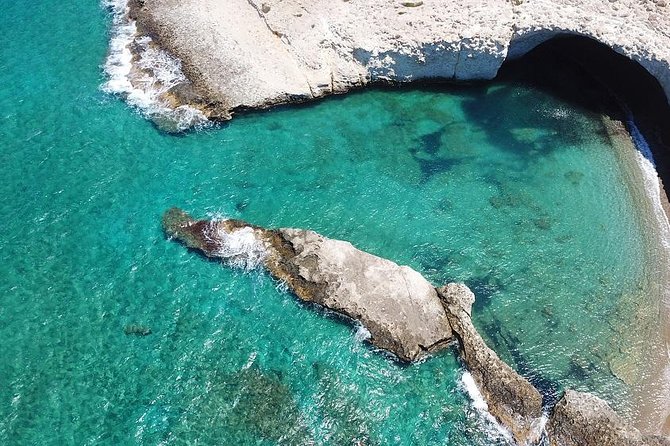
Klima lies below Tripiti at the entrance of the bay of Milos, six kilometres from the port of Adamantas. A visit joins the descent from the village, the painted boathouses, the ruins of ancient Milos on the slope, and a swim at the village beach.
The village of Tripiti is the starting point. It stands at 150 metres above the sea, on the northern side of the island, at the sea entrance to the bay of Milos, and 5 kilometres north-west of Adamantas. The village has been a designated traditional settlement since 1978, and it had 766 residents in 2021. Klima lies below it on the shore, at the entrance of the bay. The small chapel of Panagia Faneromeni stands on the road from Tripiti to the Catacombs. Two tombs with arches stand inside the chapel, and the sanctuary keeps traces of wall paintings.
Between Tripiti and the shore lies the slope of the ancient city. The old town of Milos lay nearer the entrance of the harbour than Adamas and covered the ground between Trypiti and the landing place at Klima. Remains there include a theatre of Roman date, stretches of town wall and a building with a mosaic, which the British School at Athens excavated in 1896. The Catacombs of Milos, the ancient underground cemetery, lie next to the village above.
The shore faces the bay. The Dorian city stood on the eastern shore of the bay, south-west of Trypiti, and an eastern shore looks west across the water, toward the side where the sun sets. The doors and windows of the boathouses are painted in strong colours, and the late light of the day shows those colours along the row. Klima is a seaside village of Milos, with its boathouses along the shore.
The beach of the village, together with the nearby beach of Schinopi, is suitable for swimming. Eating places work in the village, and a number of the boathouses serve as tourist accommodation. The cave church of Agia Paraskevi stands inside the village. Respect for the residents is simple: a visitor keeps voices low, stays on the shore, and leaves boats, gear and doors untouched.
- Start: Tripiti, at 150 metres above the sea, is the village above Klima.
- Distance: Klima lies 6 kilometres from Adamantas, the main port of the island.
- Church: The cave church of Agia Paraskevi stands inside the village.
- Swimming: The beach of the village and the nearby beach of Schinopi suit swimming.
- Residents: In 2021 the village had 8 residents.
A visit here runs downhill from the high village to the water. The road passes a chapel, the slope holds the remains of the old town, the shore holds the boathouses and the bay gives the swimming. The same ground carries two periods, the ancient city and the working fishing village. The questions below cover the residents, the seasons, the rock, the churches and the finds from the slope.

What do visitors ask about Klima before they go?
Klima is a village of 8 residents on the shore below Tripiti. The answers below cover its population, its season, its crowds, the rock above it, the churches and windmills of Tripiti, the finds from the slope and the community that governs it.
What is the population of Klima?
Klima had 8 residents in 2021, down from 13 in 2011. Tripiti above it had 766 residents in 2021, and the municipality of Milos had 5,193 inhabitants in the same year. The village therefore holds a very small share of the island population, and Tripiti above it is far larger.
Which season suits a trip to Klima?
Milos has a Mediterranean climate, with mild, rainy winters and warm to hot dry summers, and the island is a popular summer destination. The ground floors of the boathouses sheltered the boats in winter. The beach suits swimming, which points to the warm, dry months.
Is Klima as busy as the better-known Cyclades?
Milos draws fewer visitors than the more visited islands of Santorini and Mykonos and offers a less crowded setting. Klima is a seaside village with 8 residents in 2021, and it lies near the ancient theatre of Milos. The village sits on the shore of the bay, below the larger village of Tripiti.
Why is the rock above Klima full of holes?
The volcanic rock under Tripiti is full of holes, made by natural erosion or by human work, and the village is called Tripiti for that reason. The rock is soft, and that allowed the Catacombs, the ancient underground cemetery of the island, to be dug beside the village. Klima lies below this rock.
Which church above Klima keeps Cretan icons?
The church of Agios Nikolaos stands in the centre of Tripiti. It was built in 1888 on the plan of Agios Nikolaos of Syros, with a marble altar screen, an icon stand of the 17th century and icons of the Cretan School and of Emmanuel Skordilis. The church inside the shore village is a cave church.
What became of the windmills above Klima?
The restored windmills are among the sights of Tripiti. They once ground grain, and today they mainly serve as accommodation. The windmills stand in the same village as the church of Agios Nikolaos, at 150 metres above the sea, on the volcanic rock that looks down toward Klima.
Which sculptures came from the slope near Klima?
Works of art found on the slope between Trypiti and Klima include the Aphrodite now in Paris, the Asclepius in London, and the Poseidon and the archaic Apollo in Athens. The Venus de Milo is the Aphrodite in the Louvre. Its find lies near the ancient theatre, close to the village.
Which community includes Klima?
Klima belongs to the community of Tripiti, with Agia Kyriaki, Zefyria, Kanava, Paliochori and Schinopi, and the community had 502 residents in 2021. Tripiti joined the municipality of Milos in 1835 and became the seat of its own community in 1912. The community therefore ties the shore settlement to the village above it.