Once you rent a car, an ATV or a buggy from Rac SA, you are ready to discover the beaches of Milos.
The beaches are one of the great strengths of Milos as a destination. The island has many beaches, each different and each beautiful in its own landscape. Milos owes this variety to its volcanic nature and to the strong winds and waves of the Aegean, which have carved its distinctive beauty over thousands of years.
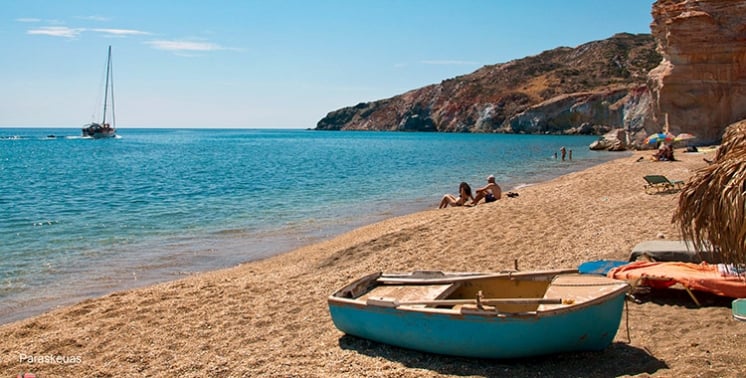
The beaches of the island are full of colour: not only the blue-green sea and the blue sky, but also white, black, grey, red, yellow and brown earth and rock, and golden sand.
There is a beach for every taste, from fully organised beaches to secluded coves, and they face in every direction. Whatever the weather and wherever the Aegean wind blows from, you can find a sheltered beach for a swim, or a windy one for windsurfing and kitesurfing, sports that win more fans every summer.
On Milos the beaches are sights in their own right, close to traditional villages, archaeological sites and old and new mines; thanks to the make-up of its soil, the whole island is a natural history museum.
The shape of the island has played an important part in shaping its beaches: Milos looks like a horseshoe, with many bays and headlands cutting into the land, which gives it more than 120 km of coastline.
| Beaches N. Milos | Beaches S. Milos | Beaches W. Milos | Beaches E. Milos | Beaches in the bay |
|
Pollonia |
Palaiochori |
Sykia |
Voudia |
Lagkada |
The beaches of Milos form a coastline shaped by volcanic rock, with white, red, yellow and black rock around the bays. This page covers the beaches of Milos zone by zone, from the north shore to the gulf. Readers who want wider Milos island information can start on the home page of this site, while the sections below stay with the shore.
Milos is a volcanic island in the Aegean Sea, at the south-western end of the Cyclades. The island has the shape of a horseshoe around a large gulf, and its volcanic soil gives Milos an impressive variety of beaches. The first section explains how the beaches of Milos are counted and how the coast divides into five zones. The second section looks closely at Sarakiniko and its white rock. Visitors are drawn by the varied beaches of Milos and by a less crowded setting than Santorini and Mykonos.
What is the number of beaches of Milos, and how does its coast divide into zones?
The beaches of Milos number more than 75, and a detailed count reaches 90 without being complete. The coast divides into five zones: north, south, east, west and inside the gulf, and the gulf holds the largest group of them all.
The number of beaches of Milos depends on how the coast is counted. Counts run from more than 70 small and large beaches to more than 75, and a detailed count reaches 90 without being complete. Part of the shore can be reached by land, while other beaches are open only from the sea. Fully organised beaches share the island with lonelier and wilder ones. Any single figure for the beaches of Milos is therefore an estimate.
The shape of Milos explains the layout. Milos measures about 23 km from east to west and 13 km from north to south, and it forms a horseshoe around a large gulf. The natural harbour is the hollow of the principal crater, which cuts in from the north-west and divides the island into two nearly equal parts. Beaches line both the outer coast and the inner shore of that gulf, so the beaches of Milos face different directions.
The north zone has Sarakiniko, Papafragas, Firopotamos, Pollonia, Kapros, Mandrakia and Plathiena, along with Pachena and Mitakas. The south zone has Tsigrado, Firiplaka, Paleochori, Provatas, Agia Kyriaki, Gerakas, Kipos and Kleftiko. Together, the two zones hold 38 of the 90 counted beaches. The south zone runs from the east to the west and ends at Kleftiko, which follows Gerontas. Each zone holds a separate set of beaches of Milos.
The east zone has Voudia, Kastanas, Tria Pigadia and Rema, and the west zone has Sykia, Agios Ioannis, Triades and Kalogries. Inside the gulf are Lagada, Papikinou, Achivadolimni and Emporios. The western half of Milos is the wildest part of the island, with no villages and a minimal number of settlements, and the beaches there are remote. The gulf zone also counts Adamas, the harbour town, among the beaches of Milos.
- North: This zone has 17 beaches, from Plathiena in the west to Pollonia in the east.
- South: This zone has 21 beaches, running west as far as Kleftiko.
- East: This zone has 12 beaches, the smallest group of the five zones.
- West: This zone has 15 beaches, and almost all of western Milos belongs to Natura 2000.
- Inside the gulf: This zone has 25 beaches, the largest group of the five zones.
Counting the beaches of Milos by zone gives a clearer picture than one island-wide number. The five zones cover the north, south, east and west shores plus the gulf, and each has its own rock, sand and exposure. The choice of a beach also depends on the direction of the wind. Sarakiniko, on the north shore, is the first of the beaches of Milos covered in detail below.
What makes Sarakiniko stand out among the beaches of Milos?
Among the beaches of Milos, Sarakiniko stands out for its white volcanic rock, which began forming 1.85 million years ago from sandstone, pumice breccia and fossil-bearing siltstone. The strip of sand is short, so the rock carries the place.
Sarakiniko lies on the north shore of Milos, about 5 km from Plaka, the island’s capital. The sand is a strip 10 metres long, and the beach is not organised. The beach is easy to reach by car and by bus, and it is popular for its setting and the colour of its water. The beach sits between white rock formations and has thin white sand. Because the sand is so short, the white rock around it, not the beach itself, defines the place among the beaches of Milos.
The geology of north Milos is a stack of volcanic layers. The lowest and oldest is the Pachaina formation, at least 70 metres thick, and the Papafragas formation lies above it. About 1.85 million years ago, new volcanic material began to settle and formed the Sarakiniko formation, about 50 metres thick. It consists of sandstone layers with pumice breccia and siltstones that hold fossils. Repeated layers of material formed the white rock.
Waves driven by north winds still shape the greyish-white volcanic rock. Waves appear to have laid down the volcanic material of the Sarakiniko and Papafragas formations. The Sarakiniko formation started below the sea and rose by degrees to the surface. In the west, an andesite layer called Korakia, formed 1.8 million years ago, lies above it. Sediments and material from phreatic eruptions of historical times lie at the top of the sequence. That sequence is the geology behind the white shore among the beaches of Milos.
Invertebrate fossils found in the area include bivalves, scaphopods, gastropods, brachiopods, echinoids and barnacles. Microfossils of diatoms date to between 1.95 and 1.73 million years ago, at the start of the Pleistocene. The rock shows constant alternations of volcanic material and abundant fossils. Waves have cut caves along the coast, and the name of Sarakiniko among the beaches of Milos comes from the Saracen pirates who sheltered in them. The ship bollards are still preserved, carved into the rock.
- West side: The west side of the site has the lunar-like landscape of bare white rock.
- East side: The east side is a desert of dry plants and rocky ground, and a wrecked ship shows when the waves retreat.
- Water: Deep blue water runs along the white rock, and green-blue water fills the small natural harbour.
- Photography: The landscape ranks among the best-photographed in the Aegean.
- Neighbours: Mandrakia and Mitakas are the north beaches next to Sarakiniko.
Sarakiniko is the best-known beach of the island and the clearest case among the beaches of Milos of a shore shaped by rock rather than sand. Its north-coast position matters for wind: it is better to choose north-side beaches when the wind blows from the south, and gulf or south-coast beaches in the meltemi and north winds. Visitors carved their names into the rock, and the municipality introduced a fine in 2015 for polluting the area.

What makes Papafragas stand out among the beaches of Milos?
The beaches of Milos include Papafragas, a small cove on the north coast beside the Bronze Age site of Phylakopi. Pale rock walls enclose the beach, a deep sea cave opens onto the sea, and a steep carving in the rock leads down to the cove.
Papafragas lies on the north coast of Milos, next to the ruins of the ancient city of Fylakopi. The Bronze Age settlement of Phylakopi sits on the northern coast of the island and ran from the middle of the third millennium BC until the 12th century BC, and the sea cave of Papafragas lies inside the archaeological site. Papafragka Cave is also placed near Apollonia, another name for the village of Pollonia. Among the beaches of Milos, Papafragas therefore shares its stretch of shore with a Bronze Age settlement.
Three caves belong to Papafragas. One of them, Papafragas Cave, is a deep sea cave. Swimmers move through turquoise water between grey and white rocks, and the rocks lead out to the open sea. The water in the cove shows blue-green tones. Among the beaches of Milos on the north coast, this swim runs along rock walls from the cave toward the open water.
The beach is small, and the rock around it is light in colour. Reaching the shore means going down a steep carving in the rock. Two pieces of history belong to the cove. In Byzantine times it served as a base for pirates. The name Papafragas comes from the last Frank Pope, who used the beach to protect his boat. Among the beaches of Milos, this cove is therefore tied to both a pirate base and a boat shelter.
North Milos is a series of volcanic layers. The lowest and oldest is the Pachaina formation, at least 70 metres thick, and above it lies the Papafragas formation. The volcanic material of the Papafragas and Sarakiniko formations appears to have been laid down by wave action, and the Papafragas layer is thicker toward the east. The name Papafragas thus appears in the geology of north Milos as well as among the beaches of Milos.
- Neighbours: Along the north beaches of Milos, Kapros comes before Papafragas and Phylakopi after it, from west to east.
- Phylakopi: This is a settlement and a beach about 10 km west of Plaka, at an elevation of 10 metres, with 4 residents in 2021.
- Caves: Three caves belong to Papafragas, and Papafragas Cave is the deep sea cave among them.
- Rock: Towering rock in a light colour surrounds the beach.
- Descent: The way down is a steep carving in the rock.
Papafragas gathers a sea cave, pale rock walls and a Bronze Age neighbour in one small cove. Among the beaches of Milos on the north coast, it links geology, pirate history and an archaeological site within a short stretch of shore. The beach itself is small, and the steep carving remains the route to the water. The cave, the pale rock and the ruins of Fylakopi are the three landmarks of the cove.
How do Firopotamos and Mandrakia compare among the beaches of Milos?
Among the beaches of Milos, Firopotamos and Mandrakia are two north-coast fishing villages with small beaches and boat shelters. Firopotamos has a sandy beach and a creek lined with boat houses, while Mandrakia has a quiet beach of almost 150 metres with fine dark grey pebbles.
Firopotamos is a fishing village at the northern tip of Milos, 3 km north of Plaka, set in a small bay. A small harbour is built around a natural cove, and the beach is one of the best on the island. The settlement was a separate place by 1920, when it was attached to the then community of Milos. It had 4 residents in 2011 and 2 in 2021, so one of the beaches of Milos sits beside a village of only 2 residents.
The cove of Firopotamos holds the wires, small houses where boats stay through the winter and which the owners use as summer homes. The wires are boat shelters dug into volcanic tuff. The village has tamarisk trees and a creek, a sandy beach and a beach bar. Past the fishing houses stand the church of Agios Nikolaos and an abandoned loading ladder. Among the beaches of Milos, this cove also has its own page on the fishing village of Firopotamos.
Mandrakia lies on the north coast, about 9 km east-north-east of Plaka and 4 km north of Adamantas, the port of the island. It is one of the north beaches of Milos and a traditional fishing village surrounded by colourful wires. The beach is quiet and small, almost 150 metres long, with fine dark grey pebbles and tamarisk trees. Rooms for rent and a restaurant stand in the village. The restaurant is traditional and looks out on the Aegean.
Above the wires of Mandrakia stands the church of Zoodochos Pigi, and the beach lies in front of the houses. Mandrakia has a small harbour where the wires hold boats and fishing gear and also serve as temporary homes. Among the beaches of Milos, the settlement has 13 residents as of 2021, against 2 at Firopotamos, and it was a separate settlement by 1961. The rocky islet of Kara lies opposite, north of Mandrakia and east of the bay of Firopotamos.
- Order: Along the north coast from west to east, Firopotamos follows Trachilas and Mandrakia comes before Sarakiniko.
- Distance: Firopotamos lies 3 km north of Plaka, Mandrakia 4 km north of Adamantas.
- Kara: The rocky islet of Kara faces Mandrakia, east of the bay of Firopotamos.
- Churches: Agios Nikolaos stands past the fishing houses at Firopotamos, and Zoodochos Pigi above Mandrakia.
- Pebbles: Among the beaches of Milos, Mandrakia has dark grey pebbles and Firopotamos sand, on a small organised beach suitable for swimming and fishing.
Firopotamos and Mandrakia show the north coast at village scale. Both are fishing places with wires in the cove, tamarisk trees and a small beach along the north shore. Firopotamos adds a creek, a beach bar and a loading ladder, while Mandrakia adds a church above the wires and a restaurant. As beaches of Milos, they sit beside boat shelters and village houses rather than a long stretch of open sand.
Where are Pollonia, Pachena, Kapros and Mitakas among the beaches of Milos?
The beaches of Milos on the north-east side are Pollonia, Pachena, Kapros and Mitakas. Pollonia is a fishing village on a sandy cove, Kapros is a small cove beside the Pollonia road, and Pachena and Mitakas are sandy shores with small settlements.
The village of Pollonia stands at the north-eastern tip of the island, almost 10 kilometres from Adamas and 14 from Plaka. The village is built around a cove with a sandy beach and tamarisk trees. At the pier in front of the church of Agia Paraskevi, the fishing boats of the locals arrive every morning with fish, octopuses and lobsters. Among the beaches of Milos, Pollonia is the one where a swim and a working harbour share the same shore. It has hotels, rooms for rent, taverns and restaurants.
On one side of the village stand the church of Agios Nikolas and the peninsula of Pelekouda. Pollonia, also called Apollonia, takes its name from a temple of Apollo that stood to the east of the settlement. Tradition says that a couple who sit on the small chair-shaped rock there stay together for ever. The bus stops at the beach, so the beaches of Milos in this corner of the island need no long walk from the road. In 1940 the village joined the community of Pera Triovasalos.
Pachena, also written Pachaina, is a spacious sandy beach with tamarisk trees. The Glaronissia islets face the shore. The settlement behind it stands 20 metres above sea level and about 9 kilometres from Plaka. It had 17 residents in 2021. Among the beaches of Milos on this stretch of the north coast, Pachena is the spacious one, and its blue water and the rocks that emerge from it are the attraction.
Kapros is a small cove between white rocks with fine sand and blue water, and the main road to Pollonia runs in view of it. Cars and public transport both reach it. Mitakas, also written Mytakas, is a sandy beach between narrow capes, beside houses of fishermen. It lies on the north coast of eastern Milos, about 7 kilometres from Plaka. Rocks around its shore form a natural bay that shields it from strong winds, which makes Mitakas the sheltered choice among the beaches of Milos.
- Kimolos link: A small boat connects Pollonia with the neighbouring island of Kimolos.
- Glaronissia: Thousands of upright pentagonal and hexagonal columns of andesite form the islets facing Pachena.
- Excursions: Boats from Adamas visit the Glaronissia, which lie off the north-coast beaches of Milos.
- Pollonia residents: The village had 268 inhabitants in 2021.
- Pumice: Layers of pumice dominate the coast as far as Mitakas.
The north-east corner of Milos holds four beaches that differ in size and setting. Pollonia joins a village, a pier and a boat link to Kimolos. Pachena faces the Glaronissia, Kapros sits beside the road, and Mitakas is sheltered by rocks. Among the beaches of Milos, distances from Adamas are 5 kilometres for Mitakas and almost 10 for Pollonia. The bus stop at Pollonia beach adds public transport to the same corner.
How do Plathiena, Trachilas and Alogomandra differ among the beaches of Milos?
The beaches of Milos on this side of the north coast differ in access and setting. Plathiena has fine white sand, Trachilas is a lonely beach reached by a passable dirt road, and Alogomandra is a sandy strip closed in by high cliffs and hidden from the road.
Plathiena is the first of the north-coast beaches from west to east, and Trachilas comes second. Firopotamos is third. Among the beaches of Milos, Plathiena therefore opens the north side from the western end. It belongs to the north beaches with Sarakiniko, Papafragkas, Firopotamos, Mandrakia and Pollonia. The north side also holds Mytakas, Alogomandra, Agios Konstantinos, Pachaina, Kapros and Tourkothalassa. Pollonia, Pachena and Kapros from the section above stand in the eastern half.
Trachilas is reached from Plaka by driving toward Firopotamos, and the first part of the drive follows the road to that village. Just before Firopotamos, a road goes up to the left and joins a passable dirt road, which ends at the lonely beach of Trachilas. This run is one of three suggested off-road routes for motorcycles. For the beaches of Milos that need a dirt track, Trachilas is the north-coast example. Kapros, by contrast, can be seen from the main road to Pollonia.
Among the beaches of Milos, Trachilas is the one that shares its name with a volcano. The volcano stands at the north-western tip of the island and has small craters. The Trachilas crater dates to the Middle to Upper Pleistocene, between 480,000 and 90,000 years ago, the same age as the Fyriplaka crater in the south. Milos therefore has a crater of that age on the north side and one in the south.
Among the beaches of Milos, Alogomandra is the one that cannot be seen from the road. It is a strip of sandy beach closed in by high cliffs. The formation of the beach recalls a mantra, and the name Alogomantra comes from that shape. Along the north side from west to east, the beach lies between Mytakas and Agios Konstantinos, which puts it near the middle of the north side. Agios Konstantinos, the next beach, is a settlement in a small fjord.
- Plathiena: Views of Akradies, Arkoudes and Mandrakia come with the fine white sand.
- Trachilas access: The turn lies just before Firopotamos on the road from Plaka, and the dirt road network of Milos is the largest in the Cyclades.
- Fyriplaka crater: The southern crater measures 1,700 metres across and 200 metres deep.
- Alogomandra water: Shallow green-blue water lies beside sloping rocky ground.
- Beach count: The north side holds 17 of the beaches of Milos.
The three beaches show how access shapes a visit on the north coast. Plathiena opens the western end of the north coast, Trachilas needs a dirt road, and Alogomandra stays out of sight until the cliffs are reached. For choosing between the beaches of Milos on a windy day, it is better to pick the bay or the south side in meltemi and north winds, and the north side in southern winds.
Where is Tsigrado among the beaches of Milos, and how is it reached?
Among the beaches of Milos, Tsigrado is a south-coast cove between Kalamos and Firiplaka, closed in by towering rocks, with white sand and emerald water. A dirt road ends above it, a steep sandy path leads down, and the beach has no organised services.
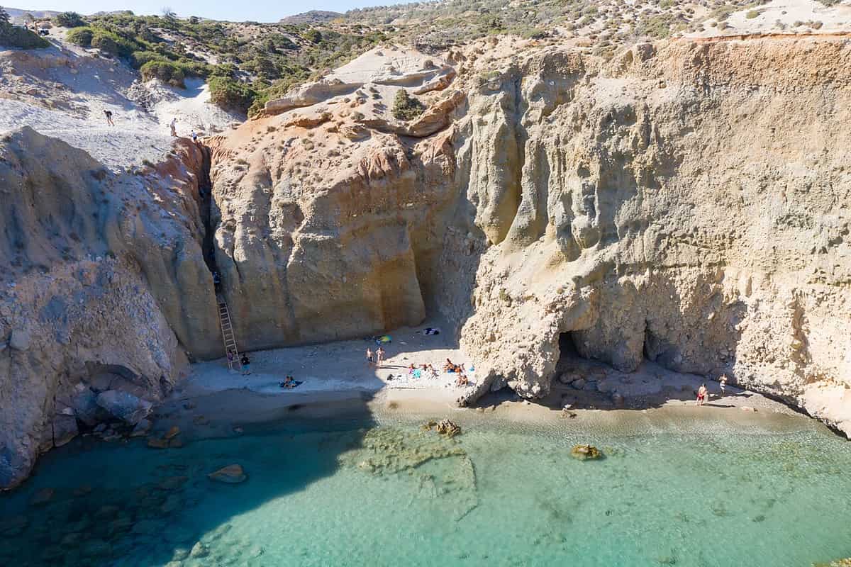
Tsigrado sits on the south side of Milos, a stratovolcano that has not erupted in historical times. Along the south coast from east to west come Gerakas, Kalamos, Tsigrado, Firiplaka and Provatas, so Tsigrado has Kalamos on one side and Firiplaka on the other. Firiplaka lies between Provatas and Tsigrado. The south side counts 21 beaches. Both Tsigrado and Firiplaka stand among the beaches of Milos that share this part of the south coast of Milos.
Tsigrado has three plain features: rocks that embrace the beach, white sand and emerald water. It is a truly exotic beach, with towering rocks and snow-white sand. Firiplaka, the next beach to the west, has white-grey fine sand and white pebbles, so the two shores differ in colour and in surface. Each of the beaches of Milos differs fully from the next, because of the special rocks that enclose them. Volcanic rocks cover the largest part of the island.
Reaching Tsigrado takes two stages. A relatively easy dirt road runs to the high ground above the cove. From there, a steep path covered with sand drops down the hill, and it is only a trace of a steep path. Visitors must go down the hill to enjoy the beauty. The beaches of Milos divide into those reached by land and those reached only from the sea, and a road leads to Tsigrado, so it belongs to the first group.
The ground around Tsigrado is volcanic. Volcanic activity on Milos began 2 to 3 million years ago and stopped about 90,000 years ago. Milos holds perlite reserves above one billion tonnes at Tsigrado and Trachilas. Perlite is a volcanic glass that holds water inside its structure. Heated to between 650 and 900 degrees Celsius, it swells 7 to 15 times and turns bright white. Among the beaches of Milos, Tsigrado carries this mineral link.
- Position: Tsigrado lies on the south side of Milos, east of Firiplaka.
- Neighbours: Kalamos lies to the east and Firiplaka to the west.
- Path: A steep path covered with sand links the dirt road to the beach.
- Services: The beach is not organised.
- Supplies: The essentials come from the nearby beach of Firiplaka.
Tsigrado joins a short drive on dirt with a steep walk on sand, and the reward is white sand under towering rocks. Among the beaches of Milos, it has no organised services, so supplies come from Firiplaka next door. Volcanic ground, perlite reserves and an emerald sea show how the south coast is built. The next beach west, Firiplaka, shares its name with an old volcanic crater and sits in the same stretch of the beaches of Milos.
What is the volcanic setting of Firiplaka among the beaches of Milos?
Among the beaches of Milos, Firiplaka lies on the south coast and shares its name with the crater of an extinct volcano. The shore has white-grey sand, white pebbles and shallow turquoise water below volcanic cliffs, with sunbeds, parasols and a beach bar on the first stretch.
Firiplaka lies on the southern side of Milos, between Provatas on the west and Tsigrado on the east, and it is one of the top beaches of Milos by popularity. The shore is extensive. Its materials are white-grey fine sand and white pebbles, with shallow turquoise water in front and imposing volcanic rocks behind. The sand is snow-grey and the cliffs are majestic. Visitors to Tsigrado get the essentials at Firiplaka.
The name belongs to a volcano as well as to one of the beaches of Milos. Milos has two extinct volcanoes: Firiplaka in the south and Trachilas in the north-west. Volcanic domes also rise on the island, among them the castle of Chora and Profitis Ilias, the highest peak. The Firiplaka crater is 1,700 metres across and 200 metres deep, a pyroclastic cone from the Middle to Upper Pleistocene, between 480,000 and 90,000 years ago, the same age as the Trachilas crater.
The crater shows how the ground formed, and it is a huge sinking of the ground. Layers of ash, sand and perlite fragments of rhyolite composition lie in continuous alternation. Road cuts expose pyroclastic deposits, mainly sands, which point to underwater sedimentation, because the volcano sat below sea level in certain periods of activity. Currents from this volcano formed perlite under the sea. The cone belongs to the south of the island, the same area as the beaches of Milos around Firiplaka.
Four ways lead to Firiplaka: a private vehicle, a taxi, a bus, or a boat that circles the island from the port of Adamas. The larger part of the road is asphalt, and the last stretch is gravel. Firiplaka is one of the beaches of Milos that a bus reaches, and the first part of the beach is organised. Visitors who want to avoid the crowds can walk along the sea and the volcanic rocks to two lonelier beaches.
- Kaolin: Deposits lie on the outskirts of the cone, and old kaolin mining galleries stand at Kalamos.
- Alteration: Hot vapours rich in hydrogen sulfide changed the older volcanic rock into kaolin through intense alteration.
- Sulfur: Yellow crystals of native sulfur mark the vapour points, formed by the oxidation of hydrogen sulfide in the atmosphere.
- Sea rock: A huge rock with a cave beneath it stands in the water near the shore, sculpted from volcanic rock long ago.
- Neighbours: Provatas lies to the west and Tsigrado to the east.
Firiplaka shows the volcanic history of the south coast in one place. A crater 1,700 metres wide, layers of ash and perlite, kaolin and sulfur surround a shore of grey-white sand and white pebbles. Among the beaches of Milos, it joins a drive on asphalt and gravel with a walk to quieter sand. Tsigrado, the next beach east, shows the same volcanic ground in an unorganised cove reached by a steep path.
How do hot springs and volcanic ground shape Paleochori among the beaches of Milos?
The beaches of Milos include Paleochori, a shore of almost 2 km on the south coast where warm water rises from volcanic ground. Red, pink, yellow and white-grey rock surrounds coloured pebbles and coarse sand, and the sea is cool, clear and deep.
Paleochori is both a settlement and a beach in the municipality of Milos, and its name is also spelled Paliochori and Palaiochori. The settlement lies about 13 km south-east of Plaka and 14 km south-east of Adamas, the island’s port. Rooms to rent and a small number of places to eat are found in the area. The shore is almost 2 km long and extremely popular among the beaches of Milos, and it sits on the south coast of the island.
Strong red and yellow rock rings the shore of Paleochori, and the colours also include pink and white-grey. The coast is sandy, with small coloured pebbles in the coarse sand, and the sea above it is deep blue, clear and cool. The colours and the scenery are a result of the volcanic energy and geological vitality of the area. The rock at the water’s edge is therefore evidence of the volcanic past that underlies the beaches of Milos.
Warm water gushes at Paleochori, so volcanic heat reaches the surface at one of the beaches of Milos. The beach also stands among the places with active fumaroles, which are vents that release gases from inside the Earth. The temperature at these vents reaches up to 100 °C, and sulfur is strongly present around them. Hot springs at Paliochori join the other thermal waters of the island, whose temperature reaches up to 55 °C. The beach also shows a wide variety of natural materials and colours.
The ground under Paleochori belongs to a volcanic island, and volcanic rock covers the largest part of it. Volcanic activity on Milos began 2 to 3 million years ago and last produced an eruption 90,000 years ago, and the volcano is considered dormant. In one cave on the south coast the heat from the volcano is still great, and steam has been found at a depth of 1,100 metres. Sulfur was mined on the island, and Pliny the Elder named Milos the richest supplier of sulfur in the ancient world. The same volcanic ground carries the old sulfur mines and the beaches of Milos.
- Community: Paleochori belongs to the Trypiti community, together with Zefyria and Agia Kyriaki.
- Residents: Paleochori had 17 residents in 2021, against 25 in 2011.
- Other vents: Pyromenes and Adamas also have active fumaroles.
- Old baths: The baths were known in antiquity, Hippocrates cites them in Epidemics, and Tournefort wrote of them in 1717.
- Sea vents: Gas from underwater vents reaches the surface as bubbles.
Paleochori combines a shore of almost 2 km, rock in red, pink, yellow and white-grey, and warm water rising from volcanic ground. Among the beaches of Milos, it links swimming with the geology of the island, from fumaroles and sulfur to hot springs. The settlement behind the beach is small, and the coast continues with Agia Kyriaki, another south-coast place with active fumaroles. Colour, vents and hot springs meet here.
Where do Agia Kyriaki and Gerakas fit among the beaches of Milos?
Among the beaches of Milos, Agia Kyriaki is a large organised beach on the south coast, with sunbeds, umbrellas, beach bars and a beach volleyball court. Gerakas lies further west on the same coast, between Tourlos and Kalamos and west of Paleochori.
Agia Kyriaki is both a settlement and one of the beaches of Milos on the south coast. It lies about 13 km south-east of Plaka and 10 km south-east of Adamas. The beach has coarse sand and white pebbles, and it is a popular destination in the summer months. Like Paleochori, the settlement belongs to the Trypiti community. The name comes from a small church of the same name in the area, and the settlement was counted as a separate settlement in 2011.
Agia Kyriaki is a large, organised beach with sunbeds, umbrellas, beach bars and a beach volleyball court. The water is cool, and the shore has coloured pebbles and a wide stretch of thick sand. A restaurant and rooms to rent stand within walking distance of the beach. Pebbles and coarse sand make up the shore, and the pebbles are white and coloured. The beach therefore pairs organised services with a pebble and sand shore among the beaches of Milos.
The land archaeological site at Agia Kyriaki holds the ancient harbour, where storage rooms still stand. The settlement had 31 residents in 2011 and 12 in 2021. Agia Kyriaki also stands among the places with active fumaroles, with a strong presence of sulfur in those areas. The volcanic ground of the south coast therefore reaches this shore, and the beaches of Milos here sit beside an ancient harbour as well as hot ground.
From east to west, the south side of Milos opens with Psarovolada and Agia Kyriaki. Three other beaches follow before Paleochori: Firligkos, Spathi and Tourkaki. After Paleochori come Tourlos, Gerakas, Kalamos, Tsigrado and Firiplaka. Gerakas therefore lies west of Paleochori and east of Tsigrado, as the eighth beach on the south side counted from the east. Its place among the beaches of Milos on the south coast is between Tourlos and Kalamos.
- Zefyria: The former capital of the island lies inland, at an altitude of 10 metres, 9 km south-east of Plaka and 5 km south-east of Adamas.
- Zefyria history: Founded in the Venetian period, the village was left after strong earthquakes in the mid-18th century, when a large part of its residents moved mainly towards Adamas.
- South side: The south coast holds 21 of the beaches of Milos, ordered from east to west.
- Gerakas neighbours: Tourlos lies just east of Gerakas, and Kalamos just west of it, both among the beaches of Milos.
- Population: Zefyria had 190 residents in 2021, is mainly agricultural, and became the seat of the municipality of the same name in 1835.
Agia Kyriaki is the organised stretch of this coast, with sunbeds, beach bars and a restaurant near the sand, while Gerakas is a named beach west of Paleochori. The beaches of Milos on this coast run from the ancient harbour at Agia Kyriaki past the vents of Paleochori to Gerakas. The about Milos section of this site places each shore in the wider story of the island.
What sets Provatas and Kipos apart among the beaches of Milos?
The beaches of Milos include Provatas and Kipos on the south coast. Provatas has golden-red sand and shallow water in three small coves, while Kipos has a sandy beach, a small port for boats to Kleftiko, and Panagia tou Kipou, the oldest church on the island.
Provatas is a settlement and a beach in the municipality of Milos, on the southern side of the island. The beach lies between Firiplaka and Kipos and is made of three small coves separated by rocks. Provatas had 33 permanent residents in 2021, against 27 in 2011, and it was first counted as a separate settlement in 2011. Among the beaches of Milos, Provatas is therefore a small village with a shore, not only a stretch of sand.
Abundant sand with a golden-red colour, caused by iron oxides, covers the shore at Provatas, and the water stays very shallow, so children can play at the edge, which makes the beach suit families. Sunbeds and umbrellas organise the beach. Behind it stand a hotel, rooms to let and taverns. Access is easy: a signed, paved road runs 7 km from Adamas, and the bus service to the beach is frequent. These details keep Provatas among the beaches of Milos with the simplest approach.
Agios Sostis follows Provatas along the south coast. It is a small beach of shallow sand, and the name comes from the church of the same name a little above it. The beach is an extension of Provatas, with a restaurant and rooms for rent. A wartime detail belongs to Provatas as well: German forces built fortification works there, and the remains of those works survive today. The two beaches of Milos therefore share one stretch of coast.
Kipos comes next along the coast, further west. It has a sandy beach with a small port from which boats start for Kleftiko, plus a restaurant and rooms for rent. The name Kipos is Greek for the Garden. Provatas, Kipos and Kleftiko all sit on the south coast. Among the beaches of Milos, Kipos is the one that joins a swim with a departure point for the south-west coast.
- Church: Kipos, one of the beaches of Milos, also has Panagia tou Kipou, the oldest church on the island.
- Date: The building dates to the Byzantine years, the 5th century AD.
- Condition: The church is well preserved.
- Baptistery: The church holds one of the two baptisteries on the island.
- Sarcophagus: Pieces of a marble sarcophagus from the Hellenistic period can be seen there.
Provatas and Kipos show two sides of the south coast. Provatas offers golden-red sand, shallow water, services and a bus line, while Kipos offers a sandy beach, a restaurant, a small port and a church from the 5th century AD. Both lie among the beaches of Milos that sit west of Firiplaka and east of Kleftiko, so both come before the white rock of the south-west coast, where Psathi, Gerontas and Kleftiko follow.
Where do Psathi, Gerontas and Kleftiko lie among the beaches of Milos?
The beaches of Milos reach the south-west with Psathi, Gerontas and Kleftiko, three of the 21 beaches on the south side. Gerontas needs a dirt road and a walk, while Kleftiko needs an excursion boat, a sailboat or a trail.
The south side of Milos has 21 beaches, ordered from east to west. After Provatas, Agios Sostis and Kipos, the run continues with Tsigkoulia, Psathi, Akrotiraki, Katergo, Gerontas and Kleftiko. That order puts Psathi west of Kipos and Kleftiko at the western end of the south side. The south-west of the island is a habitat of the Mediterranean monk seal. Among the beaches of Milos, these places mark the far end of the southern run.
Gerontas is the farthest south beach that cars can reach. Access is relatively difficult, because a dirt road leads there and the last part is a walk of 10 minutes. The cove is embraced by white rocks and caves, with dark sand and turquoise water, and the water is clear. A rock shaped like a bridge joins the sea and the land. Among the beaches of Milos, Gerontas therefore mixes a road drive with a walk.
Kleftiko is one of the beaches of Milos, yet its main feature is volcanic rock cut by the sea and the wind. White cliffs and islets in the sea spread over three consecutive coves. The rock is tuff in shades from white and yellowish-white to dark, with pumice that formed about 3.1 million years ago and built layers. Erosion carved hollows and caves into these rocks. The landscape is classed as one of special natural beauty and falls within a Natura 2000 area. Kleftiko is the typical example of the volcanic past of the island, seen in its caves and coastal formations.
Kleftiko is best enjoyed from a boat or sailboat, which show its clear turquoise water and rock formations. It is a popular destination today, and excursion boats or a trail lead there. Boats start from the small port at Kipos. Kleftiko took its name from the era of piracy in the Mediterranean, when the coves served as a base for pirates and the caves as shelters in bad weather. Excursion boats also leave from the ports of Adamas and Pollonia, and the one-day cruises from Adamantas belong to that sea route. For swimmers, these are the beaches of Milos where the approach shapes the visit.
- Psathi: It lies between Tsigkoulia and Akrotiraki on the south coast.
- Namesake: The harbour of Kimolos carries the same name and is a separate place.
- Between: Akrotiraki and Katergo are the two beaches that stand between Psathi and Gerontas.
- Bridge rock: Gerontas, one of the beaches of Milos, has a rock in the shape of a bridge between sea and land.
- Viewpoint: The road up Prophet Elias offers a view of the sea and of Kleftiko.
Psathi, Gerontas and Kleftiko close the south side of Milos, and each one needs a different approach. Gerontas asks for a dirt road and a walk, Kleftiko asks for a boat, a sailboat or a trail, and Psathi sits west of Kipos on the way there. Together they show that the beaches of Milos range from roadside sand at Provatas to rock coves that open to boats and walkers.


How do the Sykia sea cave and Kalogries fit among the beaches of Milos?
The beaches of Milos include Sykia, a sea cave on the west coast reached only from the sea, and Kalogries, a secluded sandy beach in the north-west. Sykia has no roof, and Kalogries has calm water in a bay.
Among the beaches of Milos, Sykia is the sea cave. It lies on the west coast and is a cave accessible only from the sea. The roof of the cave has collapsed, so the rays of the sun enter from above and light the emerald water inside. The sunlight gives the water a play of colours and shine. Counted from south to north, Sykia is the third of the 15 beaches on the west side, after Akrotiri Psalida and Vaisis.
Sykia is reached by boat, because the sea is the only way in. Excursion boats that call at Kleftiko, in the south-west, call at Sykia as well. Sea excursions bring swimmers to beaches of Milos that cannot be reached from land, with clear water to swim in and caves to visit. Paddlers can read about the water side of the island on the page for kayak trips in Milos.
Kalogries is one of the beaches of Milos in the north-west, and it is secluded. The water is turquoise and crystal clear, and the shore is sand. The bay and the calm water together form a natural pool, a place for rest and relaxation. Kalogries is the thirteenth of the west beaches counted from the south, and Aspra Gialoudia and Vani follow it.
The area around Kalogries belongs to the wildest half of the island. The western half has no villages, only a handful of settlements and old mines. Almost all of west Milos belongs to the Natura 2000 network, and its beaches are isolated. Kalogries is also among the permanent settlements of the Bronze Age, known mainly from cemeteries. The graves are box-shaped and trapezoid, with upright slabs on the sides, and the dead lay in a contracted position. That gives the place a role in the prehistory of Milos as well as among the beaches of Milos.
- Access split: The west beaches fall into two groups, those reached by land and those reached only by sea.
- Wildlife: The south-west is a monk seal habitat, and the rest of the west shelters the Milos viper and a lizard.
- Mountain: Chondro Vouno, at 636 metres, rises in the western part.
- Mine: The one working mine in the west extracts pozzolan at Xylokeratia.
- Position: Sykia lies on the western coast, and Kalogries lies in the north-west.
Sykia and Kalogries show two sides of the beaches of Milos on the west coast. Sykia is a cave with an open roof and emerald water, reached from the sea. Kalogries is a sandy bay in the north-west, with calm water like a natural pool. Sykia lies near the southern end of the west side and Kalogries near the northern end, and both are among the beaches of Milos that lie in the half of the island without villages.


How do Agios Ioannis, Ammoudaraki, Triades and Agathia compare among the beaches of Milos?
Among the beaches of Milos, Agios Ioannis, Ammoudaraki, Triades and Agathia are sandy beaches on the west coast. Agios Ioannis has three parts joined by paths, Triades has three beaches in a row, and Agathia has a sheltered bay and a long sandy shore.
Among the beaches of Milos, Agios Ioannis takes its name from the monastery of Agios Ioannis Siderianos. The beach has white-gold sand divided into three parts joined by paths. Reaching it means crossing a dirt road of about 12 km. The first part is open to cars, while the other two parts need a long walk and a descent over rocks. The three parts are numbered (1), (2) and (3), and they follow each other in a row along the coast.
The monastery after which one of the beaches of Milos is called stands on the south-west side of the island, in Halakas, and it has been known since 1582. The church is a domed basilica, well preserved, with cells of different sizes around it. The name Siderianos comes from a tradition about pirates. On the feast day they appeared, and the people locked themselves inside the church and begged the saint to iron the door. The pirates failed to open it. In World War II a British warship fired a shell at a German fort in the area, and the shell stuck in the church wall without exploding. It can still be seen inside the church today. The route to Ammoudaraki passes the monastery.
Among the beaches of Milos, Ammoudaraki has rich blonde sand and lies next to Triades. It comes after Agios Ioannis along the coast. The route to it passes Agia Marina and the monastery of Agios Ioannis Siderianos, turns right and follows the dirt road. Triades is three sandy, secluded beaches set one after another. The water is deep blue and shallow, and the blonde sand lies enclosed between rocks. The landscape is bucolic and the journey is tedious, and the three beaches are numbered (1), (2) and (3).
Among the beaches of Milos, Agathia is quite inaccessible, because of the dirt road that leads there. The name is also spelled Agkathia. The water is shallow and blue, the bay is sheltered, and the sandy beach is long, and these features reward the effort of the road. The route passes the monastery of Agia Marina and turns right at the second crossroads. Vourlidia lies between Triades and Agkathia along the coast.
- Order: From south to north, the four run Agios Ioannis, Ammoudaraki, Triades and Agkathia.
- Access: Agios Ioannis, Ammoudaraki and Agathia are reached by dirt road.
- Sand: Ammoudaraki and Triades have blonde sand.
- Water: Triades and Agathia have shallow water.
- Landmark: The routes to Ammoudaraki and Agathia both pass Agia Marina.
The west-coast beaches of Milos share sand, dirt roads and long approaches. Agios Ioannis stands out for its three parts and its monastery, Ammoudaraki and Triades for blonde sand between rocks, and Agathia for its sheltered bay. Agios Ioannis and Triades are each split into three numbered parts, so the six places covered in these two sections stand for ten separate spots among the beaches of Milos.

Which beaches of Milos lie on the east coast near the mines?
The beaches of Milos on the east coast near the mines are Voudia, Kastanas and Tria Pigadia. Voudia is a large fine-pebble beach beside industrial facilities. Kastanas is a wild pebble beach with red, orange and purple rocks. Tria Pigadia is small, rocky and remote.
Voudia is a settlement and a beach at the north-eastern tip of Milos, at an altitude of 20 metres. It is about 13 kilometres east-north-east of Plaka and about 12 kilometres from Adamas, the island harbour. The settlement had 11 residents in 2021. The beach is extensive, with fine pebbles and clear water that forms an open bay. Among the beaches of Milos, Voudia is the one with a loading pier at its edge. The pier and the facilities of a mining operation stand at one end of the shore.
The road to Voudia starts in Pollonia, the second harbour of Milos after Adamas. From the beach there, an asphalt road runs south and south-east. It passes the last houses of the village, a football field and the chapel of Timiou Staurou, and then reaches the area of the mining facilities. Voudia belongs among the beaches of Milos but is inaccessible because of those facilities. Route 4 of the geological walks turns uphill outside the gate, and Kimolos comes into view behind.
Kastanas is a wild beach on the east coast, just south of Pollonia. Unlike the sandy main beach of Pollonia, it has no sand. Small multicoloured pebbles cover the shore. Among the beaches of Milos, Kastanas is a shore of coloured stone, because the rocks around it show red, orange and purple shades. Milos is a volcanic island, and tuff, trachyte and obsidian are among its ordinary rocks. Visitors who want sand at the beaches of Milos find none here.
Tria Pigadia is a small, rocky and remote beach on the east side of Milos. It lies between Kastanas and Agkali. In the east-side order it comes right after Kastanas and right before Voudia. The east side has 12 beaches in all, and six of them are Theiorycheia, Kastanas, Tria Pigadia, Voudia, Kolympisionas and Rema. Among the beaches of Milos, Tria Pigadia is the remote one.
- Voudia status: Voudia counted as a separate settlement in 1940, within the community of Peran Triovasalos.
- Pilonisi: This small peninsula joins Milos by a narrow strip of land near Voudia.
- Sand nearby: Pollonia has a sandy main beach, and Polychroni and Piso Thalassa lie near the village.
- Pollonia distances: Pollonia lies almost 10 kilometres from Adamas and 14 from Plaka.
- Island size: Milos measures about 23 kilometres from east to west.
The three beaches near the mines are pebble and rock shores, not sand shores. Voudia has fine pebbles, Kastanas is a wild shore of small multicoloured pebbles, and Tria Pigadia is small, rocky and remote. Among the beaches of Milos, they form the east-coast group that starts just south of Pollonia. Beyond Tria Pigadia, the east side goes on with Agkali, Rema and the old sulphur mines at Thiorichia, and the next part of this page covers those places.
Where are Agkali, Rema, Thiorichia and Firligkos among the beaches of Milos?
The beaches of Milos at Agkali, Rema and Thiorichia lie on the east side, and Firligkos is listed on the south side. Rema has deep blue water and coloured pebbles. Thiorichia has yellowish pebbles and the ruins of old sulphur mines in a small cove.
Agkali lies on the east side of Milos, on the far side of Tria Pigadia from Kastanas. The name is also spelled Agali. In the east-side order, Voudia comes first, then Kolympisionas, Agkali and Rema. Rema is a small beach with deep blue water and colourful pebbles. The rocks around it have their own shades, and the water is crystal clear. Among the beaches of Milos, Rema is worth a visit for exactly those two features.
Thiorichia fills the small cove of Paliorema, and the name is also spelled Theiorycheia. The pebbles there are yellowish, and the water is crystal clear. The ruins of the old sulphur installations share the cove, and the beach is one of the geological attractions of the island. Sulphur exports from the mines operated until 1956, and wagons on their rails, old rusty tools and unused spare parts still stand in the warehouse. Thiorichia is also an uninhabited settlement, like the Glaronisia islets. Of all the beaches of Milos in this group, it is the one tied to mining.
Among the beaches of Milos, Thiorichia is the end point of Route 3 of the marked geological walks, and a passable dirt road leads down to it. The track leaves Zephyria, follows the Lagada ravine and then drops along the Paliorema ravine to the old mines. The vegetation on that slope is very degraded. Along the way, sea air has eroded hard volcanic rock into odd shapes called noches. A motorcycle route from Emporio, through Agios Stylianos and the junction to Vani, also ends at the swimming spot.
Firligkos belongs to the south side, not the east side. The south side has 21 beaches from east to west. Psarovolada comes first, then Agia Kyriaki, then Firligkos, followed by Spathi. Agia Kyriaki lies on the south coast, about 10 kilometres south-east of Adamas. Among the beaches of Milos, Firligkos therefore sits near the eastern start of the south coast, and the run closes in the west with Gerontas and Kleftiko.
- Rema neighbours: After Rema come Paliorema, Old Thiorichia and Kampanes in the east-side order.
- Kolympisionas: This beach, which comes just before Agkali, is small with deep blue water.
- Noches: These rocks sometimes resemble open-mouthed animal heads.
- Firligkos neighbours: Spathi, Tourkaki, Paleochori, Tourlos and Gerakas follow Firligkos along the south coast.
- Agia Kyriaki: This beach lies about 13 kilometres south-east of Plaka.
Agkali and Rema stand side by side in the east-side order, while Firligkos belongs to the south side that begins nearby. Thiorichia is the one place here where mine ruins share the cove with a pebble beach. Among the beaches of Milos, the four show how the shore changes from coloured pebbles at Rema to yellowish pebbles at Thiorichia, with crystal clear water at both. A dirt road is the way down to the old sulphur mines.
Which beaches of Milos lie closest to Adamantas?
The beaches of Milos closest to the port are Lagada and Papikinou. Lagada is the nearest beach to Adamas, with golden white sand and tamarisk trees for shade. Papikinou lies 1 km east of the town and counts among the beaches with the mildest waves on the island.
Adamantas is the harbour town of Milos, built in the north of the gulf. It is the main port of the island and the first image seen from a boat, and it lies on the north-east shore of the bay. Two of the beaches of Milos begin beside the harbour town of Adamantas: Lagada, which is the nearest to the port, and Papikinou, which follows the coast road to the east. Both belong to the group of beaches inside the gulf, a group that also holds Achivadolimni and Rivari.
Lagada is also spelled Lagkada, and it is the nearest beach to the port of Adamas. Among the beaches of Milos in the bay, it is therefore the one that starts closest to the harbour. It is a large beach with golden white sand and clear water, and tamarisk trees give it natural shade. The beach is organised, and it is one of the 25 beaches inside the bay.
Among the beaches of Milos, Papikinou is a large beach 1 km east of Adamas. The coastal road from the port runs east and passes the Mining Museum of Milos after about 500 m, and the beach begins straight after the museum. Its natural extension reaches as far as Alykes. The beach suits children, since its waters deepen slowly, and it ranks among the beaches with the mildest waves on the island. It has tamarisk trees, umbrellas, sunbeds and a restaurant.
Alykes, at the far end of the Papikinou stretch, is where these beaches of Milos meet the old salt production facilities, where seawater evaporated naturally. It lies just before the airport, and the abandoned salt pans are now an important wetland. Back at the port, a closed thermal spring sits at the foot of the hill, on the Adamantas beach, and traces of ancient buildings lie about 30 m deep, left by a settlement that sank when the ground subsided.
- Lagada sand: The large beach has golden white sand and clear water.
- Lagada shade: Tamarisk trees give natural shade, and the beach is organised.
- Papikinou water: The sea deepens slowly, and the waves are among the mildest on the island.
- Papikinou services: The beach has umbrellas, sunbeds, tamarisk trees and a restaurant.
- Alykes: The abandoned salt pans at the end of the beach form a wetland.
The beaches of Milos near the port are easy to tell apart. Lagada offers golden white sand and shade, while Papikinou offers gentle waves and a long shore that runs on to the salt wetland of Alykes. In the meltemi and north winds, beaches inside the bay are the better choice, and both of these beaches of Milos lie inside the gulf. The beaches deeper in the bay begin with Achivadolimni.
Which beaches of Milos lie deeper in the bay, from Achivadolimni to Agios Dimitrios?
The beaches of Milos deeper in the bay are Achivadolimni, Fatourena, Rivari, Emporios and Agios Dimitrios. Achivadolimni is the largest beach on the island, and Agios Dimitrios, at the west end of the bay, can only be reached by boat.
The gulf of Milos is the hollow of the main volcanic crater of the island. It is horseshoe-shaped, it cuts in from the north-west and splits the island into two fairly equal parts, and it is one of the largest natural harbours in Greece. Among the beaches of Milos deeper in the gulf, Achivadolimni is the largest of the island, with white sand and shallow blue water. It divides into two sandy beaches: the first is quieter and secluded, and the second is busy and organised, with a beach bar and restaurants.
The name Achivadolimni, also written Hivadolimni, comes from the pond opposite the beach, which is full of clams. The pond lies in the Natura area and forms the largest natural wetland of the Cyclades, an important stop for migratory birds. The coastal road past the beaches of Milos near the port shows “sugar” lava, broken into large and small blocks, from Mavra Gremna to the beach, and lavas with perlite or glassy texture follow from Achivadolimni to Agia Marina.
Among the beaches of Milos in the bay, Fatourena is reached from Achivadolimni by the main road to Agia Marina and then by a dirt road down to the sea. It is a quiet, blue beach that overlooks the entire port. The monastery of Agia Marina stands on a rise just before the beach, on the road to Chalaka, and looks over the gulf and the harbour entrance. Rivari is a natural lagoon and refuge for migratory birds, among small vegetation and low hills.
Emporios, also spelled Empourios, lies past Fatourena and Rivari, and among the beaches of Milos in the bay it is the one with an old commercial port. The port has a beach, rooms for rent and a traditional tavern for food, and Empourios is one of the inhabited settlements of Milos. Agios Dimitrios lies at the west end of the bay and can only be reached by boat. It has clear blue water, a small sandy beach and a chapel.
- Achivadolimni access: A bus reaches the beach, and organised camping is available.
- Achivadolimni sports: The beach is a choice for surf and kite-surf fans.
- Fatourena road: The last part of the way is a dirt road down to the sea.
- Rivari quiet: It is a place for absolute privacy, since the west side of Milos is little developed for tourism.
- Agios Dimitrios: Only a boat reaches this small sandy beach with its chapel.
The beaches of Milos deeper in the bay change from one stop to the next. Achivadolimni is the largest and has a bus, Fatourena needs a dirt road, Rivari is a lagoon for birds, Emporios is an old commercial port, and Agios Dimitrios needs a boat. In meltemi and north winds, beaches inside the bay are the better choice. Lagada and Papikinou, near the port, belong to the same bay.
How does wind direction help choose among the beaches of Milos?
The beaches of Milos suit the wind of the day. In the meltemi and north winds, the better choice is a beach inside the bay, or better still on the south side, and when the wind blows from the south, a beach on the north side.
On Milos, a beach is chosen for the direction of the wind as well as for its looks. In the meltemi and other north winds, the bay is the better choice, and the south side of the island is better again. When the wind turns to the south, the north side is the one to pick. The rule turns the beaches of Milos into a compass, since the wind direction decides which coast to visit on a given day.
The wind advice follows a season. Light northerly winds called forerunners appear in late spring and early June and last two to three weeks. They pause in June, and a week later the meltemia return, blowing from a northern direction until early October, at a mean force of 6 to 7 on the Beaufort scale. The sky stays clear and the sea turns wavy. These are the months in which the wind rule for the beaches of Milos applies.
The beaches of Milos fall into three zones that match the advice: the north beaches, the south beaches and the beaches inside the gulf. The north zone holds Sarakiniko, Papafragas, Fyropotamos, Plathiena, Mandrakia, Pollonia, Mitakas, Alogomandra, Pachena and Kapros. The south zone holds Kleftiko, Paleochori, Firiplaka, Agia Kyriaki, Gerakas, Tsigrado, Provatas, Kipos and Gerontas. In a southern wind the north zone applies. In the meltemi the south zone applies, together with the bay, which holds Empourios, Fatourena, Achivadolimni, Papikinou and Lagkada.
Wind direction also sets where boats can stop. The coves suitable for mooring depend on the wind direction, and Provatas, Kleftiko and Paliochori are examples. The meltemia also interrupt small-boat services, above all by day, when they are at their strongest. Kleftiko, a set of grey and white rocks with caves and pits, is reached by boat or sailboat, so a visit to that part of the beaches of Milos follows the wind.
- Mitakas: Rocks around the shore form a natural bay that protects it from strong winds.
- Provatas: The south-coast beach has very shallow water and golden red sand.
- Paleochori: Among the beaches of Milos, it is almost 2 km long, with cool deep water.
- Kipos: Boats for Kleftiko start from the small port of this south-coast beach.
- Pollonia: This north-east village is one of two mooring places for own boats, the other being the marina of Adamas.
A wind check comes first when choosing among the beaches of Milos. In the meltemi months the bay and the south coast are the better choice, with Mitakas as the sheltered case on the north shore. In a southern wind the north shore takes over. Boat trips to Kleftiko and the other sea-access places follow the same rule, because the meltemia interrupt small-boat services in the daytime. The check matters from June to early October.
Which beaches of Milos suit snorkelling, windsurfing and kitesurfing?
The beaches of Milos suit snorkelling where the water is clear and the waves are small, and they suit windsurfing and kitesurfing inside the bay. Achivadolimni and Papikinou suit both sports, and the natural bay of the island is the safest place.
Snorkellers favour warm water with small waves and something to see near the surface, such as a reef or a shipwreck, and the sport needs no special training, only very basic swimming and the ability to breathe through the snorkel. Such water is easy to find among the beaches of Milos. Alogomandra has sloping rocky ground and shallow green-blue water, Gerontas has clear water and a rock shaped like a bridge, and Kleftiko has crystal clear turquoise water, caves and pits. Sykia has no roof, so sunlight lights its emerald water.
Leisure craft are the greatest danger to snorkellers, and sailboats and sailboards are a particular hazard, since their quiet propulsion can fail to alert a snorkeller. A snorkeller can float with only the tube visible, which makes a collision possible. Bright colours or a dive flag towed on a float help boaters to spot a swimmer, and a buddy is safer than swimming alone. Near Achivadolimni and Papikinou, the two beaches recommended for windsurfing, these precautions apply among the beaches of Milos.
Windsurfing combines sailing and surfing, and learning goes best on large, buoyant boards in light winds on flat water. With modern equipment, planing starts at a wind speed of around 12 knots. The weather conditions of Milos suit amateurs and masters of the sport. Among the beaches of Milos, Achivadolimni is the largest, with white sand and shallow deep blue water, and it is an ideal choice for surf and kite-surf lovers. Papikinou is the other beach recommended for the sport.
Cross-shore and cross-onshore winds are the best for unassisted kitesurfing. A direct onshore wind risks throwing the rider onto land or into shallows, and a direct offshore wind risks blowing the rider away from the shore. Riders with less experience avoid more than 15 knots, and wind passing over land creates wind shadow with gusts and lulls. Among the beaches of Milos, the two bay beaches recommended for the sport need the same check of wind against shore.
- Gear: A snorkel tube and a mask or goggles are essential, and fins are common.
- Depth: Snorkellers favour shallow reefs of 1 to 4 metres.
- Light wind: Twintip boards and inflatable kites are barely rideable below 11 knots.
- Upper limit: Safe practice for an experienced rider covers winds up to 33 knots.
- Wetland: Among the beaches of Milos, Achivadolimni has a wetland that is a stop for migratory birds.
The beaches of Milos in the bay suit the wind sports, and the clear, shallow shores suit snorkelling on calm days, as the two sections above show. The wind direction from the first section settles which shore applies on a given day. Boat trips to the sea caves follow the same signal, the direction and strength of the wind. Plans that mix beach days with other activities continue on the page about combined activities in Milos.


How do travellers reach the beaches of Milos, and how do organised and natural beaches differ?
The beaches of Milos are reached by paved road, dirt road, bus or boat, and the way in matches the setting. Organised beaches lie beside paved roads and bus stops, while natural beaches lie at the end of dirt tracks, steep paths or open water.
A paved road leads to Provatas on the south coast, and the main road to Pollonia passes Kapros. The approach to Provatas is easy, because the road is paved, signed and 7 km long from Adamas. Kapros and Pollonia are easy to reach by car and transport. Two more of the beaches of Milos lie close to the harbour: Papikinou, 1 km east of Adamas, and Lagada, the nearest to the port of Adamas, with golden-white sand.
Dirt roads lead to the quieter shores. Tsigrado is reached by a relatively easy dirt road, but the last part is a steep trail covered with sand. Ammoudaraki lies beyond Agia Marina and the monastery of Agios Ioannis Siderianos, where a right turn joins the dirt road. Triades are three sandy beaches placed one after the other, and the journey to them is tedious. The western half of the island is the wildest part, with no villages.
Local buses stop at or near the beaches below. A bus connection serves Achivadolimni, the largest beach on the island, where organised camping is also available. The beach takes its name from the pond opposite it, full of clams. The bus service to Provatas is frequent. At Pollonia, at the north-east end of the island, the buses stop beside the beach. At Sarakiniko, a path climbs south from the shore to a parking area and a bus stop.
Boats reach the places that no road serves. A boat or a sailboat is the way to reach Kleftiko, a set of grey and white rocks with caves and pits shaped over centuries by air and sea. Kipos has a sandy beach and a small port from which boats leave for Kleftiko. Agios Dimitrios, at the west end of the bay, can only be reached by boat. Pollonia also links Milos with the neighbouring island of Kimolos and with Glaronissia.
- Agia Kyriaki: Sunbeds, umbrellas, beach bars and a beach volleyball court.
- Lagada: Organised, with golden-white sand and tamarisk shade near the port.
- Firiplaka: Only the first beach is organised; the two loneliest lie beyond, on foot.
- Tsigrado: Not organised, so supplies come from nearby Firiplaka.
- Kastanas: Wild, with no sand, only small multicoloured pebbles.
The choice comes down to two kinds of swim: fully organised beaches and lonelier, wilder ones. A map of the island places each beach against the roads and the harbours, which helps to match a beach to a way of travelling. Among the beaches of Milos, the organised ones lie beside roads and bus stops, and the natural ones ask for a dirt road, a trail or a boat.


Which practical questions do travellers raise about the beaches of Milos?
The beaches of Milos suit different needs: shallow bays for children, tamarisk shade near the harbour, pebble coves on the east coast, caves reached from the sea and white rock on the north shore. The answers below point to the beaches for each need.
Which beaches of Milos suit children?
Provatas has golden-red sand, coloured by iron oxides, and very shallow water, so it is ideal for families. A hotel, rooms to let and taverns stand beside it. Papikinou has water that deepens slowly and counts among the calmest beaches of Milos. Achivadolimni has white sand and shallow blue water.
Which beaches of Milos give natural shade?
Tamarisk trees give natural shade at Lagada, Papikinou, Pollonia, Firopotamos, Mandrakia and Pachena, and Papikinou adds umbrellas and sunbeds. Sarakiniko differs: a couple of trees give small areas of shade at the back of the beach, and little vegetation grows around the white rock.
Which beaches of Milos have pebbles?
Rema is a small beach of colourful pebbles and deep blue water. Mandrakia has a quiet beach of almost 150 metres with fine dark grey pebbles. Paleochori is almost 2 km long and consists of colourful pebbles, coarse sand and deep clear water. Agia Kyriaki mixes colourful pebbles with a thick sandy shore.
Which beaches of Milos lie near caves?
Sykia is a cave with no roof, so the sun lights its emerald water, and it can be entered only from the sea. Papafragas has three caves beside the ruins of Fylakopi, and one is a deep sea cave where swimmers pass between grey and white rocks. Kleftiko has caves and pits cut by air and sea.
Which beaches of Milos lie nearest to Adamantas?
Lagada is the beach nearest to the port, with large golden-white sand. Papikinou lies 1 km east of Adamas and has umbrellas, sunbeds and a restaurant. In the same bay, Achivadolimni has a quiet first beach and a busier second beach with a beach bar, restaurants and organised camping, and a bus reaches it.
Which beaches of Milos have white rock around them?
Sarakiniko has all-white volcanic rock formations and a small natural harbour with sand. Kapros is a small cove between white rocks with fine sand. Tsigrado is embraced by rocks beside white sand, and Papafragas is a small beach surrounded by bright light rocks. Kleftiko is a set of grey and white rocks with strange shapes.
Which beaches of Milos sit beside fishing villages?
Pollonia is a fishing village built around a cove with rich sand and tamarisk trees. Mandrakia is a traditional fishing village with a restaurant and a quiet beach. Firopotamos is a seaside settlement with a small organised beach, and Mitakas is a northern beach with houses of fishermen and very clear water.
Which of the beaches of Milos is best known?
Among the beaches of Milos, Sarakiniko is the island’s best-known, thanks to its lunar landscape. It lies on the north shore, where waves driven by north winds carve the greyish-white volcanic rock into shapes compared to a moonscape. The landscape ranks among the best-photographed in the Aegean.