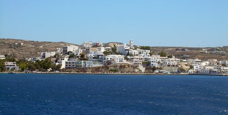
Adamas is the main port of the island and one of the largest natural harbors in the Mediterranean. It is the most developed tourist center on the island. Around the harbor and the village you will find many hotels and inns, cafes, restaurants and bars. The beaches you can visit from Adamas are Dell and Papikinos. The sights of Adamas include the Church of the Assumption, the Catholic church of St. Nicholas, the Mining Museum and the Ecclesiastical Museum, which is housed in the thousand-year-old church of Agia Triada. You can also visit the German refuge and the spas.
The island of Milos lies in the Cyclades, and its main harbour is Adamantas. The port town greets arrivals by sea and stands as the commercial heart of the island. A wider view of the island sits on the travel pages for Milos, which cover the beaches, the villages and the museums in one place, from the port to the quiet coves.
Ferries and fast boats reach the harbour through a wide bay, and the waterfront holds the cafes and rooms that travellers meet first. Adamantas keeps offices, shops and services near the quay, so the town works as a base for the whole island. The sections below follow the history of Adamantas, its museums and its boat trips in turn.
How did Adamantas grow into the port of Milos?
Adamantas is the harbour town of Milos and the main port of the island. Cretan refugees founded Adamantas in 1831, after a decision of the Greek government, and their descendants are called Milokritikoi. The settlement counts 1,268 people and stands as the commercial centre of Milos.
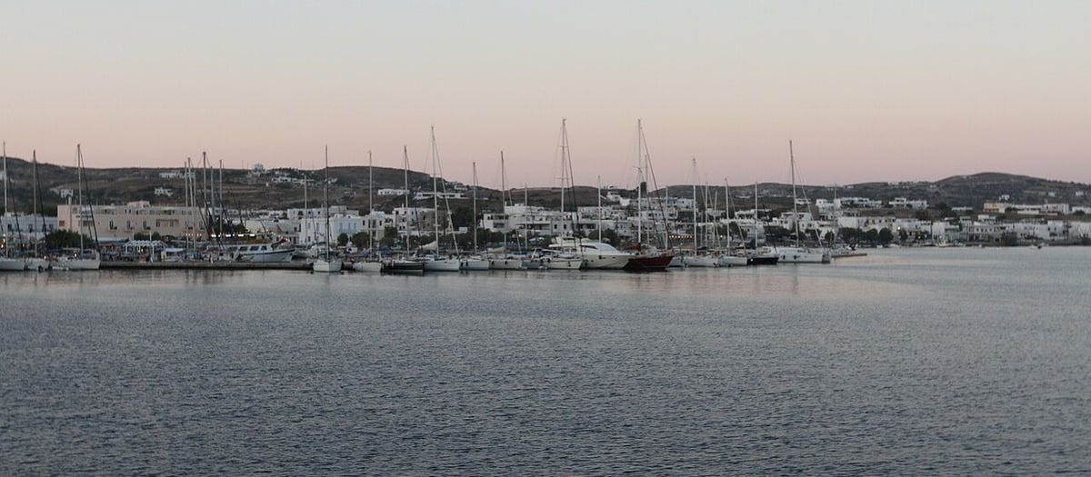
Cretan refugees reached the north-eastern coast of the bay in 1831 and built a village on the shore. Their families took the name Milokritikoi, and the settlement became the harbour of the island. Adamantas later took the place of the inland villages as the point of entry for goods and travellers. The community covers 3.970 square kilometres of land. Adamantas keeps the old form of the name in official use, and the islanders use both names in daily speech.
The bay lies open to the north-west, and the town takes shelter on its eastern side. Two arms of land narrow the entrance, so the water inside stays calm through the summer winds. The harbour counts among the largest natural harbours of the Mediterranean. The quay follows the inner shore, and the town stands just behind it. Adamantas sits on the north-eastern coast of this bay. Boats leave the port for the coves of the west coast.
The town spreads along the shore and climbs a little into the low ground behind it. One main street follows the waterfront, with the church of Agia Triada close to the harbour. Shops, offices and the island services gather on the streets around the quay. Houses stand close together, and the settlement reaches the foot of the hills that hold the villages of Milos above the bay. Adamantas holds the community offices for its own district.
A military cemetery of British and French soldiers stands near the village, a reminder of the Crimean War, when the French fleet used the bay. A French warship still arrives once a year to honour the dead. During the years 1941 to 1945, fifty residents died from hunger and from bombardments. In the water off the beach, traces of old walls lie about thirty metres down, and they point to a settlement that sank with the land.
- Founded: Cretan refugees built Adamantas in 1831, after a decision of the Greek government.
- Population: The community counted 1,268 residents in the 2021 census.
- Area: The district covers 3.970 square kilometres.
- Position: The town lies on the north-eastern coast of the bay, at 36°43.5′N 24°26.7′E.
- Name: The word adamas means diamond in Greek, and the older form of the name is Adamas.
Adamantas grew from one landing place into the busiest corner of Milos, and the pattern of the town still follows the water. The bay gave shelter to the French fleet in the Crimean War and gave work to miners and sailors in later years. The name, the harbour and the cemetery all keep a piece of that past. A walk from the quay to the church of Agia Triada reads the history of Adamantas at a glance.
What are the things to see and do in Adamantas?
Adamantas holds three museums, a war refuge, a waterfront and two nearby beaches, and boats leave the port for the west coast. The mining museum, the naval museum and the church collection sit within the town, and the bays of the west open to day trips.
Three collections stand in the town. The mineral museum opened in 1998, and its rooms show the social, economic and technical side of the island trade, from the minerals dug in the Neolithic age to the industrial minerals of today. Films on mining and the stories of old miners fill the projection room. The naval museum opened in September 2008 above the harbour, in the old community building, and its exhibits run from obsidian tools to the sea battle at Salamis.
The church of Agia Triada, close to the quay, holds the ecclesiastical museum and counts a thousand years of life. Its shape, a three-aisled basilica with a cross roof and a dome, appears once more in Greece. Cretan refugees bought the building in 1839 and made it their parish church. Two mosaics of 1937 decorate the courtyard, one with a dragon in the shape of Milos. The war museum fills the rooms of an old refuge built in the Second World War.
The waterfront carries the daily life of the town, with cafes along the quay and a beach at each end of the bay. Two beaches lie within easy reach, Dell and Papikinos. A warm spring rises at the foot of the hill on the town beach; the bath house is shut, and a sign marks the spot. Swimming in the shallow water and the evening walk fill the warm hours. Adamantas also keeps shops for food, clothes and boat tickets.
Boats leave the port for the west side of the island. A day trip along the west coast passes the fishing coves of Skinopi, Klima, Areti and Fourkovouni, the cliffs known as the Bears, and Cape Vani with its old mines. Swimmers stop at the Nuns and at Kalogries. The route then reaches the Sykia cave and Kleftiko, where the boat carries masks and fins for diving. A night trip under the stars and longer journeys also start from Adamantas.
- Mining museum: Adamantas holds this collection of island minerals and miners’ stories.
- Naval museum: Rare maps and a wooden boat fill the old community building above the port.
- Church museum: Icons from the fourteenth century hang inside Agia Triada.
- War refuge: The rooms of a shelter from the Second World War hold wartime photographs.
- Boat trips: The harbour sends boats along the west coast and to the caves of Kleftiko.
A day in Adamantas fits the museums, the church and the beach into a short walk, and the boats fill the hours on the water. The town serves as the meeting point for the island, so the return to the quay closes each trip. Two beaches sit beside the harbour, and the springs and the refuge mark the older layers of the place. A slow evening on the waterfront ends a day that began at the port.


What do travellers ask about Adamantas?
Adamantas answers turn on the harbour, the museums, the beaches, the warm spring and the boat trips. The questions below cover the arrival at the port, the collections in the town, the swimming close to the quay, and the trips along the west coast of Milos.
Why is Adamantas the main port of Milos?
The bay gives deep and sheltered water, so boats have used it for a long time. Adamantas took the role of the main harbour, while the older villages stayed on the heights. The town then gathered the offices, shops and services that a port needs. Fishing boats and passenger boats share the quay, and the water inside stays calm.
Which museums stand in Adamantas?
Three collections sit inside the town. The mining museum opened in 1998 and shows the minerals of Milos, with films and the stories of old miners. The naval museum opened in 2008 in the old community building above the harbour, with rare maps and a wooden boat. The ecclesiastical museum fills the church of Agia Triada.
Where can a swimmer enter the water in Adamantas?
Two beaches lie close to the town, Dell and Papikinos, within walking distance of the quay. A warm spring rises at the foot of the hill on the town beach, and a sign marks the spot, though the old bath house stays shut. The water in the bay stays calm, and Adamantas gives access to the south shores too.
What does the war refuge of Adamantas hold?
A refuge cut during the Second World War stands in the town, and its rooms hold a war museum. The display brings together photographs and mementos from the First and the Second World War. The town remembers hard years too: between 1941 and 1945, fifty residents died from hunger and from bombardments.
Which trips leave the port of Adamantas?
Boats leave the quay for the west coast. The route passes the fishing coves of Skinopi, Klima, Areti and Fourkovouni, the cliffs known as the Bears and Cape Vani with old mines. Swimmers stop at the Nuns and at Kalogries, and the boat then reaches the Sykia cave. The day ends at Kleftiko, where masks and fins allow diving.
How does Adamantas serve as a base for Milos?
Adamantas sits on the main road of the island and holds the offices, banks and shops. From the town, a road climbs to the hill villages above the bay, and the beaches of the south lie along the eastern road. Rooms and cafes stand near the quay, so a stay in Adamantas covers the needs.
When did Adamantas begin, and who built it?
Cretan refugees settled on the shore of the bay in 1831, after a decision of the Greek government, and the village took the name Adamantas. Their descendants, the Milokritikoi, still live in the town. The older form of the name is Adamas, and the Greek word adamas means diamond. The community counted 1,268 residents in the 2021 census.