The villages of Milos stand on a volcanic island in the south-west of the Cyclades, around a gulf that is the hollow of the main crater. This page reads the island of Milos as one map: where each group of villages lies, how far apart the groups are, and which villages join into one walking area.
Four of the villages of Milos stand on hills above the port. The north-east tip holds a second harbour, the old capital survives as a farming settlement in the inner east, and small boathouse coves line the shore. The first section places these groups on the island. The second section follows the short links between the hill villages.
How are the villages of Milos spread over the island?
The villages of Milos spread around the gulf in five groups: four hill villages above the port of Adamantas, Pollonia on the north-east tip, Zefyria in the inner east, and small boathouse coves along the shore. The uninhabited west has no villages.
Milos has the shape of a horseshoe. From east to west it measures about 23 kilometres, and from north to south 13 kilometres. The natural harbour is the hollow of the main crater. It cuts in from the north-west and splits the island into two near-equal parts, joined by an isthmus no wider than 2.2 kilometres. The villages of Milos stand around this gulf and across the north and east, while the west stays uninhabited.
Height and distance separate the groups. Among the villages of Milos, Pollonia stands 10 metres above the sea, Pera Triovasalos 120 metres, Triovasalos 143 metres, Tripiti 150 metres and Plaka 220 metres. Pera Triovasalos lies about 3 kilometres from Adamantas. Zefyria lies 5.5 kilometres from the port and 9 from Plaka, and Pollonia lies almost 10 kilometres from the port and 14 from Plaka. Only the hill group fits inside one walk.
The map of the villages of Milos also has a history. The Venetians founded Zefyria in the 13th century, and it served as the capital. Strong earthquakes in the middle of the 18th century forced much of its population to leave, mainly for Adamantas, and the capital title passed to Plaka. The castle of Plaka, founded after 1204, controlled the ship traffic in the gulf. The population thus moved from the inland capital to the harbour and the heights above it.
- Port: Adamantas lies on the north side of the gulf and is the main harbour of Milos.
- Hill cluster: Plaka, Triovasalos, Pera Triovasalos and Tripiti stand on one height above Adamantas.
- North-east: Pollonia, on the north-east tip, is the second harbour of the island.
- Inner east: Zefyria lies in the centre of east Milos, the former capital of the island.
- Coves: Klima, Mandrakia, Firopotamos, Areti, Agios Konstantinos, Fourkovouni and Empourios are small fishing ports built in coves and cut into soft rock.
Seen together, the villages of Milos make five clear groups: one harbour, one hill cluster, one north-east port, one inland old capital and a ring of boathouse coves. Pera Triovasalos lies about 1 kilometre from Plaka, while Zefyria lies 9 and Pollonia 14, so only the hill cluster works as one walking area. The wider setting of the island is in the page about Milos.

How can visitors walk between the hill villages of Milos?
The hill villages of Milos, Plaka, Tripiti, Triovasalos and Pera Triovasalos, stand close together above Adamantas. Pera Triovasalos lies about 1 kilometre from Plaka, Tripiti is almost joined to Plaka, and Plakes fills the space between Plaka and Triovasalos, so each link is short.
Of the villages of Milos, Triovasalos and Pera Triovasalos formed one settlement until 1908. They occupy two neighbouring hills, with Triovasalos at 143 metres and Pera Triovasalos at 120 metres, and a field lies between them. Both villages are densely built and rise like an amphitheatre. Travellers from the port pass them before Plaka. Pera Triovasalos lies about 3 kilometres from Adamantas and about 1 kilometre from Plaka, so the pair forms the lower end of the hill group.
Plakes, a hamlet of white houses and lanes, stands between Plaka and Triovasalos at the foot of the castle. Its name means level ground, because the area was flat. The church of Agios Charalampos holds one of the oldest icons of the island, Panagia Akradiotissa. From Plakes the beach of Plathiena is an easy, quick trip. The hamlet is therefore the middle step of the walk, between the commercial streets below and the capital above.
Among the hill villages of Milos, Plaka stands at 220 metres, the highest point of the group. Tripiti, at 150 metres, is almost joined to Plaka, and a hiking route links the two villages. The Catacombs and the ancient theatre lie nearby and can be reached on foot from Tripiti. The walk can end at the ancient town, whose remains lie on the slope between Tripiti and the landing place at Klima.
- Churches: Agios Spyridon in Triovasalos, Agios Georgios in Pera Triovasalos, Agios Charalampos in Plakes and Agios Nikolaos in Tripiti mark the route between the hill villages of Milos.
- Shops: Triovasalos keeps shops on its pedestrian street, and the Karodromos holds banks, public services, cafes and stores.
- Traffic: Cars cannot enter Plaka, so motorbikes and mopeds are the only vehicles in its lanes.
- Views: The castle hill of Plaka looks over the gulf and the neighbouring Cycladic islands, and Tripiti looks over the bay of Adamas.
- Windmills: Tripiti keeps old windmills that once ground grain.
The hill villages of Milos make a walking area of short links: the two Triovasalos villages at the low end, Plakes and Plaka above them, and Tripiti beside Plaka. The one measured link, Pera Triovasalos to Plaka, is about 1 kilometre. Beyond this group, Zefyria and Pollonia lie 9 and 14 kilometres from Plaka, and the 15 taxis of the island cover that gap.
How do the villages of Milos compare for a visit?
The villages of Milos differ by purpose: Adamantas holds the port, Plaka and Tripiti hold the hill views, Pollonia holds the second harbour, and Zefyria lies on the road to the south beaches. Each village suits a different part of a visit.
Among the villages of Milos, Adamantas is the natural starting point. The main port of the island is the first image of Milos for a traveller who arrives by boat, and the village is also the largest tourist centre of the island. White houses with small courtyards full of flowers line narrow quiet streets, and rest and tranquility sit beside nightlife and entertainment. The harbour, the shops and the evening life all share one settlement.
Of the villages of Milos, Plaka and Tripiti serve a visit built around views. Plaka stands 220 metres above the sea, and the castle at its top looks over the bay and the neighbouring Cycladic islands, with sunsets as a main sight. Tripiti, almost joined to Plaka, looks over Adamas Bay, and the catacombs and the ancient theatre lie within walking distance. Between Plaka and Triovasalos, the small white village of Plakes lies at the foot of the castle.
The edges of the island are smaller and slower. Zefyria is a rural settlement of about 150 inhabitants in the centre of East Milos. Pollonia is a fishing village of about 300 inhabitants built around one cove at the north-eastern tip, and its fishing boats reach the pier every morning loaded with fish, octopuses and lobsters. These two villages stand apart from the hill group, Zefyria inland and Pollonia on the coast.
Beach access differs across the villages of Milos too. Lagada, the nearest beach to the port, has clear water and tamarisk shade, and Papikinou, 1 km east of Adamas, has waves among the mildest on the island. From Plakes, the fine white sand of Plathiena is quick to reach. Zefyria stands on the way to Agia Kyriaki, an organised beach with sunbeds, beach bars and a beach volleyball court, and to Paleochori, a beach of almost 2 kilometres with coloured pebbles and hot water.
- Port: Adamantas holds the main port and the largest tourist centre of Milos.
- Views: Plaka and Tripiti look over the bay from the heights above the harbour.
- Crossing: Pollonia is the second port among the villages of Milos, and the boat link to Kimolos starts there.
- Farmland: Zefyria keeps a rural character in the centre of the east.
- Trade: Triovasalos and Pera Triovasalos hold the banks, shops and cafes between the port and Plaka.
A visit to the villages of Milos works best when the base matches the purpose: the harbour at Adamantas for arrivals by boat, the hill villages for views on foot, the north-east for the Kimolos crossing, and the east for farmland and the south shore. The list of places to stay on the island shows which village each stay belongs to.

What architecture do the villages of Milos share?
The villages of Milos share Cycladic architecture: white one-room houses with thick walls and small openings, lanes that follow the ground, a castle layout at Plaka, and churches and windmills that stand as the main landmarks of the hill villages.
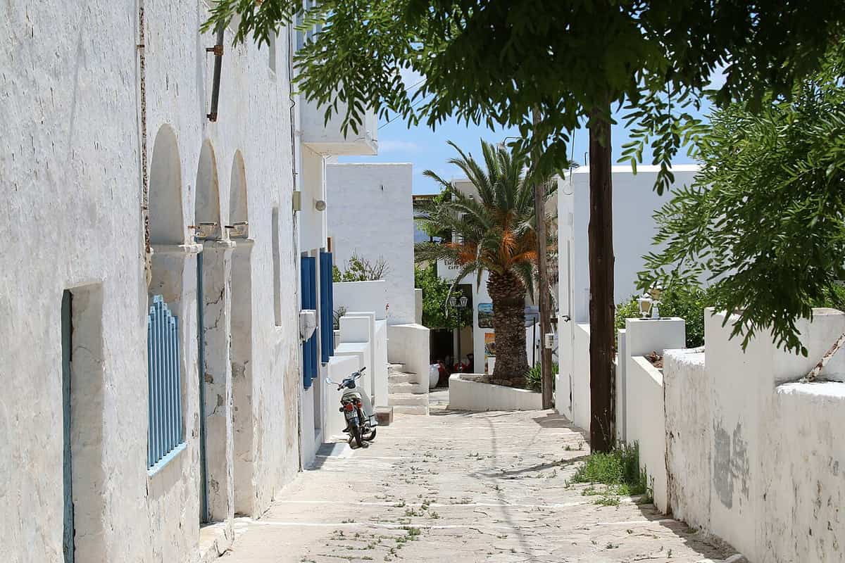
The Cycladic house follows a plain rule, and the villages of Milos inherit it. The basic form is a one-room cube of about 3 by 4 metres in plan and 2.5 metres in height, because timber was not available and beams did not pass three metres. The walls are 60 to 80 centimetres thick to keep the temperature steady, and the openings stay small for the same reason. One opening on the north side lets the meltemi cool the house in summer.
The layout of a village follows the same logic. A Cycladic settlement grew without a plan, shaped by the natural ground, and a village built from a plan is very rare in the Cyclades. Piracy gave the architecture a defensive character, and certain islands built houses inside a closed castle, as on Andros and Naxos. Plaka shows the castle type among the villages of Milos: the Venetian castle crowns the rock, and the medieval town formed on the plateau directly below it.
Tripiti, Triovasalos and Pera Triovasalos follow their hills in another way, because all three rise like an amphitheatre. Churches add the larger forms to the villages of Milos. Panagia Thalassitra, on the climb to the castle, was built in 1839 where a smaller church stood in 1739, and it took the neighbouring Frankish church of Panagia Eleousa in as its southern aisle. The courtyard of Panagia Korfiatissa, at the western end of Plaka, is paved with marble tombstones from the old town.
- Colour: White walls limit the heat that each house absorbs.
- Windmills: Tripiti keeps restored windmills that once ground grain, and the majority now serve as lodgings.
- Boathouses: The sirmata of Klima, Mandrakia and Firopotamos are rock-cut seaside houses and a mark of Cycladic architecture.
- Status: Plaka and Tripiti have held the rank of traditional settlement since 1978.
- Vaults: The small vaulted church of Mesa Panagia crowns the castle, and the residents rebuilt it after 1944.
The shared pattern across the villages of Milos is the reuse of old shells and old stone: tombstones become paving, a Frankish church becomes an aisle, a mill becomes a lodging and a boathouse becomes a rented house. The page on the fishing village of Milos treats the rock-cut boathouses one by one, while the hill villages above the harbour keep the cube house and Plaka keeps the castle layout.
How do churches and feast days shape life in the villages of Milos?
The villages of Milos are served by seven parishes, one each for Plaka, Plakes, Triovasalos, Pera Triovasalos, Tripiti, Adamantas and Zefyria. Each parish carries a church dedication in its name, and dedications such as the Assumption and the Nativity of the Virgin carry fixed feast days.
The seven parish names show where the dedications fall. The Nativity of the Virgin names the parish of Plaka, and the Assumption of the Virgin names both Adamantas and Zefyria. Agios Charalambos names Plakes, Agios Spyridon names Triovasalos, Agios Georgios names Pera Triovasalos and Agios Nikolaos names Tripiti. The Orthodox calendar keeps the Assumption on 15 August and the Nativity of the Virgin on 8 September, so three of the seven parishes in the villages of Milos carry feast days in late summer.
A parish reaches beyond its own village. Pollonia is not among the seven, and its church of Agia Paraskevi belongs to the parish of Agios Spyridon in Triovasalos. That parish lists nine churches in all, among them Agios Fanourios on the road to Pollonia. The parish of Plaka lists seven and reaches the south-west, where the monastery of Agios Ioannis Siderianos stands at Chalakas. The church network therefore ties the harbour village and the outer coast to the hill villages of Milos.
War also left its mark on churches in the villages of Milos. At Pollonia, the Germans demolished the small church of Agia Paraskevi to build a machine-gun post, and after the war the residents rebuilt it from the start as a basilica under a double-pitched tiled roof. It stands on a rise opposite the small pier where the fishing boats moor. Agios Fanourios, a chapel on the road from Triovasalos to Pollonia, was built in 1920 and fully renovated in 1962.
- Assumption of the Virgin: The parishes of Adamantas and Zefyria carry this dedication, which the Orthodox calendar keeps on 15 August.
- Nativity of the Virgin: The parish of Plaka carries this dedication, kept on 8 September.
- Presentation of Christ: Panagia Thalassitra, on the climb to the Kastro above Plaka, carries this name, kept on 2 February.
- Zoodochos Pigi: The parish of Triovasalos includes a church of this name, a title that the Orthodox calendar gives to the Friday after Easter Sunday.
- Agios Charalambos: The saint appears in three parishes, Plakes, Adamantas and Zefyria.
Church dates give the villages of Milos one shared calendar, from the February feast through the week after Easter to the summer feasts of 15 August and 8 September. Food follows the same calendar, and the page on food and drink in Milos describes the dishes that belong to feasts and weddings. Each parish church therefore marks a place and a date at once.
What else do travellers ask about the villages of Milos?
The villages of Milos raise questions beyond the main sights. The answers below cover the Catholic church of Plaka, the oldest church of the island, hill churches with a view, Ottoman-era rule, a monastery seen in 1700 and the mosaics of the Holy Trinity church in Adamantas.
Where does a Catholic church stand among the villages of Milos?
Panagia ton Rodon, also called Rozaria, stands in Plaka on a narrow street below the north side of Panagia Korfiatissa. It is the second Catholic church of the island. The French deputy consul Louis Brest built it in 1823, as the inscription above the entrance shows. Brest is buried inside, and the lintel carries the arms of King Louis XVI.
Which is the oldest church near the villages of Milos?
Panagia tou Kipou, at Kipos in the south of the island, is the oldest church of Milos. It dates from the Byzantine years, in the 5th century AD, and it is well preserved. It holds one of the two baptisteries on the island, together with pieces of a marble sarcophagus.
Which hill churches look over the villages of Milos?
Panagia Tourliani stands on Klimatovouni, the hill above Klima, and looks over the upper villages and the entrance of the bay of Adamas. Very old icons hang inside, and its small courtyard is a place to watch the sunset. Agios Panteleimonas, in the parish of Adamantas, is a small church with a view of the port of Adamas.
Who ran the villages of Milos in the early 18th century?
A Turkish judge, the kadi, and a Turkish governor, the voivode, ruled the island, whose population of more than 6,000 was almost entirely Greek and Christian. The voivode collected taxes and enforced the decisions of the kadi. Three elected magistrates, the epitropi, managed daily affairs, and two bishops served the island, one Greek Orthodox and one Latin Catholic.
Which monastery served the villages of Milos before 1830?
The monastery of Agia Marina stands on the road to Halakas, just before the beach of Fatourena. It worked from 1650 until about 1830 and was one of 13 monasteries that the French traveller Tournefort found in operation when he visited Milos in 1700. It stands on a rise with a view of the gulf and the harbour entrance.
Which church mosaic among the villages of Milos shows the island as a dragon?
Two coloured mosaics at the entrance courtyard of the Holy Trinity church in Adamantas date from 1937 and are the work of the local artist Giagos Kavroudakis. One shows a dragon in the shape of Milos, and the other shows the battle of good and evil. The church also houses the Ecclesiastical Museum of Milos.