Route No. 1 covers a distance of 4.8 km and lasts about 2.5-3 hours. We set off calmly from Plathiena beach, where we can see the well-known but rare lilies in a fenced area. We start kayaking with Antimilos on the horizon, along with the other cape of Milos, called Vani. We paddle through secret caves and past small islands in crystal-clear, turquoise waters. At hot spot 8 we leave our kayaks in a cave, put on masks and fins, and explore the area by snorkelling. It consists of three magical caves. After a short break, we continue to the shore of Nerodafni, where we have our long 15-30 minute break to eat or swim. On the way back we paddle faster and arrive at “Arkoudes“, two huge rocks that look like real bears. Finally, we return to Plathiena beach, where we have refreshments at the beach bar. Price: 35 euros
The island of Milos, at the south-western end of the Cyclades, measures about 23 km from east to west and 13 km from north to south. A paddle of 4.8 km begins and ends at Plathiena beach, passes sea caves and small islands, and stops for a swim inside three caves. The Plathiena kayak Milos line keeps to one corner of the island.
The pages below follow that paddle in the order of a day on the water. The first section sets out what the Plathiena kayak Milos route covers, from the launch at Plathiena to the return past the Arkoudes rocks. Later sections turn to the beach and its sea lilies, to the north-west coast seen from a kayak, and to the swim inside the sea caves.
What does the Plathiena kayak Milos route cover?
The Plathiena kayak Milos route covers 4.8 km from the beach at Plathiena, past caves and small islands, a snorkelling stop inside three sea caves, a break at Nerodafni, the Arkoudes rocks and the paddle back to the same beach.
The outing starts on the sand at Plathiena, the first beach on the north side of Milos when the coast is counted from the west. Kayaks go into the water at the open part of the shore, clear of the fenced patch of sea lilies, and the group settles into a steady stroke. The Plathiena kayak Milos line is a loop, so the outward leg and the return follow the same coast in opposite directions, with the land on one side of the boat.
Along the cape the coast turns rough and broken. Waves have worked on the volcanic rock of Milos over a long period, and the result is a line of small caves with a scatter of islets just off the shore. The kayaks on the Plathiena kayak Milos line pass these openings one after another, each close to the cliff and low above the water. The islets take the swell before it reaches the land, so the water behind them runs calm and the paddling stays easy.
At the eighth stop on the line the kayaks are left inside a cave and the group changes gear. Masks and fins come out, and the water is explored face-down, with the swimmer breathing through a tube. Snorkelling asks for no heavy equipment and no special training, only steady swimming and an easy breath. The three caves around the stopping point form one area, so the swim stays in a single place while the Plathiena kayak Milos boats rest in shelter.
After the swim the paddle carries on to the shore of Nerodafni, where the boats land and the group takes the long break of the day. The way back is covered at a faster pace. Near the end of the return, two large rocks stand in the water at the entrance of the bay of Milos. They carry the name Arkoudes, and their shape reads like bears. From there the beach at Plathiena comes back into view, and the Plathiena kayak Milos route closes where it opened.
- Start: the kayaks launch from the sand at Plathiena beach, the first north-coast beach of Milos counted from the west.
- Distance: the whole line covers 4.8 km, with the paddle split by a swim and a shore break.
- Caves: the boats pass sea caves and small islands before the paddlers leave the kayaks inside a cave.
- Snorkel: masks and fins carry the swimmer through an area of three caves in clear water.
- Finish: the return runs past the Arkoudes rocks and ends at the same sand.
The order of the day is simple: paddle, swim, rest, paddle back. Nothing on the Plathiena kayak Milos route moves far from the coast, and the landmarks mark the stages in sequence. A visitor who wants the wider set of pairings can read about combined days on the water and on foot, where one shore work joins a walk or a second paddle.

Why do the sea lilies of Plathiena matter on the Plathiena kayak Milos route?
The Plathiena kayak Milos route begins beside a fenced patch of sea lilies at Plathiena beach, a rare coastal plant that grows on sandy shores, stores its strength in a bulb and opens white flowers from the middle of July to October.
Plathiena opens the north coast of Milos when the beaches of the island are counted from the western end. The sand is fine and white, and the shore sits below low ground with the small islands of Akradies in sight and the cape of Mandrakia along the coast. The water stays clear close to the sand, and the horizon holds the rocks that close the route. The Plathiena kayak Milos line starts and ends at this beach.
The lily that grows behind the sand is the sea daffodil, known in Greek as the lily of the sea. It is a bulbous perennial, which means it lives for years and keeps its strength in a bulb below the ground. A long neck and narrow leaves push up through the sand, and much of the plant stays buried through the hot months. Its roots reach a depth of about 1.5 metres, which holds it steady where the wind moves the sand.
Flowers come in white at the top of a stem that reaches about 40 cm above the sand. One plant can carry three to fifteen flowers in a single cluster, and each flower grows to about 15 cm long. The scent belongs to still nights, when the air settles and the fragrance travels, and a hawk-moth visits the flowers in light wind. The flowering season runs from the middle of July into October, the same warm months that suit the Plathiena kayak Milos paddle.
The plant faces pressure along the Mediterranean coast. Building near the shore has taken ground from it, and the populations that remain sit among those in decline, so the species needs care on coastal stretches in other lands. On Milos a fenced area at Plathiena keeps feet away from the bulbs and from the sand above them. The Plathiena kayak Milos kayaks launch from the open part of the beach, so the paddle and the plant share the shore.
- Beach: Plathiena is the first north-coast beach of Milos counted from the west, with fine white sand.
- Plant: the sea daffodil is a bulbous perennial with a long neck and narrow leaves.
- Roots: the root system reaches a depth of about 1.5 metres under the sand.
- Flowers: white blooms, three to fifteen in one cluster, open from the middle of July to October.
- Pollinator: a hawk-moth visits the flowers in light wind.
Two things share the sand at Plathiena: a launch point for kayaks and a plant that has grown on Mediterranean shores for a long time. Both need the same ground to stay in good condition, which is why the Plathiena kayak Milos route keeps its gear on the open beach, away from the fenced patch. Other shores of the island, and the way they are reached, are set out on the page listing the beaches of Milos.
What does the north-west coast add to the Plathiena kayak Milos route?
The Plathiena kayak Milos route looks out on the north-west coast of Milos, where the cape of Vani closes the land and the island of Antimilos stands on the horizon with its volcanic crater and steep cliffs above the sea.
Two names fix the direction of the paddle. Cape Vani is the cape of Milos that closes the north-west end of the land, and it sits on the horizon from the water, with open water between them. Antimilos lies 21 km north-west of Milos and rises to 671 m, an uninhabited island of trachyte that islanders call Desert Milos. The two stand together on the outward view, and both belong to the Plathiena kayak Milos horizon.
Antimilos, the island on the Plathiena kayak Milos horizon, is volcanic and its crater remains clear. Old inhabitants turned that crater into an open tank for rain, and a rare kind of goat lives there. The rock is a dome of andesitic and dacitic lava, tuff and flows, with an age of 320,000 years, and the flows end in steep cliffs. The island counts as a site of community importance in the Natura 2000 network, and walls and obsidian arrowheads point to prehistoric settlement.
The land under the Plathiena kayak Milos paddle belongs to the western half of Milos, where no villages stand and only a small number of settlements and old mines break the ground. The greater part of that land sits inside the Natura 2000 network. Volcanic rock covers the greater part of the island, and andesite is the rock of the domes. The shore below Cape Vani carries old mining works, with hard volcanic rock and low vegetation around them.
Close to the water the coast is a line of openings. Waves cut caves where the rock is weak, and small islands stand just off the shore, where they take the swell before it reaches the cliff. Behind them the water runs calm, and a kayak passes with little effort. These shapes give the Plathiena kayak Milos paddle its changing view: the land stays near on one side, while the water and the rock in front of it change with every headland.
- Cape Vani: the cape closes the north-west end of the land of Milos and shows old mining works on its shore.
- Antimilos: the island lies 21 km north-west of Milos and rises to 671 m.
- Crater: the volcanic crater of Antimilos stays clear and was once turned into an open tank for rain.
- West Milos: no villages stand in the western half, and the greater part of it belongs to Natura 2000.
- Rock: andesite forms the volcanic domes, and waves cut caves into the weaker bands of the coast.
The Plathiena kayak Milos paddle on this coast holds three views at once: the cliff at the shoulder, the caves and islets at the bow, and the island of Antimilos across the water. Cape Vani gives the land an edge, and the horizon keeps a second island in sight. The sea side of the island is compared with other paddled lines on the page for kayak routes in Milos.
How does the snorkelling stop work on the Plathiena kayak Milos route?
On the Plathiena kayak Milos route the boats are parked inside a cave while the group snorkels a set of three caves, then lands at Nerodafni for a break and passes the Arkoudes rocks on the way home.
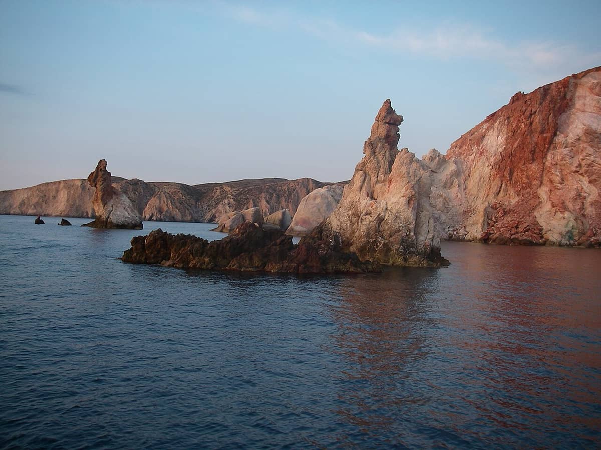
The boats come to rest inside a cave, and masks and fins replace the paddles. Snorkelling means swimming face-down while breathing through a tube, with a mask over the eyes and fins on the feet. It takes little effort and no special training, which suits a group that has just paddled the Plathiena kayak Milos line. At the stopping point the group works one area with three caves, so the swim stays close to the kayaks and the rock.
A sea cave forms where waves wear away a weak band in the rock, and the opening grows until the roof closes over the water. The rock of Milos is volcanic, so weak bands sit between harder layers, and caves follow those bands along the coast. Inside, light comes in from the mouth and from the water itself, and the colour of the sea changes with the depth below the swimmer. The three caves of the stop sit close together.
After the swim the Plathiena kayak Milos group returns to the kayaks and paddles on to Nerodafni. That shore lies inside the gulf of Milos, the large bay held by the horseshoe shape of the island. The bay works as a natural harbour, and it gives calm water on a day when the outer coast turns rough. The landing at Nerodafni is the long stop of the trip: food, rest and a second swim, with the boats pulled up onto the sand.
The last landmark arrives on the way back. The Arkoudes are two large rocks that stand in the water and take the shape of bears, and they cannot be seen from the road, only from the sea. Their place sits near the entrance of the bay of Milos, which is why they appear late in the return leg. Past them the kayaks reach Plathiena again, and the Plathiena kayak Milos route ends on the shore where it started.
- Stop: the boats are left inside a cave, and masks and fins come out for the swim.
- Method: the swimmer lies face-down and breathes through a tube, with little effort.
- Caves: three caves form the swim area, cut into volcanic rock by the waves.
- Break: the landing at Nerodafni sits inside the gulf, where the water stays calm.
- Return: two rocks that look like bears stand near the entrance of the bay.
The stop at the caves, the landing at Nerodafni and the rocks at the end give the paddle three fixed points, and each one follows from the shape of the coast. A swimmer sees the rock from below, and a paddler sees it from the side, so one coastline reads in two ways on the same day. Both belong to the Plathiena kayak Milos route, and both sit inside 4.8 km.

What do visitors ask about the Plathiena kayak Milos route?
The Plathiena kayak Milos route answers come down to where the paddle starts, how far it runs, what the swim covers, where the break falls and how the day ends near the Arkoudes rocks, all inside 4.8 km and one stretch of coast.
Where does the Plathiena kayak Milos route start?
The paddle begins on the sand at Plathiena, the first beach on the north coast of Milos counted from the west. Kayaks go into the water at the open part of the shore, away from the fenced patch of sea lilies. The first strokes follow the land, and the beach stays in sight behind the group.
How far does the Plathiena kayak Milos route run?
The line covers 4.8 km. It is a loop rather than a crossing, so the distance is shared between the outward paddle, the swim, the break at Nerodafni and the return past the Arkoudes. Milos measures about 23 km from east to west, so the paddle covers a small part of the island.
Which caves does the Plathiena kayak Milos route reach?
The route reaches a set of three sea caves, and the boats are parked inside one while the group swims. Sea caves open where waves wear away a weak band of rock, and the volcanic layers of Milos hold such bands along the coast. The three caves sit together, so the Plathiena kayak Milos swim stays in one place.
What is the snorkelling stop on the Plathiena kayak Milos route?
The stop is a swim with a mask and fins over an area of three caves. The swimmer lies face-down and breathes through a tube, which takes little effort and no special training. The kayaks wait inside a cave nearby, and the group returns to them after the swim, before the next stage of the paddle.
Where does the Plathiena kayak Milos route take a break?
The break comes at Nerodafni, a shore inside the gulf of Milos. The gulf is a natural harbour, and its water stays calm when the outer coast turns rough. The stop is the long one of the day, given to food, rest and a second swim, with the kayaks pulled up on the sand.
What are the Arkoudes on the Plathiena kayak Milos route?
The Arkoudes are two large rocks that stand in the water near the end of the route and take the shape of bears. They sit close to the entrance of the bay of Milos, and they show only from the sea. Paddlers on the Plathiena kayak Milos line pass them on the way back.
When can a visitor paddle the Plathiena kayak Milos route?
The sea lilies at Plathiena flower from the middle of July until October, which marks the warm half of the year on the island. The beach faces north, so the water stays clear close to the sand. A morning start gives the calmest water of the day for the outward paddle of the Plathiena kayak Milos line.