Route No. 4 (Firiplaka – Tsigrado – Gerakas) covers a distance of 6.0 km and lasts about 3.5-4 hours.
Price: 35 euros. Transport, equipment, food and safety are included.
Tweet
The southern coast of Milos holds a short sea route that joins three shores between Firiplaka and Gerakas. Milos Advisor sets out the island, its beaches and its travel services for visitors who plan a summer trip. The kayak Tsigrado route follows the same stretch of volcanic shore, where coloured cliffs, small caves and open coves sit below steep rock on the water.
On the pages about kayak in Milos, the south side holds 21 of the counted beaches of the island. The route itself keeps to a short middle stretch of that coast, between the two shores named Firiplaka and Gerakas. Kayaks leave the sand of Firiplaka, turn east toward the small cove, and return along the same water to the starting point.
What is the kayak Tsigrado route at a glance?
The kayak Tsigrado route at a glance covers 6.0 km of the south coast between Firiplaka, Tsigrado and Gerakas. Transport, equipment, food and safety come with the trip, and the paddle ends back at the beach where it began.
The route is short and stays close to land, so the three beaches appear one after another along the same shore. Volcanic rock covers the largest part of Milos, and the south coast shows that rock in white, red, yellow and black bands above the water. The sea below the cliffs stays shallow near the sand and deepens further out. A paddle from Firiplaka turns east into the bay of Tsigrado and then crosses to Gerakas, where the whole line turns back.
Milos is the south-western island of the Cyclades, 120 kilometres east from the coast of Laconia. It measures about 23 km from east to west and 13 km from north to south, with an area estimated at 151 square kilometres. The harbour town is Adamantas and the capital is Plaka. Mount Profitis Elias, the highest point, reaches 748 metres in the west. The south side holds 21 of the counted beaches of the island, and the kayak Tsigrado line uses three of them.
A trip of this kind carries a paddler from the road to the water. Transport, equipment, food and safety belong to the arrangement, so the group reaches Firiplaka without carrying a boat or a paddle. An expert-led group keeps a tour leader on the water and stays together through the crossing. Sun cover, drinking water and a flotation vest stay with each paddler on the kayak Tsigrado line. The boat, paddle and vest belong to the equipment that comes with the trip.
- Distance: The line covers 6.0 km of the south coast.
- Start: Kayaks launch from the sand at Firiplaka.
- Middle: The kayak Tsigrado cove sits between the two ends.
- Far point: Gerakas marks the turn before the return.
- Included: Transport, equipment, food and safety come with the trip.
Three shores, one line of water and a return make the shape of this paddle. The route suits a paddler who wants colour in the rock, caves to look at from the sea and a swim away from the road. Firiplaka gives an easy launch, Tsigrado gives the small cove under the rope, and Gerakas gives the far bay. The kayak Tsigrado group returns to the same sand where it began.

What does a paddler see at Firiplaka on the kayak Tsigrado route?
On the kayak Tsigrado route, Firiplaka opens as a long beach of white-grey fine sand and white pebble, with shallow green-blue water in front. High volcanic cliffs stand behind the sand, and a huge rock with a cave beneath it sits near the shore.
Firiplaka is an extended shore on the south side of the island. The first stretch of sand carries a beach bar, sunbeds and parasols, while the two lonelier beaches beyond it stay open and free of services. A paddler sees all three from the water, one after another, with volcanic rock rising behind them. The organised part gives shade and a place to rest before the kayak Tsigrado group takes to the water. One huge rock with a cave below it stands near the sand.
Near the shore stands a huge rock, sculpted from volcanic material, with a cave that opens under it. The beach carries the name of the Firiplaka crater, a pyroclastic cone 1,700 metres across and 200 metres deep. Layers of ash, sand and perlite fragments lie inside that cone, and road cuts show deposits that point to underwater sedimentation. The cone belongs to the Middle to Upper Pleistocene, between 480,000 and 90,000 years ago. The rock above the kayak Tsigrado line holds the same long history.
Colour is the mark of this coast. Iron oxides make the kaolin of the island less white, and the same oxides turn the sand of neighbouring Provatas a golden red. Yellow crystals of native sulfur sit at points where vapour rises, and hot vapours rich in hydrogen sulfide changed older rock into kaolin. Around the bay the cliffs show white, red, yellow and dark bands beside the kayak Tsigrado line. Old galleries where kaolin was mined stand at Kalamos, close to the route.
- Sand: The shore is white-grey fine sand with white pebble.
- Water: Shallow green-blue water lies along the first stretch.
- Services: A beach bar, sunbeds and parasols stand on the organised part.
- Sea rock: A huge rock near the shore has a cave beneath it.
- Crater: The Firiplaka cone measures 1,700 metres across and 200 metres deep.
Firiplaka gives the kayak Tsigrado line a soft start on a long shore, with shallow water and an easy view of the cliffs. The beach belongs to the wider set of beaches of Milos, and the coast on both sides carries the same volcanic stone. Two quieter stretches follow the first, reached by a walk along the water and the rock. Paddlers leave from the sand and turn east with the whole group.
Why does the kayak Tsigrado route reach the small cove by sea?
The kayak Tsigrado route reaches the small cove from the sea, so the paddler avoids the rope and the ladder. Walkers come down a steep sandy path and finish at a narrow gap in the rock, where a rope and a ladder lead to the sand.
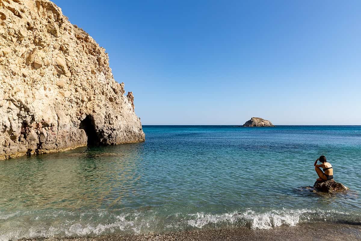
Tsigrado is a cove embraced by towering rocks, with snow-white sand and emerald water. It lies on the south side of Milos between Firiplaka and Kalamos. A dirt road runs to the high ground above the cove, and a steep path covered with sand drops to the shore. The beach is not organised, so the essentials come from Firiplaka next door, before the kayak Tsigrado group goes afloat. Kalamos lies east of the cove and Firiplaka lies west of it. The two shores sit close.
From the water the approach is simple. A paddler brings the boat straight to the white sand and steps out without a climb. The rope and the ladder belong to the land route, which walkers use when they come down from the road above. The kayak Tsigrado line reaches the cove without bags on a slope and leaves the same way, with a paddle rather than a climb. The cove offers a rest, a swim and shade from the high rock before the next leg.
The ground here is volcanic. Activity on Milos began 2 to 3 million years ago and stopped about 90,000 years ago. The island holds perlite reserves above one billion tonnes at Tsigrado and Trachilas. Perlite is a volcanic glass that keeps water inside its structure, and heat at 650 to 900 degrees Celsius makes it swell 7 to 15 times and turn bright white. Small caves open along the rock beside the kayak Tsigrado cove.
- Land route: A steep sandy path and a narrow gap with rope and ladder lead down.
- Sea route: Kayaks land on the white sand of the cove.
- Sand: The beach is snow-white under towering rock.
- Water: Emerald water fills the small bay.
- Services: The cove has none, and supplies come from Firiplaka.
Tsigrado turns a hard walk into a simple landing on the water. The kayak Tsigrado group meets the cove from the sea, where the boat rests on white sand below high rock. The rope and the ladder stay on the land side, and the return leg is a paddle rather than a climb. From here the coast runs east toward Kalamos and the bay of Gerakas. The next leg of the paddle points east.
What closes the kayak Tsigrado route at Gerakas?
Gerakas is the bay where the kayak Tsigrado line turns back, past Kalamos on the eastern run. The shore sits between Tourlos and Kalamos, west of Paleochori, and volcanic rock encloses it. The return follows the same water to Firiplaka.
Gerakas is the far point of the paddle. The bay lies on the south coast, between Tourlos on the east side and Kalamos on the west. Paleochori, with its warm water and coloured rock, follows further east beyond Tourlos. Pale walls of volcanic stone enclose the small bay, and the water inside stays clear. The kayak Tsigrado group rests here before the return leg. Agia Kyriaki, another organised shore with vents and coloured pebbles, lies further east again on the coast.
On the way east the coast passes through two through-caves before the bay opens. A through-cave forms when the sea eats a narrow headland from both sides. Rock caves need a weak zone, such as a fault or a vein, to start. Where a cave cuts right through a headland, a sea arch stands with an opening below it. Paddlers on the kayak Tsigrado line move under the arch without stopping. Caves with more openings take more wave and grow faster.
Heat from the volcano remains strong in one cave on the south coast. Active vents at Agia Kyriaki and Paleochori reach 100 degrees Celsius, and gas from submarine vents rises to the surface as bubbles. Warm water also comes up at Paleochori. The rocks of the south coast carry white, red, yellow and black tones, and a pale wall of volcanic stone closes the bay of the kayak Tsigrado line. Volcanic heat stays in the island, which is classed as a dormant volcano that can erupt again.
- Position: Gerakas lies between Tourlos and Kalamos, west of Paleochori.
- Neighbours: Kalamos lies to the west and Tourlos to the east.
- Caves: Two through-caves open on the way to the bay.
- Warm ground: Vents at Agia Kyriaki and Paleochori reach 100 degrees Celsius.
- Return: The group paddles back west to Firiplaka.
Gerakas gives the kayak Tsigrado line a clear end under pale cliffs and a calm bay. The run east passes two through-caves and a coast of sculpted rock before the shore opens. A rest in the bay comes before the return leg, which follows the same water all the way back to the start. Provatas follows to the west with golden-red sand and shallow water, and a stay on the south coast at Provatas keeps that shore within reach.

What do paddlers ask about the kayak Tsigrado route?
Paddlers on the kayak Tsigrado route ask about the distance, the wind, the small cove and the beaches at each end. The line covers 6.0 km between Firiplaka and Gerakas. The answers below cover the south coast, the rope, the caves and the season.
How far does the kayak Tsigrado route run along the south coast?
The route covers 6.0 km between Firiplaka and Gerakas. Firiplaka sits between Provatas and Tsigrado, and Gerakas lies between Tourlos and Kalamos, west of Paleochori. The south side of Milos holds 21 of the counted beaches of the island. The line turns east from the starting sand and comes back on the same water.
When is the kayak Tsigrado route at its best on the water?
The south coast is the better side in meltemi and north winds, when the shore sits in the lee of the island. In southern winds the north side becomes the better choice. Winds blow mainly from north-western directions in summer and build through the day. Surface water in the Aegean holds 19 to 24 degrees Celsius in summer.
How do paddlers land at the Tsigrado cove on the kayak Tsigrado route?
The cove is reached from the sea, so a kayak rests straight on the white sand. Walkers use a dirt road, a steep path covered with sand, and a narrow gap in the rock with a rope and a ladder. The beach has no services, and the necessities come from Firiplaka. A landing by boat keeps bags off the slope.
Where does the kayak Tsigrado route pass through caves?
Two through-caves open on the eastern run before the bay of Gerakas. A through-cave forms when the sea wears a narrow headland from both sides. The rock needs a weak zone, such as a fault or a vein, for a cave to start. Sea arches carry an opening below, and each arch collapses in time.
What rock colours appear on the kayak Tsigrado route?
Volcanic rock covers the largest part of Milos, and the south coast shows white, red, yellow and black bands. Iron oxides give the sand of Provatas a golden-red tone. Yellow crystals of native sulfur mark points where vapour rises. Firiplaka and Tsigrado have white-grey sand and white pebbles. Dark rock appears on other shores of the same coast.
What ground lies near the kayak Tsigrado route?
Milos has two extinct volcanoes, Firiplaka in the south and Trachilas in the north-west. The Firiplaka crater measures 1,700 metres across and 200 metres deep. Layers of ash, sand and perlite fragments fill that cone. Volcanic activity began 2 to 3 million years ago and stopped about 90,000 years ago.