Route No. 5 covers a distance of 9.0 km and lasts about 3-4 hours.
Price: 35 euros. Transport, equipment, food and safety are included.
The island of Milos lies in the south-western Cyclades, and its coast draws paddlers and walkers to the water. This page follows one kayak and hike Milos outing of 9.0 km that joins a paddle with a walk on the same shore. The island offers the setting, and the route offers the day. A full picture of the island sits on the Milos travel pages.
Two elements carry the route, and each has its own demands. The page sets out the distance and the four inclusions that come with the outing, then turns to the island, to the coast of caves and rock that a boat reaches and to the paths that cross the land above it. Wind and season follow, and the other combined routes close the picture.
What does a kayak and hike Milos route include, and what comes with it?
A kayak and hike Milos route covers 9.0 km, and transport, equipment, food and safety are included. The distance places the outing with the longest combined routes on the island, and the four inclusions cover the road crossing, the boat and walking gear, a meal and supervision.
The distance of 9.0 km is the first number to hold on to. Milos measures about 23 km from east to west and 13 km from north to south, so a route of 9.0 km covers a good part of one shore. A kayak and hike Milos outing splits that distance between two ways of moving, a paddled leg on the sea and a walked leg on the land. The two legs share the number between them, and the island sets the scale of the whole outing.
Transport belongs to the outing for a reason. The harbour town of Adamas sits inside the gulf, the villages of Plaka, Trypiti and Triovasalos stand on the plateau above it, and the western half of the island holds no villages at all. A road crossing links the settled middle of Milos to the wilder shores, so a kayak and hike Milos day reaches ground that lies far from the port without a private car. The included transport carries the group over that ground and back.
Equipment covers both halves of the day. A boat moves on the water, and the walker moves on the land, so the route needs gear for two elements. The ground of Milos gives the reason: the greater part of the island is rugged and hilly, and it rises to Mount Profitis Elias at 748 metres in the west. Tuff, trachyte and obsidian lie among the ordinary rocks, so the walking surface changes with every step. A kayak and hike Milos outing therefore carries what each element asks for.
Food and safety close the list. A meal belongs to the outing, and it comes with the route. Safety covers the water and the path, and the coast of Milos asks for care, because the etesian winds of the Aegean rise in clear weather without warning and can reach force 7 to 8 on the Beaufort scale. Supervision and the included safety arrangements answer that risk on both legs, and a kayak and hike Milos day keeps food and safety in the plan from the start.
- Distance: The route covers 9.0 km, the longest of the four combined routes.
- Transport: A road crossing comes with the outing, so the group reaches the coast by road.
- Equipment: Boat gear and walking gear come with the route.
- Food: A meal is part of the outing and comes with the route.
- Safety: Safety arrangements come with the day, which matters when the wind rises on a kayak and hike Milos outing.
Four inclusions turn a stretch of coast into a full outing. Each one answers a practical question. Transport removes the need for a car, equipment removes the need for personal gear, food removes the need for a packed meal, and safety covers the water and the path. A kayak and hike Milos route of 9.0 km therefore asks for little beyond the will to paddle and walk. The next sections set out why the island suits the pairing.

Why do paddling and walking fit a kayak and hike Milos day?
A kayak and hike Milos day fits the island because the coast holds caves and rock formations that a boat reaches, while paths cross the land between them. The sea gives the first approach to the cliffs, and the shore gives the second.
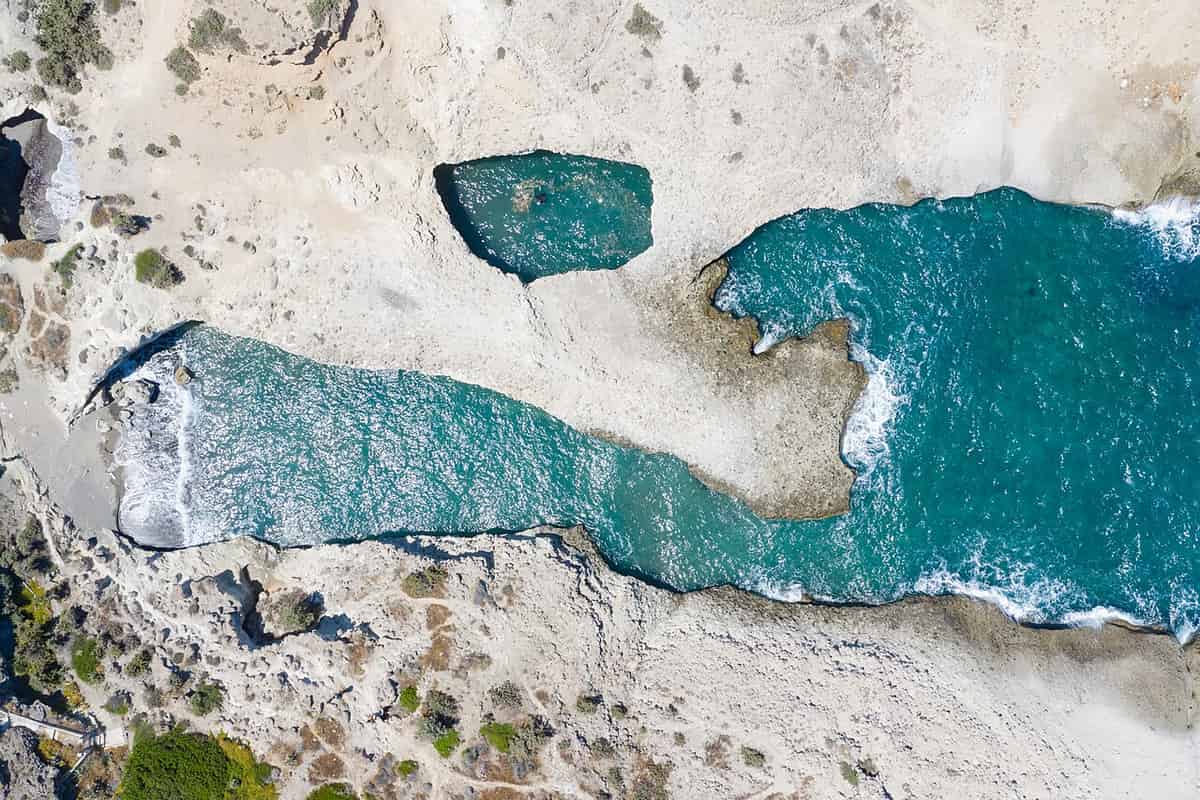
The coastline of Milos explains the pairing. The island has a great number of beaches, and the list runs to 90 of them, with 17 on the north side, 12 on the east, 21 on the south, 15 on the west and 25 inside the gulf. Part of that list can be reached on foot from the road, while the rest stay open only to a boat. A kayak and hike Milos outing works with both kinds of shore. The pairing suits a coast of this kind.
Caves and rock formations give the water leg its purpose. Sarakiniko holds white volcanic rock that formed in repeated layers, and fossils have been found inside it. Glaronisia, an islet north of Milos, shows columns of dacite lava in the sea. On the south coast, one cave still keeps great heat from the volcano, and the south-west side of the island is a habitat of the Mediterranean seal. A kayak and hike Milos route reaches this coast from the sea, where the cliffs stand closest to the water.
Paths on land carry the second leg. The greater part of Milos is rugged and hilly, and the highest ground, Mount Profitis Elias, stands 748 metres above the sea in the west. The villages of Milos, Plaka, Trypiti and Triovasalos, stand on the plateau above the gulf, and the western half has none, only a small number of settlements and old mines. A path between the shore and the settlements therefore covers ground that a boat cannot reach, which is why a kayak and hike Milos day uses both legs.
The two legs meet where the sea touches the land. A beach that only a boat reaches becomes the point where the paddle ends and the walk begins, and the same shore receives the group again at the end of the paddle. The natural harbour of Milos, the hollow of the principal crater, gives one such meeting point, and 25 of the island’s beaches lie inside that gulf. A kayak and hike Milos outing turns that meeting point into the hinge of the whole day.
- Coast: The island lists 90 beaches across five shores.
- Caves: One cave on the south coast still keeps great heat from the volcano.
- Rock: Sarakiniko holds white volcanic rock in repeated layers, with fossils inside.
- Paths: The land is rugged and hilly, and Mount Profitis Elias rises to 748 metres.
- Seal: The south-west side is a habitat of the Mediterranean seal, seen from the water on a kayak and hike Milos route.
Water and land answer different questions on this island. A boat reaches the caves, the cliffs and the beaches that lie below the roads, and a path reaches the plateau, the villages and the old mines above them. A kayak and hike Milos day joins the two answers, so the coast and the interior share one outing and one plan. The next section turns to the wind, which decides when each leg happens and which shore stays calm.
How do wind and sea shape a kayak and hike Milos day?
A kayak and hike Milos day follows the meltemi, the strong north wind of the Aegean. The wind blows from late spring to the middle of September, it rises in the afternoon and eases at night, and it leaves the southern shore calm.
The meltemi sets the rhythm. These strong, dry north winds of the Aegean blow from late spring to the middle of September. They reach their greatest strength in the afternoon, they ease at night, and a clear sky gives no warning of them, because they arrive in fine weather. The same winds can blow at force 7 to 8 on the Beaufort scale, and that force is dangerous to sailors. A calm morning follows a windy afternoon, and a kayak and hike Milos plan starts with that pattern.
Direction decides which shore stays calm. In the northern Aegean the etesian winds blow from the north-east to the north, in the central Aegean from the north, and in the southern Aegean from the north-west. Milos lies in the south-western Cyclades, so the wind reaches the island from the north and the north-west, and the southern and south-western shores lie in its shelter. The southern coast therefore stands in the lee of the island. A kayak and hike Milos outing uses those shores when the wind is up.
The gulf gives the island its own shelter. Milos has the shape of a horseshoe and forms a large bay, and that bay counts among the largest natural harbours of Greece. Inside that bay lie 25 of the island’s beaches. The season works in the same direction, with light north winds in late spring, a pause in June, and meltemia that blow until early October at an average force of 6 to 7 Beaufort. A kayak and hike Milos day therefore sits inside a long window.
Wind and sea turn the plan into an order. A paddled leg belongs in the calm part of the day, and the walk belongs after it, because the wind gathers strength as the afternoon arrives. The gulf and the southern shore keep the water quiet when the open coast does not, and the climate of the island, with warm and dry summers, keeps the season long. A kayak and hike Milos day follows the water first and the land second, and the order can change with the wind.
- Meltemi: These strong, dry north winds of the Aegean blow from late spring to the middle of September.
- Afternoon: The wind reaches its greatest strength in the afternoon.
- Night: The same wind eases at night.
- Gulf: The horseshoe shape of the island forms one of the largest natural harbours of Greece.
- Season: The meltemia continue until early October, outside the calm window of a kayak and hike Milos day.
The wind sets the clock, and the coast sets the water for each leg. A morning paddle meets a calmer sea, an afternoon walk meets the rising wind, and the gulf or the southern shore keeps the plan alive when the north wind blows hard. A kayak and hike Milos outing fits that order rather than fighting it. The last section turns to the other combined routes on the island and sets them side by side with this one.
How do the other combined routes compare with this kayak and hike Milos route?
A kayak and hike Milos route sits beside three other combined routes: a kayak and snorkelling route from Plathiena of 4.8 km, a kayak and hiking route from Lagada to Adamas of 8.1 km, and a hiking and snorkelling route towards Kleftiko of 3.3 km.
The four routes form one family. Two of them pair a kayak with a walk, one pairs a kayak with a snorkel, and one pairs a walk with a snorkel. Their distances run from 3.3 km to 9.0 km, and the route on this page holds the longest. The shapes differ too: one is a loop from a single beach, one runs from beach to beach, and one begins with a road crossing. A kayak and hike Milos route sits in the middle of that set.
The Plathiena route works entirely on the water. It covers 4.8 km, it starts and finishes at Plathiena beach, and it uses the north coast. Paddlers set out with Antimilos on the horizon and the cape of Vani in view, pass caves and small islands, leave the kayaks in a cave and put on masks and fins for three caves, then land at Nerodafni for a break. The return passes the Arkoudes, two rocks shaped like bears. That route pairs a paddle with a swim, not with a walk.
The kayak route to Klima joins the gulf to the ancient town. It covers 8.1 km and runs from Lagada beach past Skinopi and Small Skinopi to Klima, where the kayaks stay on the shore. The walk then climbs towards the Catacombs and passes the spot where the statue of Aphrodite of Milos was found and the Ancient Theatre, before the descent to Klima. The paddle back ends at Adamas. A kayak and hike Milos day of 9.0 km is the longer of the two kayak and hiking routes.
The hiking and snorkelling route works on the south-west. It covers 3.3 km, it leaves Adamas by car, and it crosses to western Milos, an area protected under Natura 2000. The car stays at Platorahes, the walk follows the natural path towards Kleftiko on the south-west coast, and the day ends with snorkelling in the surrounding caves before the shore stop for food and the trip back. That route carries no kayak at all, so it differs from a kayak and hike Milos outing in its first leg.
- Route 1: Kayak and snorkelling from Plathiena over 4.8 km, with a break at Nerodafni.
- Route 2: Kayak and hiking from Lagada to Adamas over 8.1 km, with the walk to the Catacombs.
- Route 3: Hiking and snorkelling from Adamas towards Kleftiko over 3.3 km.
- Route 4: Kayak and hiking over 9.0 km, the longest of the four, with transport, equipment, food and safety included.
- Choice: The activities and the distance separate the four kayak and hike Milos outings.
The choice between the four rests on two questions, the activities and the distance. A swimmer turns to the Plathiena route or to the Kleftiko shore, a walker turns to the two kayak and hiking routes, and a group that wants the longest line along the coast turns to the 9.0 km outing. The combined activities in Milos cover all four, and the kayak routes in Milos add the sea-only options for a kayak and hike Milos visitor.

What do travellers ask about a kayak and hike Milos route?
A kayak and hike Milos route raises questions about distance, season, gear, wind and the other routes on the island. The answers below cover the 9.0 km outing, the wind of the Aegean, the calm shores and the combined routes that share the island.
How far does a kayak and hike Milos route run?
The route on this page covers 9.0 km, and it is the longest of the four combined routes. The other distances are 8.1 km from Lagada to Adamas, 4.8 km from Plathiena and 3.3 km towards Kleftiko. Transport, equipment, food and safety come with the outing, so a kayak and hike Milos day carries its own support.
Which season suits a kayak and hike Milos outing?
The season runs from late spring into early autumn. Light north winds arrive in late spring, June brings a pause, and the meltemia then blow until early October. Summer on Milos is warm and dry, so the calm part of the day belongs to the morning. A kayak and hike Milos outing fits that long window well.
What gear does a kayak and hike Milos day need?
The equipment comes with the route, so the list for the visitor stays short. The water leg uses a boat and a paddle, and the land leg uses walking gear for rough ground. Sun protection belongs to both legs, and water as well. A kayak and hike Milos day asks for clothing that suits sun and sea air.
How does the wind change a kayak and hike Milos plan?
The wind decides the order of the two legs. The meltemi reaches its greatest strength in the afternoon and eases at night, so a paddle belongs in the calm part of the day and a walk follows. When the north wind blows hard, the gulf and the southern shore keep the water workable for a kayak and hike Milos day.
Which shore stays calm on a kayak and hike Milos day?
The southern and south-western shores stay calm when the north wind blows, because the meltemi reaches the island from the north and the north-west. The gulf gives a second shelter, since the horseshoe shape of Milos forms a large bay and 25 of its beaches lie inside it. A kayak and hike Milos outing has two calm options.
What else can a kayak and hike Milos visitor compare?
The island holds two kayak and hiking routes, one kayak and snorkelling route and one hiking and snorkelling route, and each has its own page. Sea-only kayak routes add further options for a paddler. A visitor who wants caves, rock and a path between them finds the four combined routes cover that ground for a kayak and hike Milos day.