Route No. 2 covers a distance of 5.9 km and lasts about 3 hours. First we come to the catacombs, where we have a guided tour and see the chambers and tombs. Next, as we go downhill, we see the church of Agia Paraskevi and then the traditional town of Klima. We have a short break at “Kitrino Syrma” (Yellow Syrma), a shop with a wide range of unique handmade jewellery and other creations. While hiking we start climbing and see the Ancient Theatre, the Baptism place and the church of Prophet Elias, where we have our second break and admire the view. Walking downhill again, we see Tramithia and the church of Saint Nicholas, where we have our second break. We then set off for the traditional town of Areti and start going uphill towards Plaka, the capital of the island, where we have our last break at the Marmara location. Finally, we head to the back part of Plaka, and as we end our journey we arrive at the spot where the Aphrodite of Milos was first discovered. Price: 30 euros
Milos lies in the Aegean, the south-western island of the Cyclades, and its ground is volcanic from end to end. White rock, dry slopes and a deep bay shape the place. A walker can follow a path that begins above the water and ends in the capital. The villages, sights and routes of the island are collected at milosadvisor.gr for a day on foot.
The Plaka hike Milos route runs on one slope of the island and keeps the sea in view for much of its length. It passes burial chambers cut in soft rock, a shore of boat houses, a theatre of Roman date, churches on the heights and small settlements on the way up to the capital. The distance is 5.9 km.
What does the Plaka hike Milos route cover from the catacombs to Plaka?
The Plaka hike Milos route covers 5.9 km, from the catacombs down to the shore at Klima, then up past the ancient theatre to the church of Prophet Elias, through Tramithia and Areti to Plaka, and on to the spot where the Venus de Milo was found.
The Plaka hike Milos route follows one slope of the island and turns at every stage. It starts high above the bay, drops to the water at Klima, climbs to the height where the church of Prophet Elias stands, loses it again at Tramithia, then gains it a second time on the way to Plaka. The walk covers 5.9 km, and the ground changes underfoot, from dirt to stone to the paved lanes of the villages.
The ground under the Plaka hike Milos route belongs to a volcanic island. Tuff, trachyte and obsidian are among the ordinary rocks of Milos, and the volcano that shaped them last erupted 90,000 years ago. Soft tuff is the rock that walkers notice first, because it holds the cut chambers, the carved caves and the worn edges of the path. The surface stays rough and pale, and the water below keeps the light moving on the rock.
A walker meets the stops of the Plaka hike Milos route in a fixed order. The catacombs come first, then the church of Agia Paraskevi, then the lanes of Klima. The climb brings the ancient theatre, the baptism place and the church of Prophet Elias. Tramithia and the church of Saint Nicholas follow on the descent, then Areti, then the last climb to Plaka by Marmara, and the end of the walk at the back of Plaka.
The bay of Milos opens below the whole line of the Plaka hike Milos route. The path holds the water on one side for long stretches, and the harbour town of Adamantas lies across the gulf. Above the path, the slope carries the ruins of the ancient city of Melos, and below it the shore at Klima marks the old landing place. Height and water stay close together here, and the sea never leaves the view for long.
- Distance: The Plaka hike Milos route covers 5.9 km between the catacombs and the back of Plaka.
- Direction: The walk drops to Klima, climbs to Prophet Elias, falls to Tramithia and rises again to Plaka.
- Ground: Soft volcanic tuff, dry dirt and rough rock carry the path for the whole distance.
- Water: The gulf of Milos stays below the path, with the harbour town on the far side.
- Finish: The route ends at the spot where the Venus de Milo came to light in 1820.
Taken as a whole, the Plaka hike Milos route joins the oldest ground of Milos to the capital. The walk passes from burial chambers cut in soft rock to a shore of boat houses, then to a Roman theatre, a baptism place and churches, and finally to Plaka. The other walks of the island sit beside this one at hiking in Milos.
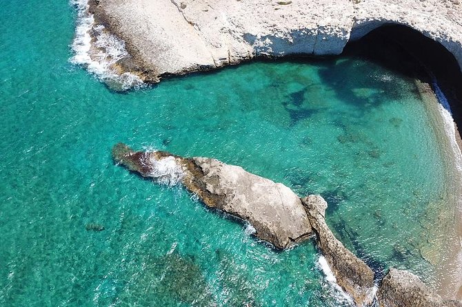
Where does the Plaka hike Milos route start at the catacombs and Agia Paraskevi?
The Plaka hike Milos route starts at the catacombs, an underground Christian cemetery of the first centuries on the hillside above Klima. A short descent then brings the church of Agia Paraskevi, a cave chapel cut into the rock, before the path continues down toward the shore.
The Plaka hike Milos route begins on the hillside south-west of Tripiti, in the area of the ancient city of Melos. The catacombs lie in soft porous volcanic rock, and their galleries run underground between the village above and the coast below. The entrance stands in the hall of gallery B, the group that can be entered today, and the walk starts from that point, with the sea already in sight below the rock for the first time.
The galleries measure between one and five metres across and between 1.6 and 2.5 metres in height, and together they run about 200 metres. Arched wall tombs, known as arcosolia, and horizontal recesses, known as loculi, line the passages, while pit graves cover the floors. Three groups of chambers, labelled A, B and C, form the plan, and artificial corridors join them into one complex. Slabs of different sizes covered the tombs, and layers of plaster sealed them.
Inside, the right side of gallery B keeps the only two-level tomb of the site and fragments of a long inscription in red capital letters in a rectangular frame. In the middle of the hall stands a single tomb shaped like a sarcophagus, the tomb of the witness, which served as an altar under a canopy. Traces of plaster carry a Christogram, the letters omega and alpha, flowers and two birds. The tombs had been looted long before the first scholars arrived.
On the way down, the chapel of Panagia Faneromeni stands beside the road toward the catacombs, and two arched tombs lie inside it, with traces of wall paintings in the sanctuary. Lower on the slope, the church of Agia Paraskevi is cut into the rock as a cave church. The Plaka hike Milos route passes it on the descent, and the ground turns from dirt to stone under the feet, with the shore drawing closer at every step.
- Start: The Plaka hike Milos route begins at the catacombs above the shore at Klima.
- Entrance: Walkers enter through the hall of gallery B, the group open to visitors.
- Galleries: Three groups of chambers, A, B and C, run about 200 metres underground.
- Chapel: The cave church of Agia Paraskevi comes next on the descent to the water.
- Road: The chapel of Panagia Faneromeni stands on the way to the catacombs.
The opening stage of the Plaka hike Milos route holds the oldest layer of this walk. The catacombs, the chapel of Panagia Faneromeni and the cave church of Agia Paraskevi stand within a short distance of each other, and the ground falls the whole way to the water. The start stays quiet, and the sea waits below the slope of the walk.
What does a walker meet on the Plaka hike Milos route at Klima?
The Plaka hike Milos route reaches Klima, a seaside settlement at the entrance of the gulf below Tripiti. Its boat houses, known as syrmata, stand in a row at the water, and lanes run behind them, between painted doors and small courtyards.
Klima stands at the entrance of the gulf of Milos, below the village of Tripiti, and it lies 6 km from Adamantas, the main port of the island. The settlement has been a designated traditional settlement since 1978. Its beach, together with the nearby beach of Schinopi, suits swimming, and eating places work in the village. The Plaka hike Milos route arrives here from the slope above, and the water comes close for the first time on the walk.
The boat houses of Klima are known as syrmata. A sirma is a two-storey building, with the fisherman and his family living on the upper floor and the lower floor used to keep the boat through the winter. Doors and windows are painted in strong colours, and the row of houses follows the line of the shore. A number of the syrmata now serve as tourist accommodation in the warm months, and the village keeps its working character.
Behind the row of doors, lanes run along the back of the boat houses, between the buildings and the rock. The Plaka hike Milos route takes these lanes, where the ground is level and the water stays close on the other side. The passage between the houses and the slope is narrow, and the doors face the sea while the rock rises behind. The lanes give the walk its quietest stretch, with the bay in front.
Klima lies near the site of ancient Milos, with the ancient theatre close by, and the statue of the Aphrodite of Milos was found near that theatre. The ruins of the ancient city, its harbour town and its cemeteries spread over a wide area around the cove. The Plaka hike Milos route leaves the lanes of Klima and starts the climb toward the monuments on the slope above. A fuller account of the settlement sits at Klima.
- Shore: Klima stands at the entrance of the gulf of Milos, below the village of Tripiti.
- Syrmata: The boat houses are two-storey buildings with doors and windows in strong colours.
- Lanes: The Plaka hike Milos route follows the lanes behind the boat houses at the water.
- Winter: The lower floor of each sirma kept the fishing boat through the winter months.
- Swim: The beach of the village and the nearby beach of Schinopi suit swimming.
Klima gives the Plaka hike Milos route its water level. The boat houses, the painted doors, the lanes behind them and the beaches make one small settlement where the walk touches the shore. Above the roofs, the slope carries the remains of the ancient city, and the climb begins at the end of the lanes. The stage is short and level.
What stands on the climb of the Plaka hike Milos route above Klima?
The Plaka hike Milos route climbs from Klima to the ancient theatre, a Roman building of marble seats, then passes the baptism place, and reaches the church of Prophet Elias, where the view opens over the bay of Milos.
The ancient theatre stands on the slope of the hill where the ancient city of Milos spreads, between the modern settlements of Trypiti and Klima, and it looks over the gulf of Milos. The building dates to the Roman period, and the visible remains belong to that Roman phase of the monument. Preserved are the cavea with seven marble rows of seats, the orchestra, the floor of the stage building and a large number of carved architectural parts.
The theatre held about 800 spectators, and the excavated part covers about a tenth of the building. The lower cavea is divided into seven tiers of marble seats, with eight marble staircases between them, and each tier carries four to five marble seats. Inscriptions cut into the seats name groups of citizens who sat there, among them young men, hymn singers and councillors. The orchestra is slightly larger than a semicircle, so that it worked as an arena.
Above the theatre the Plaka hike Milos route passes the baptism place, the point on the slope that carries the name of baptism. The same hillside holds the catacombs, where the first Christian community buried its dead and also gathered for worship, and the two places belong to one layer of the island’s past. The path then climbs steadily, and the ground underfoot turns to dirt and broken rock as the height increases, and the bay drops away behind.
The climb ends at the church of Prophet Elias, which stands on the height above the slope. From that point the view opens over the bay of Milos and the water below, and the route gives the walker a place to stop and turn around. Prophet Elias is also the name of the highest summit of the island, which reaches 751 metres. The Plaka hike Milos route reaches this height before it turns downhill again.
- Theatre: The ancient theatre lies between Trypiti and Klima and looks over the gulf.
- Seats: Seven marble rows of seats, the orchestra and the stage floor survive.
- Capacity: The building held about 800 spectators, and one tenth of it is excavated.
- Baptism: The Plaka hike Milos route passes the baptism place above the theatre.
- View: The church of Prophet Elias gives the walker a wide view over the bay.
The climb is the part of the Plaka hike Milos route that carries the weight of the monuments. The theatre with its marble seats, the baptism place and the church of Prophet Elias follow each other on the same slope, and the view takes in the whole bay. The walk then turns downhill, with the water still in sight below.
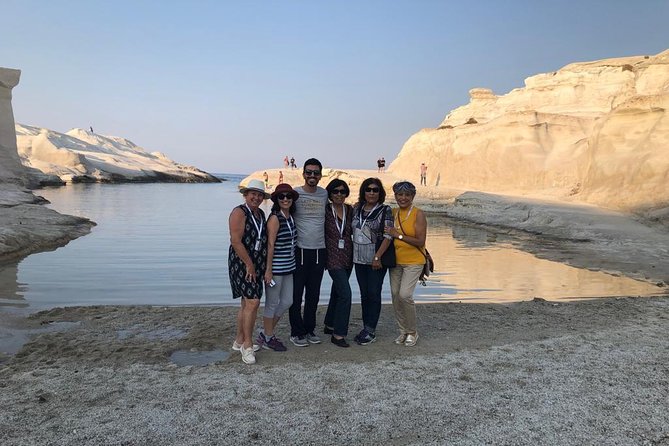
What does the Plaka hike Milos route pass at Tramithia and Saint Nicholas?
The Plaka hike Milos route turns downhill after Prophet Elias and comes to Tramithia, then to the church of Saint Nicholas. The ground falls toward the village of Tripiti, which stands at 150 metres above the sea on the northern side of the island.
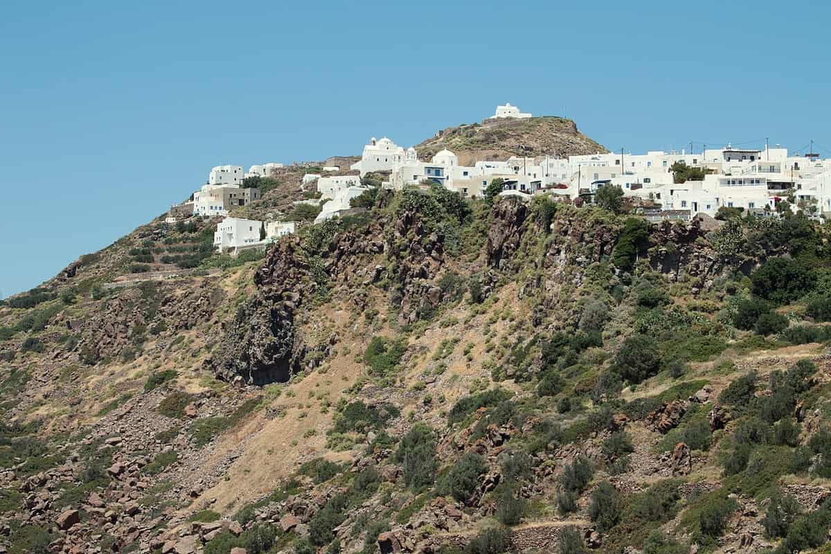
After the church of Prophet Elias the Plaka hike Milos route turns downhill and comes to Tramithia. The path loses the height it has just gained, and the ground falls toward the villages on the slope below. The descent runs between dry ground and low walls, and the bay stays in view behind the walker. Tramithia marks the middle point of the walk, between the monuments above and the capital that waits at the end.
The church of Saint Nicholas stands in the centre of the village of Tripiti, and it was built in 1888 on the plan of the church of Saint Nicholas of Syros. It keeps a marble altar screen, an icon stand of the 17th century and icons of the Cretan School. The Plaka hike Milos route passes the church on its way through the settlement, and the houses of the village gather around it, with narrow lanes between them.
Tripiti stands at 150 metres above the sea, on the northern side of the island at the sea entrance to the gulf of Milos, and 5 km north-west of the harbour town of Adamantas. The village has been a designated traditional settlement since 1978, and the community of Tripiti counted 502 residents in 2021. Its name comes from the soft volcanic rock around it, which appears pierced with holes, and the same soft rock gave the catacombs their ground.
The restored windmills of Tripiti are among the sights of the village. They once ground grain for the whole island, and today they serve as accommodation for visitors. The Plaka hike Milos route leaves the village behind and turns toward the last stage of the walk, with the capital still above and the water still below. The rock that gives Tripiti its name stays in sight for the rest of the descent to the water.
- Descent: The Plaka hike Milos route loses height from Prophet Elias down to Tramithia.
- Church: The church of Saint Nicholas stands in the centre of the village of Tripiti.
- Date: The church was built in 1888 on the plan of the church of Saint Nicholas of Syros.
- Village: Tripiti stands at 150 metres above the sea, 5 km from the harbour town.
- Windmills: The restored windmills of Tripiti once ground grain and now serve as accommodation.
Tramithia and Tripiti give the Plaka hike Milos route a village stage between two climbs. The church of Saint Nicholas, the restored windmills and the rock full of holes belong to the same settlement, and the ground falls away toward the water. The capital stays above, waiting at the end of the last ascent, and the bay opens wider behind.
How does the Plaka hike Milos route cross Areti and reach Plaka by Marmara?
The Plaka hike Milos route leaves Tramithia and passes through Areti, a small settlement on low ground near the eastern entrance of the bay of Milos. The last climb then runs up to the Marmara location and into Plaka.
Areti is a settlement of Milos on low ground, near the eastern entrance of the great bay of Milos and close to Fourkovouni. It stands at a mean weighted elevation of 80 metres, about 7.5 km north-west of Plaka, and it was recognised as a settlement in 1981. The beach of the settlement is its own sight, and the Plaka hike Milos route passes through it on the way to the capital. In 2021 the settlement counted 3 residents.
The Plaka hike Milos route leaves Areti and turns uphill for the last time. The ground rises in stages, and the path moves away from the water toward the plateau where the capital stands. Walls, low brush and bare rock line the climb, and the bay opens wider behind the walker with every step. The last stage carries the walk from the shore level to the town, and the height gained here is the last of the walk.
The climb brings the walker to the Marmara location, the last stopping point on the Plaka hike Milos route before the town. Plaka takes its name from the level ground where houses were built when the Kastro no longer held the population of the hill. The settlement stands at 220 metres, with a view toward the gulf of Milos. The capital, with its streets and churches, has its own account at Plaka for a longer visit.
The Plaka hike Milos route enters the capital on foot, because cars do not pass inside the settlement. The lanes between walls and buildings are narrow, and motorbikes and mopeds are the usable vehicles there. The village has been a designated traditional settlement since 1978, and it counted 902 residents in 2021. The walk ends at the back of the town, where the last stage of the route closes, and the bay lies far below the roofs.
- Areti: Areti is a settlement of Milos on low ground near the bay.
- Elevation: Areti stands at a mean weighted elevation of 80 metres.
- Marmara: The Marmara location is the last stopping point before the capital.
- Capital: Plaka stands at 220 metres and looks toward the gulf of Milos.
- Streets: Cars do not pass inside Plaka, where the lanes stay narrow.
Areti and the Marmara location close the climbing part of the Plaka hike Milos route. The walk passes from low ground near the bay to the plateau of the capital, and the height gained on the last stage brings the roofs of Plaka into view. From there the route continues on foot into the town, between its narrow lanes.
Where does the Plaka hike Milos route end in the back of Plaka?
The Plaka hike Milos route ends at the back of Plaka, at the spot where the Venus de Milo was found on 8 April 1820. A Greek farmer came upon the statue in the ground, and a French sailor who watched urged him to keep digging.
Plaka, whose official name is Milos, is the chief town of the island, and it sits on top of a large rock that looks over the gulf of Milos. The village stands at 220 metres, and cars stay outside its inner streets on the hill. Plaka counted 902 residents in 2021, and the settlement has been designated traditional since 1978. The Plaka hike Milos route ends at its back part, where the ground opens toward the bay.
The Kastro occupies the highest point of Plaka, on a hill of volcanic origin. Venetian builders created it in the 13th century, and its position above the ancient city allowed control of ship movement in the gulf of Adamantas. The medieval town of Plaka grew on the plateau just below the fortified height, as a natural extension of it, with the houses rising toward the rock, and the castle has been classed as an ancient monument.
Churches mark the upper village of Plaka. Panagia Thalassitra stands on the climb toward the Kastro, and the church of the Dormition of the Virgin, also called Mesa Panagia, crowns the summit. At the western end, Panagia Korfiatissa is the cathedral of Milos, built in 1820 in a style that joins Byzantine and Cycladic elements. The Plaka hike Milos route finishes among these heights, and the houses of the town close around them on the hill.
The Venus de Milo was found on 8 April 1820 by a Greek farmer, in the area of the ancient city near the theatre. A French sailor watched and urged him to keep digging, and they uncovered two large pieces of the statue and a third, smaller piece. A fragment of an arm, a hand holding an apple and two herms lay beside it. The statue is now in the Louvre, and a copy stands in the museum at Plaka.
- Town: Plaka is the chief town of Milos, and its official name is Milos.
- Kastro: The Kastro was built by Venetians in the 13th century above the ancient city.
- Churches: Panagia Thalassitra, Mesa Panagia and Panagia Korfiatissa mark the upper village.
- Find: The Venus de Milo was found on 8 April 1820 near the ancient theatre.
- Museum: The archaeological museum of Plaka keeps a copy of the statue.
The Plaka hike Milos route ends on ground that has given the island its best-known work of art. The back of Plaka, the Kastro above it and the find spot of the Venus de Milo stand within the same small area. The sea, the bay and the harbour town close the line of travel that began at the catacombs above Klima.

What do walkers ask about the Plaka hike Milos route?
The Plaka hike Milos route raises questions about its start, its distance, its ground, the sights along the way and the place where it ends. The answers below set out the details of the walk, from the catacombs above Klima to the back of Plaka.
Where does the Plaka hike Milos route start and finish?
The Plaka hike Milos route starts at the catacombs on the hillside south-west of Tripiti, above the shore at Klima. It finishes at the back of Plaka, the capital of the island, at the spot where the Venus de Milo was found. The walk covers 5.9 km between the two points.
What distance does the Plaka hike Milos route cover?
The Plaka hike Milos route covers 5.9 km. The line of the walk runs from the catacombs down to the shore at Klima, up past the ancient theatre to the church of Prophet Elias, down to Tramithia, and then up through Areti to Plaka by the Marmara location. The route ends at the back of the capital.
Which sights does the Plaka hike Milos route pass?
The Plaka hike Milos route passes the catacombs, the church of Agia Paraskevi, the lanes of Klima, the ancient theatre, the baptism place, the church of Prophet Elias, Tramithia, the church of Saint Nicholas, Areti, the Marmara location and the back of Plaka. It ends at the spot where the Venus de Milo was found.
What ground does the Plaka hike Milos route cross?
The Plaka hike Milos route crosses volcanic ground. Tuff, trachyte and obsidian are among the ordinary rocks of Milos, and soft tuff holds the cut chambers and the carved caves of the slope. The surface underfoot changes from dirt to broken rock and back, and the walk stays dry and open for its whole length.
Which churches stand along the Plaka hike Milos route?
The Plaka hike Milos route passes the chapel of Panagia Faneromeni, the cave church of Agia Paraskevi, the church of Prophet Elias, the church of Saint Nicholas in Tripiti and the churches of Plaka. The church of Saint Nicholas was built in 1888, with a marble altar screen and an icon stand of the 17th century.
Why does the Plaka hike Milos route end at the Venus de Milo find spot?
The Plaka hike Milos route ends at the back of Plaka because the ground there carries the find spot of the Venus de Milo. The statue came to light on 8 April 1820, when a Greek farmer dug in the area of the ancient city. The walk closes on the place that gave the island its best-known work.