Miloterranean Geo Experience caters to the inquisitive traveler’s desire to discover the multifaceted beauty of the landscape and volcanic origin of the Greek islands of Milos and Kimolos. Maps with detailed routes, complemented by concise text, guide the visitor through the island’s unique geology, its rich mining history and present, and its beautiful natural environment. A so-far “secret” Milos is revealed. Geologists, mining engineers, foresters, cartographers and historians combined their expertise and insights to take you on an unprecedented journey through this Cycladic scenery.
The island of Milos is volcanic ground in the Aegean Sea, and its rock tells a long story of eruptions and mines. Milos geo walks turn that story into a day outdoors, across marked lines of tuff, lava and white stone. This page sets out what those routes are, what the ground shows and how to plan a walk.
Milos lies at the south-western end of the Cyclades. Its area is estimated at 151 square kilometres, and the land measures about 23 kilometres from east to west and 13 kilometres from north to south. Mount Profitis Elias reaches 748 metres in the west, and dry hills and a rocky coast make the island a natural classroom.
What are Milos geo walks and where do they run?
Milos geo walks are marked routes that follow the volcanic ground of the island, its industrial minerals and the remains of old mines. Each line carries a map and a short text that open the geology to any walker.
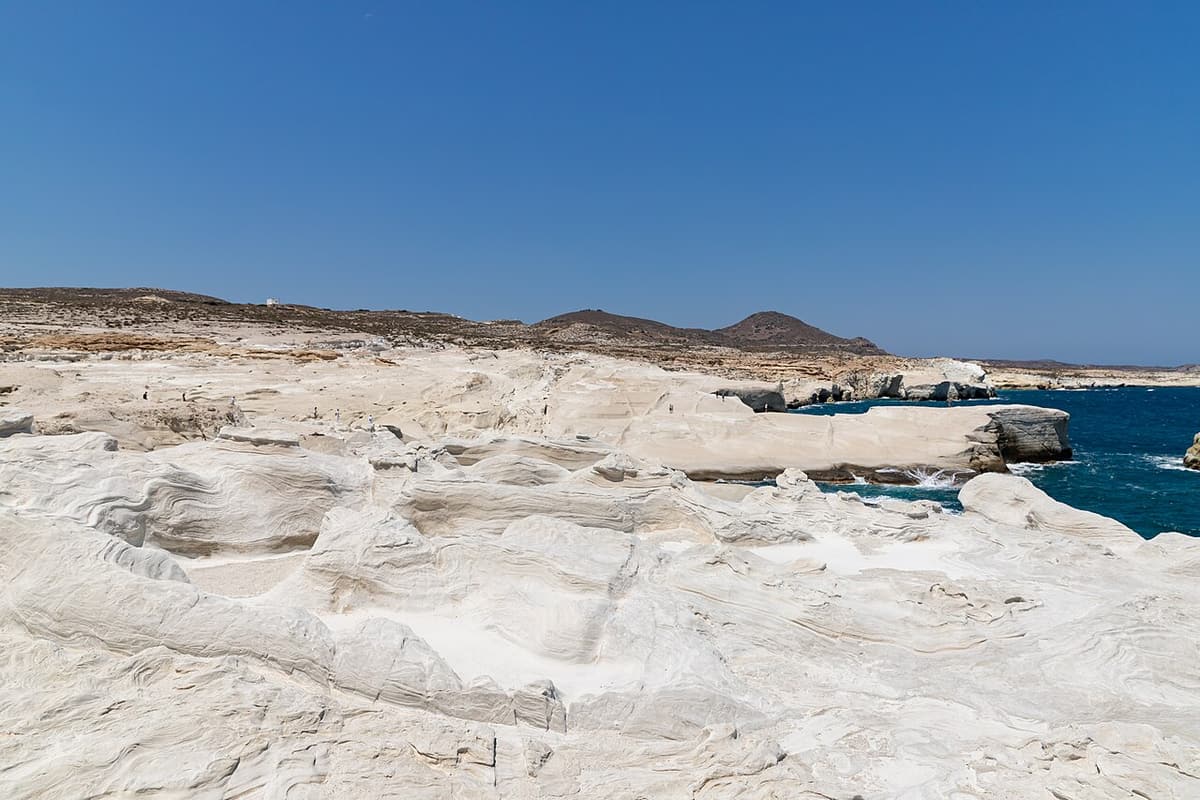
The island is the south-western island of the Cyclades and stands on the South Aegean Volcanic Arc. Subduction of the African plate beneath the Eurasian plate built that arc, and the island counts as a dormant volcano along it. Activity began two to three million years ago in the Pliocene and last erupted 90,000 years ago in the Pleistocene. Tuff, trachyte and obsidian are ordinary rocks here, and Milos geo walks cross all three of them.
The marked lines form a network of seven geo-routes across the island. Each one comes with a descriptive text and a detailed map, so Milos geo walks carry their own explanation of the ground underfoot. The shortest of the seven runs 4.5 kilometres from Agios Konstantinos to Sarakiniko, and the six longer lines cover between 8.5 and 24 kilometres. Geologists, mining engineers, foresters, cartographers and historians worked together on the material that sits behind the routes.
The mineral history of the island runs deep. Bentonite, perlite, pozzolana and small quantities of kaolin are still collected by strip mine and open-pit methods and sold around the world. Baryte, sulfur, millstones and gypsum were mined in the past, and the ancient world knew the island as its richest source of sulfur. The Mineral Museum of Milos keeps the social, economic and technological side of that story, and it gives Milos geo walks their wider setting.
- Origin: The island is a dormant volcano on the South Aegean Volcanic Arc.
- Rock: Tuff, trachyte and obsidian are the ordinary rocks of the island.
- Network: Seven marked geo-routes cross the island, each with a text and a map.
- Length: The shortest route covers 4.5 kilometres and the longest covers 24 kilometres.
- Museum: An exhibition in Adamas presents the minerals mined here since the Neolithic age.
Milos geo walks join a volcanic landscape to a working mineral past. The arc that shaped the island still leaves heat in the ground, and hot sulfurous springs rise on the harbour’s eastern shore. Seven marked lines carry walkers across that ground with a text and a map in hand. The next section sets out the main routes and the mines seen on them.
Which rocks and old mines do Milos geo walks pass?
Milos geo walks cross tuff, lava and white stone, and they pass old galleries, quarries and abandoned works. Route 1 covers 24 kilometres from Adamas towards cape Vani and combines driving with walking stretches, while Route 3 ends at the old sulphur works beside a small cove.
Route 1 of the Milos geo walks leaves Adamas and follows the coast road east. A restored building of the old kaolin plant stands beside the road, and the abandoned salt works of Alykes appear later as a wetland. Tuffs and andesites alternate along the track beyond Agia Marina. In the area of Mersinia lie old galleries of kaolin and barite mining, and further north, towards cape Vani and its mine, hard volcanic rocks take over from the tuffs.
The second line of the Milos geo walks turns from clay to sulphur. Its ravine carries galleries where white kaolin was mined, although iron oxides in the rock keep the kaolin of Milos from looking very white. The dirt road ends at the old sulphur works, which form the destination and the main draw. The cove of Paliorema holds yellow pebbles and clear water beside the ruins, and the beach of Agathia keeps old galleries and old port facilities.
The ground crossed by Milos geo walks carries the mineral story. Bentonite is a swelling clay that forms from weathered volcanic ash, and the island holds a deposit of it. Perlite is a volcanic glass that forms when obsidian takes up water. Greece holds reported perlite reserves of 120 million tonnes. Obsidian from the island was a commodity 15,000 years ago. Pozzolana and small quantities of kaolin are collected today, and Melian earth served ancient artists as pigment.
- Vani route: Route 1 covers 24 kilometres from Adamas, and walking stretches alternate with driving.
- Mersinia: Old galleries of kaolin and barite mining lie in this area.
- Agathia: The beach keeps old galleries and old port facilities beside the water.
- Paliorema: The cove of the old sulphur works has yellow pebbles and clear water.
- Kaolin: Iron oxides in the rock keep the kaolin of the island from looking white.
Milos geo walks show how the rock of the island was dug and processed. Route 1 follows the coast from Adamas past kaolin, barite and salt remains towards cape Vani, and old port facilities stand beside the galleries at Agathia. Route 3 ends at the sulphur works of Paliorema, in a cove beside the sea. The shorter lines cross tuff and white stone.

How does a walker plan Milos geo walks in season and heat?
Milos geo walks ask for water, an early start and a month chosen with care. Spring and autumn bring mild days and little rain, while midsummer brings high temperatures and a strong dry north wind. Sturdy footwear, sun cover, a map and a compass complete the kit.
The season decides the day for Milos geo walks. April has a daily mean of 15.2 degrees Celsius and 2.9 rainy days, and late spring reaches 19.3 degrees with 1.4 rainy days. September holds 22.3 degrees and 0.9 rainy days, and October holds 18.5 degrees. From June to September, the mean daily maximum sits between 25.2 and 28.1 degrees. July brings 0.3 millimetres of rain on average, and the highest June temperature reached 44.0 degrees.
Water comes first. Two litres can be enough for a day, and hot conditions can call for one litre for every hour of walking. Natural water in the countryside can be unfit to drink, so the supply starts at the base. The meltemi, a dry north wind, tempers the summer heat, and it can blow at force 7 to 8 from a clear sky. In low humidity, sweat evaporates quickly, so drinking stays steady on Milos geo walks.
Maps and starts decide the rest of Milos geo walks, and the hiking in Milos routes of the island run beside the geological lines. Each marked line carries signs at its beginning, and the shortest one sets out from Agios Konstantinos. Route 5 has signs at Seladi, where a path of 1.5 kilometres leads to Skiadi, and Route 4 has its own signs north of the Aggeria viewpoint. Route 2 begins at the catacombs near Tripiti.
- Water: One litre for every hour of walking suits hot conditions, and the supply starts full.
- Sun: A hat, sunglasses, sunscreen and covered skin answer the light.
- Footwear: Boots with ankle support help on rough ground, and ankle sprain makes up 42% of injuries.
- Wind: The meltemi is a dry north wind that can reach force 7 to 8.
- Wildlife: The Milos viper is venomous, averages 50 to 70 centimetres and is strictly protected.
A walker who plans around season, heat and water keeps Milos geo walks comfortable. Spring and autumn bring mild days and little rain, and midsummer brings temperatures near the highest measured. An early start, a full bottle and covered skin answer the sun, while a map and signs answer the route. The museum in Adamas holds the mineral story behind the ground.
What do walkers ask about Milos geo walks?
Milos geo walks raise practical questions about season, water, marking and starts. The answers below rest on the climate, the terrain and the marked lines of the island, so a walker can match a route to the day and to the hours available.
When do Milos geo walks suit the island best?
Spring and autumn give the mildest days. April has a daily mean of 15.2 degrees Celsius and 2.9 rainy days, and late spring reaches 19.3 degrees with 1.4 rainy days. September has 22.3 degrees and 0.9 rainy days, and October has 18.5 degrees. July shows 0.3 rainy days, and midsummer heat shapes the day.
What must be carried on Milos geo walks?
Water comes first. Two litres can be enough for a day, and hot conditions can call for one litre for every hour of walking. Natural water in the countryside can be unfit to drink, so the supply starts full. A hat, sunglasses, sunscreen and covered skin answer the light, and the white rock reflects it back.
Where do Milos geo walks start?
Each line has its own start. The shortest marked route sets out from Agios Konstantinos and ends at Sarakiniko. Route 2 begins at the catacombs near Tripiti and ends at Plaka. Route 1 leaves Adamas and combines car stretches with walking. Route 5 begins at Seladi, and Route 7 has a marked path of 850 metres to Tramythia.
Are Milos geo walks marked on the ground?
The lines are marked on the island and each one comes with a text and a detailed map. Signs stand at the start of the shorter routes, and Route 4 has its own signs north of the Aggeria viewpoint. Paths are not visible along the whole length of the line, so walkers keep parallel to the coast on flat rock.
Can Milos geo walks be joined with a swim?
The lines pass close to the sea in places. The coastal route ends at Sarakiniko, where small beaches follow almost one kilometre of white formations beside the water. The Sykia line allows a break for food and a swim at the cave, and the cove of Paliorema holds clear water beside the old sulphur works.