
Antimilos is a small, steep island that rises from the sea north-west of Milos. This page on Milos Advisor explains what the island is, what it is called, and where it sits. Nobody lives there, so its rocky slopes stay wild and quiet all year round.
The island belongs to the Cyclades, a Greek island group south-east of the Greek mainland. It also falls under the municipality of Milos, so it shares the same local council. Low bushes cover its slopes, and sheer cliffs make it a striking shape on the horizon.
What is Antimilos, and what is it called?
Antimilos is an uninhabited volcanic island in the Cyclades, close to the larger island of Milos. Its crater still shows clearly at the top. Locals also call it Erimomilos, meaning Desert Milos. In ancient times it carried the names Ephyra and Ephora.
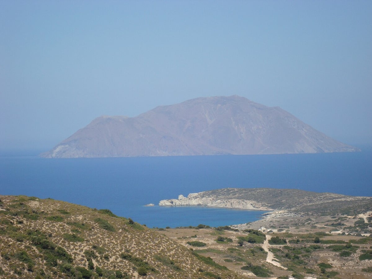
Antimilos is an islet, which is a word for a very small island in the sea. Nobody lives on it at all, and no village or harbour town stands there. Low bushes, called scrub, grow over its rocky slopes.
In Greek, the name of the islet is written Αντίμηλος. The stress falls on the second syllable, so it sounds like an-DEE-mee-los. The name itself shows how closely the islet is tied to its much larger neighbour, Milos.
Islanders also call Antimilos by a second name, Erimomilos. It means Desert Milos, a fitting label for an island with no people. People already used this name back in the Middle Ages, hundreds of years ago.
In ancient times the island carried the names Ephyra and Ephora. Ephora means watchtower, a tall post used by guards to watch for danger. From the highest point, a person can scan the sea over long distances.
- Type: It is a small, steep volcanic islet that belongs to the Cyclades.
- People: Antimilos is uninhabited, so no one lives there.
- Local name: Islanders call it Erimomilos, meaning Desert Milos.
- Ancient names: It was once known as Ephyra or Ephora.
- Council: It falls under the municipality of Milos.
The names of Antimilos tell its story in a simple way. One name points to its emptiness, and another points to its long sea views. Together they paint a clear picture of a wild rock where nature, not people, sets the rules.

Where does Antimilos lie, and how big is it?
Antimilos lies north-west of Milos, in the Myrtoan Sea on the western side of the Cyclades. It covers 8.8 square kilometres of land. Its highest point stands 671 metres above sea level, higher than the second-tallest mountain on Milos.
Milos lies in the far south-west of the Cyclades, a ring of Greek islands in the Aegean Sea. Antimilos lies off its north-west coast, on the side facing away from Kimolos and Polyaigos. Those two neighbours lie to the north-east and east instead.
The name Cyclades comes from the old idea of a circle of islands. The islands form a loose ring around Delos, a holy island in ancient Greek religion. This islet sits on the western edge of that ring, close to Milos.
The open water around the islet has its own name, the Myrtoan Sea. This sea lies between the Cyclades and the Peloponnese, on the western side of the island group. It is described as the part of the Aegean south of Euboea, Attica and Argolis.
Antimilos covers 8.8 square kilometres of rock, which makes it a small island on any map. Milos spreads over 151 square kilometres, more than seventeen times as much land. Even so, the summit of this little islet climbs to 671 metres above sea level.
- Direction: The islet lies north-west of Milos, on the opposite side from Kimolos and Polyaigos.
- Sea: It rises from the Myrtoan Sea, between the Cyclades and the Peloponnese.
- Area: Its land area is 8.8 square kilometres, or 8.801 in exact figures.
- Height: The highest point stands 671 metres above the surface of the sea.
- Compared with Milos: Its summit beats Chondro Vouno, the second-tallest mountain on Milos, at 636 metres.
Ancient writers did not agree on whether the Myrtoan Sea belonged to the Aegean. One counted it as part of the Aegean, while another kept the two apart. Either way, Antimilos remains a small but tall landmark on the western edge of the whole island group. The map of Milos shows the main island it sits beside.
How did the Antimilos volcano form?
Antimilos is the youngest volcanic centre in the Milos volcanic field, a group of volcanic islands. It is a small central volcano, built from lava domes and lava flows. These layers piled up in turns, and a crater still sits on top of the island today.
The story of this volcano starts far below the Aegean Sea, where moving plates meet. The African plate slides under the Eurasian plate, a process called subduction. Behind this zone the crust grew thin and weak, so melted rock pushed up and broke through.
That rising rock built a long chain of volcanoes called the South Aegean Volcanic Arc. Methana, Milos, Santorini and Nisyros all sit along this chain of volcanoes. The stretching of the crust under the Aegean Sea is still going on today.
The Milos volcanic field takes in Milos, Kimolos, Polyaigos, Antimilos and the small islets around them. It is one of four active volcanic fields in the southern Aegean. Its rocks hold metals, useful minerals and geothermal heat, which means natural warmth from underground.
Milos, Kimolos and Polyaigos have no large central volcano. They grew from small, scattered lava domes, which were later joined together by ash from big eruptions. Antimilos is different, because it is the only small central volcano in the whole field.
- Lava dome: A lava dome is a pile of lava that set hard before it flowed far.
- Building blocks: The island grew from lava domes and lava flows that were laid down in turns.
- Newest part: The Agriokastro lava dome is the youngest part of the whole volcano.
- Crater: An inactive crater, meaning one that no longer erupts, still crowns the summit.
- Cliffs: Old lava flows end in steep cliffs, and the whole island is very rugged.
State geologists mapped and sampled the rocks of Antimilos to judge the volcanic hazard there. That hazard means the risk of new eruptions in the area around Milos. A separate page shares more about facts on Milos, its rocks and its long volcanic past.

What makes the wild goats of Antimilos special?
Antimilos is home to a rare wild goat called Capra aegagrus pictus. It looks close to the kri-kri goat of Crete, yet it is not the same animal. The remaining goats on the island now face the real threat of dying out.
In Greek, the animal is known by a name that means the spotted wild goat. Close relatives of the Cretan wild goat also live on Gioura and other islands. The island itself has no human residents, so the goats roam there alone.
These wild goats are skilled climbers on hard and rocky ground. They move up near-vertical rock slopes with ease, which suits the steep sides of Antimilos well. They also stand up well to frost, a useful skill on a rocky island.
Wild goats change the colour of their coat as the seasons pass. It is light brown in summer and then turns dark or black in winter. Females are smaller in size than males, and their horns are smaller too.
The wild goat is thought to be the ancestor of the farm goat. In plain words, the farm goats seen today came from wild goats long ago. On Antimilos, mixing with ordinary goats now threatens the wild line of these animals.
- Name: Scientists know this rare goat by the name Capra aegagrus pictus.
- Relative: It resembles the Cretan kri-kri goat closely but is not the same animal.
- Family life: Males live alone, while the females stay together in groups called herds.
- Young: Newborn goats are able to follow their mother right after they are born.
- Threats: Mixing with other goats and a shortage of water put the last goats at risk.
Because the wild goat is endangered, hunting it is fully banned across Greece. This rule helps protect the goat herds that live on the steep cliffs of Antimilos. Each goat that survives helps keep a rare and very old animal line alive on the island.
Why is Antimilos a protected nature area?
Antimilos has the status of a Site of Community Importance within the Natura 2000 system. This label marks land that holds rare wild animals and rare plants. It also covers habitats, meaning the natural home places of wild living things.
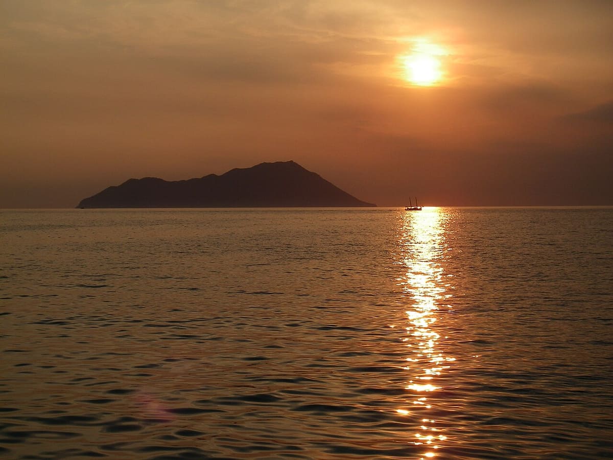
Natura 2000 links protected nature areas in every country of the European Union. Each member country picks its best wildlife areas. It then sends that list to the European Commission, which must agree to it.
Sites in the network are chosen by strict scientific rules. Experts look at real evidence about plants, animals and habitats. A Site of Community Importance protects wild species other than birds, plus special types of habitat.
The island itself is rocky and extremely steep, with low, woody shrubs. It is home to a rare wild goat and the rare Eleonora’s falcon. The Milos viper, a rare kind of snake, also lives there.
The Milos viper is classed as endangered, meaning it faces a high risk of dying out. It is also strictly protected under the Bern Convention. This is a European treaty, or formal agreement, to save wildlife and natural habitats.
- Status: The island is a Site of Community Importance.
- Network: Natura 2000 links nature protection areas across the European Union.
- Goats: The wild goat is endangered, and hunting it is banned in Greece.
- Threats: Mixed breeding with other goats and lack of water put the goats at risk.
- Visits: A visit to the island needs a permit, issued by the Hunting Directorate of the Cyclades.
Together, these rules keep Antimilos quiet and wild. Its goats, falcons, vipers and small Milos wall lizards share the rocky slopes with no human homes. The Milos wall lizard is near threatened, so the island gives it a safe place to live.
How can visitors see Antimilos from Milos and by boat?
Antimilos can be seen clearly from the north-west coast of Milos. A chapel viewpoint with views of the bay of Adamas also faces it. Sea trips from Milos also sail past the island, showing its steep cliffs from the water.
One fine viewpoint is the old chapel of Panagia Tourliani on Milos. The road to Tripiti passes a side road to Klimatovouni on the left. From there, a thin concrete road heads west to the chapel.
The chapel works like a natural balcony, a raised spot with wide views. It looks out over west Milos and the bay of Adamas. Antimilos rises beyond them as a lone shape in the open sea.
The bay of Adamas opens from the north-west and almost splits Milos in two. The mouth of the bay faces the open water in that direction. In spring and summer, the sun sets in the north-west, the same direction as the island.
The north coast gives another view, from Plathiena, a beach on that shore. A kayak route, a paddling trip in small boats, starts on this beach. Paddlers see Antimilos on the horizon, along with Cape Vani, another cape of Milos.
- Chapel view: Panagia Tourliani looks over west Milos, the bay of Adamas and the island.
- Beach view: Plathiena on the north coast shows the island on the horizon.
- Sunset: The sun sets in the north-west during spring and summer.
- Boat ports: Sea trips start at the harbours of Adamas and Pollonia.
- Shape: From the sea, the steep cliffs and rocky slopes stand out clearly.
A Milos private boat tour is one way to see the cliffs of Antimilos from the water. On land, the chapel and the north coast give calm views at sunset. More activities in Milos include walks, beaches and sea trips around Milos.

What do people want to know about Antimilos?
Antimilos raises common questions about its people, goats, volcano and views. The answers below cover who lives there, how far away it sits and how to see it. Each answer keeps to plain facts about this small, wild island.
Does anyone live on Antimilos?
No, nobody lives on the island today, and the census counts zero residents on the small island. It is also called Erimomilos, meaning Desert Milos, and it belongs to the local municipality of Milos. Old walls and arrowheads of obsidian, a natural volcanic glass, point to human settlement in prehistoric times.
Which direction is Antimilos from Milos?
The island lies to the north-west of the main island of Milos. It sits in the Myrtoan Sea, which is the south-western part of the wider Aegean Sea. Its highest point reaches 671 metres above the sea. That tall shape rises clearly on the horizon from the north-west coast of Milos.
What kind of goats live on Antimilos?
The rare wild goat of the island lives on these rocky, steep slopes. In Greek it is called the spotted wild goat, and hunting it is banned in Greece. It is similar to the Cretan kri-kri goat but not the same, and mixed breeding threatens it.
Is the volcano on Antimilos still active?
No, the old crater at the top of the island is inactive, meaning it no longer erupts. The island is a lava dome, a rounded hill of cooled lava, with steep cliffs at its edges. Its rocks are 320,000 years old. In ancient times, the crater served as an open rain tank.
Can visitors see Antimilos on a boat trip?
Yes, the island can be seen from boats sailing through the open sea to the north-west of Milos. Adamas and Pollonia, two harbour towns on Milos, are where sea-trip boats set off. From the deck, the steep cliffs, rocky slopes and low shrubs of the island stand out clearly.
Where is the best viewpoint for Antimilos on Milos?
A strong choice on Milos is the old chapel of Panagia Tourliani, a natural balcony with wide views. From there, the view takes in west Milos, the Adamas bay and the islet far out at sea. The route leaves the road to Tripiti for Klimatovouni, then follows a narrow cement road west.