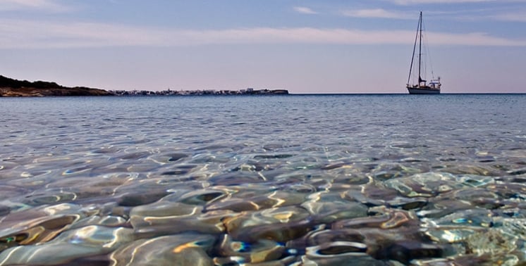
Milos is an ideal destination for your holidays. It has everything. First of all, it has some of the most beautiful beaches in the Aegean, thanks to its volcanic geology. Milos has been known for its mineral wealth since antiquity. This wealth is responsible for the colourful and highly varied landscape along the whole coastline of the island, and also inland.
Besides its beautiful beaches, Milos gives you the opportunity to visit very important archaeological sites, museums and traditional villages. During your stay in Milos you will not miss out on nightlife and culinary delights either, and the local cuisine and local products of the island will complement all of the above.
For your holiday in Milos, you need several days, so that you can see as much as possible and swim at as many beaches as possible. A nice option, which I consider essential on many Greek islands and especially on Milos, is to choose one of the daily mini cruises that tour the island and visit most of the inaccessible beaches that you cannot see otherwise. Spend one day of your holiday in Milos sailing around the island in this way. Happy holidays in beautiful Milos!
Practical travel information about the island of Milos covers more than beaches and ferries. A trip also depends on money, language, clock time, emergency contacts, phone codes and plugs. This page gathers that Milos information in one place, so the basics can be checked at home and the days on the island can then be planned by area.
The first section lists the everyday facts of Greece that apply on Milos: the euro, the Greek language, Eastern European Time, the number 112, the area code and the electric plugs. The second section turns Milos information about the five areas of the island into sample plans for a short stay and for a longer stay.
What practical Milos information do travellers need before the trip?
Milos information for the practical side of a trip starts with the euro, Greek as the main language, Eastern European Time at UTC+02:00, the emergency number 112, the area code 2287 for Milos and Kimolos, and plug types C and F at 230 volts.
Milos is a popular summer destination in Greece, so the currency on the island is the euro. Greece adopted the euro in January 2001, replacing the Greek drachma, and the euro has circulated since 1 January 2002. Greek is the first or only language of a large majority of the native population. English, French and German are the popular foreign languages in Greece, and schools teach them. This is the basic Milos information on language for a trip.
Standard time in Greece is Eastern European Time, which is UTC+02:00. Daylight saving time moves the clock one hour ahead to UTC+03:00 from the last Sunday in March to the last Sunday in October. Milos keeps the same time as the rest of Greece. The key emergency Milos information is 112, the common European number. Every GSM handset can dial it even when locked, and Greece keeps separate short numbers for the police, the coastguard, ambulances and the fire service.
Greek telephone numbers have ten digits, and the first digit shows the type of service. Landline numbers start with 2 and carry an area code. Milos and Kimolos share the area code 2287, a four-digit code followed by a six-digit subscriber number. Mobile numbers start with 6, and short codes start with 1 and have three to five digits, which is the group that holds 112. This Milos information explains how a Milos number is built.
- Plug types: Milos information on sockets is simple, since Greece uses plug types C and F.
- Type C: The Europlug has two round pins and fits all three CEE 7 sockets.
- Type F: The type F plug has two round pins, and its socket has a circular recess with two earthing clips.
- Voltage: The nominal supply is 230 volts for single-phase connections and 400 volts for three-phase connections.
- Frequency: The alternating current supply has a nominal frequency of 50 hertz.
These facts form the practical core of Milos information: the euro, Greek, UTC+02:00, 112, the area code 2287 and plug types C and F. A traveller who checks them before leaving covers money, speech, clocks, safety, calls and charging. The next section turns to the shape of the trip itself and shows how the areas of Milos fill a short or a longer stay.
How does Milos information turn a short or longer stay into a day plan?
Milos information on the island’s layout supports one rule: plan by area. Five areas hold the listed beaches: the bay, north, east, south and west. One area per day fills five days, and a short stay keeps to the bay and the north.
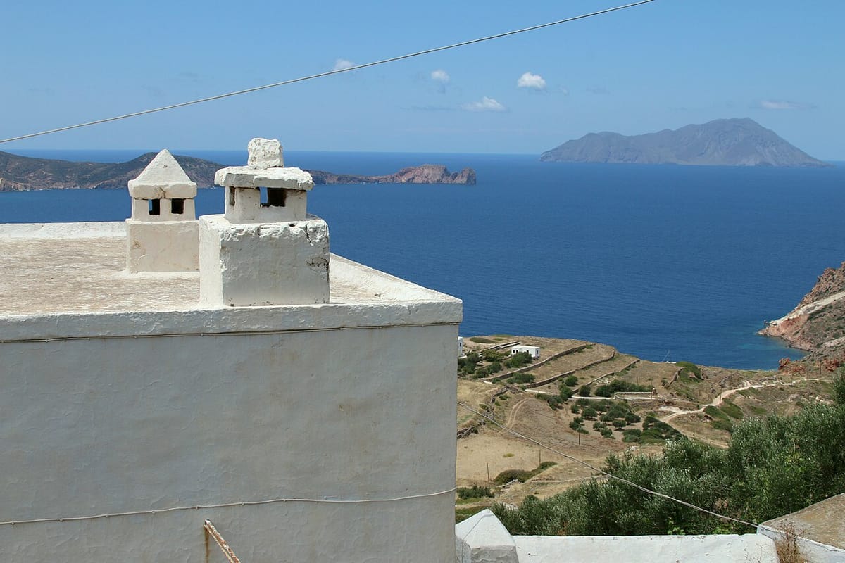
Milos information for a short stay centres on the bay area. The ancient town stood on the slope between Tripiti and Klima, and its theatre was first taken for a Roman work of the 1st century AD before a Hellenistic part from the 3rd century BC was found. The catacombs near Tripiti are a cemetery of the early Christians with 185 metres of corridors, and the public can enter them. Plaka adds its Archaeological Museum and Folklore Museum.
A longer stay adds the north coast. Milos information on this side begins at Phylakopi, a Bronze Age settlement on the north-east coast that was first excavated between 1896 and 1899 under the British School at Athens. Firopotamos and Mandrakia keep syrmata, boat shelters cut into volcanic tuff beside the sea. Pollonia is the second harbour of Milos, and a small boat links it with Kimolos, so the neighbouring island can join this part of the plan.
The longest plan adds the south and the west. Kleftiko lies in the south-west, where white cliffs and islets stand in three joined inlets, and erosion by sea and wind has cut caves into the rock. The rock is tuff made of pumice that formed about 3.1 million years ago. Excursion boats and a footpath lead to Kleftiko, so Milos information on this part of the island covers both sea and walking access.
- Bay area: The gulf holds 25 of the 90 listed beaches, among them Adamas, Klima and Kanava, where hot water flows onto the sand.
- North coast: The north side lists 17 beaches from Plathiena in the west to Pollonia in the east, with Sarakiniko and Papafragkas between them.
- East coast: The east side lists 12 beaches, among them Polychroni, Kastanas and Voudia.
- South coast: The south side lists 21 beaches, among them Agia Kyriaki, Provatas and Kleftiko.
- West coast: The west side lists 15 beaches, from the cape of Psalida in the south to Vani in the north.
The arrival day also belongs in the plan. The harbour town of Adamantas lies in the bay, so a plan that starts with the bay area suits that day. Travellers who still need the crossing or the flight can read how to go to Milos. Milos information on the five areas then fills the remaining days, one area at a time, from the bay out to the west.


What Milos information covers island services for visitors?
Milos information on island services names a health centre, pharmacies in four settlements, a police station, a port authority, a customs office, a post office, four banks and fuel stations. The municipality has its seat in Plaka, and the main port is Adamantas.
Milos has a health centre, and a veterinarian also works on the island. Pharmacies serve four settlements: Adamantas has pharmacies, while Plaka, Triovasalos and Pollonia have one each. Adamantas is the harbour town, Plaka is the chief town on the plateau above the harbour, Triovasalos stands on the same height above Adamantas and Pollonia, also written Apollonia, is the second harbour in the north-east. Practical Milos information therefore places pharmacies at both harbours and on the plateau above Adamantas.
The police station, the port authority, the municipal port fund and the customs office belong to the public services of Milos. The municipality has its seat in Plaka and covers the island together with the islets around it. Plaka, as the municipal seat, also holds one of the pharmacies. A tourist information service assists visitors as well. Adamantas is the main port, and Pollonia is the smaller harbour of the island, used mainly for the link between Milos and Kimolos.
Four banks and a post office handle money and mail on Milos. Fuel stations supply the island with fuel, and the same service group covers the supply of boats, so one group serves vehicles and vessels. Taxi stations stand at Adamantas and Triovasalos. Triovasalos, the village on the height above the harbour, holds both a pharmacy and a taxi station. Each need has its own address on the island: health, police, harbour, money, mail and fuel.
- Health centre: The island has a health centre, and a veterinarian is also available for animals.
- Pharmacies: Adamantas, Plaka, Triovasalos and Pollonia are the four settlements with pharmacies, and Adamantas has more than one.
- Police: The island has its own police station.
- Harbour offices: A port authority, a municipal port fund and a customs office form the harbour services.
- Post and banks: A post office and four banks serve the island and its visitors.
Island services on Milos follow the settlements. Pharmacies stand in Adamantas, Plaka, Triovasalos and Pollonia, taxi stations in Adamantas and Triovasalos, and the municipal seat in Plaka. The map of Milos shows how these four settlements relate to the gulf and to each other. Practical Milos information of this kind lets a visitor link each need to a place and sort errands by settlement.
Which further Milos information do travellers ask for?
Milos information beyond services covers the name of Adamantas, the French graves near the port, the name and the Kastro of Plaka, the volcanoes of the island and the wildlife of the west, with a short answer for each of them in the questions below.
What Milos information explains the name Adamantas?
The harbour town is written both Adamantas and Adamas. Adamas is the older form, and it comes from the Greek word adamas, which means diamond. The town lies on the north-eastern shore of the gulf and is the main port of the island. Milos information about the town starts with these two spellings of one name.
Which Milos information explains the French graves near Adamantas?
An Anglo-French military cemetery from the Crimean War lies near Adamantas. The town served as the base of the French fleet during that war, and the cemetery recalls those years. A warship of the French fleet still calls at the port of Adamantas once a year to pay tribute to the dead buried there.
What Milos information explains the name of Plaka?
The name Plaka comes from the flat ground where houses were built when the Kastro no longer held the population. The official name of the chief town is Milos, which it received in 1912. Plaka grew after the abandonment of Zefyria, also called Chora, so the town is not called Chora. The history of Milos gives the wider story.
Which Milos information covers the Kastro above Plaka?
The Kastro stands on a hill of volcanic origin at the highest point of Plaka. Venetians built it in the 13th century, and its founding is placed after 1204. The castle is a declared ancient monument and once allowed control of ship movements in the gulf. The church of the Dormition of the Theotokos stands at its top.
What Milos information covers the volcanoes of Milos?
Volcanic activity on Milos began two to three million years ago and ended 90,000 years ago. Two extinct volcanoes, Fyriplakas and Trachilas, stand on the island, and no eruption has occurred in historic times. Fumaroles with temperatures up to 100 °C occur at Agia Kyriaki, Paliochori, Pyromenes and Adamantas, and hot springs reach 55 °C.
Which Milos information covers the wildlife of western Milos?
The south-western side of Milos is a habitat of the Mediterranean seal, and the rest of the west is the habitat of the Milos viper and a lizard. Achivadolimni, the largest natural wetland of the Cyclades, is an important station for migratory birds. A rare forest of horizontal-branched cypress trees with centuries-old trees also grows in the west.