The island’s more than 75 beaches and its natural, safe bays are ideal for sailing and for a variety of water activities. Milos offers a variety of activities for all tastes and reveals its grandeur in depth.
When you visit the island, you can admire the amazing depths by diving; explore the sea, the volcanic islands and the traditional villages by canoe-kayak; discover the beaches and the natural beauty of the island on a boat trip; get your adrenaline going with windsurfing and kite-surfing; relax and get to know the marine fauna by angling; and enjoy the crystal-clear sea, the sun and the beautiful bays of the island while sailing.
In addition, the triangle of Milos – Kimolos – Polyaigos is ideal for sailing, diving and fishing. It is a natural water park with countless caves and one of the most important fishing grounds in the Cyclades. (Polyaigos is included in the Natura 2000 programme, as one of the most important habitats in the EU.)
Milos is a volcanic island at the south-western end of the Cyclades, and the activities in Milos reflect that setting: sea trips between bays, walks across volcanic hills, and visits to ancient and mining sites. This page sets out how the island of Milos divides into groups of activities, where each group takes place, and how the season and the wind change a plan.
The island has more than 75 beaches and natural, safe bays, and the water around it suits diving, canoe-kayak, boat trips, windsurfing, kite-surfing, angling and sailing. The nearby islands of Kimolos and Polyaigos extend the sea side of the activities in Milos. On land, the west of the island is the wildest part, while the culture group centres on Plaka, Adamas and the ancient town beside Klima.
What are the main groups of activities in Milos, and where does each take place?
The main groups of activities in Milos are sea, land and culture. Sea activities use the bays, the coast and the waters around Kimolos and Polyaigos. Land activities cover the hills, the volcanic landscape and the wild west. Culture activities centre on Plaka, Adamas, Trypiti and Klima.
Sea activities start from the shoreline. The island has more than 75 beaches and natural, safe bays, and the water activities that use them are diving, canoe-kayak, boat trips, windsurfing, kite-surfing, angling and sailing. The coast falls into five zones: the north coast with 16 beaches, the east with 12, the south with 21, the west with 15 and the gulf shore with 25. Each sea item among the activities in Milos starts from one of these zones.
Beyond the main island, the triangle of Milos, Kimolos and Polyaigos suits sailing, diving and fishing, three of the water activities in Milos. It works as a natural water park with countless caves and ranks among the key fishing grounds of the Cyclades. Kimolos lies north-east of Milos, and Polyaigos lies south-east of Kimolos. Along the south-western side of Milos, the sea is a habitat of the Mediterranean monk seal, and almost all of western Milos belongs to the Natura 2000 network.
Land activities in Milos spread over rugged, hilly ground that rises to Mount Profitis Elias in the west. The western half is the wildest part of the island, with no villages, hardly any settlements and old mines, and it holds over 800 different taxa, 35 of them endemic to Greece. Walking routes start at the Papafragkas caves on the north coast, at the catacombs and in western Milos. The island also holds more than 250 geosites that form 12 geo-routes.
The culture group sits mainly in three places. Plaka holds the Archaeological Museum and the Folklore Museum, while the Mining Museum, the Ecclesiastical Museum and the Maritime Museum stand in the Adamas area. Next to Trypiti lie the catacombs, an early Christian burial site dug into volcanic ground, and the theatre of Roman date above Klima. The sea villages of Klima, Mandrakia and Firopotamos keep sirmata, boat shelters cut into volcanic tuff, and they complete the culture side of the activities in Milos.
- Sea: diving, canoe-kayak, boat trips, windsurfing, kite-surfing, angling and sailing run along five coastal zones.
- Islands: sailing, diving and fishing fill the triangle of Milos, Kimolos and Polyaigos.
- Land: walking and geology routes among the activities in Milos cross the hills, the catacombs area and western Milos.
- Culture: museums in Plaka and Adamas join the ancient theatre above Klima and the catacombs beside Trypiti.
- Villages: the sirmata of Klima, Mandrakia and Firopotamos are boat shelters dug into volcanic tuff.
Together the three groups give the activities in Milos a clear structure: sea and nearby islands, hills and the wild west, and the cultural sites around Plaka, Adamas and Klima. The island measures about 23 km from east to west and 13 km from north to south, so a visit can move between groups from one day to the next. The next section shows how the season and the wind decide which group fits each day.
How do the season and the wind shape planning activities in Milos?
Planning activities in Milos follows the meltemi, the strong north wind of the Aegean. Light northerly winds come in late spring, the meltemi returns at force 6 to 7 on average, and a wavy sea under a clear sky moves the plan between sea, land and culture.
The wind year has three phases. From late spring to early June, light northerly winds called precursors blow for two to three weeks. In June they pause, and only weak northerly winds blow with breaks between them. About a week later the meltemi returns and settles at an average of force 6 to 7 on the Beaufort scale. Planning activities in Milos by season therefore starts with the phase, because the phase sets how calm the sea is on a given day.
A meltemi day brings a clear sky and a wavy sea. The wind interrupts the routes of small craft, above all during the day and in the hours of the highest temperature. For boat trips and other sea activities in Milos, that means a fixed plan needs a spare day or a land alternative. Sailing is the exception: the meltemi gives a steady wind that leisure sailors favour, and windsurfing and kite-surfing sit in the same sea group.
Land and culture plans run on the same days. The north wind arrives as a cool air mass and tempers the summer heat, and the dry air gives a deep blue sky with better visibility. Walking routes and geology routes on the hills gain from these conditions, while the museums, the catacombs and the ancient theatre do not depend on the wind. This split lets one wind forecast sort the activities in Milos into sea days and land days.
Direction matters as much as strength when planning activities in Milos. In the southern Aegean the meltemi blows from the north-west, and Milos lies at the south-western end of the Cyclades, just north of the Sea of Crete. The gulf of Milos opens from the north-west, and its shore is one of five coastal zones. A wind from that direction meets the north, east, south, west and gulf shores at different angles, so the shore chosen for each sea activity is part of the plan.
- Sailing: a steady meltemi is the wind that leisure sailors favour.
- Boat trips: small-craft routes for sea activities in Milos stop on the windiest days, above all at the hottest hours.
- Walks: the cool north wind tempers the summer heat on the hills.
- Geology routes: dry air brings a deep blue sky and better visibility.
- Culture: the museums, the catacombs and the theatre of Roman date do not depend on the wind.
Season and wind thus turn the three groups into a flexible plan. Light winds arrive first, the meltemi follows, and the island offers a sea option, a land option and a culture option for every kind of day. The gulf, the west coast and the nearby islands each meet a north-west wind from a different angle, so a plan that names a backup group for each day keeps the activities in Milos running whatever the wind does.
How do boat trips from Adamantas fit activities in Milos on the west and south coasts?
Activities in Milos from the port of Adamantas include day cruises that pass the Bears cliffs, the old mines at Cape Vani and the west-coast beaches, then call at the Sykia cave and Kleftiko before sailing back to Adamantas at sunset.
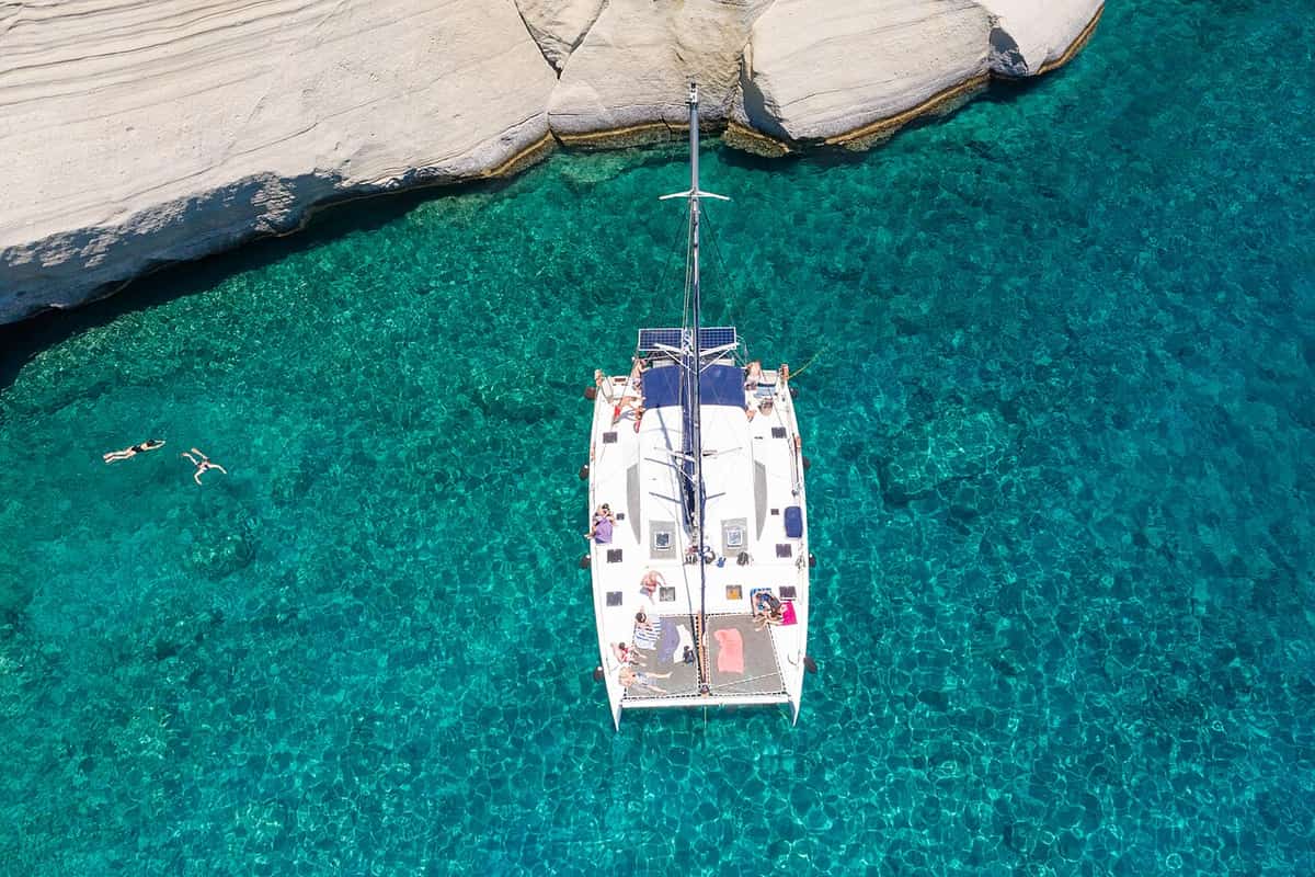
The first leg of these activities in Milos stays inside the bay, which fills the hollow of the main volcanic crater. The water there is between 55 and 130 metres deep, and 25 beaches line the shore. After leaving Adamantas, the boat passes the settlements of Skinopi, Klima, Areti and Fourkouvouni, all on that shore, and then the cliffs known as the Bears. This stretch is a sail along the coast, and passengers watch the shoreline from the deck. The first swim comes later, at the Nuns.
After the bay, the route runs to Cape Vani at the north end of the west coast, the half of the island with no villages. Only a very small number of settlements and old mines stand there. The cruise stops at the old mines, then continues south to the Nuns, the Kalogries shore. This is the first swimming stop for activities in Milos on this route, with emerald water and water games. Kalogries also holds a prehistoric settlement that is known from its graves.
From Kalogries the boat sails past Agkathia, Triades, Ammoudaraki and Agios Ioannis. Together with Kalogries, they make five of the 15 beaches listed along the west coast, between Cape Psalida in the south and Vani in the north. Triades and Agios Ioannis each divide into three separate beaches. Passengers see this shore from the water, and the swimming stops fall between the beaches. Activities in Milos by boat therefore turn a long, empty coast into a sequence of separate places.
Next comes the Sykia cave, where passengers swim inside the cave itself. The route then continues to Kleftiko in the south-west, where activities in Milos by boat change from sailing to snorkelling. Swimmers dive from the boat and from the rocks, and an inflatable boat takes passengers into the caves. In the afternoon a fishermen’s meal is served on the boat or on Thieves’ Beach. The return leg is a sail under open sails, with coffee, toward the sunset and the port.
- Bay leg: The boat passes Skinopi, Klima, Areti, Fourkouvouni and the Bears cliffs.
- Cape Vani: One stop is made at the old mines at the north end of the west coast.
- West beaches: Kalogries, Agkathia, Triades, Ammoudaraki and Agios Ioannis follow in a row.
- Sykia: Passengers swim inside the cave on the west coast.
- Kleftiko: Snorkelling from the boat and rocks goes with a cave tour by inflatable boat.
Visitors who want activities in Milos without a car can book the day cruises from Adamantas along the west coast, which carry the whole sequence in one outing. The route suits swimmers and snorkellers, and the sail back at sunset gives photographers an open view of the coast. The same port also offers night cruises under the stars and multi-day cruises at sea, which extend the activities in Milos beyond one day.


How do trips from Pollonia link activities in Milos with Kimolos and Polyaigos?
Activities in Milos from Pollonia run through a triangle of three volcanic islands: Milos, Kimolos and Polyaigos. Boats and sailing trips leave Pollonia for swim stops, picnics on empty beaches and sunset moorings, and the short distances allow a choice of destinations on the day.
Milos, Kimolos and Polyaigos form a compact triangle, and Pollonia sits at its Milos corner. Kimolos lies half a nautical mile north-east of Milos, the shortest side of the triangle. Polyaigos lies 3.8 nautical miles east of Milos and 1.1 nautical miles south-east of Kimolos. Sifnos lies 8.8 nautical miles north-east of Polyaigos. The first high-temperature geothermal field in Greece was found across these three islands. For activities in Milos by boat, the short sides of the triangle give every departure from Pollonia a choice of destinations.
Polyaigos has no residents, and its name refers to its goats. A lighthouse has stood on the east side since 1898, on Cape Maskoula at a height of 138 metres. Boats that coast the island pass four named beaches: Panagia, upper Mersini, lower Mersini and Ammoura, which is also called the lighthouse beach. The islet of Manolonisi lies off the west side, and the Kalogeroi islets lie off the south side. Each of these is a landmark for activities in Milos that circle the island by boat.
Greece includes Polyaigos in the Natura 2000 programme as an important habitat that human presence does not disturb. The island is also a special protection zone for Eleonora’s falcon, a migratory bird of prey, and the Mediterranean monk seal gives birth there. Passengers on activities in Milos that include Polyaigos therefore see a protected island instead of a developed one. Its landscape consists mainly of volcanic rock, like Kimolos and Milos. Its coast measures 27 kilometres, and boats follow it.
Kimolos completes the triangle for activities in Milos by boat. Its southern shore carries rocky land with a silver colour, which gave the island the medieval name Argentiera. Tuffs cover large areas, and hot springs and a notable geothermal field show the volcanic activity beneath. Tamarisk trees grow across Milos, and a picnic under tamarisks on an empty beach is part of a day on a traditional boat. The Glaronisia islets, which have no residents, are the setting for a sunset stop.
- Pollonia: The smaller harbour of Milos serves mainly the link to Kimolos.
- Monastery: Ruins of a domed basilica founded in 1622 stand in the north-west of Polyaigos.
- Quarries: Two quarries in the same part of the island cut trachyte for millstones.
- Kleftiko: Activities in Milos from Pollonia can also continue to Kleftiko or another destination on request.
- Sunset: The evening stop at Glaronisia comes with ouzo and small plates called mezedes.
The day cruises from Pollonia to Polyaigos and Kimolos turn the triangle into a route of swim stops, picnics and sunset moorings. These activities in Milos suit swimmers and anyone who prefers small groups to crowded beaches. Each island offers a different shore: the protected hills of Polyaigos, the silver rock of Kimolos and the shore of Milos itself. The boat departs from the Milos corner of the triangle, the village of Pollonia.


How do the six numbered kayak routes fit into the activities in Milos?
The activities in Milos include six numbered sea kayak routes along the north, east and south coasts of the island. Route 4 is the shortest at 6.0 km, and routes 5 and 6 are the longest at 8.8 km each.
Route 1 is the north-coast route among the activities in Milos. It covers 6.6 km and starts at Gerania beach, where paddlers keep close to the shore and pass more than 10 caves known for their colours. A merchant ship wreck and a cave appear before the halfway break at Sarakiniko beach. There, anyone who wishes can walk on with the group leader to see the caves and rock formations, or explore the seabed. The return is paddled faster and ends at a snack bar in Mandrakia.
Route 2 starts at Agios Konstantinos beach and covers 6.5 km, a second north-coast outing among the activities in Milos. The paddle passes Alogomantra beach and the village of Agios Konstantinos, then caves and rock formations, the two Pachena beaches, Kapros beach and the Papafragas caves. At the small cave of Papafragas, a tour leader walks anyone who wishes around Filakopi, the Bronze Age settlement on the north-east coast, while others swim to nearby caves. The way back passes the Kanal of Kofto.
Routes 3, 4 and 5 are listed by the beaches they link. Route 3 joins Paliochori and Firlingos over 6.6 km, and route 4 joins Firiplaka, Tsigrado and Gerakas over 6.0 km. All five of these beaches lie on the south coast. Route 5 joins Tria Pigadia and Theiorichia over 8.8 km on the east coast. Routes 3, 4, 5 and 6 include transport, equipment, food and safety, so these routes reach paddlers fully organised, like the other activities in Milos on the water.
Route 6 covers 8.8 km and starts from the small beach of Psathi, paddling along the right-hand side. Two small, unspoilt beaches come first. Then the orange-beige rock gives way to vertical brown-black rock with small dark caves. At Katergo the scenery turns white, with large multicoloured caves, and a break for food and a swim takes place on the beach. The way back passes Psathi, the small Kleftiko and two more caves, ending one of the two longest activities in Milos by kayak.
- Sarakiniko name: Among the activities in Milos, route 1 breaks at a beach named for Saracen pirates, who sheltered in its caves.
- Sarakiniko access: The beach lies about 5 km from Plaka.
- Sarakiniko rock: Sandstone and pumice breccia layers form a band about 50 metres thick.
- Kleftiko name: Its coves served pirates as a base against ships, which gave the area its name.
- Kleftiko rock: The white tuff is pumice breccia formed about 3.1 million years ago.
Choosing among the activities in Milos on the water starts with the coast, because each numbered kayak route belongs to one shore. Routes 1 and 2 run along the north coast, routes 3, 4 and 6 along the south coast, and route 5 along the east coast. Route 4 is the shortest. The page on sea kayaking in Milos sets out the six routes stop by stop.

Which combined kayak, hiking and snorkelling routes are part of the activities in Milos?
The activities in Milos include four combined routes that mix paddling, walking and snorkelling. One pairs kayaking with snorkelling, two pair kayaking with hiking, and one pairs a coastal hike with snorkelling, over distances from 3.3 km to 9.0 km.
The kayak and snorkelling route is the first of the combined activities in Milos. It covers 4.8 km and starts at Plathiena beach, where rare lilies can be seen in a fenced area. Paddlers head out with Antimilos on the horizon and the cape of Vani nearby, passing caves and small islands in clear turquoise water. At one stop the kayaks stay in a cave while the group puts on masks and fins and snorkels a set of three caves.
After the snorkelling stop, the route continues to the shore of Nerodafni, where a long break is set aside for eating or swimming. The paddle back is faster and passes Arkoudes, two huge rocks shaped like bears, before the route closes at Plathiena beach with refreshments at the beach bar. Among the activities in Milos, this route treats the sea caves twice, once by paddling past them and once by snorkelling inside them. Antimilos, on the horizon, is an uninhabited mass of trachyte 21 km north-west of Milos.
The kayak and hiking route covers 8.1 km. Paddlers leave Lagada beach, pass the French monument, Fanari and the settlements of Skinopi and Small Skinopi, and land at Klima beach. A walk leads to the Catacombs, passing Saint Paraskevi’s church, with a tour leader through the tombs and chambers. It goes on to the spot where the statue of Aphrodite of Milos was found, the Baptism place and the Ancient Theatre. A paddle back to Adamas ends one of the activities in Milos that joins sea and history.
The hiking and snorkelling route covers 3.3 km and needs no kayak. It starts in Adamas, and a drive leads to Platorahes in west Milos, an area designated and protected under Natura 2000. The car stays there, and a hike along the natural path leads towards Kleftiko. After a short break, the group explores the surrounding caves by snorkelling, then returns to the shore for food and rest before the trip back. This is the shortest of the combined activities in Milos by distance.
- Fourth route: A fourth kayak and hiking route covers 9.0 km and includes transport, equipment, food and safety.
- Klima site: Among the activities in Milos, the catacombs walk crosses the slope that the ancient town of Milos occupied near Klima.
- Roman theatre: A theatre of Roman date and town wall remains stand there.
- Kleftiko coves: Its white cliffs and islets span three coves.
- Kleftiko access: Excursion boats and a footpath lead to Kleftiko in south-west Milos.
Choosing among the combined activities in Milos comes down to what each route adds to the paddle or the walk: snorkelling in caves from Plathiena, a walk to the catacombs and the theatre from Klima, or a short hike and snorkel at Kleftiko. The page on combined kayak, hiking and snorkelling routes sets out each route in order, with the fourth route listed at 9.0 km.
What are the three hiking routes among the activities in Milos?
The activities in Milos on foot include three numbered hiking routes. Route 1 runs 6.7 km from the Papafragkas caves to Sarakiniko, Route 2 runs 5.9 km from the catacombs to Plaka, and Route 3 runs 2.1 km from a monastery to the Sykia cave.
The three hiking routes cover different ground, and each begins in a different place. Route 1 follows the coast from the Papafragkas caves to the white rock of Sarakiniko. Route 2 links the early Christian catacombs with the settlements above the bay and finishes in Plaka. Route 3 begins with a car transfer from Adamas, crosses the west and ends with a short walk to the biggest cave on Milos. Together the routes show coast, village and wild country among the activities in Milos.
Route 1 covers 6.7 km and is the coast walk among the activities in Milos. It starts at the Papafragkas caves, and Phylakopi, the Bronze Age settlement on the north-east coast, lies on the right. The path passes Kapros beach, the village and the two Pachena beaches, then hexagonal volcanic formations like those of Glaronisia. It continues through Agios Konstantinos, past Alogomantra beach and the small island of Kofto, and follows white rock beside the sea for almost one kilometre.
Route 2 covers 5.9 km and is the village-and-history walk among the activities in Milos. It starts at the catacombs, the large community cemetery of the first Christian years. A tour-led visit shows the chambers and tombs. The path drops past the church of Agia Paraskevi to Klima, climbs to the ancient theatre, the baptism place and the church of Prophet Elias, and descends to Tramithia and the church of Saint Nicholas. It rises through Areti to Plaka and ends behind the town.
Route 3 is the shortest of the activities in Milos on foot at 2.1 km. It starts from Adamas by car and crosses west Milos, an area protected under Natura 2000, to the Siderianos monastery of Saint John. A natural path leads on foot to Sykia, the biggest cave on the island. The path is easy except for the last 200 metres, where steep ground makes the going slightly difficult. The cave allows time to explore, eat and swim, and the return follows a different path.
- Route 1: The 6.7 km route passes a merchant-ship wreck near its end and finishes at Sarakiniko beach.
- Route 2: The 5.9 km route ends at the spot in Plaka where the Aphrodite of Milos was found.
- Route 3: The 2.1 km hike, one of the activities in Milos that starts with a drive, includes transport, equipment, food and safety.
- Breaks: Route 1 includes stops for photos, rest, lunch and a beach bar in Mitakas.
- Season: Milos has mild, rainy winters and warm to hot dry summers.
A walker choosing among the activities in Milos on foot starts with the route that matches the interest. Route 1 suits walkers who prefer a coast, Route 2 walkers who prefer villages, churches and ancient remains, and Route 3 walkers who want a short hike to a cave. The page on hiking routes in Milos sets out each route in order, and the geology walks described next add a second way to read the same land.
Where do geology walks cross volcanic and mining ground among the activities in Milos?
Geology walks are among the activities in Milos that follow mapped routes across volcanic rock and former mining ground on Milos and Kimolos. Each route has a detailed map and a short text covering the geology, the mining history and the natural environment.
The geology walks follow routes set out on detailed maps, and each map comes with a short text. The routes cover Milos and its neighbour Kimolos. They explain the volcanic origin of the landscape, the history of mining and the mining that continues today. Geologists, mining engineers, foresters, cartographers and historians prepared the material. The walks suit curious visitors who want to read the ground beneath the beaches and hills, and they sit beside the other activities in Milos as a map-led option.
Volcanic rock covers the larger part of Milos. The volcanic activity began 2 to 3 million years ago and stopped 90,000 years ago. Two extinct volcanoes remain, Fyriplaka and Trachilas, and Trachilas lies in the north-north-west. Volcanic domes of lava that hardened before flowing rise from the land. The castle rock above Plaka is one of them, and Profitis Elias, the highest peak, is another. Among the activities in Milos, geology walks link each of these shapes to the story of how the island formed.
The ground of Milos is still warm in places. Active solfataras and fumaroles, with temperatures up to 100 degrees Celsius, release gases at Agia Kyriaki, Paleochori, Pyromenes and Adamas, and sulfur is strongly present in these areas. Vents under the sea send gas to the surface as bubbles. These places show that heat and gas still rise from the volcanic system. Geology walks, among the activities in Milos, explain why one stretch of coast is white layered rock and another is warm ground with sulfur.
Mining marks the volcanic ground in a second way. Bentonite, perlite and pozzolana are still extracted by strip and open-pit mining, together with small quantities of kaolin, and the minerals are sold all over the world. Barite was mined until 2000 and sulfur until the middle of the 20th century. Manganese and gypsum were mined in the past as well. Geology walks treat the cuts and workings in the hills as chapters of one mining story, which ties the activities in Milos to the working life of the island.
- Andesite: The volcanic domes are formed mainly of andesite.
- Fossils: Fossils have been found inside the layered white rock of Sarakiniko.
- Hot springs: Hot springs on the island reach 55 degrees Celsius.
- Millstones: Millstones were quarried until the early 20th century.
- Other rock: Besides volcanic material, the island holds sedimentary and metamorphic rocks.
Geology walks turn the volcanic and mining past of Milos into a route on a map. Together with the hiking routes, they form the land side of the island and give the background for each coast and hill met on the way. The page on geology walks across Milos and Kimolos introduces the maps and the team behind these activities in Milos, and it suits anyone who wants to understand a landscape.
What does diving add to the activities in Milos?
Activities in Milos below the surface centre on diving among underwater caves, shipwrecks from the Second World War and earlier, and hot springs that create small communities of their own. Diving schools on the island hold modern equipment and run courses in scuba diving, free diving and rescue.
Milos is a volcanic island, and its volcano shaped the sea floor as well as the land. Tuff, trachyte and obsidian are among its ordinary rocks, and volcanic activity began two to three million years ago. The island has underwater caves, shipwrecks from the Second World War and from earlier periods, and hot springs on the seabed. Among the activities in Milos, diving is the one that reaches all three at close range, because a diver moves through the water where a swimmer only looks down from the surface.
The volcano is still warm. Gas vents on land reach 100 degrees Celsius at Agia Kyriaki, Paleochori, Pyromenes and Adamas, and the hot springs of the island reach 55 degrees. Vents under the sea send their gas to the surface as bubbles. One cave on the south coast still holds great heat from the volcano. Among the underwater activities in Milos, the hot springs on the seabed create separate micro-communities, so each spring supports a small community of sea life that differs from the plain rock around it.
Depth sets the level of the dive. The natural harbour of Milos is the hollow of the main crater, and its depth diminishes from 130 metres to 55 metres. Entry-level divers keep to about 18 to 20 metres. The main certification agencies treat 40 metres as the limit for recreational diving, so even the shallower part of the crater lies beyond it. A dive plan for activities in Milos therefore starts with the certificate that the diver holds and with the depth that the certificate allows.
Scuba training comes from a qualified instructor who belongs to a certification agency. Basic training covers the use of equipment, safety, emergency self-help and rescue, and dive planning. A diving school on Milos is recognised by the Greek authorities and teaches free diving, scuba diving, and lifesaving and rescue. Dive operators can refuse an uncertified person a dive, which is why activities in Milos built on diving begin with proof of training for qualified divers and with a course for beginners.
- Shipwrecks: Wrecks from the Second World War and from earlier periods lie on the seabed.
- Hot springs: Warm springs on the seabed support separate small communities.
- Vents: Gas from vents under the sea reaches the surface as bubbles.
- Entry level: Beginners keep to about 18 to 20 metres.
- Limit: The main agencies set 40 metres as the recreational limit.
Diving fits the activities in Milos for visitors who want the volcano seen from below. A certified diver follows the depth plan above, and a beginner starts with a course and shallow water. A swimmer who prefers the surface moves on to snorkelling, the next of the activities in Milos. The school, its courses and its equipment are described on the page about diving trips in Milos.
Where do snorkellers meet sea life among the activities in Milos?
Activities in Milos for snorkellers centre on clear bays and on the sea caves around Polyaigos, a protected island where Mediterranean monk seals find refuge. Snorkelling needs none of the complicated equipment and training of scuba diving, and watching sea life from a distance keeps it undisturbed.
Snorkelling lets a swimmer watch underwater life in a natural setting without the complicated equipment and training that scuba diving needs. That suits the water around Milos, which counts more than 75 beaches and natural, safe bays with crystal-clear sea. The triangle formed by Milos, Kimolos and Polyaigos adds countless caves and works as a natural water park. Snorkelling is therefore the simplest of the activities in Milos for visitors who want to see sea life but hold no diving certificate.
Polyaigos shows what lives in the water at the edge of the island group. The island has beaches on its southern side and caves at the water surface, and these caves serve as a refuge for a dwindling population of Mediterranean monk seals. The seals also give birth to their young on the island. Its coast measures 22 to 27 kilometres, a long stretch of shore that stays undisturbed by human presence. Snorkellers who add Polyaigos to their activities in Milos swim in a protected habitat.
Protection follows the sea as well as the land. Natura 2000 is an EU network of nature protection areas that includes marine protected areas, and Greece has placed Polyaigos in it as an important habitat. Almost all of the uninhabited west of Milos belongs to the same network. The south-west side of Milos is a habitat of the monk seal, and Polyaigos is a Special Protection Area for Eleonora’s falcon. Snorkelling among the activities in Milos along these coasts therefore means visiting protected habitats.
Meeting a seal calls for distance. A seal can seem harmless and docile, but it can become alarmed if approached or if it feels threatened. The population is dwindling, so each animal counts. The rule for marine life is to observe and not to touch. A snorkeller who meets a seal stops, watches from a distance and lets the animal choose where to go, which keeps the activities in Milos on the water safe for people and animals alike.
- Sea caves: Polyaigos has caves at the water surface where monk seals take refuge.
- South-west coast: This side of Milos is a habitat of the Mediterranean monk seal.
- Marine areas: The Natura 2000 network covers marine as well as land areas.
- Birds: Polyaigos is a Special Protection Area for Eleonora’s falcon.
- Etiquette: The rule for marine life is to observe and not to touch.
A snorkelling day among the activities in Milos follows the sea first. Clear bays suit a short swim with a mask, while the caves and coasts of the protected areas call for distance from wildlife. A visitor who wants more depth than the surface offers moves on to the diving in the section above, where training and certificates set the limits. Both of these activities in Milos depend on respect for the animals that live in the water.
What do sailing and yacht day trips add to the activities in Milos?
The activities in Milos include day trips under sail. A sailing yacht leaves from Adamas or Pollonia and follows the coast of Milos, Polyaigos and Kimolos, with snorkelling, cave visits, scuba diving and evening sails added to the day on the water.
Sailing is the slow, wind-powered way to see the shore, and among the activities in Milos it fills a whole day on the water. The sailing yacht leaves from Adamas or Pollonia and follows the coastline of Milos, Polyaigos and Kimolos. The day is built around stops. A snorkelling safari is on the programme, and a trip by RIB takes the group into the caves of Kleftiko. Scuba diving is on offer as well, so one outing joins sailing, swimming and caves.
The coast of the island suits sailing. Milos has more than 75 beaches and natural, safe bays that are ideal for sailing and for a variety of other water activities. Its horseshoe shape forms a large gulf, and Milos counts as one of the largest natural harbours in Greece. Adamas is the main port of the island, and the smaller port of Pollonia serves mainly the link between Milos and Kimolos. Sailing from either port is one of the activities in Milos that start from the sea.
The wind is the engine of a sailing day. The meltemi, the strong, dry north wind of the Aegean, blows in summer, and it is a good, steady sailing wind favoured by leisure sailors. It also has a hard side. The wind comes up in clear weather without warning and can blow at force 7 to 8 on the Beaufort scale. A share of the yachts and the inter-island ferries cannot sail at that strength, so the wind sets the plan for every sailing day among the activities in Milos.
The wind also follows a daily rhythm. The meltemi is at its strongest in the afternoon and can die down at night, although a spell sometimes lasts for days without a break. The programme of the sailing yacht includes a night sail and, for full moons, a full-moon sail under the stars. These evening outings suit visitors and their loved ones who want another side of the activities in Milos, away from the beach days. The same programme offers a daily cruise and longer stays at sea.
- Departure: The day trips sail from Adamas or Pollonia.
- Snorkelling: A snorkelling safari is part of the sailing programme.
- Caves: A trip by RIB enters the caves of Kleftiko.
- Diving: Scuba diving shows the colourful underwater world of Milos.
- Evening: Among the activities in Milos, a night sail or a full-moon sail goes out under the stars.
Sailing day trips bring sailing, snorkelling and caves together in one of the water activities in Milos. The page about sailing day trips lists the departure ports, the sailing area, the snorkelling safari, the cave visit by RIB and the evening sails. Wind strength sets the limit of every plan, because the meltemi that fills the sails can also stop a yacht from sailing at all.


Where and in which winds do windsurfing and kitesurfing fit into the activities in Milos?
The activities in Milos include windsurfing and kitesurfing in the island’s natural bays, powered by the summer meltemi from the north or north-west. Recreational windsurfers plane best in 15 to 25 knots, and kitesurfers choose the kite size by wind strength.
The shape of the island sets the scene. A large gulf enters Milos from the north-west and splits the island into two fairly equal parts, and the isthmus that remains is not more than 2.2 km broad. Inside the gulf lie 25 beaches, among them Achivadolimni and Papikinou. The natural, safe bays of the island are the setting for water activities, and windsurfing and kite-surfing are on that list for visitors who want adrenaline. Among the activities in Milos, these two sports belong to the bays.
The wind that drives both sports is the meltemi. It blows from a direction anywhere between north-east and north-west, depending on the local land. In the central Aegean it is a northerly, and in the southern Aegean and the Sea of Crete it is a north-westerly. Milos lies just north of the Sea of Crete, and the gulf enters the island from the north-west. For a rider choosing a bay among the activities in Milos, the direction of the wind matters as much as its strength.
Among the activities in Milos, windsurfing is a matter of reading the wind speed. Recreational riders find the best conditions for planing in 15 to 25 knots, and experts windsurf in much stronger winds. A harness is worn in planing conditions, since it lets the weight of the rider counter the pull of the sail. In strong wind the sail is hard to haul out of the water, so riders use a waterstart. Windsurfing suits children as young as 5, and kids’ rigs are made for them.
Among the activities in Milos, kitesurfing is flown on lines of about 20 m, and the wind strength decides the kite. Stronger winds call for a smaller kite, and a depower option reduces the pull. Warm air matters too. Between 10 and 40 degrees Celsius a kite loses about 0.4% of its lift for each degree, and Milos has warm to hot dry summers. A kitesurfer who travels from the Baltic to the Mediterranean can feel 10% less pull from the same kite at the same wind speed.
- Boards: A kitesurfer rides a twin-tip, a directional surfboard or a foil board.
- Wind window: The kite flies in a 180 degree arc of sky downwind of the rider.
- Lessons: Kitesurfing schools teach line handling, the water start, relaunch and self-rescue.
- Windsurfing kit: A harness, a wet suit, footwear, a helmet and a personal flotation device belong to the equipment.
- Safety gear: A line, a distress strobe light, a whistle and a marine VHF radio are the safety items for windsurfing.
Windsurfing and kitesurfing depend on one signal, the meltemi, and the bays of the gulf are where the activities in Milos meet it. The direction of the wind, its speed and the right equipment together decide whether a day on the water works. Riders who learn the basics in a lesson and carry the proper gear can add these two sports to the other activities in Milos, such as sailing, kayaking and diving.
What do angling trips involve among the activities in Milos?
The activities in Milos include angling in the waters between Milos, Kimolos and Polyaigos, which rank among the major fishing grounds of the Cyclades. Fishing from a boat, from the shore or underwater suits the reefs, caves and rocky coasts of the volcanic seabed.
Angling is the activity on the island that brings a visitor closest to the marine fauna. Milos owes its fishing to its volcanic geology, because the reefs, caves and rocky shores form natural habitats for a wide variety of fish. The wider triangle of Milos, Kimolos and Polyaigos adds to this. It is a natural water park with countless caves, and the fishing there carries weight across the Cyclades. For that reason, angling holds a firm place among the activities in Milos.
Fishing here can be done from a boat, from land or underwater. The methods in use are spearfishing, nets, longlines, trolling, vertical fishing and rods. The catch changes with the season and with the part of the coast. Red mullet, red snapper and sea bream are among the fish of the island, and the marine fauna also includes octopuses, squid, cuttlefish and lobster. Angling among the activities in Milos therefore starts with a choice of method and then a choice of coast.
The triangle is compact. Polyaigos lies 1.1 nautical miles south-east of Kimolos and 3.8 nautical miles east of Milos. It is uninhabited, covers about 18 square kilometres and has a coastline of 27 km. Like its neighbours, it consists mainly of volcanic rock, with hills of 320 to 350 metres. The islet of Manolonisi lies off its west side and the Kalogeroi islets off the south. A boat working the coast of Polyaigos for the activities in Milos meets a long shoreline with no village on it.
Protection shapes this part of the sea. Greece placed Polyaigos in the Natura 2000 network as an important habitat free from human pressure, and the island is a Special Protection Area for Eleonora’s falcon. The Mediterranean monk seal gives birth there, and the sea-surface caves of the island shelter the seals. The south-west side of Milos is also a habitat of the seal. Angling in this part of the activities in Milos is therefore done in a protected setting, close to caves that seals use.
- Reefs: Volcanic reefs hold a wide variety of fish.
- Caves: Countless caves in the triangle shelter marine life and monk seals.
- Shores: Among the activities in Milos, fishing from rocky shores needs no boat.
- Catch: Red mullet, red snapper and sea bream are among the fish of these waters.
- Wind: The meltemi comes up without warning and can blow at force 7 to 8.
Angling therefore combines a protected sea, a long volcanic coast and a fishing history that reaches back to the Bronze Age, when the first settlers of Phylakopi, on the north-east coast, were tuna fishermen. The wind sets the day. The meltemi is at its strongest in the afternoon and at night it can die down, yet it sometimes lasts for days without a break. A fishing trip among the activities in Milos takes the forecast into account first.
How is a beach-hopping day among the activities in Milos planned by coast and wind?
The activities in Milos include a beach-hopping day by car or scooter, planned one coast at a time. The island has beaches on five coasts, and the wind of the day decides which coast comes first and which one is kept for later.
A beach-hopping day starts with the shape of the island. Milos is horseshoe-shaped around a large gulf and measures 23 km from north-east to south-west and 13 km from north to south. The gulf cuts in from the north-west, and an isthmus no more than 2.2 km broad joins the two halves. More than 75 beaches of Milos sit on this outline, so among the activities in Milos, a day by car or scooter is easier to plan by coast than by beach name.
The north coast holds 17 beaches, listed from Plathiena in the west to Pollonia in the east. Between them lie Trachilas, Fyropotamos, Mandrakia, Sarakiniko, Mytakas, Alogomandra, Agios Konstantinos, Pachaina, Kapros and Papafragas. This coast faces the north wind, which blows from between north-east and north-west, and at Sarakiniko the waves driven by north winds carve the greyish-white volcanic rock. A north-coast day among the activities in Milos suits calm weather and the hours before the afternoon peak of the meltemi.
The south coast holds 21 beaches, listed from Psarovolada in the east to Kleftiko in the west. The route follows the coast in one direction and passes Agia Kyriaki, Spathi, Paliochori, Tourlos, Gerakas, Kalamos, Tsigrado, Firiplaka, Provatas, Agios Sostis and Kipos. When the meltemi blows, this is the coast that the activities in Milos on land turn to, since the wind arrives from the north. A south-coast day is a single line of stops from one end to the other.
Wind sets the order of the stops. The meltemi is at its strongest in the afternoon, and at night it can die down. It also comes up in clear weather without warning and sometimes lasts for days without a break. A plan for the activities in Milos therefore keeps a second coast in reserve, and the gulf, the east coast and the west coast give three more choices. Almost all of west Milos belongs to the Natura 2000 network, which makes it a day of its own.
- Gulf: For activities in Milos near Adamas, the gulf holds 25 beaches, among them Rivari, Patrikia and Kanava.
- East: The east coast holds 12 beaches, among them Polychroni, Voudia, Agkali and Kampanes.
- West: The west coast holds 15 beaches, from Akrotiri Psalida in the south to Vani in the north.
- Seals: The south-west side of Milos is a habitat of the Mediterranean monk seal.
- Fumaroles: Fumaroles at Agia Kyriaki and Paliochori reach up to 100 degrees Celsius.
A beach-hopping day among the activities in Milos therefore rests on three choices: one coast, one direction of travel and a reserve coast for the wind. The north coast reads from west to east, the south coast from east to west, and the gulf, the east coast and the west coast fill the other days. The wind of the day settles the first stop, and the afternoon settles the last stop of the day.
What do off-road and jeep trips involve among the activities in Milos?
Activities in Milos on dirt tracks, from off-road rides to jeep trips, cross the wild western half of the island, which has no villages, only small settlements and old mines, and lies almost entirely inside the Natura 2000 network.
Off-roading means driving or riding on unpaved ground such as dirt, gravel and rocks, and it ranges from casual drives in regular vehicles to events with customised ones. A jeep trip uses a four-wheel-drive vehicle, which sends power to all of its wheels at once. Activities in Milos of this type are slow by nature, because the surface of the track sets the pace of the day, and the western half of the island has no village where a stop for supplies can be made.
Directions in the west run by landmarks, not by road names. The track to Agkathia passes the monastery of Agia Marina and turns right at the second crossroads. The track to Ammoudaraki passes Agia Marina and then the monastery of Agios Ioannis Siderianos, turns right and follows a dirt road. Each crossroads needs a decision, so the route is read first. Triades, three sandy beaches set one after the other, lie at the end of a tedious journey, so activities in Milos in the west reward patience.
The monastery of Agios Ioannis Siderianos stands on the south-west side of the island, at Halakas. Documents mention it from 1582. The church has a dome, is spacious and very well preserved, and is surrounded by cells of different sizes. During the Second World War a shell from a British warship hit a German fort nearby and lodged in the church wall without exploding, and it can still be seen inside. The monastery is a natural stop for activities in Milos on west-coast tracks.
Vehicle noise can change the behaviour of wildlife, and the west holds protected animals. The south-west coast is a habitat of the Mediterranean monk seal, and the rest of the west shelters the Milos viper, a venomous snake found only in the Cyclades, and the Milos wall lizard. A forest of horizontal-branched cypresses, a rare habitat of centuries-old trees, also grows there. Road-killing is one of the recorded threats to the viper, so slow driving is part of activities in Milos on dirt roads.
- Agkathia: a sheltered bay with a long sandy beach, reached past the monastery of Agia Marina.
- Ammoudaraki: a beach of rich blonde sand beside Triades, at the end of a dirt road.
- Chondro Vouno: the second highest mountain of Milos rises to 636 metres in the west.
- Profitis Ilias: the highest summit is a volcanic dome of mainly andesite.
- Achivadolimni: the largest natural wetland of the Cyclades, a stop for migrating birds.
A map of Milos places the monastery, the sandy beaches and the western summits in relation to the plateau villages, which helps to plan a route for activities in Milos before the tracks begin. Off-road rides and jeep trips are the activities in Milos that reach these places by land, and the protected habitat decides how they are done: at low speed, on existing tracks, with respect for the animals that live beside them.


How do cycling and e-bike rides fit among the activities in Milos?
Activities in Milos on two wheels, from plain cycling to e-bike rides, suit short hops between neighbouring places on a rugged, hilly island, where an electric motor takes the strain out of the climbs for weaker or less experienced riders.
The greater part of Milos is rugged and hilly, and volcanic rock covers the larger part of the island, so slopes shape every ride. The island measures 23 kilometres from east to west and 13 kilometres from north to south, so a ride is built from short legs between neighbouring places rather than one long circuit. Activities in Milos on two wheels therefore depend on how steep each leg is more than on how far it runs, and the listed distances show the scale.
An e-bike is a bicycle with an electric motor that assists the rider. The common type, called a pedelec, gives assistance only while the rider pedals, and the motor cuts out once the bike reaches 25 kilometres per hour. Its continuous rated power is limited to 250 watts, although the motor can give more for short periods, such as when climbing a steep hill. Pedalling stays part of the ride. On an island of slopes, that help defines the e-bike side of activities in Milos.
E-bikes help riders cover greater distances and steeper hills without high physical effort, and they work as adaptive technology for weaker, older, disabled or inexperienced riders. They are built in a large number of forms for different uses and sporting purposes, so each rider can choose the level of help. For travellers in a mixed group, an e-bike keeps activities in Milos by bicycle open to everyone, since the motor evens out differences in fitness without removing the pedalling that makes the ride a physical activity.
Milos has a Mediterranean climate with mild, rainy winters and warm to hot, dry summers. In the south Aegean the summer meltemi blows from the north-west, with an average force of 6 to 7 on the Beaufort scale until early October, and the same wind cools the hot season. Riders plan their legs with the wind in mind, because a headwind on a climb costs more effort than the distance suggests, and that planning belongs to every one of the activities in Milos on two wheels.
- Adamas to Zefyria: the village in east Milos lies 5.5 kilometres from the harbour town.
- Adamas to Pollonia: the second port of Milos lies almost 10 kilometres away.
- Zefyria to Plaka: the chief town lies 9 kilometres from the village.
- Pollonia to Plaka: the chief town lies 14 kilometres from the port.
- Battery: range falls with hills, speed and the weight of bike and rider.
Cycling and e-bike rides are activities in Milos for travellers who choose short legs, read the wind and match the motor to the slope. A plain bicycle suits the shorter legs, an e-bike suits the ascent from the harbour to the plateau and the longer rides to Pollonia, and either one reaches places that a bus timetable does not. Planning the legs in advance keeps these activities in Milos within the energy of the rider and the battery.


How does a mining heritage visit work among activities in Milos?
Activities in Milos that follow the mining past start at the mining museum in Adamas, continue to the abandoned sulphur works on the east coast, and reach the old workings of the wild west half, where one pozzolana mine still operates.
The mining museum in Adamas is the first stop of this visit, because it sets out the mineral history of the island before any site is reached. The museum organises geological walks and holds educational programmes on its premises. It also arranges teaching and recreational activities together with skilled educational bodies and museum educators. Adamas is the harbour town of Milos, so the museum sits at the natural start of the route. Among activities in Milos, it is the stop that explains the sites visited afterwards.
A mining tour is a form of alternative or complementary sustainable tourism. It encourages the protection of nature and tradition, has a small effect on the environment, and involves local people and the mining history of the place. Milos is named among the Greek areas able to host such tours, thanks to its mines of industrial minerals and its sulphur mines. In the list of activities in Milos, the mining visit sits beside hiking and geology walks as a way to understand the landscape.
The western half of Milos is the wildest part of the island. It has no villages, only a handful of settlements and old mines, and the pozzolana mine at Xylokeratia is the only one still working there. Almost the whole west belongs to the Natura 2000 network and is a habitat of the Milos viper and of the lizard Podacris milensis. A visit to the old workings of the west is therefore also a nature visit within the activities in Milos.
Mining on Milos has two layers, and a visit separates them. The first layer is closed. Millstone work ended early in the twentieth century, and sulphur work ended in its middle, leaving old workings and ruins. The second layer is active. Bentonite, perlite, pozzolana and small quantities of kaolin come from open pits and strip mines, and they are sold all over the world. Among mining activities in Milos, the ruins show the past, and the pits show how the island earns income from its rock.
- Museum area: The mining museum stands in the Adamas area, beside the ecclesiastical and naval museums.
- Sulphur works: The old sulphur works lie on the east side of the island, under the name Thiorichia.
- West workings: The old mines of the west lie inside the Natura 2000 area, away from the villages.
- Other minerals: Manganese and gypsum were also mined on Milos in the past.
- Educational tourism: The museum is a favourite destination for educational tourism among activities in Milos.
A mining heritage visit adds the working past to activities in Milos that otherwise centre on the sea. The museum gives the background, the sulphur works on the east coast show a closed industrial site, and the west shows old workings inside a protected landscape. The open pits show that mining still shapes the island. Visitors who like history or geology are well served by this part of the activities in Milos.

What are the main photography and sunset viewpoints among activities in Milos?
Activities in Milos for photography and sunsets centre on four places: the Venetian castle hill above Plaka for sunsets and bay views, the white volcanic rock of Sarakiniko, the boat houses of Firopotamos on the north tip, and the coloured doors of Klima.
Plaka is the capital of Milos, built on a hill at a height of 220 metres, and it is the first stop for sunset activities in Milos. The Venetian castle of the 13th century stands at the top of the hill, on a rocky rise that once allowed control of ship traffic in the gulf of Adamas. From there, sunsets and panoramic views of the bay and of the neighbouring Cycladic islands are on show. The church of Panagia Korfiatissa adds a second sunset point among the activities in Milos.
Sarakiniko is the best-known stop for photographers among the activities in Milos. It lies on the north shore, about 5 km from Plaka, and the area is among the best-photographed landscapes in the Aegean. The west side shows the lunar rock, while the east side is a desert of dry plants and rocky ground. Waves have cut caves along the coast. The small sandy beach sits niched between the white formations, so the rock, not the sand, is the subject.
Firopotamos is a fishing village at the northern tip of Milos, 3 km north of Plaka, set in a small bay. Its small harbour is built around a natural cove. Beside the water stand the syrmata, small colourful houses dug into the volcanic tuff, where boats are kept in winter and owners stay in summer. The name recalls the fishermen who dragged the boats out of these rooms and back into the sea. Among activities in Milos, the bay is a compact scene of harbour, boat houses and water.
Klima is a seaside village at the entrance of the bay of Milos, 6 km from Adamas, below the village of Trypiti. Its syrmata are two-storey houses cut into natural hollows of the rock. The upper floor housed the fishing family, the ground floor held the boat, and the doors and windows carry bright colours. A number of them now serve as tourist lodgings. The cave church of Agia Paraskevi also stands in the village, which makes a photo stop among activities in Milos.
- Plaka access: Cars cannot enter Plaka, and only motorbikes and mopeds use its narrow spaces.
- Sarakiniko access: The site is easy to reach by car and by bus.
- Sarakiniko rule: The municipality set a fine for polluting the site after visitors carved their names into the rock.
- Firopotamos beach: The village has one of the best beaches of the island beside its boat houses.
- Klima swimming: The village beach and the nearby beach of Schinopi suit swimming.
Photography and sunsets add a visual layer to the activities in Milos. Plaka offers the sunset and the panorama of the bay, Sarakiniko offers the white rock, and Firopotamos and Klima offer the boat houses and the colours of the shore. The old city of Milos, with its theatre, lies close to Klima and adds history to the same stop on a route of activities in Milos.
Which activities in Milos suit families with children?
Activities in Milos for families with children cluster around Adamantas and the villages above it: short walks, boathouses by the sea, birdwatching at a wetland, volcano stories and beach time. The island measures about 23 by 13 kilometres, so the distances between stops stay short.
Families planning activities in Milos can use Adamantas as the base. The harbour town is the cultural and commercial centre of the island, and a short ascent leads from it to the plateau where Plaka, the chief town, stands with Kastro rising on a hill above it. Triovasalos and Trypiti sit on the same rise. From east to west the island runs about 23 kilometres, and from north to south about 13, so a day plan for activities in Milos rarely needs a long transfer.
Beach time anchors family activities in Milos. The island has a list of 90 beaches: 17 on the north coast, 12 on the east, 21 on the south, 15 on the west and 25 inside the gulf. Part of them can be reached by land and part only by sea, so families with small children pick those with road access. Klima, Mandrakia and Firopotamos add a walk with a purpose, since boathouses dug into volcanic rock stand right at the water’s edge in bright colours.
Geology gives family activities in Milos a story that ties the stops together. Volcanic activity began two to three million years ago and stopped about 90,000 years ago, and the island counts as a dormant volcano. Steam vents at Agia Kyriaki, Paliochori, Pyromenes and Adamantas reach 100 degrees Celsius, so children watch them from a distance. Hot springs on the island reach 55 degrees Celsius. Fossils have been found inside the white rock at Sarakiniko, a shore built from repeated layers of ancient volcanic material.
Quieter activities in Milos for children lie in the west. Almost all of the uninhabited west belongs to the Natura 2000 network. Achivadolimni, the largest natural wetland of the Cyclades, is a stop for migratory birds, and a forest of cypresses with horizontal branches and centuries-old trees is a rare habitat there. The west is also the habitat of the Milos viper, so children stay on the tracks. Its beaches are remote, and the way to them is long, so the west suits a planned outing.
- Crater bay: The gulf of Milos is the hollow of the main crater, which divides the island in two.
- Obsidian: This glass-like volcanic rock from Milos was already traded about 15,000 years ago.
- Apple coins: Ancient Milos struck coins with an apple, which sounded like the island’s name in Greek.
- Seals: The south-west coast is a habitat of the Mediterranean monk seal.
- Wetland name: Achivadolimni is named after the clams that once filled it.
A family day with activities in Milos works best with one main stop and one short walk. Adamantas and Plaka cover the town side, the boathouse villages cover the coast, and the west covers nature, so every day has a different centre. Hot ground, steep rock and the viper are the points where adults stay close to the children. Sea trips and kayak routes have their own entries, and the museums of Adamantas wait for the windy days.
Which activities in Milos work on windy or cooler days?
Activities in Milos on windy or cooler days move indoors and underground: the museums of Adamantas and Plaka, the catacombs near Trypiti and walks between the villages above the port. The meltemi brings clear skies and a rough sea, so a land plan fills the day.
Planning activities in Milos around the wind starts with the meltemi, a strong, dry north wind of the Aegean. It blows from late spring into early autumn, peaks in the afternoon and eases at night, although a spell can last for days without a break. Force 7 to 8 on the Beaufort scale is possible, and the average is 6 to 7. The sky stays clear and the sea turns rough, which interrupts small-boat routes, mainly by day. The English name, etesian, comes from the Greek word for year.
The museums of Milos give a windy day a roof. Adamantas has the Mining Museum, the Maritime Museum and the Ecclesiastical Museum, all within the harbour town, and Plaka has the Archaeological Museum. When boats stay in port, the Maritime Museum keeps the sea in the plan with rare maps and the wooden boat Irini. Among indoor activities in Milos, these museums need no calm water and no sun. Plaka lies on the plateau above the harbour, so both towns share one day.
Underground sites do not depend on the weather above ground, so they fit every kind of day among the activities in Milos. The Catacombs of Milos near Trypiti hold about 200 metres of galleries and halls cut into soft volcanic rock. Two kinds of tombs line the walls, arched ones called arcosolia and horizontal recesses called loculi, while pit graves are cut into the floor. Looting had already damaged the site when a German archaeologist visited in 1844, and a systematic study followed in 1928.
Cooler weather also changes activities in Milos in the mild winter. The island has a Mediterranean climate, with mild, rainy winters and warm to hot, dry summers. In summer the north wind tempers the heat. Plaka, Triovasalos, Pera Triovasalos and Trypiti lie on one rise above Adamantas, which allows a walk from village to village, and the dry air gives long views. Rainy days send visitors back to the museums and catacombs, while dry, cool days suit the walks.
- Wind force: The etesian winds can blow at force 7 to 8 on the Beaufort scale.
- Small boats: Their routes are interrupted when the wind peaks, mainly by day.
- Sailing: The steady north wind suits leisure sailors but arrives without warning in clear weather.
- Visibility: Dry air gives a deep blue sky and clear views.
- Port cemetery: Adamantas also keeps a French cemetery from the Crimean War.
A windy day does not cancel activities in Milos; it moves them. The sea plan waits for a calmer day, while the land plan fills the hours with museums, catacombs and village walks. Sailors treat the same wind as a resource because it blows steady, but it arrives without warning in clear weather, so a land plan stays in reserve. Cooler days in the mild winter follow the same logic and keep activities in Milos indoors and on foot.
How do travellers book and stay safe on activities in Milos?
Activities in Milos stay safe when the traveller picks a licensed operator, reads the wind forecast, agrees cancellation terms before paying and packs for sun, wind and rough ground. The sea sets the schedule, so a flexible plan matters more than a fixed one.
A licensed operator is the first safety check for activities in Milos. Diving, kayaking, windsurfing, kite-surfing, angling and sailing each carry their own risks, and each needs trained staff and sound equipment. A traveller asks to see the licence for the exact activity before paying, and treats a refusal as a reason to book elsewhere. A fixed meeting point and a named contact for the day add further confidence, because the operator can then be reached when plans change.
The meltemi is the strong, dry north wind of the Aegean Sea, and it blows from late spring until mid-September. In those months it dominates the weather of the whole region. The wind can blow at force 7–8 on the Beaufort scale, while the same wind gives leisure sailors a steady breeze. For a traveller, the lesson is practical: the forecast is read before each booking, and every sea activity gets a calm-weather plan and a windy-weather plan.
Wind is the main reason for cancelling activities in Milos. Strong wind interrupts the routes of small boats, above all in the daytime hours when the wind is strongest and the heat is highest. Yachts and inter-island ferries can be unable to sail as well. Before paying, the traveller asks what the operator offers when weather cancels a trip: a new date, a credit or a refund. The traveller also avoids a tight link between a trip and a flight or ferry.
Milos has a Mediterranean climate with mild, rainy winters and warm to hot, dry summers, and the northerly winds temper the summer heat. The basic kit for activities in Milos holds a hat, sun protection, a full water bottle and a windproof layer for the deck of a boat. Swimwear, a towel and a dry bag for phones and keys complete the kit. Divers, kayakers and sailors add the specialist equipment that the operator names in the written confirmation.
- Briefing: a traveller asks for a safety briefing that fits the chosen activity.
- Sheltered bays: natural, safe bays suit sailing and water activities and carry less wind risk.
- Cave waters: the Milos, Kimolos and Polyaigos triangle has countless caves, so cave swims stay with a trained leader.
- Departure harbour: Adamantas is the harbour town and Pollonia the second harbour, so the booking names one.
- Kimolos crossing: a regular small-boat connection joins Pollonia with Kimolos, and wind can interrupt small-boat routes.
A booking for activities in Milos works best when four things are settled: the operator holds a licence, the departure harbour is confirmed, the wind forecast has been read and the cancellation terms are agreed in writing. Each step takes only minutes, and each one protects the day. The practical information about Milos supports these checks, and the questions below answer the details that remain.

What do travellers ask about booking and safety for activities in Milos?
Activities in Milos raise practical questions about booking time, operator checks, wind timing, footwear, volcanic heat and protected land. The answers below give plain facts for each one, so that a traveller can prepare each day with clear expectations.
How far ahead do travellers book activities in Milos?
Milos is a popular tourist destination during the summer, so a traveller books the key activities as soon as the dates of the stay are fixed. The remaining days stay open for the forecast, because wind moves trips. An open day lets a cancelled activity be repeated on a calmer day instead of lost.
What do travellers confirm before booking activities in Milos?
A traveller confirms five things in writing: the meeting harbour, the size of the group, the equipment that is supplied, the weather policy and the contact for the day. The harbour matters because Pollonia lies in the north-eastern part of the island, away from Adamantas, and a wrong harbour costs the whole trip.
Which time of day suits sea activities in Milos?
The meltemi is at its strongest in the afternoon and can die down at night, although it sometimes lasts for days without a break. A morning start therefore avoids the afternoon peak. A traveller asks the operator how the schedule handles the strongest hours and whether a calmer fallback time exists.
Does a clear sky mean calm water for activities in Milos?
A clear sky does not mean a calm sea. Meltemi weather pairs a cloudless sky with a wavy sea, and the wind comes up in clear weather without warning. The dry air also gives good visibility, so a bright morning offers no reading of the water. The wind forecast and the operator give the answer, not the sky.
Which volcanic spots need care during activities in Milos?
Milos has active fumaroles and sulphur vents, with temperatures of up to 100 degrees Celsius, at Agia Kyriaki, Paliochori, Pyromenes and Adamantas. Gas escapes from the ground there, and the smell of sulphur is strong. A traveller keeps to marked paths, does not touch the ground near a vent and keeps children close.
Does hot water affect swimming during activities in Milos?
Hot water occurs in places around Milos. Hot springs reach up to 55 degrees Celsius, and underwater vents send gas to the surface as bubbles. Hot sulphurous springs lie on the eastern shore of the harbour, and in one cave on the south coast the heat of the volcano is still great. Swimmers follow the leader’s advice near such spots.
What footwear suits activities in Milos?
The greater part of Milos is rugged and hilly, and its ordinary rocks include tuff, trachyte and obsidian. Obsidian was once shaped into extremely sharp stone tools, so broken pieces can cut. Closed shoes with a firm sole suit land routes, and water shoes protect the feet at rocky entry points to the sea.
How do visitors treat protected areas during activities in Milos?
Almost all of the uninhabited western region of Milos is a Natura 2000 site with over 800 taxa, including 35 that are endemic to Greece. Polyaigos belongs to the same Natura 2000 programme. Visitors take rubbish out with them, do not pick plants, keep to existing tracks and follow the leader’s instructions around caves.