- Combined (Hiking – Snorkeling) – Route 3
- Combined (Kayak – Hiking) – Route 2
- Combined (Kayak – Hiking) – Route 4
- Combined (Kayak – Snorkeling) – Route 1
Combined activities in Milos join two outdoor activities in one outing on the volcanic island of Milos in the south-western Cyclades. Four numbered routes set the pattern, each pairing two of kayaking, hiking and snorkelling along the coast.
This page sets out how the pairs work, which shore each route uses, and how the wind and the season decide the order of a day.
What are combined activities in Milos, and how do the four numbered routes work?
Combined activities in Milos join two activities in one outing, with a handover point between them. The four numbered routes pair kayaking with snorkelling, kayaking with hiking on routes 2 and 4, and hiking with snorkelling, over distances from 3.3 km to 9.0 km.
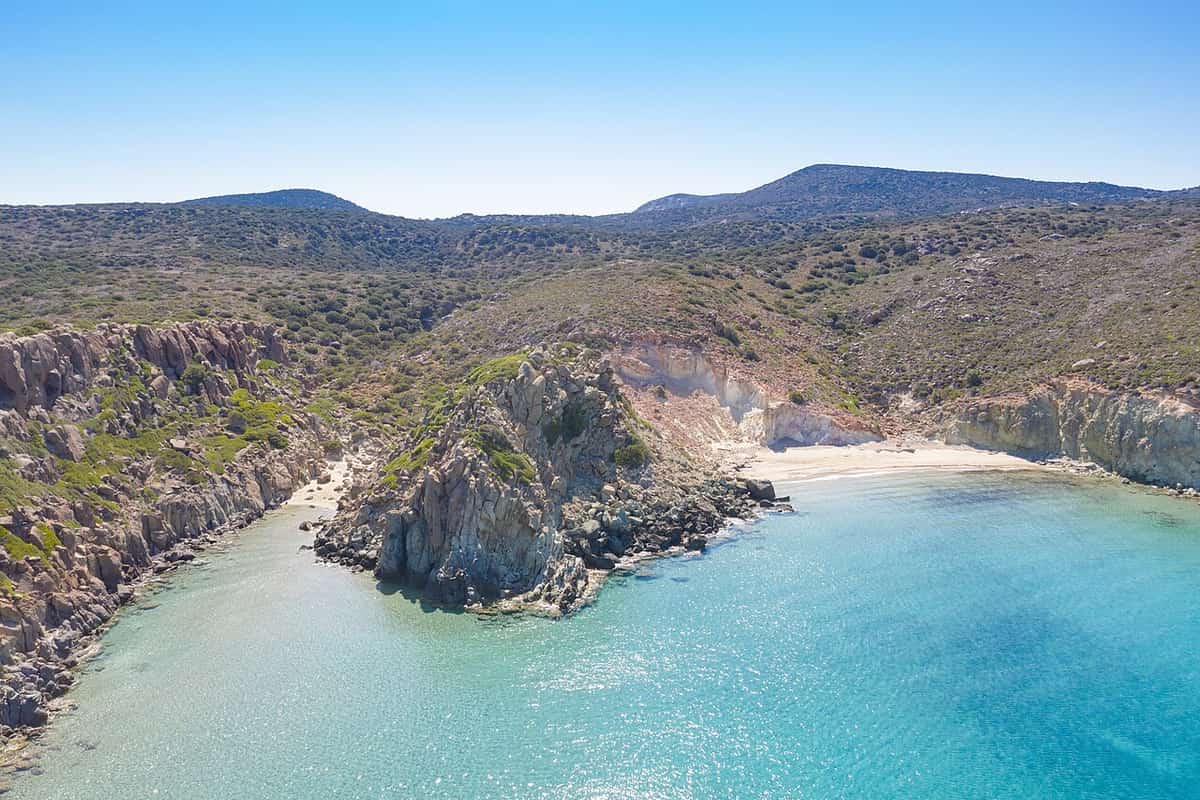
Each of the combined activities in Milos is built around a handover. On route 1 the kayaks stay in a cave while masks and fins come out for the snorkelling stop. On route 2 the kayaks stay on the beach at Klima, a fishing village whose houses kept boats on the ground floor, while the walk begins. On route 3 a car stays at the trailhead while the hike starts. In every case the first activity ends where the next begins, and each leg uses its own gear.
Three pairings appear across the four routes. Kayaking and hiking is the only pairing used twice, on routes 2 and 4, while kayaking and snorkelling make route 1 and hiking and snorkelling make route 3. Counting each activity once per route, kayaking appears three times, hiking three times and snorkelling twice. Five of the eight slots in the combined activities in Milos are therefore on or in the water, and the other three are on foot.
The four distances rise in a clear order: 3.3 km for route 3, 4.8 km for route 1, 8.1 km for route 2 and 9.0 km for route 4. Route 2 comes within 0.9 km of route 4, so the two kayak and hike pairs sit close together, while route 3 and route 1 sit 1.5 km apart. The numbers follow the listing and not the length, because route 3 is the shortest of the four combined activities in Milos.
The routes also differ in how they begin and end. Route 1 starts and finishes at the same beach, Plathiena, so the outing is a loop. Route 2 starts at Lagada and finishes in Adamas, so it runs from one place to another. Route 3 starts from Adamas by car, and the trip back follows the snorkelling stop. Each shape fixes where the outing ends, so the finish point belongs in the plan for the combined activities in Milos from the start.
- Route 1: kayak and snorkel, with the snorkelling stop at a set of three caves.
- Route 2: kayak and hike, with the paddle landing at Klima for the walk.
- Route 3: hike and snorkel, the one route among the combined activities in Milos with no kayak.
- Route 4: kayak and hike, the longest of the four routes.
- Snorkel leg: the swimmer lies face-down, breathes through a tube, and watches the underwater scene with little effort, using a mask and swim fins.
The four routes make a compact set: one kayak and snorkel outing, two kayak and hike outings and one hike and snorkel outing. Each outing hands over from one activity to the next at a fixed point, so the choice between routes rests on the pair of activities and the distance. The next section adds the two outside factors, wind and coast, that fix which of the combined activities in Milos fits a given day.
How is a day of combined activities in Milos planned by wind and coast?
Combined activities in Milos are planned by matching each route’s water leg to the day’s wind and to the shore it uses. The wind is strongest in the afternoon, so the paddle comes first, the gulf is the calmest water, and route 3 carries no kayak.
The wind sets the clock for the combined activities in Milos. The etesian winds of the Aegean are at their strongest in the afternoon and ease at night. A clear sky gives no warning of calm, because these winds rise in clear weather without warning and can reach force 7 to 8 on the Beaufort scale. A paddled leg therefore belongs early in the day, before the afternoon peak. Routes 1 and 2 both open with a paddle, so a morning start suits both.
Coast adds the second filter to the combined activities in Milos. Route 1 starts on the north coast at Plathiena, the westernmost beach on that shore, and passes the Arkoudes rocks near the entrance of the bay on the way back. Its break falls at Nerodafni, a beach inside the gulf, so route 1 links the north coast with the gulf shore. Route 3 works in western Milos, on a path towards Kleftiko, the last name on the list of south-coast beaches from east to west.
The gulf is the answer to a windy day. The natural bay of Milos offers maximum safety on the water, and Achivadolimni and Papikinou, both on the gulf shore, are the beaches recommended for windsurfing and kite-surfing. Route 2 stays on that shore from Lagada through Skinopi and Klima to Adamas, and all four names appear on the list of gulf beaches. Lagada is the nearest beach to the port of Adamas, where the route finishes. Its paddled line among the combined activities in Milos sits inside the bay.
A worked day shows the logic. When the morning is calm and the afternoon wind rises, the plan starts the paddled leg early and keeps the walk for later. When the wind is strong from the start, route 3 replaces the kayak routes, and route 2 keeps to the gulf. Both choices keep one outing of combined activities in Milos in the plan instead of cancelling the day. The reserve is named in advance, so a change of wind changes the route and not the day.
- Route 1: both legs are on the water, so the sea decides the whole outing.
- Route 2: the walk to the catacombs and the ancient theatre sits between two paddles.
- Route 3: the path and the snorkel replace the paddle, with no kayak leg.
- Months: escorted day trips by canoe-kayak run from April to October, the season of the paddled combined activities in Milos.
- Gulf: Papikinou, 1 km east of Adamas, is one of the beaches with the mildest waves on the island.
Wind and coast turn the four routes into a flexible set. The wind sets the hour, the shore sets the water, and the gulf and route 3 give two answers to a windy day. A plan that names one route and one reserve keeps the combined activities in Milos running on any day, and the other groups of activities across the island add more choices on land and at sea.
How does the kayak and snorkelling route work among the combined activities in Milos?
The combined activities in Milos include a 4.8 km kayak and snorkelling route from Plathiena beach. Paddlers pass caves and small islands, leave the kayaks in a cave, snorkel through three caves, rest at Nerodafni and return past the Arkoudes rocks.
The route starts at Plathiena, a beach of fine white sand with views of Akradies, Mandrakia and the Arkoudes. Counted from the west, Plathiena is the first of the beaches on the north side of the island. The Arkoudes stand near the entrance of the bay of Milos, so the rocks that close the route are already in sight from the sand. In the combined activities in Milos, route 1 begins and ends at the same beach.
On the combined activities in Milos route that starts at Plathiena, two landmarks frame the outward paddle. Antimilos rises on the horizon to 671 m, an island of volcanic trachyte with a crater that is still clear. Its ancient inhabitants turned that crater into an open rain tank, and a rare variety of goat lives there. Towards the cape of Vani, the rock turns to hard andesitic lava with low vegetation and forms called noches, which salty wind erodes.
At the eighth stop, the kayaks are left inside a cave and the group explores an area of three caves by snorkelling, with masks and fins. Snorkelling means swimming face-down while breathing through a tube. It lets a swimmer watch the underwater world for a long time with little effort, without the equipment and training that scuba diving needs. Sea caves form where waves wear away weak zones in the rock. The combined activities in Milos join the paddle and the swim at this single cave stop.
After the caves, the route continues to the shore of Nerodafni, where the group lands for a long break to eat or swim. The way back is paddled faster. The Arkoudes then come into view, rocky islets about 20 feet high whose shapes recall bears, with what look like an open mouth, a nose, eyes and ears. They can be seen only from the water. Past them, the paddlers reach Plathiena again, and the beach bar there ends the combined activities in Milos route with refreshments.
- Old name: Antimilos was once called Ephyra or Ephora, meaning watchtower, for its long view over the sea.
- Odyssey: One reading of the Odyssey makes Antimilos, on the horizon of the combined activities in Milos route, the island of Helios.
- Remains: Walls and obsidian arrowheads on Antimilos point to settlement in prehistoric times.
- Gear: Swimfins are common snorkelling gear and make propulsion more efficient.
- Ages: Snorkelling suits all ages because it takes little effort.
In sequence, route 1 runs paddle, swim, shore break and faster return, all within 4.8 km, which is shorter than the 8.1 km of route 2. For a comparison with routes that centre on paddling, the page on kayak routes in Milos lists the numbered kayak routes. Among the combined activities in Milos, the Plathiena route is the one built around a swim inside the caves.

What does the kayak and hiking route add to the combined activities in Milos?
The combined activities in Milos include an 8.1 km kayak and hiking route from Lagada beach. Paddlers land at Klima, walk to the catacombs, the find spot of the Aphrodite statue and the ancient theatre, then paddle back to Adamas.
The paddle runs along the gulf of Milos, one of the largest and safest natural bays in the Mediterranean. Skinopi, one of the settlements on the way, lies at the sea entrance to the gulf, 3 km west of Adamas, and no residents were counted there in 2021. The combined activities in Milos use this leg to bring paddlers to Klima, which counts among the beaches inside the gulf, where the kayaks stay on the sand.
Klima is a fishing village with 8 residents in 2021. Its houses, called syrmata or wires, are two-storey homes set into hollows of the rock. The ground floor kept the fishermen’s boats and the family lived above. Klima was also the first port of the island. After the decline of Phylakopi, the Dorians built the second largest city of Milos from the south of Trypiti down to Klima, so the walk starts on ancient ground. Here the combined activities in Milos swap the paddle for a path.
The path leads to the catacombs near Trypiti, set in caves 150 m above sea level. Three large galleries are cut into porous volcanic rock, with five corridors and a funerary chamber. The total length is 185 m, and 126 arcosolia, carved arched tombs, survive. Gallery B, the Catacomb of the Elders, is open to visitors on a wooden platform and holds the only two-storey tomb. Among the combined activities in Milos, this walk reaches the first community cemetery of Christians, dated to the end of the 2nd century.
Just past the walls of the ancient city lies the spot where a local farmer found the statue of Aphrodite of Milos in 1820. The Hellenistic statue, over 2 m high and carved in Parian marble, has stood in the Louvre since 1821. The ancient theatre follows on the combined activities in Milos walk. The people of ancient Klima raised the first theatre in the Hellenistic era, the 3rd century BC. The later Roman rebuild in white marble is estimated to have held about 7,000 spectators.
- Sacred island: The Holy Synod declared Milos a sacred island in 2009, since the catacombs are the oldest Christian monument.
- Galleries: The galleries are 1 to 5 m wide and 1.6 to 2.5 m high.
- Distance: The catacombs lie 200 m east of the ancient theatre, so both stops of the combined activities in Milos walk sit close together.
- Theatre: The theatre keeps seven marble stands and six rows of seats, and excavations began in 1989.
- Capacity: The theatre in its current state holds up to 700 people.
The paddle back to Adamas ends the route at the harbour town of Milos, home to 1,268 people in 2021. Cretan refugees from Sfakia built it, and it has been inhabited since 1824. Its highlights include the church of the Holy Trinity, the Mining Museum and the Maritime Museum. Among the combined activities in Milos, this route ties the paddle to the ancient city of Klima.
How does the combined hiking and snorkelling route work among the combined activities in Milos?
Among the combined activities in Milos, route 3 replaces the paddle with a drive and a walk. It starts in the harbour town of Adamas, crosses to the protected west, follows a natural path towards Kleftiko and ends with snorkelling in the surrounding caves.
Route 3 begins in Adamas, the harbour town of Milos, which has a population of 1,268 and serves as the cultural and commercial centre of the island. Cretan refugees founded the town in 1841, and it stands on the natural harbour formed by the hollow of the main crater. From this harbour, the route turns away from the water and travels by car to the western side of Milos. Among the combined activities in Milos, route 3 therefore starts with a drive, not a paddle.
The drive ends in western Milos, a designated area protected under Natura 2000, and this is the land stage of one of the combined activities in Milos. The west is the wildest part of the island. It has no villages, only a very small number of settlements and old mines, and almost all of it belongs to the Natura 2000 network. The western region is home to over 800 different taxa, 35 of them endemic to Greece. The car stays at Platorahes, and the route continues on foot.
The path leads towards Kleftiko in the south-west, where the sea and the wind have eroded volcanic rock into hollows and caves, and the area has been designated a landscape of special natural beauty within the Natura 2000 area. Fishermen of the region report that Mediterranean seals used these caves as breeding places. Among the combined activities in Milos, route 3 approaches this coast on foot, and after a short break it turns from walking to snorkelling in the surrounding caves.
Snorkelling is the practice of swimming face-down in the water while breathing through a shaped tube, with a diving mask or goggles and swimfins. It lets a swimmer observe the underwater environment for extended periods with relatively little effort, and it needs none of the complicated equipment and training that scuba diving requires. Among the combined activities in Milos, route 3 uses this simple method in the caves, then returns to the shore for food and rest before the trip back.
- Seals: The south-west side of Milos is a habitat of the Mediterranean seal.
- Viper: The rest of the western part of the island is a habitat of the Milos viper.
- Wetland: The Achivadolimni, once full of clams, is the largest natural wetland of the Cyclades.
- Cypresses: The west also holds a forest of horizontal-branched cypresses, a rare habitat with centuries-old trees.
- Snorkel: A swimmer’s snorkel is a tube bent into a shape resembling the letter L or J, fitted with a mouthpiece at the lower end.
Route 3 follows a clear order: a drive from the harbour, a walk through protected western land and a swim in the caves. That order keeps the sea for the final stage of one of the combined activities in Milos. Walkers who want more distance on land can compare it with the three walking-only routes, which cover 2.1 km, 5.9 km and 6.7 km.
What does the combined kayak and hiking route 4 add to the combined activities in Milos?
The combined activities in Milos include route 4, the second kayak and hiking route, which covers 9.0 km. It is the longest of the four combined routes and longer than any of the six kayak-only routes. Transport, equipment, food and safety are included.
At 9.0 km, route 4 is 0.9 km longer than route 2, the other kayak and hiking route, and 0.2 km longer than kayak routes 5 and 6, which cover 8.8 km each. It is also more than two and a half times the 3.3 km of the hiking and snorkelling route. Milos measures about 23 km from east to west, so route 4 equals about two fifths of that length. Among the combined activities in Milos, route 4 covers the longest distance.
Route 4 lists the same four inclusions as kayak routes 3 to 6 and hiking route 3: transport, equipment, food and safety. Standard kayaking safety gear includes a personal flotation device, also called a life jacket, buoyancy aids that help keep a flooded kayak from sinking, and a whistle for signalling for help. Because the inclusions match those of the sea routes, route 4 sits alongside them in what it provides, which keeps the combined activities in Milos consistent.
Among the combined activities in Milos, the paddling half of route 4 uses a kayak, a small, narrow, human-powered boat driven by a double-bladed paddle. A sea kayak is the type designed for open water such as lakes, bays and oceans. It has a covered deck and trades the manoeuvrability of a whitewater kayak for higher cruising speed, cargo capacity, easier straight-line paddling and comfort on long journeys. Solo sea kayaks are 3.0 to 5.5 metres long, and tandem kayaks reach up to 8 metres.
The walking half of route 4 is a hike, which means a long, vigorous walk on trails or footpaths in the countryside. Milos has rough ground for that kind of walking, because the greater part of the island is rugged and hilly, and tuff, trachyte and obsidian are among its ordinary rocks. Hiking boots are constructed for comfortable walking over rough terrain, and they protect the feet and ankles. This pairing of sea and land is what defines the combined activities in Milos.
- Cargo: Modern sea kayaks are designed to carry large amounts of equipment.
- Rudder: A rudder fitted to a sea kayak can be retracted for beach landings.
- Spray deck: A spray deck covers the cockpit and keeps out water from waves and splashes.
- Boots: Hiking boots, which suit the walking half of the combined activities in Milos, give ankle support and are fairly stiff.
- Fit: Footwear that is neither too loose nor too tight helps prevent blisters and sore feet.
Route 4 joins two ways of travelling along a coast in one outing. The paddle covers the water in a covered-deck boat, and the walk covers the land in boots. The change from boat to boots is the point where the route stops being a kayak route and starts being a hike, and it sets route 4 apart from the sea-only routes among the combined activities in Milos.
How do combined activities in Milos join a boat trip to the west coast with a sunset in Plaka?
Combined activities in Milos pair a boat trip along the west coast, which has no villages, with an evening in Plaka, the island capital. The boat reaches the swim stops, and the Venetian castle above Plaka gives a sunset with a panoramic view of the bay.
The west coast and Plaka show two very different sides of Milos. On the water side, old mining works line the shore. The beach of Agkathia still shows old galleries, open-air workings and the old port facilities, and the area of Mersinia holds old galleries of kaolin and barite mining. Cape Vani, further north, carries the mine of the same name. Combined activities in Milos therefore begin with a working coast and end in a hill town.
The beaches of this coast need effort by land. The three beaches of Triades follow one after the other, sandy and secluded, with shallow, deep blue water between rocks. Agkathia has a sheltered bay and a long sandy beach, but the dirt road past the monastery of Agia Marina makes it hard to reach. Kalogries, in the north-west, has calm water and a bay that works as a natural pool. Combined activities in Milos by boat show all of these shores from the sea.
After the boat, the evening belongs to Plaka. The village stands 220 metres above the sea, and its name comes from the flat ground where the first inhabitants built their houses, when the castle was too small for the whole population. The cobbled alleys were first built as protection from pirates. Car traffic is prohibited, so the evening part of combined activities in Milos is a walk on foot between small shops, restaurants and cafes.
At the top of the hill stands the Venetian castle of the 13th century. It gives sunsets full of colour and a panoramic view of the bay and the neighbouring Cycladic islands. The castle rises on a rocky hill above the ancient city and allowed control of ship movement in the gulf of Adamantas. In combined activities in Milos, the climb passes Panagia Thalassitra, the church of the patron saint of sailors. At the western end of Plaka, Panagia Korfiatissa stands on steep rocks with sea views and sunsets.
- Mining shore: Combined activities in Milos on this coast pass old galleries and port facilities at the beach of Agkathia.
- Triades: Three sandy beaches lie one after the other between rocks.
- Kalogries: Calm water and a bay form a natural pool in the north-west.
- Castle: The Venetian castle of the 13th century crowns the hill of Plaka.
- Thalassitra: The church of the patron saint of sailors stands on the way up to the castle.
The two parts also tell two stories of the island. The coast shows the mining past, with galleries, old ports and the mine of Cape Vani, while the castle hill shows the medieval past, with a fortress above an ancient city and a church for sailors. Combined activities in Milos set the two side by side, so one day covers both the volcanic shore and the capital of the island, with sea first and town second.


How do combined activities in Milos fit a Kimolos and Polyaigos day with a crossing, a swim and a village walk?
Combined activities in Milos turn a Kimolos and Polyaigos day into three parts: a sea crossing from the north of Milos, swimming in sheltered coves, and a walk from the harbour of Psathi to the village of Chorio, 800 metres away.
The crossing opens the day. The Ammoni strait separates Milos from Kimolos, and the Pyrgi strait separates Kimolos from Polyaigos. A lighthouse on the islet of Agios Efstathios, also called Pyrgi, serves ships in the second passage. The islets of Kasseles, Agios Georgios and Manolonisi lie between Milos and Polyaigos. Trips to Polyaigos run on private boats, either conventional boats or speedboats. Combined activities in Milos by sea therefore pass small islets before the first swim.
Kimolos has beaches of fine sand and pebbles in sheltered coves. At Ellinika and Mavrospilia, swimmers meet traces of the ancient city on the seabed, and Rema is a place for a dip. Polyaigos has good harbours only on its west coast. At Pano Mersini, two small coves form safe anchorages, and a large concentration of obsidian, flint and pottery from prehistoric to Byzantine times has been found there. In combined activities in Milos, these coves are the swimming part.
The walk joins the harbour to the village. Psathi is the main port of Kimolos, and Chorio stands 800 metres away. At the harbour, slipways cut into the rock are called syrmata or magazia by the locals. The old part of the village, Palio Chorio, is the castle and the area around it, while newer settlements spread beyond. A part of the village is pedestrian in the evenings of the main tourist season, which suits the walking part of combined activities in Milos.
Two small museums stand in the village. The Archaeological Museum occupies an old two-storey house in the heart of Chorio and shows the history of Kimolos from the Neolithic to the Roman era. Its collection holds over 300 vessels from the geometric cemetery of Ellinika, with cremations from the 8th century BC, and a funerary stele with a female figure of the 7th century BC. The Folklore Museum stands inside the castle. Combined activities in Milos can add both museums to the walk.
- Ammoni: This strait lies between Milos and Kimolos.
- Pyrgi: A lighthouse on the islet of Agios Efstathios serves the passage to Polyaigos.
- Ellinika: Swimmers in combined activities in Milos meet traces of the ancient city on the seabed.
- Pano Mersini: Two small coves on the west of Polyaigos form safe anchorages.
- Museum: An old two-storey house in Chorio shows finds from the Neolithic to the Roman era.
The one-day cruises from Pollonia start from the northern harbour of Milos, the point from which the crossing to Kimolos and Polyaigos begins. The sea part and the village part balance each other: the water gives distance and swimming, and Chorio gives streets, stone and museums. In combined activities in Milos of this kind, the whole day stays inside one small group of volcanic islands in the south-west of the Cyclades.


Which combined activities in Milos pair a north-coast walk with swims at Sarakiniko, Mytakas and Papafragas?
Combined activities in Milos on the north coast join walks over ancient ruins and white rock with swims at Papafragas, Mytakas and Sarakiniko. Each stop gives a different swim: a sea cave, a sandy bay beside fishermen’s houses, and a harbour closed in by volcanic rock.
Papafragas holds the first walk of these combined activities in Milos, because the way to the water is made on foot. The three caves of Papafragas lie next to the ruins of the ancient city of Phylakopi, so a walk through the site comes before the swim. The beach itself is small and surrounded by bright, light rocks. A steep carving in the rock leads down to it, which makes the descent part of the walk. In Byzantine times pirates used the beach as a base.
The swim at Papafragas happens in a deep sea cave. Swimmers move through turquoise water between grey and white rocks, and the passage leads out to the open sea. Among combined activities in Milos, this is the stop where the ruins and the water share one shoreline, so the walk and the swim follow each other directly. Taken from east to west, Papafragas is the first of the three stops, and Kapros, Pachaina, Agios Konstantinos and Alogomandra lie between it and Mytakas.
Mytakas is the sandy stop. It is a northern beach between narrow capes, with very clear water and houses of fishermen beside it. The beach lies directly east of Sarakiniko, so the two stops sit side by side on the shore. After the rock of Papafragas and the rock of Sarakiniko, Mytakas supplies sand. Combined activities in Milos on this coast gain from that change of ground between one swim and the next, because each beach has a different kind of ground.
Sarakiniko is the last stop, and it is the rock walk of the three combined activities in Milos on this shore. Waves driven by north winds shape the grey-white volcanic rock, which holds layer after layer of material and abundant fossils. The sand beach covers only a small part of the site, niched between the white formations, with a couple of trees for small areas of shade. The swim takes place in a natural harbour closed between the rocks, where the water is green-blue.
- Papafragas: Three caves lie beside the ruins, and one is a deep sea cave.
- Mytakas: Sand and clear water lie between narrow capes, beside the fishermen’s houses.
- West Sarakiniko: The rock forms a lunar landscape that wind and waves keep shaping.
- East Sarakiniko: Dry plants and rocky ground cover the land, and a wrecked ship shows when the waves pull back.
- Shade: Only a couple of trees stand behind the Sarakiniko beach.
Combined activities in Milos on the north coast therefore follow one pattern: a walk over ruins or rock, then a swim in water of a different kind. The caves of Papafragas, the sand of Mytakas and the harbour of Sarakiniko all lie on the same shore, so the three swims form one coastal sequence. The page on the beaches of Milos describes the other shores of the island, and it adds to these combined activities in Milos.
How do combined activities in Milos link the Plaka, Catacombs and Klima walk with a swim at Klima or Firopotamos?
Combined activities in Milos can close the Plaka, Catacombs and Klima walk with a swim, either at Klima inside the gulf or at Firopotamos on the north shore. The walk runs downhill, so the sea lies at its lowest point.
The walk leaves Plaka and drops through Tripiti, and the Catacombs form its inner stretch. They lie in caves at the village, whose name comes from the caves cut into the porous volcanic rock around it. The complex has three large underground galleries and five corridors, with a total length of 185 metres. Only gallery B is open to visit, and a wooden platform runs through it. Combined activities in Milos therefore trade open sky for an underground stretch before the swim.
The Catacombs date from the end of the 2nd century AD, when they served as the first community cemetery of the early Christians. On the walls of the galleries, 126 carved arched tombs survive. Gallery B holds the only two-storey tomb of the complex and fragments of an inscription in capital red letters. This stretch sets the pace of the walk, which pauses at a monument before it descends toward the shore, and it gives these combined activities in Milos their change of scene.
Klima is the natural place to swim, and it counts among the beaches inside the gulf. The Dorians built a city that spread from the southern part of Tripiti to the area of today’s Klima, the second largest city on the island. The walk therefore follows the line of that old city downhill, and the swim ends it at the old port. Colourfully painted doors and windows mark the fishermen’s houses beside the water, which suits combined activities in Milos built around varied stops.
Firopotamos is the alternative swim. It is a seaside settlement among the north beaches, west of Mandrakia and Sarakiniko. The beach is small, sandy and organised, suited to swimming and fishing, and it has a beach bar and tamarisk trees. A creek is ringed by syrmata, the same kind of fishermen’s houses as at Klima. Past the fishing houses stand an abandoned loading ladder and the church of Agios Nikolaos, which makes Firopotamos a second option among combined activities in Milos.
- Catacombs: Gallery B is the one open to visit, along a wooden platform.
- Tombs: A total of 126 carved arched tombs survive on the gallery walls.
- Ancient city: It stretched from the southern part of Tripiti down to Klima.
- Klima: The swim ends the downhill line of the walk, beside the old port.
- Firopotamos: The small sandy beach has a beach bar and tamarisk trees.
Combined activities in Milos on this slope join a walk through a town and an underground monument with a swim at the foot of the hill. Klima ends the route because the descent leads straight to it, while Firopotamos offers a different swim on the north shore. The choice between the two depends on whether the outing stays inside the gulf or turns to the north coast.
How do the mining museum, a geology walk and the sulphur mines fit together among combined activities in Milos?
Combined activities in Milos link the mining museum, a geology walk and the sulphur mines into one route, because the third marked geo-route starts at the museum, crosses the east of the island and ends at the protected industrial site of the old mines.
The mining museum opens these combined activities in Milos with the background. It stands on the coastal road about 500 m east of Adamas, and the third geo-route starts from it. The ground floor presents the social and technological side of mining, and the first floor shows the minerals taken from the island since the Neolithic era. Films explain how minerals are extracted and processed. The stories of old miners add the human side of mining.
From the museum, the route runs south-east along the coastal road for 2.3 km to a central crossroads and turns left towards Zefyria. This village lies in the centre of east Milos, 5.5 km from Adamas. The Venetians created it in the 13th century, and it served as the capital of the island until earthquakes and epidemics tied to gases from ground cracks emptied it in 1767. Beyond it, a dirt road follows the Lagada ravine, the next stage of these combined activities in Milos.
The slopes of the ravine carry the first lessons in rock. Old galleries mark places where white kaolin was mined, although the iron oxides in the kaolin of Milos keep it from showing much whiteness. Large rocks stand in strange shapes along the dirt road. These noches sometimes resemble open-mouthed animal heads, and sea air shapes them by eroding hard volcanic rock. Reading these shapes is the core of the geology walk among the combined activities in Milos.
The route ends at the old sulphur mines, the main attraction of the whole walk. The Ministry of Culture designated them a historic site, and they are the only industrial complex of Milos with protected status. Elemental sulphur is found near hot springs and volcanic regions, and Milos is a volcanic island, so the mines are the geological finish of these combined activities in Milos. In the cove of Paliorema, sulphur exports ran until 1956, and wagons still rest on their rails beside a beach of yellow pebbles.
- Start: The third geo-route begins at the mining museum on the coastal road east of Adamas.
- Crossroads: After 2.3 km the route turns left towards Zefyria.
- Church: An inscription places the church of Panagia Portiani in Zefyria before 1576.
- Kaolin: Galleries on the slopes of the Lagada ravine mark the old kaolin mining.
- Mines: The sulphur mines are the final stop and a protected historic site.
Together, the mining museum, a geology walk and the sulphur mines form one chain of combined activities in Milos, with the museum as the lesson and the old works as the proof. Seven marked geo-routes cover Milos and Kimolos, and each comes with a detailed map and a descriptive text. The page on geology routes with maps and texts outlines the volcanic ground behind every one of the combined activities in Milos.
How does a morning dive or snorkel fit with an afternoon of museums among combined activities in Milos?
Combined activities in Milos can pair a morning dive or snorkel in the gulf with an afternoon in Adamantas, where the Mining, Ecclesiastical and Naval Museums all stand in the harbour town, and the beach of Papikinou lies next to the Mining Museum.
Adamantas lies in the north of the gulf of Milos, one of the largest and safest natural bays in the Mediterranean. The gulf is the sheltered water for a morning dive or snorkel before the museums. Off the beach of Adamantas, traces of ancient buildings show at a depth of about 30 metres, and ground subsidence sank a very old settlement there. In combined activities in Milos like this, a diver meets the first chapter of local history under water, and the museums continue it on land.
Papikinou suits the water part of combined activities in Milos, a first swim or a snorkel, because its water deepens slowly and its waves are among the mildest on the island. The beach lies 1 km east of Adamas, and its shore has tamarisk trees, umbrellas and sunbeds. On the coastal road, the Mining Museum stands right before the beach begins. The sea morning therefore ends beside the first of the afternoon museums, and a snorkeller wears a rash vest against sunburn and marine stings.
The morning sea and the afternoon exhibits share one subject, the volcano. Volcanic rocks cover the larger part of Milos, and the activity took place on land and in the sea, so fossil shells lie inside the rocks. Perlite is a volcanic glass that forms when obsidian takes up water, and pozzolana is made of volcanic ash or pumice. Both are dug from the pits of the island. This link joins the sea and the museum in combined activities in Milos of this kind.
The afternoon follows the coastal road back towards the harbour. The Ecclesiastical Museum fills the church of the Holy Trinity, very close to the port, and the Naval Museum occupies the building of the old Community above the port. The Naval Museum starts with obsidian tools, passes the naval battle of Salamis and ends in recent years, with rare maps and a wooden boat among its exhibits. A day that began in the water therefore closes with the history of the sea, which completes these combined activities in Milos.
- Gulf: Adamantas stands in the north of one of the largest and safest bays in the Mediterranean.
- Papikinou: The beach lies 1 km east of Adamas, with waves among the mildest on the island.
- Mining Museum: It stands on the coastal road, right before Papikinou begins.
- Harbour museums: The Ecclesiastical Museum is close to the port, and the Naval Museum stands above it.
- Sun cover: A rash vest protects a snorkeller against sunburn and marine stings.
A morning in the water and an afternoon in the museums of Adamantas make a compact set of combined activities in Milos. The sea part stays in the sheltered gulf, the museum part stays in one harbour town, and the beach of Papikinou joins the two. Divers, snorkellers and swimmers all fit this plan, because each ends the morning close to the Mining Museum, so these combined activities in Milos need little travel.
How does an e-bike or jeep day join beach stops in the west among the combined activities in Milos?
Combined activities in Milos on the west side pair a dirt-road day, by e-bike or jeep, with beach stops where the road ends and the day goes on foot or in the water, so the vehicle only carries the day between the swims.
Dirt roads give the combined activities in Milos on land their first half. The network of dirt roads on the island is the largest in the Cyclades, and the tracks lead to coastal sites, chapels and mines. The choice between an e-bike and a jeep comes first. An e-bike suits a rider who wants to pedal from one beach stop to the next, and a jeep suits a group that travels together over the longer tracks.
The e-bike half of these combined activities in Milos depends on the battery. Manufacturer claims for range run from 20 km of continuous strong assist on steep hills to 140 km of intermittent gentle assist on slight hills, so the planned distance decides the level of assistance. Hub-motor models with regenerative braking slow the bike on a descent and return a little charge to the battery. That helps on a long track down to the coast.
The jeep half depends on the surface. A four-wheel-drive system in part-time mode locks the front and rear axles together, and that mode is recommended only for off-road or loose-surface conditions. On gravel, a tyre that loses traction can leave the tyre that is not slipping with little or no power. A driver who joins paved road and gravel in one day of combined activities in Milos therefore follows the surface when choosing the drive mode, and switches it where the pavement ends.
Agios Ioannis shows how a beach stop ends a ride. The beach has white-gold sand in three parts that are joined by paths, and a dirt road of about 12 km leads to it. The first part is reachable by car. The other two call for a long walk and a descent over rocks, so the vehicle stops at the first part and the day goes on foot. A beach stop in these combined activities in Milos is a short walk, a swim and a return to the vehicle.
- Hard routes: In places the dirt routes are very difficult, so the track is checked first.
- Flat battery: Almost all e-bikes work as ordinary bicycles once the battery is depleted.
- Tyres: Fat tyres give an e-bike more stability off the road, while electric mountain bikes mainly use more common sizes.
- Rest: The motor lets an e-bike rider take short breaks from pedalling.
- Differential: A limited-slip differential limits the slip of one tyre so that power reaches all driven wheels.
A map of Milos shows where the dirt roads meet the west coast, so the order of the beach stops is set before the ride begins. Combined activities in Milos by e-bike or jeep then follow one plan: a stretch of track, a beach, a walk to the water and a return to the vehicle. The sea offers the other half of the combined activities in Milos, for beaches that no road reaches.


How does a sailing day join snorkelling and swimming stops among the combined activities in Milos?
Combined activities in Milos by sea use the sailing yacht as the link between stops: a swimming stop in a bay or cave that no road reaches, and a snorkelling stop over shallow, clear water, with the sail between them.
A sailing day becomes one of the combined activities in Milos when the sail connects the stops instead of filling the whole day. Sea excursions reach beaches that are not accessible from the land, give the chance to swim in clear water and enter secret caves. Boats and sailboats are on offer for these excursions, and the choice depends on the needs of the group. The first decision is the number of stops, and which are for swimming and which for snorkelling.
A swimming stop suits places that only the sea reaches. Sykia, on the west coast, is a cave with no roof, so the rays of the sun enter and light its emerald water, and it is accessible only from the sea. Kleftiko is a set of grey and white rocks with strange shapes, caves and pits that air and sea cut over the centuries, and its clear turquoise water is visited by boat or sailboat. Both are swimming stops of the kind that the combined activities in Milos offer.
A snorkelling stop asks for different conditions. Snorkellers favour places where the water is warm, the waves are small and something worth seeing lies near the surface, and shallow reefs of 1 to 4 metres are the favourite. The kit is a snorkel for breathing, a mask or goggles for vision and fins for easier propulsion. The activity shows underwater life for a long time with little effort and appeals to all ages, which keeps combined activities in Milos open to a mixed group.
The sailing yacht adds a risk to the snorkelling stop. Sailboats are a hazard because their quiet propulsion can fail to alert a snorkeller to their presence, and a snorkeller can surface underneath a vessel. Bright or reflective outfits and a dive flag towed on a float make a swimmer easier to see. The sun adds a second risk, because the back, ankles and rear of the thighs can burn badly even when slightly submerged. A rash guard or a T-shirt covers them during these combined activities in Milos.
- Hydration: Drinking well before entering the water prevents cramps.
- Buddy: A buddy who watches the snorkeller helps to avoid shallow water blackout after hyperventilating.
- Vest: An inflatable snorkelling vest is a buoyancy aid for safety.
- Sunscreen: Waterproof sunscreen lotions can be environmentally damaging, so covering the skin is the alternative.
- Water cover: A snorkeller needs enough water over a reef to swim across it without kicking the bottom.
Each stop on a sailing day has its own purpose. The swimming stop belongs to the cave or the bay, and the snorkelling stop belongs to shallow, clear water. The sail joins the two, and the bright outfit, the float and the sun cover keep a snorkeller visible and protected. Together with the dirt-road day in the west, the sailing day completes the two kinds of combined activities in Milos, one by land and one by sea.

What are the best combined activities in Milos for families with children?
Combined activities in Milos for families with children link a calm swim, a short walk and one museum in a single day. The bay beaches sit beside Adamas, and the villages above the port hold the museum and the walk.
Morning swims anchor combined activities in Milos for families with children, and the bay beside Adamas gives the calmest start. Lagkada, the nearest beach to the port, has golden white sand, clear water and tamarisk trees that give natural shade. Papikinou lies 1 km east of the town. Its waters deepen slowly, and its waves are among the mildest on the island. Umbrellas, sunbeds and a restaurant stand on the sand, so a swim and a meal fit into one stop.
Provatas stretches combined activities in Milos to the south coast by road. The beach lies 7 km from Adamas on a paved road with good signage, and a frequent bus service runs there. Golden red sand, coloured by iron oxides, meets very shallow water, so children can play at the edge. Sunbeds, umbrellas and taverns line the shore. Agios Sostis, a small shallow sandy beach beside Provatas, offers a second spot with a restaurant and a church above it.
A museum fills the middle of the day. The Mining Museum in Adamas links combined activities in Milos to the rocks of the island, since its first floor shows the minerals mined from the Neolithic era to today, and films explain how they were extracted. The Folklore Museum behind the church of Panagia Korfiatissa in Plaka shows a house of the 19th century, with a living room, a loom, a kitchen, a bedroom and a cellar. Furniture, clothes and household tools show children how a family lived.
Trypiti supplies the short walk. The village is almost joined to Plaka and stands over the ruins of the classical city of Klima. Windmills that once ground grain remain there. From the end of the road toward the Catacombs, an alley leads on foot to the walls of the ancient city, and the Ancient Theater lies close by with seven marble stands and six rows of seats. A walk like this adds a history stop to combined activities in Milos without a long transfer.
- Adamas bay: The harbour town stands in one of the largest and safest natural bays in the Mediterranean.
- Plaka: Car traffic is prohibited in the village, so the cobbled alleys stay free of cars.
- Pollonia: The fishing village curves around a cove with sand and tamarisk trees, and taverns serve the shore.
- Achivadolimni: The largest beach of the island has white sand and shallow water, and a bus reaches it.
- Aphrodite find-spot: A local farmer found the famous statue of the goddess near the ancient walls in 1820.
A family plan for combined activities in Milos keeps every stop in one zone. The bay beaches pair with the harbour town and its museum, Provatas pairs with the road to the south coast, and Trypiti pairs with the ancient sites. Each day needs only one swim, one walk and one museum, and the order can change with the weather. Short, repeatable plans like this keep combined activities in Milos easy for children and adults alike.
Which combined activities in Milos work on windy days?
Combined activities in Milos on windy days pair a swim on the south side or inside the bay with a museum or a village stop. In the meltemi and other north winds, those two coasts are the better choice, and the museums need no sea at all.
The road to the south coast makes the simplest of the combined activities in Milos for windy days. Zefyria lies 5.5 km from Adamas and 9 km from Plaka, and the road through it leads on to the beaches of Agia Kyriaki and Paliochori. The Venetians created the village in the 13th century, and it was abandoned in 1767 after earthquakes and epidemics. The old diocese church of Panagia Portiani stands there, so the village stop sits on the way to the swim.
Three south-coast beaches give combined activities in Milos a choice of settings on a windy day. Paliochori is almost 2 km long, with colourful pebbles, coarse sand and clear, deep water, and warm waters gush there. Agia Kyriaki is large and organised, with sunbeds, umbrellas, beach bars and a volleyball court. Fyriplaka has shallow turquoise water and volcanic rocks, and walkers who follow the shore past its organised stretch reach two quieter beaches. Each of these south-side beaches suits combined activities in Milos when the north wind blows.
For combined activities in Milos on a windy day, the museums supply the second half of the plan. The museums of Milos do not depend on the sea. The Archaeological Museum stands on the main square in Plaka, in a neoclassical building dating from 1870. Its first room holds large pottery vessels, a modern copy of the Venus de Milo and obsidian tools from the Neolithic period to the early Bronze Age, and finds from Phylakopi are among its main treasures.
Plaka also fills the hours between the swim and the museum. The village stands 220 metres above sea level, and its cobbled alleys were first built as protection from pirates. Small traditional shops, restaurants and cafes line them. A Venetian castle of the 13th century crowns the hilltop, with views over the bay of Milos and the neighbouring Cycladic islands. This village stop keeps combined activities in Milos on land when the sea turns rough.
- Tsigrado: A cove of white sand and emerald water, reached by a dirt road and a steep sandy path.
- Gerontas: The farthest south beach reachable by car has dark sand, caves and a rock shaped like a bridge.
- Kipos: A sandy beach on the south coast with a small port and a restaurant.
- Syrmata: The cave dwellings by the sea first protected fishermen’s boats in winter and in bad weather.
- War Museum: It occupies the site of an old shelter built during World War II, with photographs and memoirs from both world wars on Milos.
The wind decides the coast, and the coast decides the rest of the combined activities in Milos for that day. In north winds the swim moves to the south side or the bay, and the village and the museum fill the remaining hours. When the wind blows from the south, the north side of the island takes over. Planned this way, combined activities in Milos stay possible on every kind of day.
What does a three-day plan of combined activities in Milos look like?
Combined activities in Milos fit into three days when each day takes one coast: the north for kayaking and snorkelling, the bay for kayaking and a walk past ancient sites, and the west for a walk and a snorkel at Kleftiko.
Milos measures about 23 km from east to west and 13 km from north to south, so one base serves every day of the plan. The bay cuts in from the north-west and divides the island into two fairly equal parts. The meltemi, the strong dry north wind of the Aegean, blows through the summer until about mid-September and is at its strongest in the afternoon. Combined activities in Milos therefore put the paddle first.
Day one belongs to the north coast, and its combined activities in Milos pair a paddle with a snorkel. The paddle starts at Plathiena beach, with Antimilos on the horizon, an uninhabited island of trachyte about 21 km to the north-west, and the cape of Vani, the other cape of Milos. A stop at a group of three caves allows the snorkel, and the long break comes on the shore of Nerodafni. The return passes the Arkoudes, rocky islets near Plathiena whose shapes resemble bears.
Day two belongs to the bay, where combined activities in Milos join a paddle with a walk. The kayak leaves Lagada beach, passes the French monument, Fanari and the settlements of Skinopi and Small Skinopi, and lands at Klima. The boats stay on the beach while the walk climbs to the catacombs by way of the church of Saint Paraskevi. It goes on to the spot where the statue of the Aphrodite of Milos was found, the Baptism place and the ancient theatre. A last paddle then returns to Adamas.
Day three belongs to the west. The drive from Adamas leads to western Milos, a designated Natura 2000 area where over 800 taxa grow, 35 of them endemic to Greece. It ends at Platorahes, and a natural path leads on to Kleftiko. The caves around the shore are explored by snorkelling, and a rest on the shore comes before the return. This pairing of a walk and a snorkel closes the combined activities in Milos for a short stay.
- North walk: A walk from the Papafragkas caves to Sarakiniko passes Phylakopi, Kapros beach, the two Pachena beaches and a shipwreck.
- North paddle: A second paddle for the combined activities in Milos leaves Gerania beach, rests at Sarakiniko and ends in Mandrakia.
- Bay walk: A walk without a kayak links the catacombs, Klima, the church of the Prophet Elias, Tramithia and Plaka.
- West walk: A walk from Saint John’s Siderianos monastery to Sykia, the biggest cave on Milos, uses a natural path.
- Plathiena stop: Rare lilies grow in a fenced area on Plathiena beach, where the north paddle begins.
This three-day plan of combined activities in Milos covers the north coast, the bay and the west, and each day pairs two activities on one stretch of shore. Sea stops come first and walks follow, which keeps the plan steady when the north wind rises in the afternoon. A traveller with three days sees caves, snorkelling spots and walking paths. Longer stays add the south and the east, and the next section sets out that plan.
How does a five- to seven-day plan of combined activities in Milos work?
Combined activities in Milos grow to five days by adding the south and east coasts to the three-day plan, and to seven days by adding a trip to Kimolos and Polyaigos and one spare day for the north wind.
Day four turns to the south coast, where kayak routes run from Paliochori to Firlingos and from Firiplaka by way of Tsigrado to Gerakas. A third route starts at Psathi and heads for Katergo. One cave on this coast still holds great heat from the volcano, a reminder that the whole island is volcanic. Combined activities in Milos on the south side rest on the same two parts as the north: the paddle and the swim.
The Psathi route changes scenery as it goes. Two small, colourful beaches come first. Then orange-beige rock gives way to vertical brown-black cliffs with small dark caves. At Katergo, white rock formations and large multicoloured caves line the water, and the break is a swim at Katergo beach. On the return, the paddle passes the small Kleftiko and two more caves before the landing at Psathi. With this paddle, the combined activities in Milos reach a fourth coast.
Day five moves to the east coast, with Pollonia as the base. The village takes its name from a temple of Apollo that stood to the east of the settlement, and its main beach is sandy. A kayak route links Tria Pigadia with Theiorichia on the same coast. Pollonia lies in the north-eastern part of the island, so the east day follows on from the north coast of day one, and these two coasts complete the five-day version of the combined activities in Milos.
Days six and seven stretch the combined activities in Milos to a week. Kimolos lies across a channel 1 km wide, and Polyaigos, the largest uninhabited island of the Aegean, lies beyond it. Polyaigos has beaches mainly on its southern side and sea caves that shelter a dwindling population of Mediterranean monk seals. The triangle of Milos, Kimolos and Polyaigos holds countless sea caves, and Polyaigos belongs to the Natura 2000 programme. Day seven stays spare, so a sea day can move there.
- Adamas: The harbour town has a French cemetery, a 600-year-old church of the Holy Trinity, a mining museum and a maritime museum.
- Triovasalos: The village has two churches, Saint Spyridon and Saint George.
- Harbour springs: Hot sulfurous springs lie on the eastern shore of the harbour.
- Pollonia beaches: Polychroni and Piso Thalassa lie near the village, besides the main beach, for a swim between the combined activities in Milos.
- West skyline: Mount Profitis Elias rises to 748 metres in the west.
A five- to seven-day plan of combined activities in Milos needs a base, and the choice of accommodation on the island follows the coast of the day. Adamas, the cultural and commercial centre of the island, starts the bay days and the drive west, while Pollonia starts the east. Five days cover the north, the bay, the west, the south and the east, and seven days add the island trip and the spare day.
How do combined activities in Milos connect with local food?
Combined activities in Milos connect with local food through a planned meal at the end of each outdoor stage: a harbour lunch after a boat trip, and island cheese, honey or herbs after a walk. The food stop turns two activities into one day.
Boat trips set the pattern for combined activities in Milos that finish with a meal. Adamas is the main port of the island and the first sight on arrival by sea, and the one-day cruises along the west coast leave from its harbour each day. Pollonia is the second port, almost 10 kilometres from Adamas, and its boats head for Polyaigos and Kimolos. The return leg of a sea day therefore ends in a harbour village with taverns, restaurants and cafes.
A meal can also sit inside the boat trip itself. On the one-day cruises from Adamas, the stop at Kleftiko is followed by a traditional fishermen’s meal on the boat or on Thieves’ Beach. On the trips from Pollonia, a picnic takes place under tamarisk trees on a beach with no road access. These meals split a swimming day into two halves, and they are the simplest form of combined activities in Milos built around both the sea and the table.
The kayak, hiking and snorkelling routes of the island also place food inside the plan. The kayak and snorkelling route pauses on the shore of Nerodafni to eat or swim and closes on Plathiena beach with refreshments at the beach bar. The hiking and snorkelling route returns to the shore for food and relaxation before the trip back. The kayak and hiking route breaks for lunch and photos in Klima. Every food stop falls between two physical stages of combined activities in Milos.
Walks end differently, because island products are sold and eaten in the villages. Plaka holds small traditional shops, restaurants and cafes. Trypiti is dominated at its centre by the church of Agios Nikolaos and offers taverns and panoramic views of Adamas Bay, with the Catacombs and the Ancient Theatre a walk away. In yards, gardens and traditional kafenia, capers dry, pitarakia bake and tomatoes are picked. After a hike, a village stop with cheese, honey and herbs completes combined activities in Milos.
- Harbour lunch: Pollonia is the second port of Milos and holds taverns, restaurants and island cafes for the boat days of combined activities in Milos.
- Taverna dish: Skoufomakarono, a pasta with myzithra cheese and browned butter, appears in tavernas and at village festivals.
- Pasteli: These bars of sesame and honey belong to the sweets of the island.
- Loukoumades: Fried dough balls served with honey carry the local name kourtalides.
- Xinomyzithra: This cheese is creamy and tangy, and it joins touloumotyri and manoura among the local cheeses.
Food completes the outdoor programme because the island’s cooking follows the same land and sea. Combined activities in Milos therefore end with a lunch by a harbour after the water and with local products after the path. The dishes, cheeses, sweets and villages behind each meal are set out on the food and drink pages of Milos, so a route can be matched to a table before the day begins.

How do combined activities in Milos fit photography and sunset viewpoints?
Combined activities in Milos fit photography and sunset viewpoints by keeping the final hour of daylight for one open place: a church courtyard above a bay, a village balcony or a boat deck at sea. Low sun gives softer light than midday.
Light decides when a camera works well after a day outdoors. The golden hour is the period shortly before sunset when daylight is redder and softer, while the bright overhead sun of the middle of the day can create strong highlights and dark shadows. Because contrast is lower in the golden hour, shadows are less dark and highlights are less prone to overexposure. A day of combined activities in Milos that finishes with the sun low ends in the light that landscape photography favours.
The hill of Klimatovouni, above the village of Klima, carries the church of Panagia Tourliani. Its courtyard looks over the upper villages of the island and the entrance of Adamas Bay, and it is a place to rest at sunset. The chapel is also a balcony with views of west Milos, the bay of Adamas and Antimilos. The kayak and hiking route reaches Klima, so this sunset stop belongs naturally to combined activities in Milos.
Adamas Bay can be photographed from the heights around it. Trypiti offers panoramic views of the bay and keeps old windmills that once ground grain. The ancient theatre on its hillside looks over the port, and the small church of Agios Panteleimonas has a view of the port of Adamas. Together they give land-based frames of the same bay that kayaks and boats cross, and they add a second layer to combined activities in Milos.
The sea offers another frame. On the one-day cruises from Adamas, coffee is drunk under open sails at sunset on the final stretch back to the port, and the trips from Pollonia pair sunset at Glaronissia with ouzo and mezedes. After the sun sets, the blue hour begins, the twilight when the remaining sunlight takes a blue shade. Photographers use it for its tranquil mood and for buildings with artificial light, so combined activities in Milos can close at a lit harbour.
- Golden hour: Redder, softer daylight shortly before sunset lowers contrast and softens shadows.
- Blue hour: The twilight after sunset gives a tranquil mood and suits buildings with artificial light.
- Panagia Thalassitra: Photographed more than any other church on the island, it stands on the climb to the Castle of Plaka.
- Plathiena: The white sand beach has views of Akradies, Arkoudes and Mandrakia, and the kayak and snorkelling route begins and ends there.
- Season: The golden hour has no fixed length and varies with the season, so the last stop of combined activities in Milos moves with the calendar.
Photography and sunsets finish the day without adding another activity. A kayak, a trail or a snorkelling stop supplies the effort, and a church courtyard, a hillside theatre or a deck under sail supplies the view. Low sun, then twilight, then lit harbour windows follow in a fixed order. Combined activities in Milos that reserve the last hour for one viewpoint give the day a clear ending and photographs that match the route.
What makes combined activities in Milos safe to book?
Combined activities in Milos are safe to book when a licensed operator covers the sea half and the land half, supplies matching kit, plans the handover between them and reads the sea before departure. A named leader and a written plan protect the whole outing.
A combined outing joins two activities: kayaking with snorkelling, kayaking with hiking, or hiking with snorkelling. Each half carries its own risk, so each half needs a trained leader who holds the licence for that activity. One operator that runs the whole outing removes the gap between the two leaders. Snorkelling safety advice is simple: swimmers stay with a buddy or a tour group and do not enter the water alone. Combined activities in Milos work best when every leader is named in advance.
The sea half has its own kit. A kayak outing needs a life jacket worn at all times, and a whistle that signals for help. The snorkelling half needs a mask or goggles for vision, a snorkel for breathing and fins for easier movement. Certain snorkelling organisations also require an inflatable vest, although such a vest stops a swimmer from diving to any depth. A traveller asks the operator which items are supplied for combined activities in Milos and which must be brought.
The change from sea to land is the step that needs careful planning. On the kayak and snorkelling route, the kayaks are left inside a cave while the group swims. On one kayak and hiking route, the kayaks are left on the shore before the walk begins. The hiking and snorkelling route starts with a car transfer to a natural path towards the caves where the snorkelling takes place. Footwear that is neither too loose nor too tight helps prevent blisters on the walking section.
Sea conditions decide the place and the order of each half of combined activities in Milos. Snorkellers favour water where waves are small, and recreational kayaks, with wide beams and large cockpits, are intended for sheltered water. Wind direction in the Aegean shifts between north-east and north-west with local topography, so a traveller asks which beach the operator uses if the wind turns. Rudders and skegs assist paddling when strong wind or waves come from any direction other than directly ahead.
- Licence: the operator shows a licence for each activity before any payment is made.
- Leaders: the booking names one leader for the sea half and one for the land half.
- Inclusions: the confirmation states whether transport, equipment, food and safety are included.
- Changeover: the confirmation names the beach, cave or trailhead where the first half ends.
- Rough sea: the operator states in advance which half is swapped or dropped when waves rise.
A booking for combined activities in Milos is complete when the answers are in writing: a licence for each activity, a leader for each half, a list of supplied kit and a plan for rough sea. Each answer is quick to collect, and each protects the whole outing. General background on the island sits on the Milos information page, and the questions below cover the details that remain.
What else do travellers ask about combined activities in Milos?
Combined activities in Milos raise practical questions about kayak types, swimming skill, belongings, sun, swell, visibility to boats, snorkel kit and walking risks. Each answer below gives the plain facts for one topic, so that the sea half and the land half are both planned.
Which kayak types suit combined activities in Milos?
Sit-on-top kayaks place the paddler on an open deck above the water, and drain holes let any water run out of the boat. A dry hatch adds storage for equipment. Tandem kayaks carry two or even three paddlers. The traveller asks which type the operator supplies and where the equipment is stored.
Do combined activities in Milos need swimming skills?
Snorkelling needs no special training, only basic swimming ability and the skill of breathing through the snorkel. A traveller who feels unsure in the water tells the operator before booking, and the leader then matches the route and the buoyancy aid to the swimmer. An inflatable snorkelling vest is one form of buoyancy aid.
How do travellers protect belongings on combined activities in Milos?
A dry bag is a flexible, watertight container, and paddlers use it to protect electronics from water. The same bag keeps spare clothing dry for the land half. Phones and cameras stay inside the sealed bag during the sea half, and the roll-top is folded over and buckled before the first launch.
How do travellers avoid sunburn on combined activities in Milos?
Snorkellers’ backs, ankles and the rear of the thighs stay exposed to the sun for long spells and can burn badly, even when slightly submerged. A rash guard with sun protection, a T-shirt or waterproof sunblock lowers the risk. Dehydration is another concern, so a traveller drinks well before entering the water.
How does swell affect combined activities in Milos?
Waves batter rocky coasts and carve sea caves, and blowholes eject large sprays of seawater as waves retreat. A cave entrance that faces the prevailing swell meets the waves head-on. A cave stop on a combined outing therefore needs a calm sea, and the leader drops the stop when the swell rises.
Why do snorkellers wear bright colours on combined activities in Milos?
A snorkeller floats with only the tube visible above the surface, so leisure craft such as speed boats can strike a swimmer by accident. Sailboats are a particular hazard because their quiet propulsion gives no warning. Bright or reflective colours, or a dive flag towed on a float, help boats spot the swimmer.
How do travellers check snorkel kit on combined activities in Milos?
A mask has a soft rubber skirt that seals around the nose and a head strap that holds it in place. A snorkel tucked under the strap can cause mask leakage or snorkel loss, so a clip or keeper fixes it outside. Snorkellers avoid hyperventilating before a dive, because it can cause blackout.
Which hiking risks matter on combined activities in Milos?
Hiking carries hazards from terrain, inclement weather, getting lost and pre-existing medical conditions. Dehydration, sunburn, sunstroke and ankle sprains are the physical problems that follow. The walking half of a combined outing therefore starts with a leader who knows the path, plus sun protection and water.