
A Milos island tour is a trip by road around the island of Milos. It links the best-known sights, such as villages, ruins and viewpoints, into one planned route. The group rides in a van or a jeep, on e-bikes, or with a private driver. A tour leader explains each stop and answers questions.
This page explains how a Milos island tour works and which kinds exist. It also shows who each kind suits. The villages, museums and beaches on the route each have a page on this site. The general page on Milos, Greece, covers its beaches, villages, museums and history.
What is a Milos island tour at a glance?
A Milos island tour is a planned trip by road that links the best-known sights of the island. A tour leader or a driver handles the route and the stops. This lets a group see a rugged volcanic island without working out each leg alone.
On a Milos island tour, the group moves from stop to stop along the island’s roads. A stop can be a village square, a ruin, a mine or a sea view. Short walks lead from the road to the sights themselves. The route ties it all into one outing, so nothing needs planning.
Milos is a volcanic island. Rugged hills cover the larger share of the land, and roads climb, bend and drop between them. A Milos island tour puts a person who knows these roads in charge of the route. The group can then look at the land and the sea instead of the map.
The sights lie far apart. The ancient town of Milos stood on a slope between Trypiti and Klima. Plaka, the chief town, sits on a plateau above the harbour. Phylakopi, a Bronze Age town, lies on the north-east coast. A Milos island tour saves the visitor from zigzagging back and forth across the island.
The west of the island is wild. No villages stand there, only tiny settlements and old mines. Natura 2000, a scheme for protecting nature, covers nearly all of this land. The south-west coast shelters Mediterranean seals. Its beaches are isolated, so reaching them means covering a long distance. A jeep suits this ground best.
Milos has around 90 beaches along its coast and inside its bay. Plenty of them can be reached by road. The rest are accessible only from the sea. A Milos island tour covers the beaches that roads reach, while boat trips cover the others. The two kinds of trip fit together.
The rocks are a reason to visit too. Milos has more than 250 geosites, which are places that show how the land formed. Together with history and nature, they form 12 geo-routes across the island. A Milos island tour can follow parts of these routes. Stops include volcanic rock, old mines and hot springs.
The island also holds layers of history. Traders came for obsidian, a glass-like volcanic rock, long before farming began. A Roman-date theatre overlooks the seaside village of Klima. Early Christians used catacombs dug in volcanic ground. The Venus de Milo was found here in 1820. A Milos island tour reads these layers one by one.
On a Milos island tour, a tour leader adds the story behind each stop. At a ruin, the leader says what stood there and who used it. At a mine, the leader explains what was dug and why. Questions get answers on the spot. The same stop looks different once its story is known.
A Milos island tour also differs from a rental car. A rental car gives total freedom to visitors who want it. But the driver does all the planning and watches the road, the map and the fuel. On a tour, one person handles those jobs. The whole group simply looks around at the view.
- Route: One planned path joins villages, ruins, mines and viewpoints in a sensible order, with no backtracking.
- Transport: The group rides in a van or a jeep, on e-bikes, or in a private car.
- Terrain: Rugged hills cover the larger share of Milos, so roads climb, bend and drop between them.
- Sights: Villages, a theatre of Roman date and early Christian catacombs sit on the route, along with old mines.
- Reach: Roads lead to plenty of the island’s beaches, but not to those open only from the sea.
In short, a Milos island tour turns scattered sights into one clear route. It saves the group from reading maps on steep bends and from guessing where to stop. The next section looks at the kinds of Milos island tour. It runs from the minivan to the e-bike and shows who each kind suits.

Which kinds of Milos island tour can a visitor choose?
A Milos island tour comes in five main kinds that differ in vehicle, speed and style. These are the minivan, 4×4 jeep, e-bike, private driver and culture tours. Each kind suits a different group, a different pace and a different level of fitness.
A minivan is a small van that seats a group together. On a minivan tour, the group rides from stop to stop on the main roads. Everyone sits together, so the leader speaks to all. This kind of Milos island tour suits families and older travellers. It also suits first-time visitors who want comfort.
A minivan tour links villages, ruins and viewpoints that sit near the main roads. Walks from the parking place to each sight stay short. The van does the long distances, and the group does the looking. The cabin gives shelter from sun and wind. Anyone who dislikes steep climbs can join without worry.
A 4×4, read as four-by-four, is also called four-wheel drive. It is a vehicle that sends power to all four wheels at once. The extra grip helps on loose ground, such as gravel, where a normal car slips. Such a system is built for off-road driving. On tours, the vehicle is simply called a jeep.
A 4×4 jeep tour reaches places that a normal car struggles to reach. The wild west of Milos has no villages, only old mines and isolated beaches. Reaching them means covering a long distance in wild country. A Milos island tour by jeep suits visitors who like bumpy rides and wide views.
An e-bike, or electric bicycle, is a bicycle with a built-in electric motor. The motor helps the rider cover greater distances and steeper hills with less effort. This help also suits weaker, older and inexperienced riders. A rechargeable battery powers the motor, and the pedals still work. The rider keeps control of the pace.
Milos is hilly, so the motor matters there. A pedelec is an e-bike whose motor helps only while the rider pedals. On an e-bike tour, the group rides in the open air and stops at each sight. This kind of Milos island tour suits active visitors who want to move under their own power.
A private driver tour uses one car for one party. Nobody else joins, so the route follows the party’s own wishes. The driver can wait for a photo or skip a stop that does not interest the group. This kind of Milos island tour suits couples, photographers and visitors with a long wish list.
A culture-led Milos island tour puts history and rocks first. Milos still mines minerals such as bentonite, perlite and pozzolana, and old mines tell of sulfur and obsidian. Plaka holds the archaeological and folklore museums. The mining, church and naval museums stand near Adamas. An expert leader links the stops into one story.
A culture theme can run in a minivan, a jeep or on an e-bike. The theme sets the topic, and the vehicle is only the means. A private driver can also lead a culture tour for one party. A visitor can choose the way to travel first and the topic second, or the reverse.
- Minivan: A small van seats a group and keeps to the main roads, with shelter from the sun.
- 4×4 jeep: A vehicle with power to all four wheels reaches the wild ground in the west, far from villages.
- E-bike: A bicycle with an electric motor helps the rider climb the hills of the island with less effort.
- Private driver: One car and one driver serve one party, and that party picks the route and the stops.
- Culture tour: History, rocks and museums lead the route, whatever vehicle carries the whole group from stop to stop.
Each kind of Milos island tour trades one thing for another. A minivan gives comfort, and a jeep gives reach. An e-bike gives open air, and a private driver gives freedom. A culture tour gives depth to any route. A visitor who knows what matters first can pick the kind that fits.

What does a Milos island tour see in the hilltop village of Plaka and at the castle viewpoint?
A Milos island tour visits Plaka, the hilltop capital, and walks up to the castle hill. The stop gives a wide view over the bay and the harbour below. It also offers a car-free village of cobbled lanes and a small church at the very top.
The way to Plaka leaves the port of Adamas. It climbs to the plateau above the harbour. A Milos island tour follows it because Plaka serves as the capital of Milos. The village stands on top of a large rock, 220 metres above the sea. From there it looks out over the whole gulf of Milos.
Plaka takes its name from the level land that lies beneath the hill. The first houses of the village went up on that flat ground. Families moved down there when the castle grew too small for the whole population. The fortress above the village is therefore older than the village itself. So the castle came first.
Cars cannot enter the village. The walls and houses stand close together, and car traffic is banned. A land tour leaves its vehicle outside and goes in on foot. Only motorbikes and similar small vehicles can use the lanes. The lanes belong to people on foot. This makes a Milos island tour in Plaka a walking stop.
The cobbled alleys were first laid out to protect the village from pirates. Cycladic architecture marks the whole village. Small traditional shops, cafes and restaurants stand along the lanes today. The state has listed Plaka as a traditional settlement since 1978. A Milos island tour walks these lanes to see a village built for safety.
The castle stands at the highest point of Plaka. It rises on a rocky hill of volcanic origin, above the ancient city. Venetians built it in the 13th century, after the year 1204. The hill gave its owners control over the movement of ships in Adamas bay. A Milos island tour climbs here on foot.
A plateau lies right below the castle. The medieval town of Plaka grew there as a natural extension of the fortress. Tour groups walk through this old quarter on the way up. On a Milos island tour, this layout shows how a fortress and a town fit together. The castle itself is listed as an ancient monument.
At the very top stands a small vaulted church, Mesa Panagia, also known as Skiniotissa. The present building went up after the war. In the war years, an earlier chapel was destroyed to make room for an anti-aircraft post. Villagers rebuilt the church after 1944. On a Milos island tour, the church marks the end of the climb.
The view is the main reason for the stop. From the castle hill, the whole gulf of Milos opens below. The port lies far below. Neighbouring Cycladic islands show on the horizon. People also watch the sunset from the castle hill, as it colours the bay. A Milos island tour pauses here for photos of the bay.
Plaka also holds the main church of the island, Panagia Korfiatissa. It serves as the metropolitan church of Milos. Its builders completed it in 1820 and mixed Byzantine and Cycladic styles. A land tour only passes it on the way. The lanes, churches and history of the village have more room on the separate page about Plaka.
- Place: Plaka is the chief town of Milos, set on a high rock 220 metres above the gulf.
- Walk: The route follows cobbled lanes that cars cannot enter, then climbs on foot to the castle hill.
- Castle: Venetians built the castle after 1204 on a rocky hill, and a small church crowns the summit.
- View: A Milos island tour sees the gulf and the nearby Cycladic islands from the castle summit.
- Photos: A Milos island tour treats the summit as a photo stop for the bay and the sunset.
In short, a Milos island tour uses Plaka as its high point on land. The stop joins a car-free village, a medieval castle site and a wide bay view. Next, the road drops to Trypiti, a village that almost joins Plaka. Its hillside hides the early Christian catacombs, which lie below ground.
Why does a Milos island tour stop at the early Christian catacombs near Trypiti?
A Milos island tour stops at the catacombs, an underground burial place of the first Christian centuries. The galleries are cut into soft volcanic rock near the village of Trypiti. They lie close to the ancient town of Melos. The visit takes the group below ground.
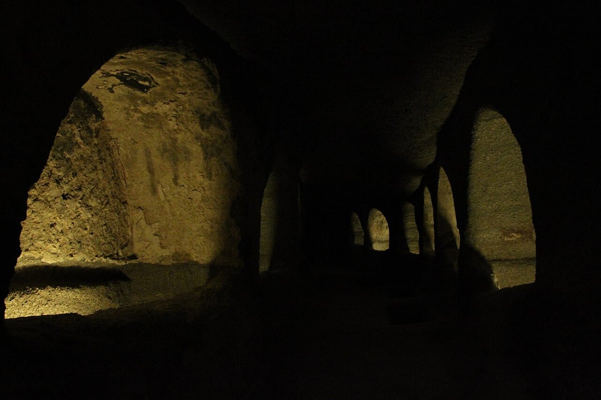
A catacomb is a set of underground galleries where the dead were buried. On Milos, the first Christians used these halls as a shared cemetery for their community. The dead lay in tombs cut into the walls and floors of the rock. A Milos island tour adds the site because it is the island’s oldest Christian monument.
The catacombs lie on a hillside south-west of Trypiti, 150 metres above the sea. Trypiti is a village about five kilometres north-west of the port of Adamas. The ancient city of Melos once covered the slope near the village. The catacombs sit about 200 metres east of the ancient theatre. Tours therefore link the two stops.
The name Trypiti comes from a Greek word for holes. The ground around the village is full of caves cut into porous volcanic rock. Villagers still keep goods and animals in these caves. In ancient times, local families used them as burial chambers. This soft rock explains why a Milos island tour finds the catacombs here.
Early builders carved halls and corridors straight into the soft volcanic rock. Their width varies from 1 to 5 metres. Their height runs from 1.6 to 2.5 metres. Three main galleries, named A, B and C, are linked by passages. One burial chamber has the shape of the small rooms in the catacombs of Rome.
Two kinds of tomb line the walls. An arcosolium is an arched recess cut into the rock. A loculus is a flat, horizontal slot in the wall. Graves were also dug into the floor and sealed with stone slabs of different sizes. On a Milos island tour, these shapes explain how the early community buried its dead.
The public way in leads to the hall of Catacomb B. On the right side stands the only two-storey tomb. Beside it, fragments of the inscription of the Elders survive in red capital letters. A raised tomb shaped like a sarcophagus stands in the middle of the hall. It is called the Tomb of the Witness.
That raised tomb is thought to have served as an altar. It is believed to hold one of the first Christian bishops of Milos. Column parts found near it suggest that a canopy once covered it. A Milos island tour pauses here to explain how a burial place became a place of worship.
Christian symbols are very rare in the galleries. A green fish is painted above the head of a dead person. It is read as a sign of faith. The Greek inscriptions carry Greek names, so the cemetery seems to have served local people. A Milos island tour sees traces of paint and written names on the arches.
Looting had already struck the tombs long before the German archaeologist Ludwig Ross visited in 1844. Local people once called the place the Greek cave. Digs between 2007 and 2009 found lamps, glass beads and pots from Asia Minor, Cyprus and North Africa. Those imported pots show that Milos had sea links with distant coasts.
- Place: The catacombs lie near Trypiti, on a hillside close to the ancient city of Melos.
- Rock: Soft volcanic rock let early builders cut about 200 metres of galleries straight into the hillside.
- Route: The public route runs on a wooden platform through Catacomb B, while the other galleries stay closed.
- Status: In 2009 the Holy Synod named Milos a sacred island, linking the title to the catacombs.
- Role: A Milos island tour treats the site as its early Christian chapter between hilltop views and ruins.
In short, the catacombs give a Milos island tour a different angle from the hilltop views. The cemetery proves that a Christian community lived on Milos in those early centuries. The altar tomb makes that past easy to see. Other places of this kind appear one by one on the sights of Milos page.
What does a Milos island tour show at the ancient theatre and the Venus de Milo find site?
A Milos island tour reaches the ancient city of Melos by road from Trypiti. It shows a restored marble theatre on a hillside above the bay. A lane nearby leads to the spot where a local farmer uncovered the Venus de Milo in 1820.
Ancient Melos was the centre of the island in historical times. Dorian settlers from Laconia founded it on the eastern flank of the narrow mouth of the bay. Athens destroyed the town in 416 BC. Life there lasted into the 6th or 7th century AD. A Milos island tour enters the old town site from Trypiti.
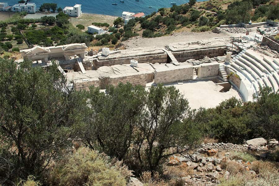
The theatre dates from the Roman period. A Milos island tour finds it south of the flat ground that was the town market. It stands west of the old stadium and touches part of the town wall. Builders shaped the seating on a natural slope of volcanic rock. From the seats, the view runs out over the bay.
Only the lower part of the theatre has been dug out so far. That part is about a tenth of the whole building. This lower part seats about 800 people. Eight marble stairways split it into seven blocks of seats. New marble pieces fill the gaps in the old rows. A Milos island tour sees the repaired rows.
The orchestra is the flat ground in front of the seats. It sits 1.6 metres below the front row and served as an arena for fights. A Milos island tour sees the orchestra from the seats above it. Carved words on four seats name who sat there: young men, singers of hymns and councillors.
A Jesuit monk first noticed the theatre in 1735. He found three rows of marble seats by digging holes. A German architect dug here in 1816 and 1817. He bought the site for Ludwig, then crown prince of Bavaria. In 1836 Ludwig came to Milos with Otto, his son and the king of Greece. He gave Otto the monument.
The theatre went out of use in the 4th century AD. Houses and workshops filled the space until the 6th or 7th century. Lime kilns stood in the orchestra, and islanders took its stones for their own buildings. Works from 2010 to 2015 repaired the stage wall and the seats. Today a Milos island tour meets a repaired theatre.
The story behind this Milos island tour stop begins on 8 April 1820. A local farmer was pulling stones from old ruins on his terrace. He struck carved marble. French officers were digging for antiquities close by. A French sailor named Olivier Voutier saw the find. He was keen on archaeology and told the farmer to dig on.
The statue lay in pieces, two large ones and a smaller third. A hand holding an apple, an arm fragment and two carved posts topped with heads lay with it. France bought the statue, and King Louis XVIII placed it in the Louvre in Paris in 1821. The pieces found beside it are on view in the same room.
The find spot lies at the end of the road that runs from Trypiti toward the catacombs. Vehicles stop there, and a lane continues on foot. A Milos island tour walks it. The old city walls come first. A little further on, in an area thought to be the town gymnasium, the farmer found the goddess.
- Names: The statue has two names, Venus de Milo and Aphrodite of Melos.
- Size: The statue stands over 2 metres high and was carved from Parian marble in separate pieces.
- Age: Experts place the statue in the 2nd century BC, in the Hellenistic period of Greek art.
- Arms: Both arms are missing, and experts still debate how the goddess held them.
- Stage front: The wall below the stage had three openings with marble frames, and the west frame survives.
The island holds a copy of the statue. It greets visitors at the entrance of the Archaeological Museum of Milos in Plaka. The Louvre sent it as a gift. A Milos island tour can pair that copy with the real find spot. Together they show where the goddess was found and where she stands now.
What is a Milos island tour stop at Klima like from the road?
A Milos island tour stop at Klima starts on the road that drops from Trypiti to the shore. The stop covers the colourful waterfront and the quiet cove. It also looks over the old harbour of ancient Melos, now silted up and partly under the sea.
The bay of Milos is shaped like a horseshoe. The bay ranks among the biggest natural harbours of Greece. Its entrance is narrow, and Klima sits beside it, six kilometres from the main port of Adamas. The old town stood above that opening and watched over it. A Milos island tour sees the opening from the shore.
Klima lies below the village of Trypiti. On a Milos island tour, the road runs down from one to the other. Plaka and Trypiti date from the second half of the 18th century. Their builders kept outside the walls of the old city. The old city stayed empty after its people left, and Klima grew at its old harbour.
Eight residents were counted in Klima in 2021, and thirteen in 2011. Since 1978 the village has held the status of a traditional settlement. The same ground once held the second large town of the island. It was built after the older town of Phylakopi fell. A Milos island tour finds a quiet cove today, not a busy harbour.
A Milos island tour walks the waterfront at Klima. Painted doors and windows mark the old fishing houses, known as syrmata, which now take guests. Cats lie in the sun by the water. The stop is for photographs and for the view across the cove. The ancient theatre is close by, as is the Venus de Milo find site.
The cove was once the harbour of ancient Melos. It was the first port of the island. Silt washed down from the valley now covers much of the old harbour. A section of it lies below the waves. The harbour served the town on the hills above. A Milos island tour looks out over the spot where ancient ships docked.
The ancient town covered two hills, Profitis Ilias and Pyrgaki. Strong walls once ran around both hills and fenced in the town. Parts of the walls are visible, and in places they stand high. The town market is thought to have lain on the flat ground between the hills. A Milos island tour sees these slopes from the road.
A Milos island tour crosses fields that cover part of the old city. Later villagers used the ruins as a stone quarry. They built houses and churches from the worked blocks. They burned the marble to make lime. Tomb chambers became barns, stables and cellars. No full dig of the old city has ever taken place.
The slope between Trypiti and Klima has given up fine statues. The Venus de Milo went to Paris. An Asclepius, the god of healing, went to the British Museum in London. A Poseidon and an early Apollo went to museums in Athens. All four statues left the island. Chance finds and illegal digs sent large numbers of works abroad.
Diggers also found a floor mosaic here in 1896. It shows vines, fish and wild animals. It was the floor of a sanctuary of Dionysus. In Roman times the centre of the town moved to the Tramythia area. The burial ground lay outside the walls, to the east. The ruins spread across the valleys of Tramythia and Klima.
- Stop: A Milos island tour links Klima, the theatre and the find spot in one drive.
- Beach: The village beach suits swimmers, and so does the nearby beach of Schinopi.
- Church: The cave church of Saint Paraskevi stands in the village itself.
- Food: The village also has places to eat.
- Ruins: Parts of the market wall and of a Hellenistic and Roman temple survive nearby.
A Milos island tour gets three things at Klima: colour, sea and history. The silted harbour and the hill walls explain why a port stood here. The theatre and the find spot lie on the slope above. The full story of the village is on the page about Klima, the fishing village of Milos.
What does a Milos island tour show at Sarakiniko from land?
A Milos island tour on land reaches Sarakiniko on the north shore. The stop lies about 5 km from Plaka, the island capital. Visitors step onto bare white volcanic rock and see a small inlet closed in by rock. A sandy beach lies at its inner end.
Sarakiniko is the best-known beach on Milos. It sits on the north coast. Cars and buses reach it easily. That makes a Milos island tour by road a simple way to visit. A car park and a bus stop lie up the path from the shore. The site ranks among the best-photographed landscapes in the Aegean.
A Milos island tour walks on volcanic rock here, which means a volcano made it. Tuff is one of the ordinary rocks on Milos. It is a soft stone made of packed volcanic ash. The white cliffs here are soft too. Waves pushed by north winds carve them into odd shapes. This wearing away is called erosion.
The pale rock carries no plants, and the scene looks like the surface of the Moon. Locals call it the lunar landscape. The white stone throws the sunlight back, and no green softens the glare. A pair of trees throws a little shade. On a Milos island tour, a hat and sunglasses suit this stop.
The coastal path runs over flat rock that is easy to cross. The track fades in places, but it follows the shore. Rain has cut a small ravine into the soft white rock. Walking in the bottom of the ravine takes more effort. A Milos island tour stop here calls for shoes with a good grip.
The inlet is a small natural harbour. Rock closes it in, and the water inside shows green and blue. At the inner end lies a beach of fine white sand. It is about 10 m long and not organised. It fills little of the site, so the rock is the main sight on a Milos island tour.
Waves have cut caves into the shore. Pirates called Saracens once took shelter in them. The place took its name from these men. Their ships tied up to bollards, which are short posts for mooring ropes. Those bollards were cut straight into the rock. They have survived to this day, and a Milos island tour can still see them.
On a Milos island tour, the rock shows bands of different volcanic material. Fossils are plentiful in it. Finds from the area include shellfish with two shells, snails, sea urchins and barnacles. Tiny fossils of diatoms, which are microscopic sea algae, lie there too. They are between 1.73 and 1.95 million years old.
The Sarakiniko layer began to build up 1.85 million years ago. It first formed under the sea and later rose slowly to the surface. Waves laid down its material, and the layer is about 50 m thick. Two older layers lie below it, named Pachaina and Papafragas. The rock is close to two million years old.
East of the beach, the ground turns dry and rocky. A ship ran aground there in 2003. Its wreck shows when the waves pull back. Visitors have scratched their names into the soft rock. The municipality of Milos set a fine for spoiling the area. The rule on a Milos island tour is simple: leave the rock alone.
- Rock: White volcanic stone that is soft enough for wind and waves to wear into odd shapes.
- Inlet: A small natural harbour closed in by rock, with green-blue water and sand at its inner end.
- Beach: About 10 m of fine white sand, with a pair of trees behind it.
- Fossils: Shellfish, snails, sea urchins and barnacles lie in the volcanic layers of the cliffs.
- Name: Saracen pirates sheltered in the caves here, which gave the beach its name.
At Sarakiniko, a Milos island tour is a walk over very old rock. It began to form 1.85 million years ago. The caves, the inlet and the fossils all belong to the same soft volcanic rock. The next stop on the north coast is Papafragas. It names the older layer below this one.
Why does a Milos island tour stop at Papafragas and the north coast?
A Milos island tour stops at Papafragas because a small cove lies there between pale cliffs. Three caves and the ruins of ancient Phylakopi sit beside it. Other coves on the north coast follow, and the main road toward Pollonia shows one of them.
Papafragas lies on the north coast, close to Phylakopi, an ancient city that now stands in ruins. Three caves open into the rock there. One is a deep sea cave with turquoise water. That water runs out to the open sea between grey and white rocks. The beach is small, and bright pale rock rises all around it.
The way down to the beach is a steep cut in the stone. From the top, the small beach lies ringed by towering pale rock. The water lies at the bottom. A Milos island tour that pauses up there can take in the whole shape at once. Swimmers can enter the cave, but a land stop shows the view.
The last Frankish priest sheltered his boat at this beach, and the name Papafragas comes from him. The Franks were a western European people, and papas is Greek for priest. Pirates knew the cove as well. In Byzantine times, the later Roman era, it served them as a base. A Milos island tour hears two stories here.
Papafragas is also the name of a rock layer. The layer lies above the oldest layer on this coast, which is called Pachaina. The Sarakiniko layer came later. Papafragas grows thicker toward the east. Waves laid down the volcanic material of both the Papafragas and Sarakiniko layers. The Pachaina layer below is at least 70 m thick.
Kapros is another beach on this coast. It is a cove tucked between white rocks. Its sand is fine and its water is blue. The main road leading to Pollonia passes it, so the cove shows from the road. Cars and local transport reach it easily. That suits a short pause on a Milos island tour.
Pachaina is a spacious beach that looks across to the Glaronisia islets. Tamarisk trees stand on its rich sand. Rocks rise through the blue water. The beach is wide, so the view of the water opens up from the sand. A Milos island tour gets this view of the islets from the shore, with no boat needed.
Agios Konstantinos is a small settlement in a sea inlet called a fjord. The inlet gives shelter from the weather. At the south end, a cross stands out from the rock. A Milos island tour sees the church dug into the soft stone under it. The beach has turquoise water, closed in like a lake, and two small caves.
Kofto lies about 200 m past the beach of Agios Konstantinos. It is a small islet cut off from the shore by faults, which are cracks in the rock. A small colony of silver gulls lives on it. West of it lies Mytakas, a sandy beach with fishermen’s houses between narrow capes. Its water is very clear.
Tours pause on this coast for plain reasons. The stretch from Agios Konstantinos west to Sarakiniko is only about 4.5 km. Kapros shows from the main road, and Papafragas sits beside an ancient ruin. A Milos island tour sees the rock change from stop to stop. For the full list of sandy coves, read about the beaches of Milos.
- Papafragas: Three caves, one of them a deep sea cave, and a small cove between pale cliffs.
- Kapros: A small cove with fine sand between white rocks, seen from the main road to Pollonia.
- Pachaina: A spacious beach with tamarisk trees, rich sand and a view across to the Glaronisia islets.
- Alogomandra: A sandy strip shut in by high cliffs, with sloping rocky ground and shallow green-blue water.
- Mytakas: A sandy beach with very clear water, in a traditional settlement of fishermen’s houses between narrow capes.
A Milos island tour reads the north coast as a row of short stops. Sarakiniko brings white rock and Papafragas brings a deep cove. The beaches between bring sand and clear blue water. Each stop takes its shape from the same soft volcanic layers. Sarakiniko and Kapros are easy to reach by road.
What does a Milos island tour show at Firiplaka and Tsigrado?
A Milos island tour on the south coast stops at two beaches. Firiplaka is long and sits under tall volcanic rocks. Tsigrado lies between tall rocks and is reached by dirt road, then a steep sandy path. Firiplaka has a beach bar and sunbeds, but Tsigrado has none.
Firiplaka lies on the southern side of Milos. Provatas is the next beach to the west, and Tsigrado is the next beach to the east. A Milos island tour that follows this shore meets all three in a row. Because they are neighbours, they form one stretch of coast on the map. Firiplaka is the popular one.
Milos grew from volcanoes, so volcanic rock covers the biggest area of the island. The cliffs at Firiplaka belong to that rock. The island also holds two old volcanoes that have gone quiet. One of them carries the name of Firiplaka. Obsidian, a glass-like stone once cut into sharp tools, comes from the same volcanic rock.
The sand at Firiplaka is fine and white-grey, and the beach also has white pebbles. The water is shallow and turquoise. The beach is extensive, meaning it runs a long way along the shore. It is one of the popular beaches on the island. A Milos island tour stop here gives room to walk along the water.
The first part of Firiplaka is organised. An organised beach has services set up for visitors. Firiplaka has a beach bar and sunbeds with parasols. A parasol is a large sunshade on a pole. Visitors can rest in the shade. This makes Firiplaka the easy stop on a Milos island tour, because shade and a bar are close.
Past the organised part, two quieter beaches follow. Visitors reach them by walking along the sea, next to the volcanic rocks. These two are the loneliest beaches on this shore. A walk along the water takes a visitor away from the crowd. A stop can end at the first beach or go on along the rocks.
Near the shore, a huge rock stands in the water, and a cave runs under it. Long ago, volcanic stone was shaped into this form. The rock is easy to spot from the sand. It stands close to the shore. A Milos island tour on land sees it from the beach, so no boat is needed.
A car, a taxi or a bus can reach Firiplaka. The larger part of the road is asphalt. Asphalt is smooth and hard. The last stretch is a driveway paved with gravel. Gravel is a loose layer of small stones. Loose stones give less grip than asphalt. On a Milos island tour, the driver takes that stretch with care.
Tsigrado lies one beach east of Firiplaka. Tall rocks wrap around it like arms. The sand is white, and the water is emerald green. Firiplaka is wide and open, while Tsigrado is closed in by rock. A Milos island tour sees both kinds of beach on the same coast. Kalamos and Gerakas lie further east.
A fairly easy dirt road leads to the high ground above Tsigrado. This kind of road has no asphalt. From the hill, visitors go down a steep path covered with sand. On a Milos island tour, the vehicle waits on the hill. Nothing is set up at Tsigrado itself. Visitors fetch the essentials from nearby Firiplaka.
- Location: A Milos island tour on the south side of Milos passes Firiplaka, between Provatas and Tsigrado.
- Firiplaka: A wide beach under volcanic rocks, with white-grey sand, white pebbles and shallow turquoise water.
- Services: Firiplaka has a beach bar and sunbeds with parasols, while the beach of Tsigrado is not organised.
- Tsigrado road: A fairly easy dirt road reaches the hill above the beach, where the vehicle waits.
- Tsigrado path: A steep path covered with sand drops from the hill down to the white beach.
A Milos island tour offers two different stops on this one stretch of shore. Firiplaka gives space, shade and a bar. Tsigrado asks for a walk down a sandy slope and gives a closed-in beach in return. Together they show how rock, sand and road shape each stop. Volcanic rock ties both stops together.
Why does a Milos island tour by jeep head into the wild west?
A Milos island tour by jeep crosses the western half of the island. It is the wildest part of Milos, with no villages. Dirt tracks lead to quiet beaches and to hilltop views. A jeep sends power to all four wheels, which suits loose sand and gravel.
Milos is wildest in the west. That half of the island has no villages. Only a handful of settlements, tiny groups of homes, and old mines are there. Rugged hills cover the larger part of Milos, and its highest peak stands in the west. A Milos island tour here moves through land with almost no homes.
Natura 2000, a European network of protected nature areas, covers almost the whole west. The area holds over 800 types of living things, and 35 of them live only in Greece. The south-west coast is where the Mediterranean seal lives. The Milos viper, a snake, and a local lizard live in the rest of the west.
A dirt road is a road with no asphalt, concrete, brick or stone on top. It is made from the ground it crosses. A dirt track is similar, but less suited to large vehicles. The surface can be sandy, stony, rocky or bare earth. A Milos island tour in the west drives on this kind of ground.
Dirt roads change with the weather. When wet, a dirt road turns muddy and slippery. After heavy rain, it can stop even off-road vehicles from passing. When dry, it bakes hard and forms ridges, like a washboard, a ribbed board for scrubbing clothes. In the warm, dry summer, a Milos island tour meets such tracks.
No other Cyclades island has a bigger dirt road network than Milos. Its roads reach coastal spots, small chapels and old mines. In places, the routes are very difficult. A Milos island tour in the west leaves the asphalt and follows these roads. Off-road driving means driving on unpaved ground such as sand, dirt, gravel and rocks.
Four-wheel drive, also written 4×4, sends engine power to all four wheels at once. In 4×4, the first number counts wheels and the second counts driven wheels. The Second World War tied the word jeep to a light army 4×4. On a Milos island tour, a system made for rough ground fits the tracks of the west.
Agios Ioannis beach is named after the monastery of Agios Ioannis Siderianos in Halakas. The track to the beach is a dirt road about 12 kilometres long. The beach comes in three parts, joined by paths. A car reaches only the first part. The other two ask for a long walk and a scramble down rocks.
Ammoudaraki and Triades lie side by side on the west coast. The way there passes the Agia Marina monastery, then the Agios Ioannis Siderianos monastery. A right turn leads onto the dirt road. Agkathia has its own route: after Agia Marina, the track turns right at the second crossroads. That dirt road makes Agkathia hard to reach.
Two stops on the dirt roads are about views. The Agia Marina monastery stands on a hill on the road toward Halakas, just before Fatourena beach. From there, the view takes in the bay of the island and the harbour entrance. The road to the top of Prophet Elias gives views of the open sea and of Kleftiko.
- Agios Ioannis: A white-gold beach in three parts, joined by paths and reached by a long dirt road.
- Triades: Three sandy, secluded beaches with deep blue shallow water follow one another between rocks.
- Ammoudaraki: A beach with rich blonde sand lies next to Triades and is reached along a dirt road.
- Agkathia: A long sandy beach, a sheltered bay and shallow blue water repay the hard road.
- Kalogries: On a Milos island tour, this north-west beach has calm water and a pool-like bay.
A Milos island tour by jeep covers the part of Milos that has no villages. Dirt roads lead to quiet beaches, small chapels, old mines and hilltop views. Four-wheel drive suits those roads, and the weather can still close them. Readers who plan their own drive can read about renting a car in Milos.

What does a Milos island tour show about the mines and minerals of Milos?
A Milos island tour passes the rocks that once gave the island its living. The mining museum in Adamas explains the minerals and their uses. Old workings, such as the sulphur mines at Thiorichia, show them on the ground. Sulphur, kaolin, alum and millstones travelled far from Milos.
The Mineral Museum of Milos, also called the Mining Museum, stands on the coast road. It lies about 500 metres east of the port. A Milos island tour on that road passes it just before the beach of Papikinou. A non-profit company opened the museum in 1998. Its goal was to promote the mining past and the geology of Milos.
The ground floor tells the social, economic and technical story of mining on Milos. The upper floor turns to the rocks and natural riches of Milos. It presents the minerals dug here from the Neolithic age, the New Stone Age, until today. A Milos island tour that starts here sees how people use each mineral in daily life.
Films explain how raw rock becomes a product. In the screening room, visitors travel back in time through the stories of old miners. The work is told by the people who did it. This makes the museum a good first stop on a Milos island tour. Everything seen later from the road then has a name and a use.
Milos had too little metal ore to mine metals. Its rock held minerals for special jobs instead. Ancient buyers wanted sulphur, millstones, building stone, white clay and alum. Ships carried the cargo to ports across the empire. Under Roman rule, that trade brought the island wealth. A Milos island tour now crosses the hills that paid for that wealth.
The coast road runs south from the museum. About 2.3 km along it, a turn to the left leads inland to Zefyria. Past that village, the dirt road follows the Lagada ravine. It runs almost beside the bed of a torrent. The road is passable, so a Milos island tour by jeep can follow it to the mines.
Strange rocks stand on the slopes. Sea air has worn the hard volcanic stone into shapes like open-mouthed animal heads. Galleries in the ravine walls were dug for kaolin, a white clay. Because of iron oxides, Milos kaolin is not very white. Miners picked out the whitest parts. A Milos island tour sees these galleries from the road.
A small marble slab stands beside the road. It marks a resistance action against German troops in December 1944. Plants are thin on the way down. Past the slab, the road drops into the ravine of Palioremata. It ends at Thiorichia, the old sulphur mines. For a Milos island tour, these ruins are the final stop of the route.
Thiorichia is the only industrial complex on Milos with legal protection. The culture ministry declared it a historic site. Its buildings were shaped by the needs of the work. The first state licence for sulphur at Palioremma came in 1862. By 1890 the mines gave about 15,000 tons a year. Exports lasted until 1956.
Sulphur was already prized in ancient times. Pliny the Elder, a Roman writer, called Milos the richest source in the ancient world. Greeks used it as a disinfectant, an antiseptic and in religious rites. Roman ports received it on special ships. On a Milos island tour, that long story ends in one ravine.
- Kaolin plant: A Milos island tour passes an old kaolin plant, built in 1925, about 2 km from Adamas.
- Alum: The Roman empire rated alum from Milos as its best, and medicines used it.
- Millstones: Millstones of Milos trachyte ground grain, and buyers in Egypt and Italy wanted them in Byzantine times.
- Pumice: Pumice from Milos polished the famous mosaics of the Roman world, and its output continued.
- Manganese: Miners dug manganese ore at Vani from 1890 until 1928, when the work stopped for good.
The museum and the old mines work as a pair. One explains the rock, and the other shows the work. A Milos island tour that includes both turns bare hillsides into a story. It is a story of sulphur, clay, stone and ships. The same hills still supply minerals to buyers around the world.
What does a Milos island tour show of Phylakopi and the Bronze Age?
A Milos island tour can reach Phylakopi, a Bronze Age town on the north shore of Milos. It ranks among the chief settlements of the prehistoric Aegean Sea. Visitors see a wall of large volcanic blocks, the remains of a big hall and a small shrine.
Phylakopi sits on the northern shore of Milos. It began as a small village on bare rock. Over time, it grew into a walled town. Life there began in the third millennium BC and ended in the twelfth century BC. A Milos island tour therefore meets a town with a very long past.
On a Milos island tour, obsidian is the first clue to the past. It is a black volcanic glass that breaks into extremely sharp edges. Early people made tools from it. Milos was a source for the Aegean and the wider Mediterranean. Its glass was in use as early as 15,000 years ago, long before the town.
The trade needed no village. Crews arrived by boat, beached it in a cove and chipped the glass out of the quarries. No permanent settlement grew from this work. One prehistoric quarry, called Nychia, can be visited by land. A Milos island tour reaches it by a narrow dirt road above Adamas. A walk of about 150 metres follows.
The first houses of Phylakopi stood on bare rock. Their pottery belongs to the early Bronze Age. From about 2000 to 1550 BC, the town was packed with houses in blocks. Long, straight streets ran between the blocks. Potters painted plants and animals in black and red. Their bird jugs went to Knossos on Crete.
An earthquake is blamed for wrecking that town. A new town rose and copied Crete. Minoan pottery styles became popular, and a wall now protected the settlement. A building called the Mansion held a piece of a clay tablet. It was written in Linear A, the script of the Minoans of Crete. That points to an office for keeping records.
The Pillar Room belongs to this age. It had pillars and cut stone blocks. Traces of a painted flying fish were found inside. Fragments nearby show lilies and a blue monkey. The rebuilt flying fish frieze is now in the National Museum in Athens. A Milos island tour therefore pairs the site with the museums.
After the volcano on Thera, now Santorini, erupted, Minoan influence faded. Mycenaean pottery and building styles from the Greek mainland took its place. Builders raised a megaron, a large hall of the kind found in mainland palaces. By then the town held at least 900 people. It worked as a trading port between Crete and the mainland.
The shrine of the town held the famous Lady of Phylakopi, a clay figure of a goddess. People used the shrine until about 1090 BC. Then the town was abandoned and never settled again. The sea has since carried away part of the headland and part of the ruins. A Milos island tour sees only what is left.
British archaeologists dug here in 1896 to 1899, in 1911 and from 1974 to 1977. Their records made Phylakopi a model for dating the Aegean Bronze Age. Finds from the first digs sit in the National Archaeological Museum in Athens. Later finds sit in the Archaeological Museum of Milos. A Milos island tour can visit that museum too.
- Wall: A strong wall of large volcanic blocks guards the neck of the headland.
- Megaron: The megaron, with its forehall and big hall, is the only example found so far in the Cyclades.
- Streets: Streets lined up with the four directions, and drains carried water away.
- Obsidian: Fine black chips of obsidian waste still lie scattered across the settlement.
- Signs: Signs and plans on site help a Milos island tour make sense of the ruins.
Phylakopi is one early chapter in the long past of the island. The history of Milos follows that story from the Bronze Age to today. A Milos island tour that adds the mines shows how one island lived from its rocks. Dorian settlers later moved the main town from Phylakopi to Klima.
What does a Milos island tour show at Achivadolimni and the south coast?
A Milos island tour shows three stops on the bay and the south coast. Achivadolimni has the largest beach and a wetland. Provatas has red-gold sand and shallow water. Paliochori has coloured rocks, and warm water gushes out of the ground there. Each stop looks different.
Achivadolimni, Provatas and Paliochori lie in different parts of the island. Each one shows a different side of Milos. A Milos island tour that visits all three sees a wetland, a red beach and coloured cliffs. The bay comes first in this section. The south coast comes after it, with Provatas first and Paliochori last.
Achivadolimni takes its name from the clams that once filled the pond opposite the beach. It is the largest beach on the island. White sand lines the shore, and the shallows are a deep blue. A Milos island tour finds plenty of room here. The beach has two sandy parts, and they feel quite different from each other.
The first part of the beach is quieter and more secluded. The second part is lively and has a beach bar and restaurants. A group that wants calm goes to the first part. A group that wants a drink and a meal goes to the second. Camping is organised here too, and a bus line serves the beach.
The pond opposite the beach belongs to the largest natural wetland in the Cyclades. It is an important stopping place for migratory birds. The Natura 2000 network of protected nature sites covers almost all of the uninhabited west. Achivadolimni belongs to it. On a Milos island tour, a stop on the shore lets the group watch the birds.
Achivadolimni lies inside the gulf, the big bay at the heart of the island. The beach suits surf and kite-surf lovers well. That makes it the sporty stop of the bay. A Milos island tour can pair it with the quiet wetland across the way. One visit then shows two moods of the same shore.
Provatas is the stop with golden-red sand. Iron oxides in the ground give the sand its colour. The water is very shallow, so the beach suits families and young children. Sunbeds and umbrellas are set out along the sand. On a Milos island tour, Provatas is the easy swim stop of the south coast.
The road to Provatas is paved and well signposted, and the beach lies 7 km from Adamas. A frequent bus service runs there. Beside the sand stand a hotel, rooms for rent and taverns. A Milos island tour finds the way easy to follow. The baths of Provatas also count among the hot springs of Milos.
Paliochori is a popular beach almost 2 km long. The shore has coloured pebbles and coarse sand, and the deep water is cool and clear. Cliffs in red, pink, yellow and grey-white rise around it, formed by volcanic energy. It lies about 14 km from Adamas. A Milos island tour stops here for the rock and the sand.
Warm water gushes out of the ground at Paliochori. The island has fumaroles, which are vents that let hot gas out of the earth. The vents at Agia Kyriaki, Paliochori, Pyromenes and Adamas reach 100 degrees Celsius. The island’s hot springs reach 55 degrees Celsius. On a Milos island tour, this is the volcano at work on land.
- Achivadolimni: The largest beach on the island has white sand, deep blue shallows and a camping area.
- Wetland: The largest natural wetland in the Cyclades is an important stopping place for migratory birds.
- Provatas: Golden-red sand, very shallow water, a paved road and a frequent bus suit families.
- Paliochori: A beach almost 2 km long has cliffs in red, pink, yellow and white-grey.
- Warm ground: Warm water, hot gas vents and springs up to 55 degrees show the volcano at work.
The bay and the south coast give a Milos island tour birds, red sand and coloured cliffs. Each stop looks different from the others, so none repeats the last. Together they show a wetland, a family beach and volcanic ground in one tour day. The north and the west of the island add more stops.
What do the inland villages add to a Milos island tour?
A Milos island tour gains its village stops from Tripiti, Triovasalos and Pera Triovasalos. Adamas and Pollonia work as the start or end point. Each place adds a view, a church or a busy street to the tour day. Together they show daily life on Milos.
Tripiti, Triovasalos and Pera Triovasalos stand on a height above the harbour of Adamas. Plaka, the chief town, stands on the same height. Readers who want more on every settlement can read about the villages of Milos. On a Milos island tour, the three villages form a chain of stops above the port.
The road from the port reaches Pera Triovasalos first. Triovasalos lies on the way to Plaka as well. Both villages are densely built, and both show a lot of trade. A Milos island tour passes through them on the way up. Each is easy to add to the route, because both sit before the chief town.
Tripiti is a traditional village that has kept its old look. It is almost joined to Plaka. The village owes its name to soft volcanic rock that looked full of holes. Holes are also cut into the rock that the village stands on. The houses climb the slope in steps over the ruins of an old city.
The church of Agios Nikolaos rises in the middle of Tripiti. Old windmills still stand in the village, and they once ground grain. The slope gives a wide view over the Bay of Adamas. Taverns and restaurants serve local dishes. The Catacombs and the Ancient Theatre are near. A Milos island tour can walk from Tripiti to both.
Triovasalos is built on a slope like an amphitheatre, and its trade is lively. The Karodromos is the central point of the island, home to banks, public offices, cafes and shops. In 2021 the village had 1,379 residents, and Pollonia belongs to its community. A Milos island tour finds a coffee stop and everyday Milos here.
Pera Triovasalos stands right next to Triovasalos, and the two villages share two neighbouring cliffs. Triovasalos has the church of Agios Spyridon, and Pera Triovasalos has the church of Agios Georgios. The older church dates from the early 19th century, and the other from 1849. A Milos island tour finds two village churches in this pair.
Adamas is the harbour town and the start or end of a Milos island tour. Cretan refugees built it beside a harbour set in a crater. In 2021 it had 1,268 residents, and it serves as the cultural and commercial hub. It holds the French cemetery from the Crimean War, the Mining Museum and the Maritime Museum.
Pollonia is the second port of the island, after Adamas. It lies at the north-east tip, around a small creek with a sandy beach. Adamas lies almost 10 km away, and Plaka lies 14 km away. Fishing boats tie up at the pier, beside the small church of Agia Paraskevi. A Milos island tour can end here.
Pelekouda, on the left side of Pollonia, is a peninsula worth a visit on a Milos island tour. The church of Agios Nikolas stands there. By tradition, a pair who sit on the chair-shaped rock never part. The lighthouse of Pelekouda marks the place of an old temple of Apollo. The village is thought to be named after it.
- Tripiti: A village of windmills and holes in the rock, with wide views over the Bay of Adamas.
- Triovasalos: Banks, public offices, cafes and shops cluster around the Karodromos, the busy centre of the island.
- Pera Triovasalos: The first village on the climb from the port, with the church of Agios Georgios.
- Adamas: The harbour town, with a French cemetery, two museums and the start or end of the tour day.
- Pollonia: The second port, with a sandy beach, two more beaches nearby, fishing boats and the Pelekouda peninsula.
Together the inland villages give a Milos island tour its pauses. They offer a view, a church, a coffee and a meal. Adamas and Pollonia frame the day as the two ports of the island. Between them lie the hill villages. They show the lived-in side of Milos, away from the beaches and the boats.

Which photo stops does a Milos island tour link, and why start at sunrise?
A Milos island tour links photo stops in a hilltop town, a fishing village and a church. It also stops at the white rocks of the north coast. A start near sunrise brings soft light, quiet paths and almost no crowds on the shore.
On a Milos island tour, a photo stop is a pause at a chosen view. The vehicle halts, the group steps out, and each person frames a shot. The stops sit between the bigger sights, so the route keeps moving. Each stop has one clear subject: a village, a church, a coast or a view.
Plaka keeps cars out, because its lanes run tight between the walls. Only motorbikes and mopeds fit. When one comes, the group steps aside. Residents use the same lanes to reach their doors. The kastro, or castle, rises on a hill above the village. From there, the gulf of Milos lies far below.
On a Milos island tour, the way up to the castle passes Panagia Thalassitra. Visitors photograph this church more than any other on the island. It honours the patron saint of sailors. The best frames come from the lane outside. Inside, cameras stay down during a service and flashes stay off at all times. Quiet voices show respect.
Klima is a seaside village of fishermen’s houses called syrmata. The ground floor of each house holds the family boat in winter. That space is working ground, not a stage. Today the houses include guest rooms, so each doorstep is private. The painted doors and windows show well from the road. Photographers never step onto a doorstep.
Sunrise is the moment the top edge of the sun appears on the horizon. Before that moment, twilight brightens the sky while the sun is still out of sight. That glow is soft and even, and it suits pale stone. A photographer on a Milos island tour can use it before the first direct beam.
In Greece, sunrise falls in the north-east sky from spring to late summer. On a Milos island tour in those months, slanting light reaches the north coast. Low light draws long shadows and shows each ridge. In autumn and winter, the sunrise point shifts toward the south-east of the sky. The north coast then loses that side light.
The white rocks of Sarakiniko reward an early start. The bare stone has no plants to break its pale shapes. Low light draws every ledge and hollow. This is the best-known beach on the island, so the shore fills as the day goes on. A Milos island tour that arrives early keeps towels out of the frame.
Near the horizon, the sun looks wider than it is tall, because air bends its light. The disc also looks larger than it does high in the sky. A rock, a roof or a chapel in the foreground gives it scale. The bending also shows the sun before it truly clears the horizon. Photographers watch for that moment.
On a Milos island tour, longer walks to wider views belong to hiking in Milos. Early walkers keep voices low and leave gates as found. Tripods stay out of narrow lanes, and nobody blocks a doorway. People live in these houses, and lanes are their way to work. A neighbour’s quiet morning matters more than any picture.
- Plaka lanes: narrow and free of cars, so the group walks in and steps aside for residents.
- Church exteriors: the best frames come from outside, and cameras stay down while a service is under way.
- Painted houses: photographs come from the road or the shore, never from a private doorstep or a gate.
- White rocks: an early arrival gives empty frames, and the stone stays unmarked for the next visitor.
- Route order: a Milos island tour can start on the north coast while the sunrise light is low.
A photo-minded Milos island tour moves with the sun and keeps good manners. Quiet voices earn space in lanes and at churches. An early start earns empty rock, soft light and a calm view of the sea. Together, these habits give better pictures and leave the villages as calm as they were found.
How does a Milos island tour work by e-bike or by jeep?
A Milos island tour by e-bike adds a motor to the pedals. A jeep tour runs on four-wheel drive over dirt tracks. The bike suits active riders who like to pedal uphill. The jeep suits groups who want rough ground without the effort of riding.
Rugged hills cover the greater part of Milos. Mount Profitis Elias, in the west, climbs to 748 metres. The road from the harbour to Plaka is a long ascent. An electric motor helps a rider cover steeper hills with less effort. On a Milos island tour, that help turns a hard climb into a steady one.
A pedelec, short for pedal electric cycle, follows an EU rule with three limits. The motor assists only when the rider pedals above 6 km/h. It cuts out at 25 km/h. Its steady power stays at or below 250 watts. A throttle bike on a Milos island tour can run on motor power alone.
Pedelecs raise average speed, and the gain is biggest on climbs and in a headwind. A Milos island tour meets both, with climbs inland and sea wind on the coast roads. An e-bike rider can brake, then return to normal speed with less effort. Car drivers can misjudge a bike that comes up fast from behind.
One study found that an e-bike uses 24% less energy than a normal bike. It also uses 64% less than walking. The gap is widest uphill, which suits a Milos island tour full of slopes. The rider still pedals and still works. A weaker rider can take short breaks from pedalling and trust the motor on the climb.
Battery range depends on the level of help and the speed. Hills and the weight of bike and rider matter too. A Milos island tour drains a battery faster than a flat ride. A sensible rider keeps the help low on easy ground and saves it for the climbs. A tour leader can plan the route around that limit.
A 4×4 ride on a dirt track feels slow, bumpy and dusty. The vehicle rocks from side to side as the wheels climb over stones. On loose gravel, one wheel can spin without gripping. A locking differential, a gear part that joins the wheels, then makes them turn together. Engine power then reaches all the wheels equally.
A Milos island tour by jeep uses a vehicle built for rough ground. Such vehicles carry features like off-road tyres, skid plates, a roll cage and a strengthened drivetrain. In places the dirt routes on Milos are very hard. A skilled driver then matters more than the engine. Passengers ride along while the driver does the work.
On a Milos island tour by e-bike, a helmet softens a blow to the head. It also has to be light and well ventilated, because cycling raises body heat. Fit matters too. In one study, 96% of young riders wore helmets that did not fit. One estimate says a badly fitted helmet raises the risk almost twofold.
A summer Milos island tour meets warm to hot, dry weather. Heat exhaustion comes from heat, hard effort and too little water. Prevention is simple: loose clothing, steady drinking and a slow pace in the heat. Sunscreen works best with sunglasses and a sunhat. A breeze hides sweat on a bike, so riders drink before they feel thirsty.
- Fitness: an e-bike still asks for steady effort, while a jeep asks for none from its passengers.
- E-bike riders: this ride suits people who like to pedal and want help on the long climbs.
- Jeep passengers: a Milos island tour by jeep suits groups of mixed fitness who want rough tracks.
- Helmets: a snug helmet, worn level on the head, goes on before the first turn of the pedals.
- Water and sun: each person carries a full water bottle, and sunscreen goes on before the group leaves.
The choice comes down to effort and ground. A Milos island tour by e-bike rewards riders who like to use their own legs. A jeep suits shared days on rough tracks. Either one pairs well with swims and walks, as the combined activities in Milos show. Either way, water and sun cover come first.

How does a traveler choose a Milos island tour?
A Milos island tour comes down to five clear choices. They are length, group size, focus, pickup point and the written tour description. Each choice sets the pace of the whole road trip. Travelers match all five to the group, the season and the pace they enjoy.
Milos spans about 23 kilometres on its long axis and about 13 on its short one. A Milos island tour can reach every side of it. A half day suits one cluster of stops, such as Plaka, Trypiti and Klima. A full day reaches the far coasts as well. The best length depends on the group and its energy.
A small group shares one minibus or van and follows a set plan. Every seat hears the tour leader, and every seat sees the view. A private tour belongs to one group. That group sets the stops and the pace with the driver. A slow walker or a keen photographer then gets the time that each stop needs.
A Milos island tour can lean toward culture or toward the beach. A culture focus keeps to Plaka, the catacombs, the ancient theatre and the museum. A beach focus spends more of the day on the coast, with swim stops. A mixed route works too. It simply gives every stop less time, so the group picks one lead theme.
Pickup shapes the start of the day. A pickup at the hotel suits a group that stays far from the port. A meeting point at Adamas, the harbour town, suits a group that stays close by. The tour description names the pickup type. A traveler checks it first, because the start of the day shapes every later stop.
The written tour description is the best test of a tour. A clear one lists the stops in order and the kind of vehicle. It names the pickup, the group size and the language of the commentary. It states how much walking each stop needs. It also says whether museum entry and swim time are part of the plan.
A road tour works well early in a stay. Milos has a horseshoe shape, wrapped around a natural harbour. A drive around it shows where the towns, the ports and the beaches sit. The group then picks later beach days with that map in mind. A Milos island tour on the first day acts as a live map.
Packing for a road trip differs from packing for a boat. The day bag rides on a seat, so it stays small and light. Stops bring short walks, sun and wind, but no deck. Five items cover the whole day on a Milos island tour. None of them is heavy, and all of them fit a small bag.
- Water: A full bottle stays within reach on the seat, and a refill fits any village stop.
- Hat and sun cream: Both protect the head, neck and arms on long sunny stretches by the window.
- Walking shoes: Closed shoes suit steps, slopes and rough ground at the old sites and the castle viewpoint.
- Swimwear: Swimwear goes on under clothes, so a beach stop starts at once, and a towel dries fast.
- Light layer: A thin jacket helps in wind at open viewpoints and when the sun drops.
Choosing well means matching length, group, focus and pickup to the people on board. The written plan and the five packed items do the rest. For the rest of a stay, the list of activities in Milos holds more ideas. A Milos island tour is only one of them, and it pairs well with a later beach day.
What should you still ask before booking a Milos island tour?
A Milos island tour raises ten practical questions, from buses and driving to heat, wind and car sickness. Each answer sticks to the roads of Milos and to what the stops ask of travelers. The facts come first, and the advice follows in short, plain words.
Can a traveler use a public bus instead of a Milos island tour?
Public buses reach only certain areas of Milos. In the summer months the routes run quite frequently. A traveler buys the ticket on the bus itself. A bus links places, but it offers no planned tour, no tour leader and no set route. No bus serves the airport, but taxis wait there and at the port.
Is driving a rental car a good alternative to a Milos island tour?
Dirt roads on Milos form the largest network in the Cyclades. Tracks run out to chapels, mines and coastal spots. Certain routes turn very difficult for drivers. A traveler who drives sets every stop and reads every map. A Milos island tour hands the driving and the route to the driver. The group watches the view instead.
Is a Milos island tour suitable for young children and their parents?
Children cope less well with heat than adults, so shade, water and rest matter more. A Milos island tour with short stops and a swim keeps children busy and cool. A hat and sun cream go on at every stop. Snacks and water ride in the day bag. Parents ask the provider about child seats before the day.
Can travelers with reduced mobility still join a Milos island tour?
The island is rugged and hilly. Plaka sits on high, flat ground above the harbour, and the castle rises on a hill above it. Certain stops involve steps or slopes. A traveler with reduced mobility asks which stops need steps. The same traveler asks how far each stop lies from the vehicle, and how the vehicle is entered.
Does a Milos island tour include swimming stops at the beaches?
That depends on the route, so the tour description is the place to look. Beaches lie on every side of the island, and each one differs from the next. Certain beaches are reachable by land, while others open only to boats. A road tour reaches the first kind. Swimwear under clothes and water shoes make a stop quick.
Does a Milos island tour include entry to the museum in Plaka?
Entry to the Archaeological Museum of Milos needs a ticket. The tour description says whether the visit is part of the plan. The museum stands on the crest of Plaka and holds four halls of finds. The vehicle stops nearby, and a short walk follows. Travelers who want more time inside the museum ask before the day.
How does summer heat affect a Milos island tour on the road?
Summer on the island runs warm to hot, with little rain. Heat exhaustion is the body overheating. It follows hot weather, long sun exposure and too little water. Loose clothes, steady drinking and rest from hard effort prevent it. A good Milos island tour puts the longer walks in the cooler parts of the day. Shade helps too.
What happens to a Milos island tour on rainy or windy days?
Winters on Milos are mild and rainy, while summers are dry. In the main season, wind matters more than rain. Strong dry winds blow from the north across the Aegean and peak in the afternoon. Strong wind stops certain boats, but a road tour stays on land. Open viewpoints feel cooler in wind, so a light layer helps.
Can a traveler combine a Milos island tour with a boat day?
Yes, because the two reach different coasts. Certain beaches lie within reach of a road, while others open only to boats. A person prone to carsickness does not always get seasick, and the reverse holds too. Two days give each coast its own time. The page on boat tours in Milos covers the sea side of the plan.
What helps against car sickness during a Milos island tour on hill roads?
Motion sickness comes from a gap between the motion the body feels and the motion it expects. Reading a map, a book or a small screen makes it worse. On the hill roads of a rugged island, a traveler keeps the head still. Looking out at the horizon helps. Not reading while the vehicle moves helps too.